
Horncliffe Walk
View Photos
Horncliffe Walk
Difficulty Rating:
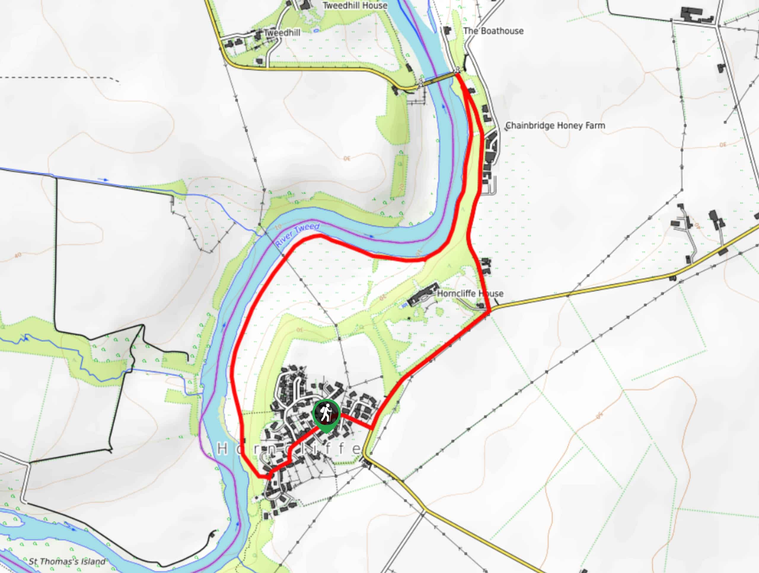
The Horncliffe Walk is a short riverside adventure in Northumberland that will provide you with scenic views across the England Scotland border. While out walking the trail, you will make your way through the charming village of Horncliffe to reach the banks of the River Tweed, following them to the Union Bridge before looping back around on the return leg. This is an excellent route for those who are after a relaxing stroll in a peaceful riverside setting.
Getting there
The trailhead for the Horncliffe Walk can be found at the village hall in Horncliffe.

About
| Backcountry Campground | No |
| When to do | Year-Round |
| Pets allowed | Yes - On Leash |
| Family friendly | Yes |
| Route Signage | Average |
| Crowd Levels | Moderate |
| Route Type | Circuit |
Horncliffe Walk
Elevation Graph
Weather
Horncliffe Walk Description
Exploring the beautifully scenic borderlands between England and Scotland, the Horncliffe Walk is a pleasant adventure in Northumberland that is suited to those outdoor enthusiasts who enjoy meandering along the water’s edge while taking in the natural beauty of the surrounding landscape.
Setting out from the trailhead next to the village hall, you will pass through the lovely little village of Horncliffe, making your way southwest until you arrive at the edge of the River Tweed. Here, you will turn right and follow the banks of the river as they wind to the northeast, offering a beautiful view across the river and into Scotland.
Eventually, you will arrive at the site of Union Bridge, which spans the River Tweed and marks the northern terminus of this walking route. Turning back to the south, you will follow along the road until you arrive at a junction next to the Horncliffe house transit stop. Turn right here and follow the road back into the village of Horncliffe, where you can wrap up your walk with a quick pint at The Fishers Arms.
Similar hikes to the Horncliffe Walk hike

Hadrian’s Wall: Steel Rigg to Lanercost
Walking Hadrian’s Wall: Steel Rigg to lanercost is a fantastic - albeit lengthy - adventure that will lead you across…

Hadrian’s Wall: Wallsend to Heddon on the Wall
Hadrian’s Wall: Wallsend to Heddon on the Wall is the first section of the long distance Hadrian’s Wall Path walking…

Scotch Gill Woods Walk
The Scotch Gill Woods Walk is a short and easy-going adventure in Morpeth, Northumberland that will take you through a…
Comments