Hadrian’s Wall: Chollerford to Steel Rigg
View Photos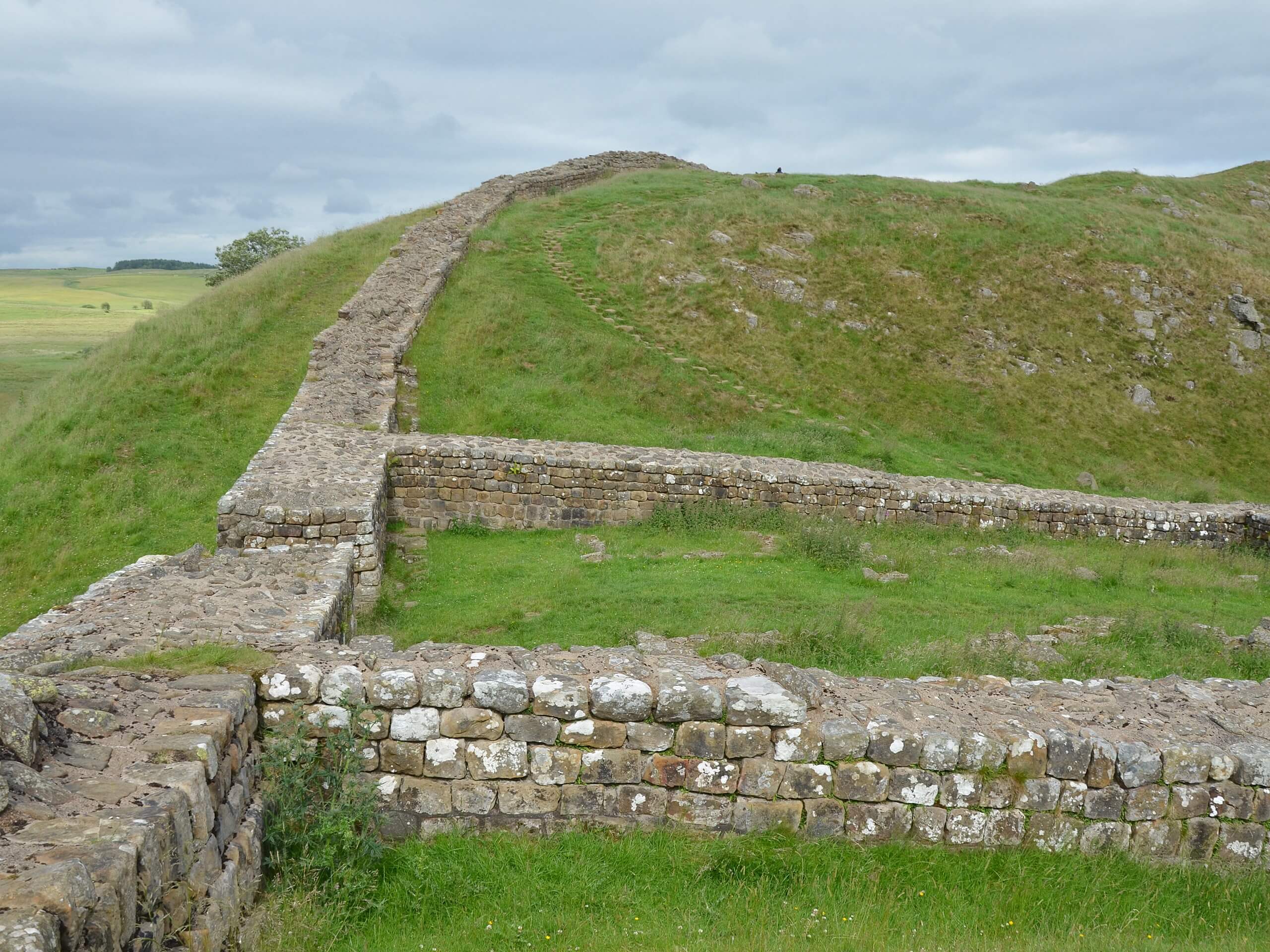
Hadrian’s Wall: Chollerford to Steel Rigg
Difficulty Rating:
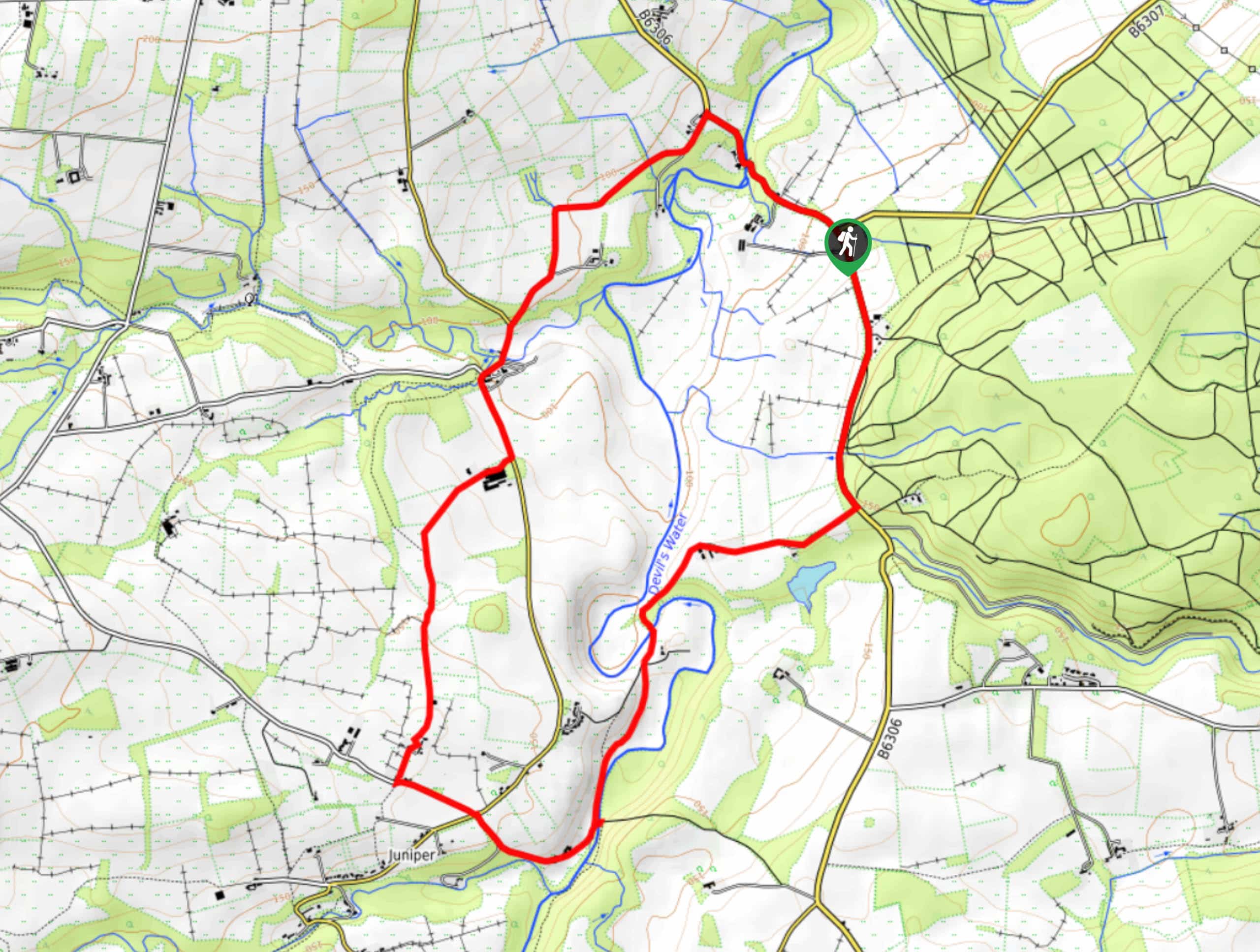
The Hadrian’s Wall: Chollerford to Steel Rigg walking route is a fantastic adventure that makes up the third segment of a long distance route across the north of England. While out walking the trail, you will experience the natural beauty of the northumberland countryside as you follow along the Roman fortification of Hardian’s Wall that was constructed to defend Roman Britain from the Picts. This is a great route for anyone that enjoys long distance walks and visiting historic sites.
Getting there
The trailhead for Hadrian’s Wall: Chollerford to Steel Rigg can be found in Chollerford, nex to the Crown Inn.

About
| Backcountry Campground | No |
| When to do | Reasonable start/end dates for route |
| Pets allowed | Yes - On Leash |
| Family friendly | No |
| Route Signage | Average |
| Crowd Levels | Moderate |
| Route Type | One Way |
Hadrian’s Wall: Chollerford to Steel Rigg
Elevation Graph
Weather
Hadrian’s Wall: Chollerford to Steel Rigg Description
Whether you are looking to complete the entire long distance walk along the length of Hadrian’s Wall or are simply looking to complete this one segment, the Hadrian’s Wall: Chollerford to Steel Rigg walking route is an exceptional adventure that will make you feel as though you are stepping back in time.
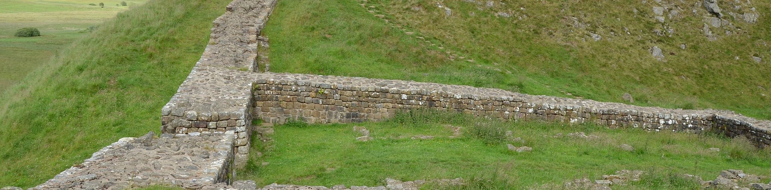
Setting out from the trailhead, you will make your way south through Chollerford, following Military Road to the west for a short distance to pass by Chesters Roman Fort Museum, eventually picking up a trail that runs parallel to Military Road. Here, you will continue on to the west while passing by the various ruined sections of Hadrian’s Wall, including Black Carts Turret and Brocolitia Fort.
Keep on along the path as it continues to follow roughly alongside Military Road, passing a number of other important Roman sites like the Housesteads Roman Fort, before arriving at the scenic location of Robin Hood’s Tree, a lone tree nested between two hills. From here, you will continue on a short distance to the southwest to reach the endpoint of the walk at the Steel Rigg car park.
Similar hikes to the Hadrian’s Wall: Chollerford to Steel Rigg hike

Hadrian’s Wall: Steel Rigg to Lanercost
Walking Hadrian’s Wall: Steel Rigg to lanercost is a fantastic - albeit lengthy - adventure that will lead you across…

Hadrian’s Wall: Wallsend to Heddon on the Wall
Hadrian’s Wall: Wallsend to Heddon on the Wall is the first section of the long distance Hadrian’s Wall Path walking…
Devil’s Water Circular Walk
The Devil’s Water Circular Walk is a laidback excursion in Northumberland that will take you through the countryside surrounding a…
Comments