Hadrian’s Wall and Vindolanda Fort Circular Walk
View Photos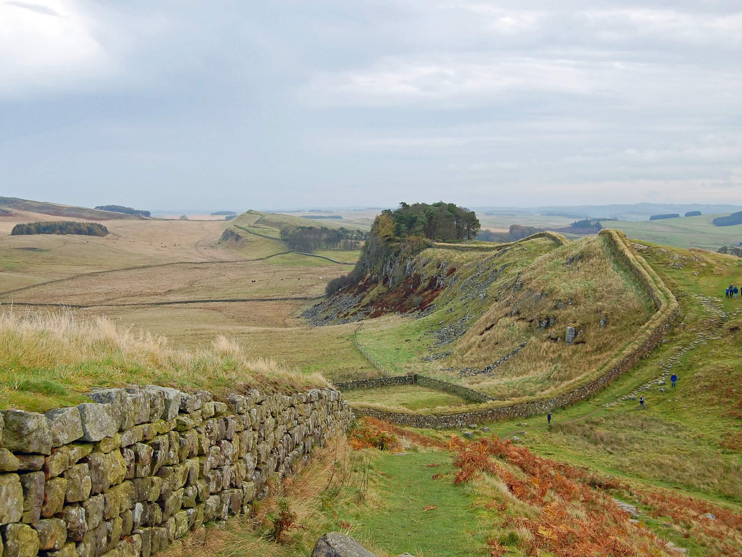
Hadrian’s Wall and Vindolanda Fort Circular Walk
Difficulty Rating:
The Hadrian’s Wall and Vindolanda Fort Circular Walk is an exceptional adventure in Northumberland that will take you to several fascinating ancient history sites in Northern England. While out walking the trail, you will make your way past the impressive 1st Century CE Roman fort of Vindolanda, before circling around the countryside along a portion of Hadrian’s Wall. This really is a spectacular walking route that will make any lover of history feel as though they have been transported back in time.
Getting there
The trailhead for the Hadrian’s Wall and Vindolanda Fort Circular Walk can be found at the Vindolanda car park on Stanegate.

About
| Backcountry Campground | Hadrian’s Wall Camping |
| When to do | Year-Round |
| Pets allowed | Yes - On Leash |
| Family friendly | Older Children only |
| Route Signage | Average |
| Crowd Levels | Moderate |
| Route Type | Lollipop |
Hadrian’s Wall and Vindolanda Fort Circular Walk
Elevation Graph
Weather
Hadrian’s Wall and Vindolanda Fort Circular Walk Description
While the Hadrian’s Wall and Vindolanda Fort Circular Walk is an exceptional adventure, the major downside to the route is that a good portion of it follows along roadways. Be sure to keep an eye out for passing traffic when traversing these sections. Additionally, if you want to fully explore the Vindolanda archaeological site and Roman history museum, you will need to pay a fee to gain admission.
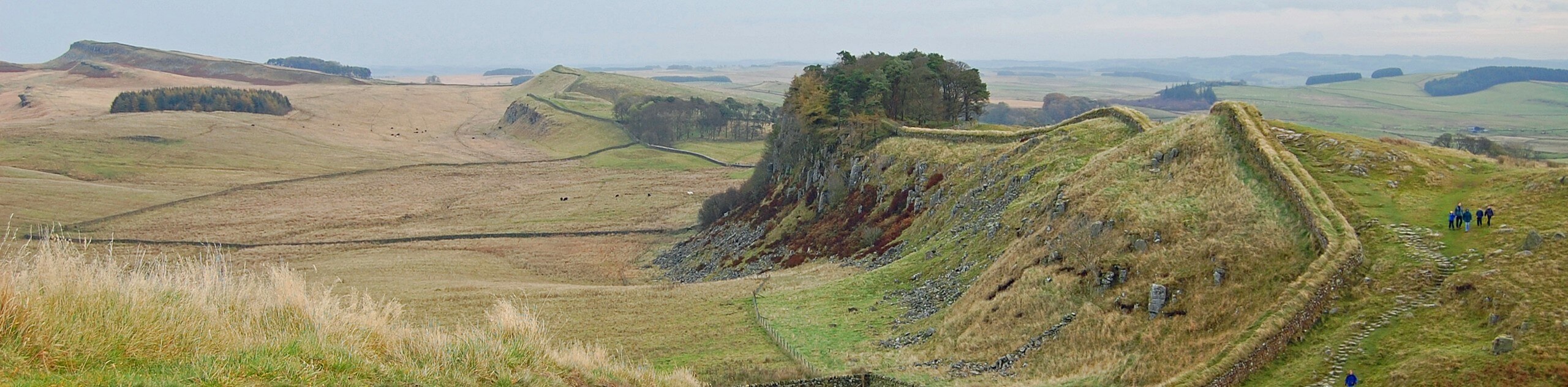
Even though you need to pay to access Vindolanda, there are still plenty of historical sites that can be explored for free on this walk. After traversing the countryside to the west of the ancient Roman fort, you will arrive at the impressive site of Hadrian’s Wall, where you can walk along its length and investigate its outposts while enjoying sweeping views across Northumberland. This is an excellent adventure for those with an interest in ancient Roman history.
Setting out from the car park, you will make your way north to reach Stanegate and turn left onto the road to follow it west for the next 1.1mi. Here you will pass by the Roman auxiliary fort known as Vindolanda on your left, which was used by the Romans from approximately 85 CE to 370 CE. If you wish to explore the fort and its associated museum, you can do so now or save it for the end of your walk. Be sure to exercise caution and keep an eye out for traffic while walking along the road here.
Reaching a T-intersection, you will head to the left on Cycle Route 72 and follow it for 0.3mi, before turning right. Here, you will make your way west for the next 1.3mi, taking in the beautiful views of the surrounding farmland, before turning right once more to walk to the northwest past the Hadrian’s Wall Campsite.
After crossing over B6318, you will pass through a gate and pick up a footpath to continue on to the northwest for 0.4mi. Here, you will traverse the open countryside and eventually arrive at a junction at Caw Gap. Turning to the right, you will begin climbing up the hillside and pass by Milecastle 41, a fortification along the UNESCO World Heritage Site Hadrian’s Wall, which was once an impressive defensive wall built by the Romans to defend the province of Britannia from the Picts to the north.
Keep straight along this trail for the next 1.4mi after Milecastle 41, taking some time to appreciate the beautifully scenic views across the Northumberland countryside. After arriving at the edge of the road near the Steel Rigg car park, you will turn right and make your way south towards the village of Once Brewed. Here, you will find the Twice Brewed Inn, which is a great place to stop for some mid-walk refreshments.
After crossing over B6318 once more, you will continue onto the south for another 0.5mi, where you will turn left along Stanegate. At this point, you can simply follow the road back towards the east, passing by Vindolanda on the return leg of the Hadrian’s Wall and Vindolanda Fort Circular Walk.
Trail Highlights
Vindolanda
Situated in Northumberland, just south of Hadrian’s Wall, Vindolanda was a Roman auxiliary fort that served to protect the northern border of the province of Britannia from the Pictish people. The site was occupied from approximately 85 CE to 370 CE, meaning that it actually predated Hadrian’s Wall in their shared role of protecting the northern reaches of the empire. Today, the fort is an intricate archaeological site that also features a Roman history museum.
Frequently Asked Questions
What was the purpose of Vindolanda?
The Vindolanda Fort was a garrison for Roman soldiers that were stationed in the northern part of Britannia to protect the province.
Is Vindolanda part of Hadrian’s Wall?
While Vindolanda is situated close to Hardian’s Wall, it is actually located a bit further south and predates the wall by approximately 40 years.
Insider Hints
Wear proper walking footwear with good support.
Keep your dog on a lead at all times.
Toilet facilities can be found near the start of the walk at the Vindolanda admission building.
Be sure to book your tickets in advance if you are looking to explore the Vindolanda site.
Similar hikes to the Hadrian’s Wall and Vindolanda Fort Circular Walk hike

Hadrian’s Wall: Steel Rigg to Lanercost
Walking Hadrian’s Wall: Steel Rigg to lanercost is a fantastic - albeit lengthy - adventure that will lead you across…

Hadrian’s Wall: Wallsend to Heddon on the Wall
Hadrian’s Wall: Wallsend to Heddon on the Wall is the first section of the long distance Hadrian’s Wall Path walking…

Scotch Gill Woods Walk
The Scotch Gill Woods Walk is a short and easy-going adventure in Morpeth, Northumberland that will take you through a…
Comments