
Greenhaugh and Thorneyburn Walk
View Photos
Greenhaugh and Thorneyburn Walk
Difficulty Rating:
The Greenhaugh and Thorneyburn Walk is a short adventure in Northumberland that loops around a stream for a chance to spot some local wildlife. While out on the trail, you will leave Greenhaugh behind and traverse the countryside surrounding Tarset Burn, where you will likely spot a number of bird and mammal species. Walkers should take note that there will likely be wildlife in the area, so be sure to keep your dog on a lead.
Getting there
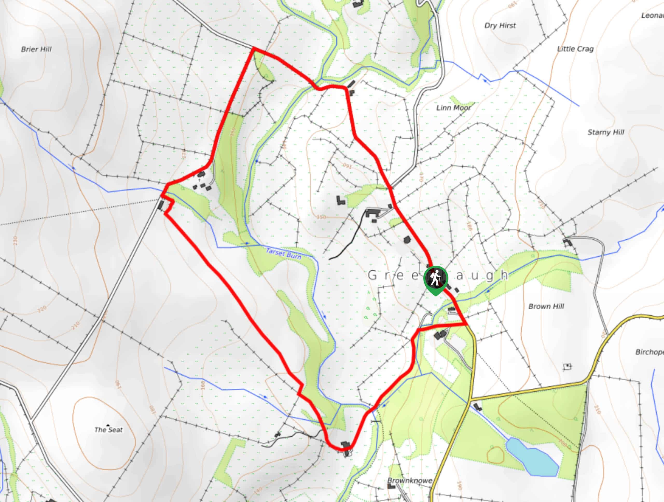
The trailhead for the Greenhaugh and Thorneyburn Walk can be found in the village of Greenhaugh, next to the Holly Bush Inn.

About
| Backcountry Campground | No |
| When to do | Year-Round |
| Pets allowed | Yes - On Leash |
| Family friendly | Yes |
| Route Signage | Average |
| Crowd Levels | Low |
| Route Type | Circuit |
Greenhaugh and Thorneyburn Walk
Elevation Graph
Weather
Greenhaugh and Thorneyburn Walk Description
If you are after a quick jaunt through the countryside that features lovely wildlife views and is suitable for the entire family, then the Greenhaugh and Thorneyburn Walk is the perfect route for you. Keep your eyes peeled, as you just might be able to spot heron, red squirrels, and grey wagtails along the trail.
Setting out from the trailhead next to the Holly Bush Inn, you will make your way north along the road in order to leave the village behind and get out into the countryside. Here, you will cross over Tarset Burn and make a sharp left along the road to head southwest, eventually passing by a small stretch of woodland terrain.
Shortly after passing by the wood, you will turn left to get off the road, traversing the open countryside to the southeast while enjoying some nice views of the surrounding landscape. After arriving at the edge of a road near Tarset Burn, you will make your way northeast on the return leg back into the village.
Similar hikes to the Greenhaugh and Thorneyburn Walk hike

Hadrian’s Wall: Steel Rigg to Lanercost
Walking Hadrian’s Wall: Steel Rigg to lanercost is a fantastic - albeit lengthy - adventure that will lead you across…

Hadrian’s Wall: Wallsend to Heddon on the Wall
Hadrian’s Wall: Wallsend to Heddon on the Wall is the first section of the long distance Hadrian’s Wall Path walking…

Scotch Gill Woods Walk
The Scotch Gill Woods Walk is a short and easy-going adventure in Morpeth, Northumberland that will take you through a…
Comments