
Blythe River Walk
View Photos
Blythe River Walk
Difficulty Rating:
The Blythe River Walk is a laidback adventure in Northumberland that will lead you along the winding banks of the River Blythe to experience the beauty of the countryside. While out walking the trail, you will pass through a tranquil stretch of Quarry Wood to reach the edge of the river, following it to the southwest while taking in the views of the scenic riverside and surrounding wildlife. This walking route is perfectly suited for a relaxing adventure that will allow you to escape the chaos of the outside world.
Getting there
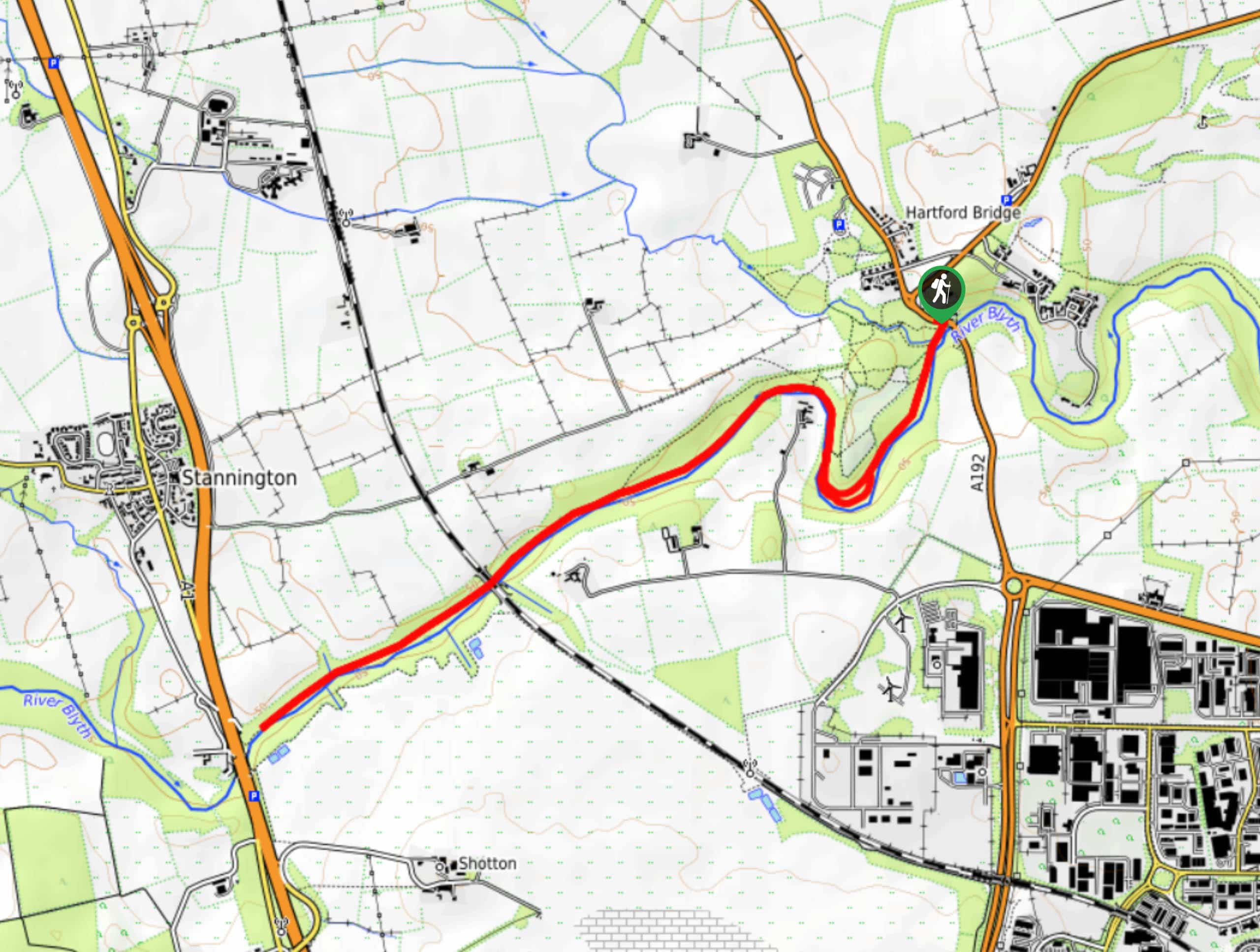
The trailhead for the Blythe River Walk can be found 1.7mi southwest of Bedlington at the point A192 crosses over the River Blythe.

About
| Backcountry Campground | No |
| When to do | March-October |
| Pets allowed | Yes - On Leash |
| Family friendly | Yes |
| Route Signage | Average |
| Crowd Levels | Moderate |
| Route Type | Out and back |
Blythe River Walk
Elevation Graph
Weather
Blythe River Walk Description
If you are looking for an easy-going trail that can serve as a natural getaway, then the Blythe River Walk is the perfect option for you. In addition to meandering through a peaceful riverside setting, you will have the chance to spot a number of wildlife species that live within the woodland landscape, making for a fun afternoon on the trails.
Setting out from the trailhead, you will immediately enter into the dense cover of the forest and head to the south, where you will cross over Pegwhistle Burn and arrive at the banks of the River Blythe. Here, you will; follow the banks of the river to the southwest, taking your time as you enjoy the tranquil atmosphere of the forest and the sound of running water nearby.
After making your way through a few bends along the river’s edge, you will continue straight to the southwest, where you will eventually come to the terminus of the route near the A1. From here, you will simply turn back and retrace your steps along the same trail, re-living the natural beauty of the forest on the return to the trailhead where you began your walk.
Similar hikes to the Blythe River Walk hike

Hadrian’s Wall: Steel Rigg to Lanercost
Walking Hadrian’s Wall: Steel Rigg to lanercost is a fantastic - albeit lengthy - adventure that will lead you across…

Hadrian’s Wall: Wallsend to Heddon on the Wall
Hadrian’s Wall: Wallsend to Heddon on the Wall is the first section of the long distance Hadrian’s Wall Path walking…

Scotch Gill Woods Walk
The Scotch Gill Woods Walk is a short and easy-going adventure in Morpeth, Northumberland that will take you through a…
Comments