Robin Hood’s Bay and Maw Wyke Walk
View Photos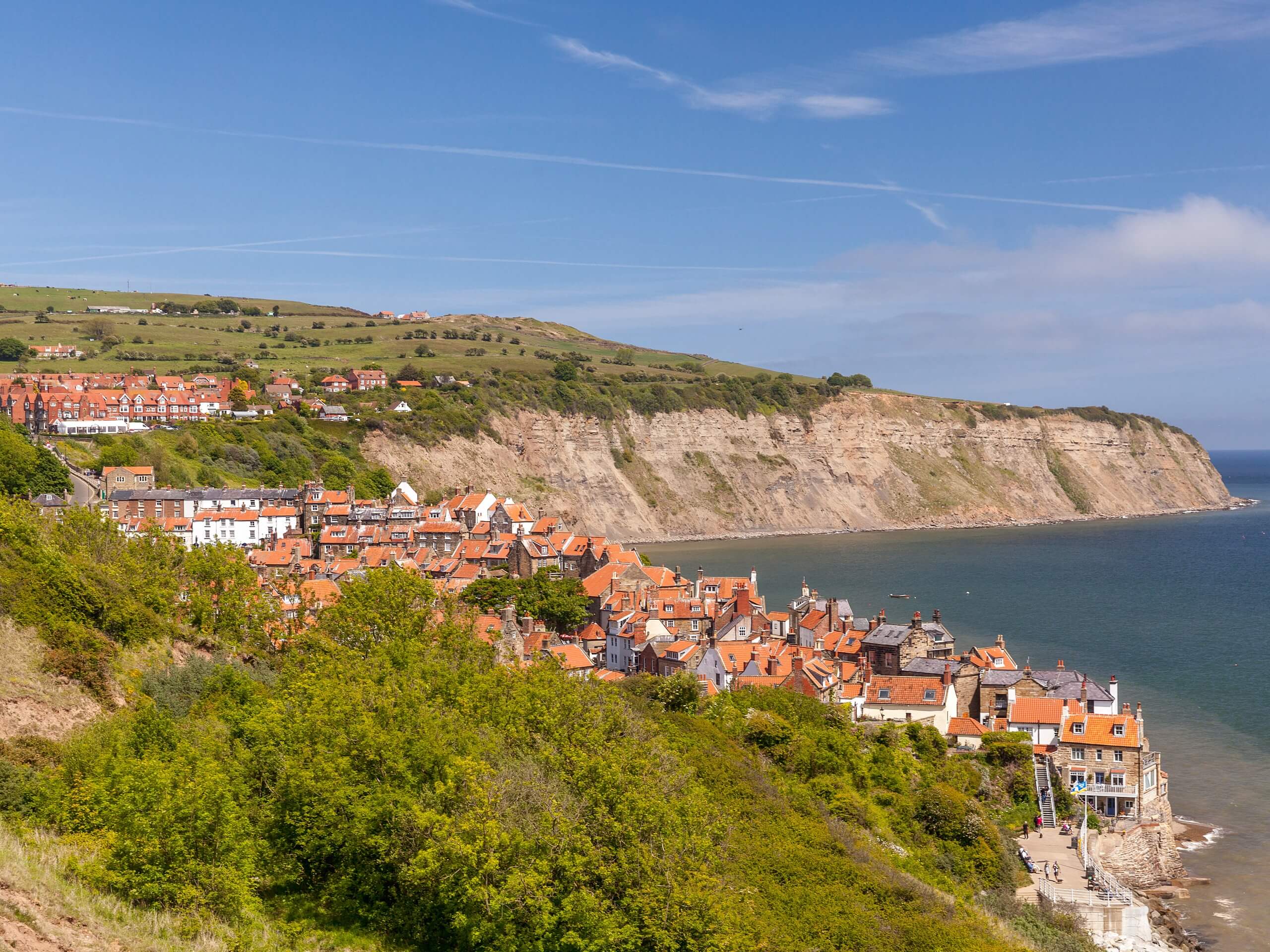
Robin Hood’s Bay and Maw Wyke Walk
Difficulty Rating:
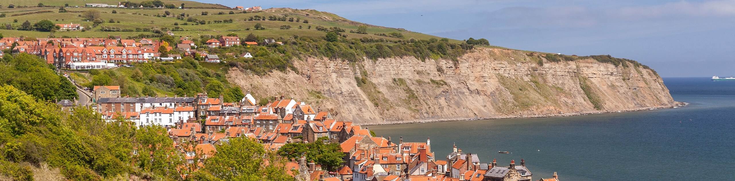
The Robin’s Hood Bay and Maw Wyke Walk is a scenic journey in North York Moors National Park that will expose you to some of the beautiful coastal areas that can be found within the park. Along the trail, you will walk along the rugged coastal cliffs and take in the views of the North Sea as you make your way to the sheltered inlet of Maw Wyke before traversing the countryside on the return leg of the journey. While this route can certainly be done as a family walk, you will want to keep an eye on children and dogs, as there are steep drop offs along the coastal portion of the trail.
Getting there
To reach the trailhead for the Robin Hood’s Bay and Maw Wyke Walk from Whitby, head south on A171 for 2.7mi and turn left onto B1447, following it for 2.4mi. Make a right here and continue on for 195ft, making another right to enter the car park.

About
| Backcountry Campground | No |
| When to do | Year-Round |
| Pets allowed | Yes - On Leash |
| Family friendly | Yes |
| Route Signage | Average |
| Crowd Levels | Moderate |
| Route Type | Lollipop |
Robin Hood’s Bay and Maw Wyke Walk
Elevation Graph
Weather
Robin Hood’s Bay and Maw Wyke Walk Description
Featuring rugged coastal terrain and gorgeous views of the sea, the Robin Hood’s Bay and Maw Wyke Walk is a bit of a departure from many of the other North York Moors adventures that focus on the barren inland areas of the park. Dramatic cliffs, sweeping views across the water, and the chance to view wildlife await on this beautifully seaside journey in North Yorkshire.
Setting out from the car park, you will head east to leave the village behind and begin making your way along the rugged coastal terrain, enjoying the scenic views overlooking Robin Hood’s Bay and the North Sea stretching out before you. Exercise caution in this area, as minor landslides can often obstruct the path, in which case, you will usually find a detour leading through the fields above.
Eventually, you will arrive at the sheltered cove of Maw Wyke, which is often inhabited by a nesting colony of kittiwakes. From here, you will climb uphill to the southwest through a caravan park before turning to the southeast to traverse the open countryside above the coast. As the trail begins to slightly descend and bend to the southwest, you will complete the final leg of the walk back into Robin Hood’s Bay.
Similar hikes to the Robin Hood’s Bay and Maw Wyke Walk hike

Kirkbymoorside and Gillamoor Walk
The Kirkbymoorside and Gillamoor Walk is a great outdoor excursion along the southern edge of North York Moors National Park…

Farndale Railway Walk to Blakey Ridge
The Farndale Railway Walk to Blakey Ridge is a lengthy but easy-going route that will allow you to experience the…

Botton and Blakey Ridge Circular Walk
The Botton and Blakey Ridge Circular Walk is a rugged and beautiful adventure that will allow you to experience the…
Comments