Old Meggison and Captain Cook’s Monument Walk
by Gary Robson, CC-BY 2.0Image tones and noise levels adjusted; image resized
Old Meggison and Captain Cook’s Monument Walk
Difficulty Rating:
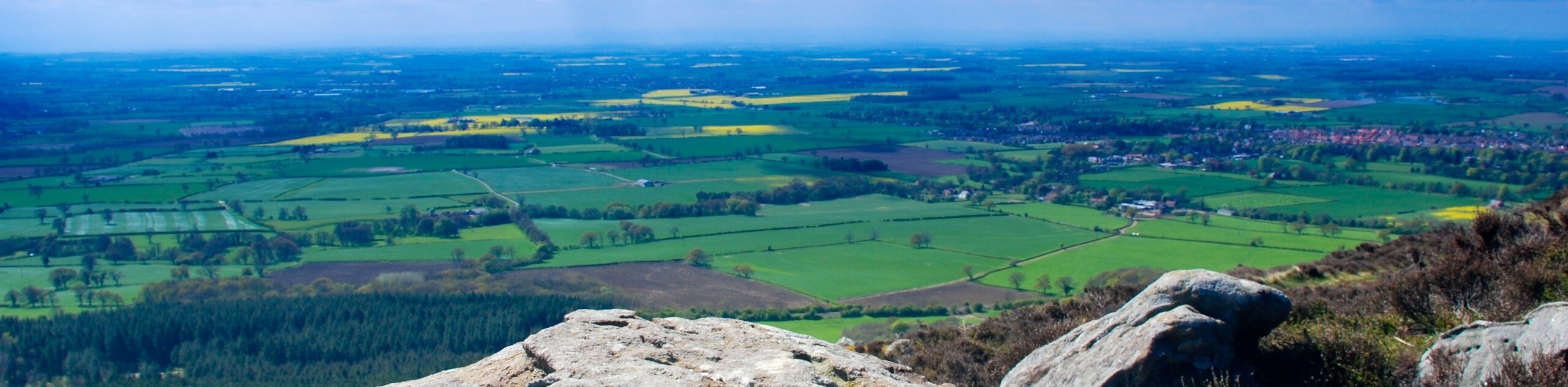
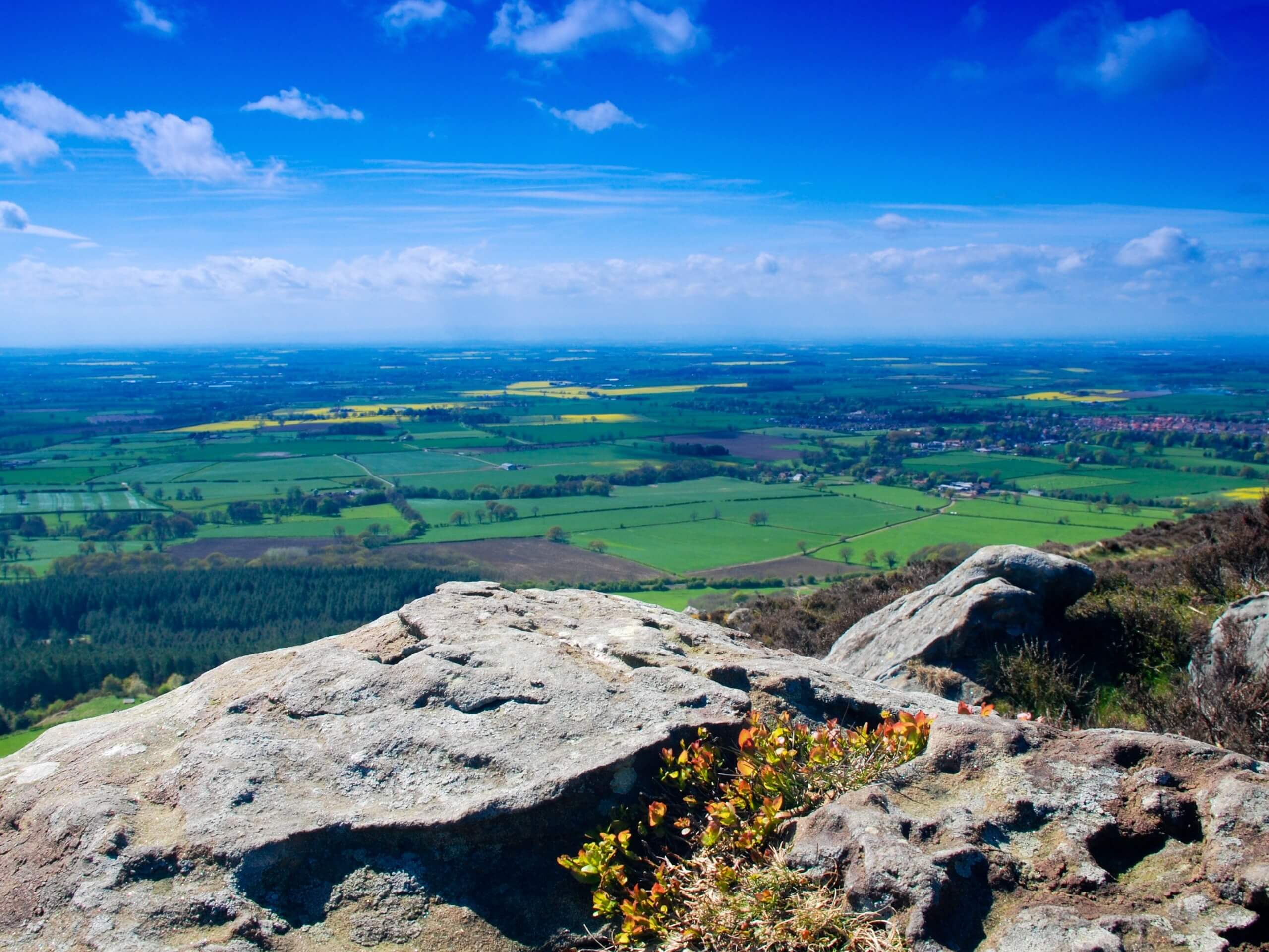
The Old Meggison and Captain Cook’s Monument Walk is a fantastic route that will showcase some of the beautiful landscapes within the North York Moors, while stopping off at some interesting historical sites along the way. While out on the trail you will descend the hillside and traverse some charming woodland terrain on the way to visiting Old Meggison Falls before climbing uphill to visit Captain Cook’s Monuments and the RAF Officers Memorial. This is a great walk for anyone with a combined interest in history and the outdoors.
Getting there
To reach the trailhead for the Old Meggison and Captain Cook’s Monument Walk from Kildale, head northeast along Cleveland Way for 1.9mi and continue straight onto Dikes Lane. Follow this for 0.3mi, where you will find the car park on the left.

About
| Backcountry Campground | No |
| When to do | March-November |
| Pets allowed | Yes - On Leash |
| Family friendly | Older Children only |
| Route Signage | Average |
| Crowd Levels | Moderate |
| Route Type | Circuit |
Old Meggison and Captain Cook’s Monument Walk
Elevation Graph
Weather
Old Meggison and Captain Cook’s Monument Walk Description
Depending on the aim of your adventure in North York Moors National Park, the Old Meggison and Captain Cook’s Monument Walk is an amazing trail that will showcase the natural beauty and local history of the surrounding area. There are several steep climbs and descents spread throughout the route, so make sure to wear some proper walking boots for this journey.
Setting out from the car park, you will make your way west and descend the hillside, turning to the south to pass through the tranquil expanse of the Round Hill and Ayton Banks woods. From here, the trail will take you to the southeast to descend further downhill until you meet up with the banks of the River Leven. Head left and follow along the river’s edge, enjoying the woodland landscape before arriving at the breathtaking sight of Old Meggison Falls.
After taking in the stunning views of the waterfall, you will continue east along the river, before turning to the northeast along the road to climb up the relatively steep hillside. Turning back towards the west, you will follow along the Cleveland Way as it traverses the top of the hill, passing through the light forest cover until you arrive at the monument to Captain Cook, who notably grew up on a farm just outside of Great Ayton. From here, you will follow the path north to pass by the RAF Officers Memorial on the way back to the car park.
Similar hikes to the Old Meggison and Captain Cook’s Monument Walk hike

Kirkbymoorside and Gillamoor Walk
The Kirkbymoorside and Gillamoor Walk is a great outdoor excursion along the southern edge of North York Moors National Park…

Farndale Railway Walk to Blakey Ridge
The Farndale Railway Walk to Blakey Ridge is a lengthy but easy-going route that will allow you to experience the…

Botton and Blakey Ridge Circular Walk
The Botton and Blakey Ridge Circular Walk is a rugged and beautiful adventure that will allow you to experience the…
Comments