
May Beck and Sneaton High Moor Walk
View Photos
May Beck and Sneaton High Moor Walk
Difficulty Rating:
The May Beck and Sneaton High Moor Walk is an intermediate length trail in North York Moors National Park that will give you a great insight into the rugged terrain that makes this area so unique. While out walking the trail, you will climb uphill alongside May Beck and make your way across the barren expanse of the moor, enjoying a commanding view that takes in the surrounding moorlands and stretches out to the coast on a clear day. The high moor here is exposed to the elements, so make sure to come prepared with adequate gear and clothing for the conditions.
Getting there
To get to the trailhead for the May Beck and Sneaton High Moor walk from Ruswarp, head southeast on High Street/B1416 for 3.0mi and make a slight right onto May Bank Farm Trail. In 1.6mi, turn right to enter the car park.

About
| Backcountry Campground | No |
| When to do | March-November |
| Pets allowed | Yes - On Leash |
| Family friendly | Older Children only |
| Route Signage | Average |
| Crowd Levels | Low |
| Route Type | Circuit |
May Beck and Sneaton High Moor Walk
Elevation Graph
Weather
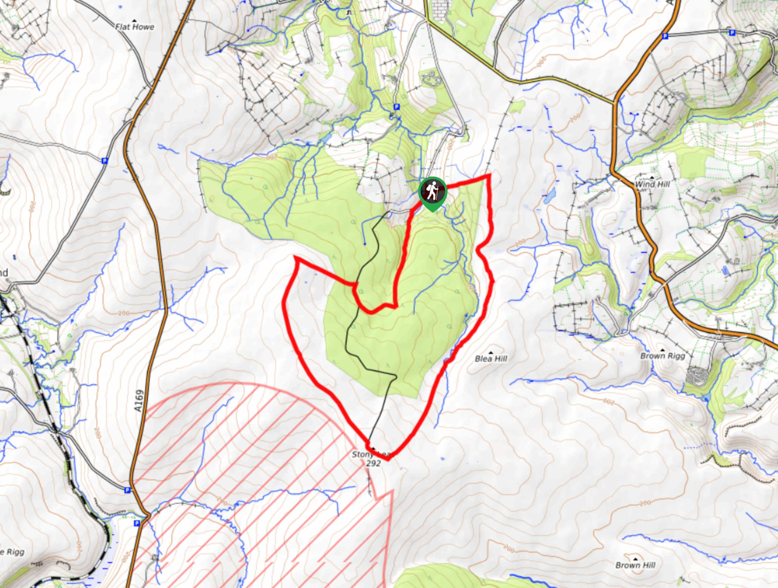
May Beck and Sneaton High Moor Walk Description
Featuring gorgeous views across the North York Moors and rugged terrain throughout, the May Beck and Sneaton High Moor Walk is a true adventure that will allow you to experience the true nature of this fascinating landscape. You will need sturdy walking boots, ideally some that are water-resistant, to better traverse the soggy terrain of the moor.
Setting out from the car park, you will head to the southwest along the banks of May Beck and climb uphill through conifer plantations to access the rough landscape of the moor. Once there, you will loop around the barren moor and take in stunning views across the park, continuing on to reach the southernmost point of the route at Stoney Leas. Turning to the northeast, you will head back across the moor and skirt around the edge of a forest before descending the hillside on the return into the car park where you began.
Similar hikes to the May Beck and Sneaton High Moor Walk hike

Kirkbymoorside and Gillamoor Walk
The Kirkbymoorside and Gillamoor Walk is a great outdoor excursion along the southern edge of North York Moors National Park…

Farndale Railway Walk to Blakey Ridge
The Farndale Railway Walk to Blakey Ridge is a lengthy but easy-going route that will allow you to experience the…

Botton and Blakey Ridge Circular Walk
The Botton and Blakey Ridge Circular Walk is a rugged and beautiful adventure that will allow you to experience the…
Comments