
Ingleby Incline Walk
View Photos
Ingleby Incline Walk
Difficulty Rating:
Walking the Ingleby Incline is a fun and scenic, but challenging, adventure in North York Moors National Park that will take you on a lengthy climb uphill for views of the moor. While the trail is well-maintained, it does feature one long incline that is a real leg-burner and will be unsuitable for some walkers. Even still, this is an amazing walk to get you out for a spot of exercise while taking in the natural beauty of the park.
Getting there
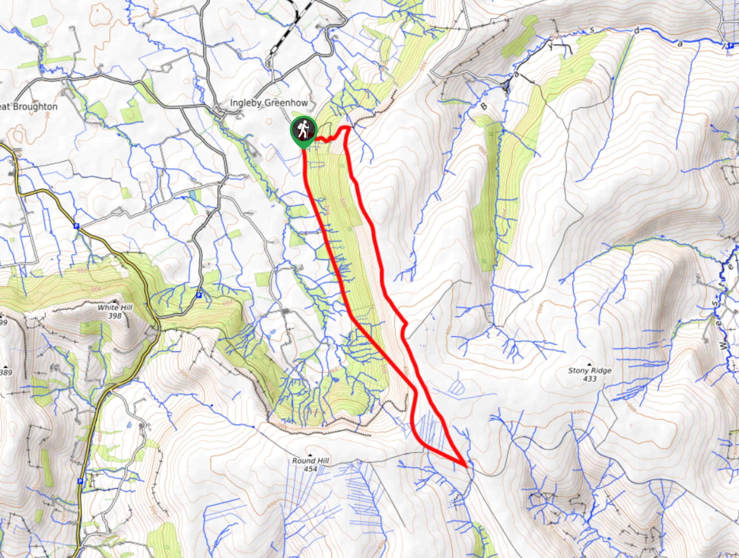
To get to the trailhead for the Ingleby Incline Walk from the nearby village of Ingleby Greenhow, head east on Stone Stoup Hill for 0.3mi and turn right to continue on for another 0.6mi. Make a right here, where you can utilize roadside parking.

About
| Backcountry Campground | No |
| When to do | Year-Round |
| Pets allowed | Yes - On Leash |
| Family friendly | Older Children only |
| Route Signage | Average |
| Crowd Levels | Moderate |
| Route Type | Circuit |
Ingleby Incline Walk
Elevation Graph
Weather
Ingleby Incline Walk Description
If you are looking for a beautifully scenic walking route that will also get your heartrate up and leave your legs burning, then the Ingleby Incline Walk is the perfect trail for you. This trail follows a quiet country road before climbing up a long incline to reach the moors, where you will enjoy stunning views across North Yorkshire. There is also a relatively steep descent towards the end of the walk, so be sure to wear proper walking boots with good ankle support.
Setting out from the trailhead, you will make your way to the south along the road as it runs alongside a woodland plantation on your left and fields on your right. Eventually, you will branch off to the southeast and begin the long and steep climb uphill that will bring you to the moor. Take your time through this stretch, as it really is quite long.
Reaching the top of the hillside at the Bloworth Crossing, you will turn to the northwest and enjoy a bit of respite along the fairly flat terrain of the moor. Take some time to appreciate the views, before turning to the west for the steep descent that will lead you through a forest on the way back to the trailhead.
Similar hikes to the Ingleby Incline Walk hike

Kirkbymoorside and Gillamoor Walk
The Kirkbymoorside and Gillamoor Walk is a great outdoor excursion along the southern edge of North York Moors National Park…

Farndale Railway Walk to Blakey Ridge
The Farndale Railway Walk to Blakey Ridge is a lengthy but easy-going route that will allow you to experience the…

Botton and Blakey Ridge Circular Walk
The Botton and Blakey Ridge Circular Walk is a rugged and beautiful adventure that will allow you to experience the…
Comments