Roseberry Topping Walk via Captain Cook's Monument hike
View Photos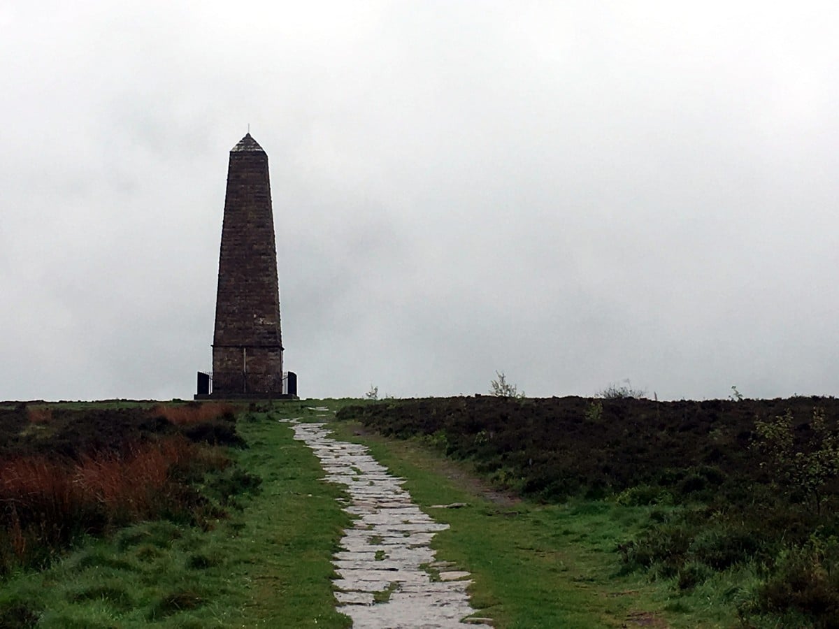
Roseberry Topping Walk via Captain Cook's Monument hike
Difficulty Rating:
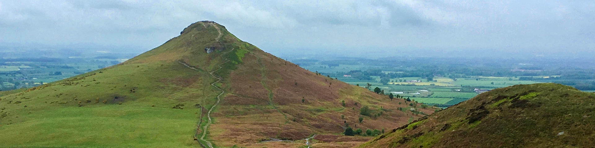
Though short in distance, the Roseberry Topping Walk is a bit of a challenge with a sharp incline for most of the ascent up Cleveland’s most photographed hill. With a unique, half-cone shape, this hill is perhaps the most notable in the area, offering rewarding views over all of the Cleveland plains on a sunny day. Continue onto Captain Cook’s Monument, which stands proudly in the land the famous explorer once grew up.
The Roseberry Topping Walk via Captain Cook’s Monument is a superb hike – taking you to two distinct peaks of the North York Moors. Though likely to be busy, especially on a summer day, it’s definitely worth the climb!
Getting there
To get to the trailhead of Roseberry Topping walk, from Great Ayton head out of the town, following signs towards Kildale. Pass the train station and continue onto Dikes Lane. After approximately 2.5mi, cross a cattle grid and come to a small car park at Gribdale Gate on your right hand side. No fee, but no facilities!

About
| When to do | All year |
| Backcountry Campsites | No |
| Toilets | No |
| Family friendly | No |
| Route Signage | Average |
| Crowd Levels | High |
| Route Type | Circuit |
Roseberry Topping Walk via Captain Cook's Monument
Elevation Graph
Weather
Roseberry Topping and Captain Cook’s Monument Route Description
To begin the Roseberry Topping walk, take the track that’s part of the Cleveland Way and signposted towards Kildale, which leads up into the woodland. The broad track climbs gently up towards Easby Moor and eventually opens up at the Captain Cook’s Monument, approximately 0.5mi from the road. The Captain Cook’s Monument was erected in 1827 to celebrate the life and achievements of Captain James Cook who attended the local school in Great Ayton.
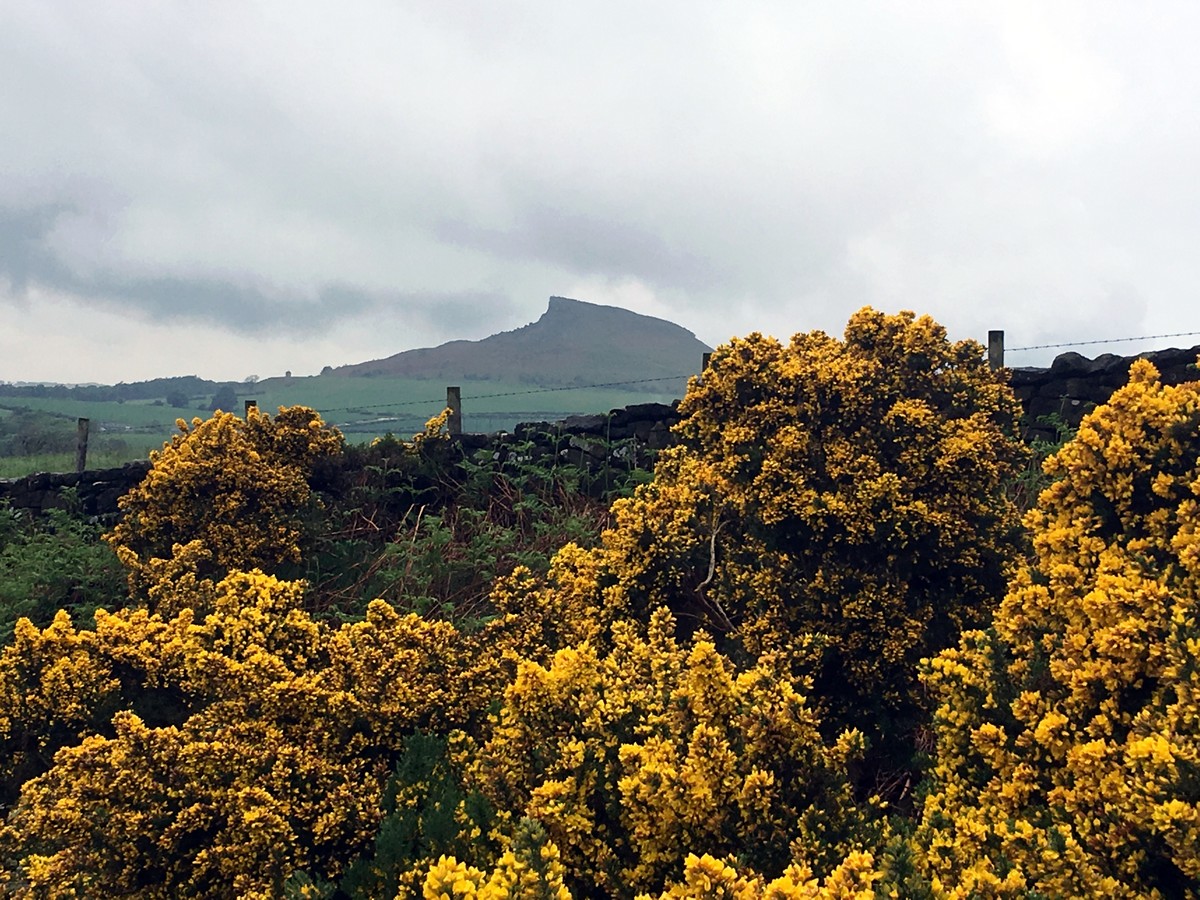
From the monument, take the narrower footpath turning sharply right up from the track . Follow this path through a gap in the wall and continue with the wall on your left. Where the wall ends, the path forks — bear left here. The path descends gently through young trees, before reaching more mature woodland and dropping off steeply. There are several paths leading off; ignore and continue ahead! After crossing another prominent footpath, you will emerge from the woodland. Pass through the gap in the wall and continue onto a grassy track to meet another track running perpendicular, turn right. Looking right you will spot Roseberry Topping, a distinctive craggy looking hill and your next stop!
Continue along the obvious track as it runs between two fence lines, through small woodland and onto a tarmacked lane, before finally emerging at a crossroads with Dikes Lane.
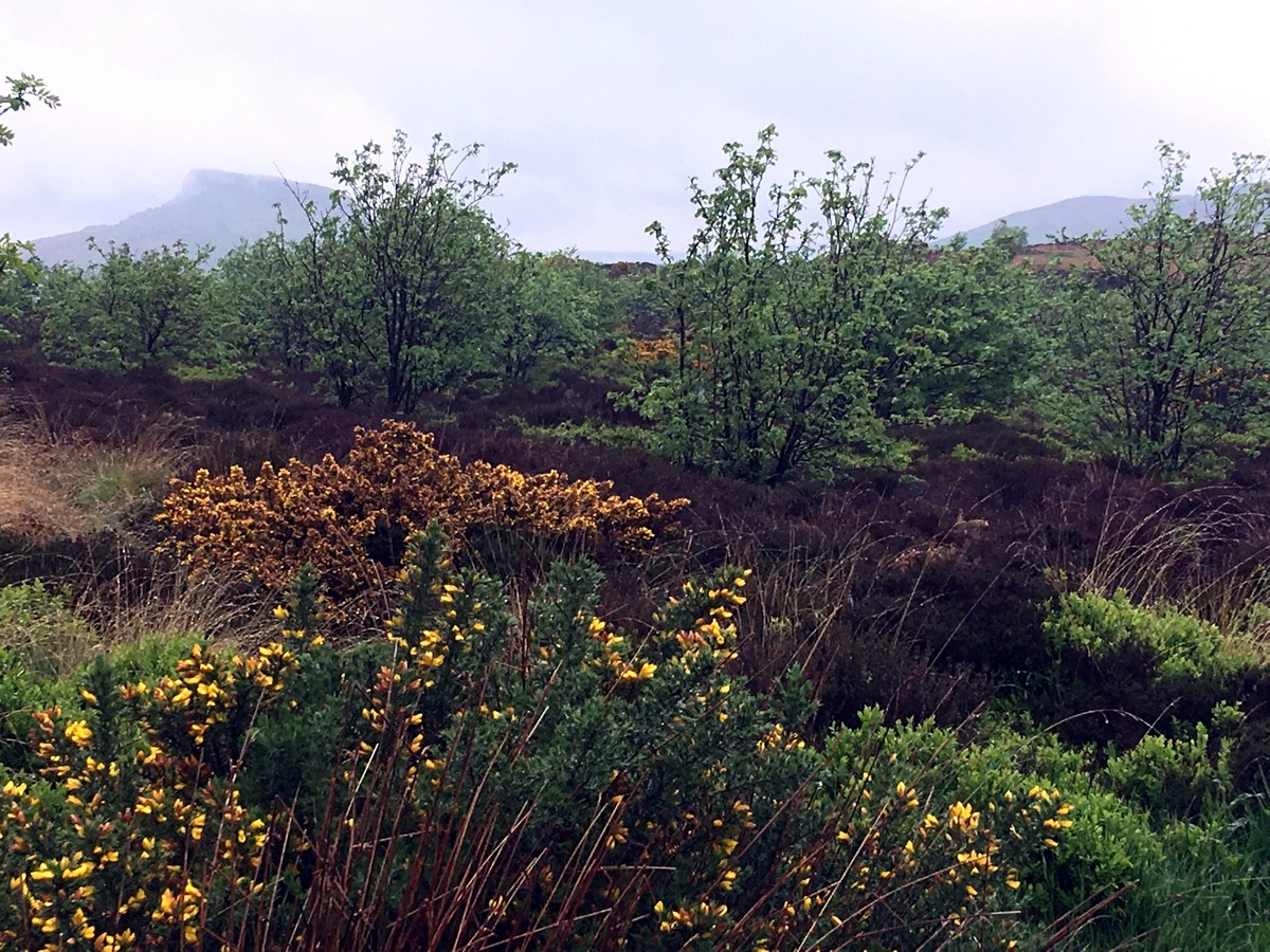
Cross straight over Dikes Lane and continue up Aireyholme Lane. This path rises quite steeply and turns sharply to the right. After 984ft, you will see a signposted footpath to your left. This path turns sharply off the road and leads up to a field over a small stile. Follow the fence line straight across the field and exit through the gate on the far side to enter the Clive Ridge Wood. Then, the Roseberry Topping path drops down to the right and continues through the woodland. In early summer, the woodland is particularly beautiful with a carpet of bluebells.
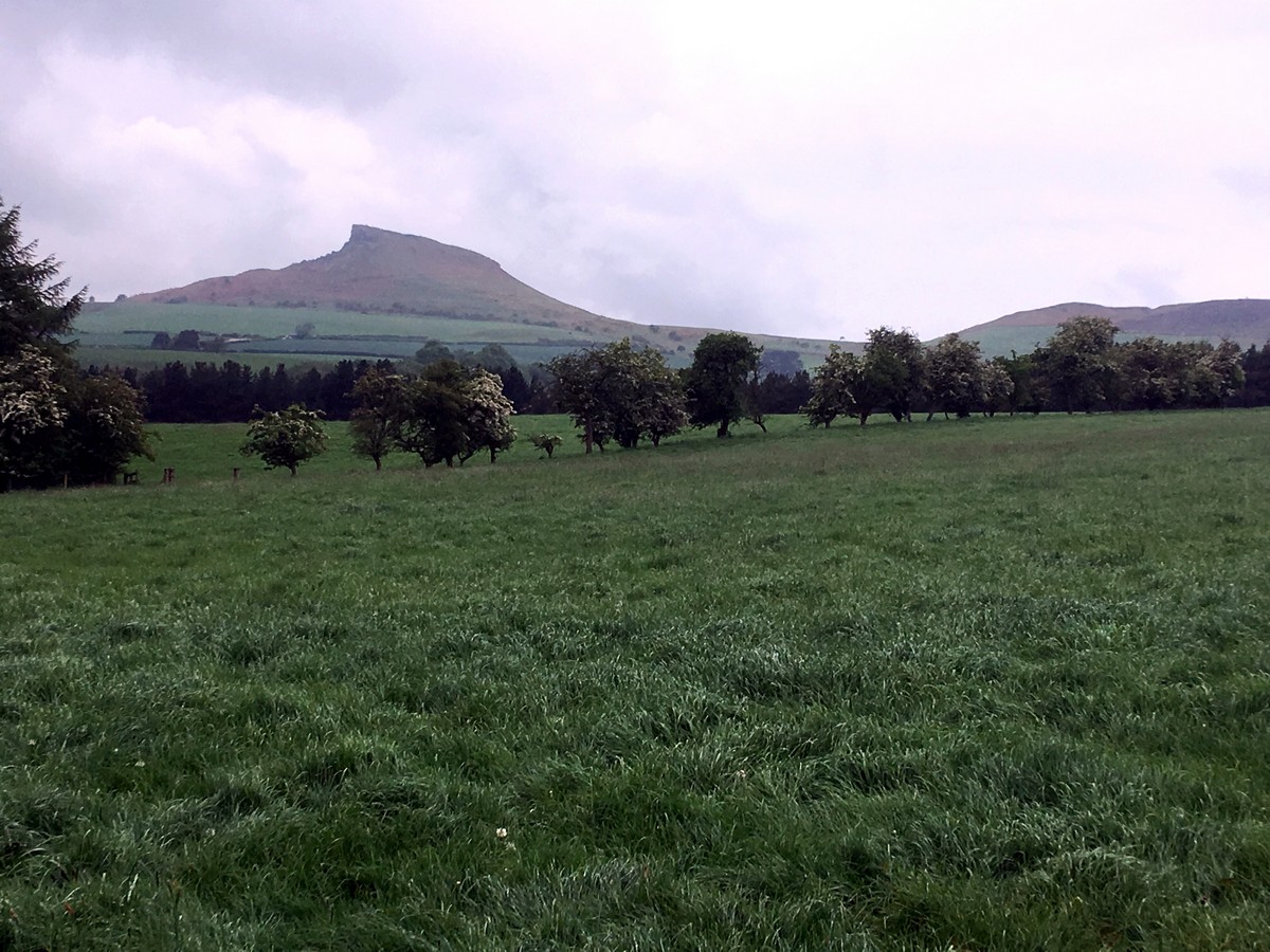
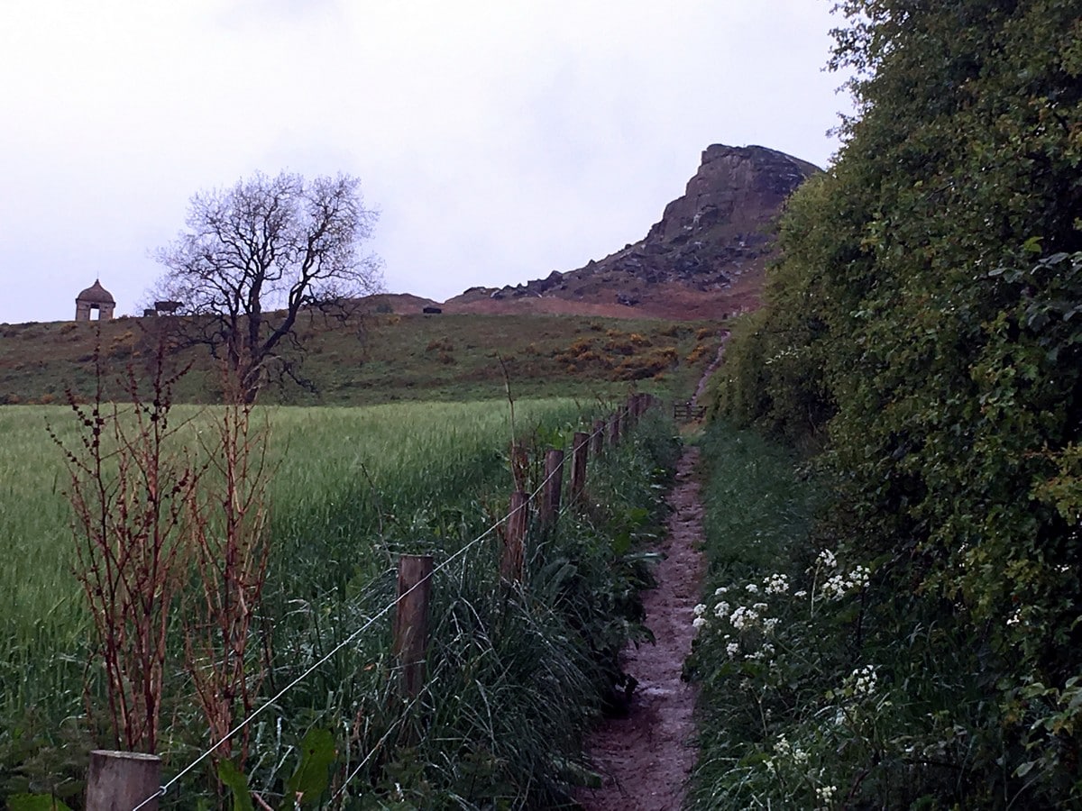
At 984ft, you will come upon a crossroad of paths, notice a disused kissing gate and another Clive Ridge Wood sign. Turn sharply right, taking a path leading you up through the woods. Continue uphill on this path, as it transverses diagonally across the steep bank to emerge from the woodland to grassy farmland via a small gate. Roseberry Topping looms ahead and dominates your view from here.
Turn immediately left to a stile, climb and turn right. Follow the fence line to another stile. Climb and continue towards the cottage ahead. At the cottage boundary, bear left to skirt around and head through the gate just slightly further on.
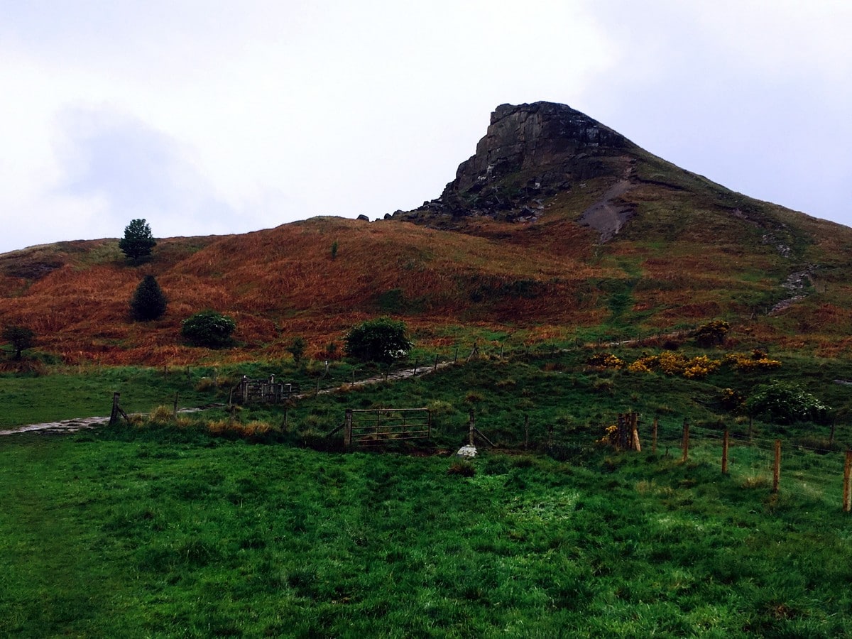
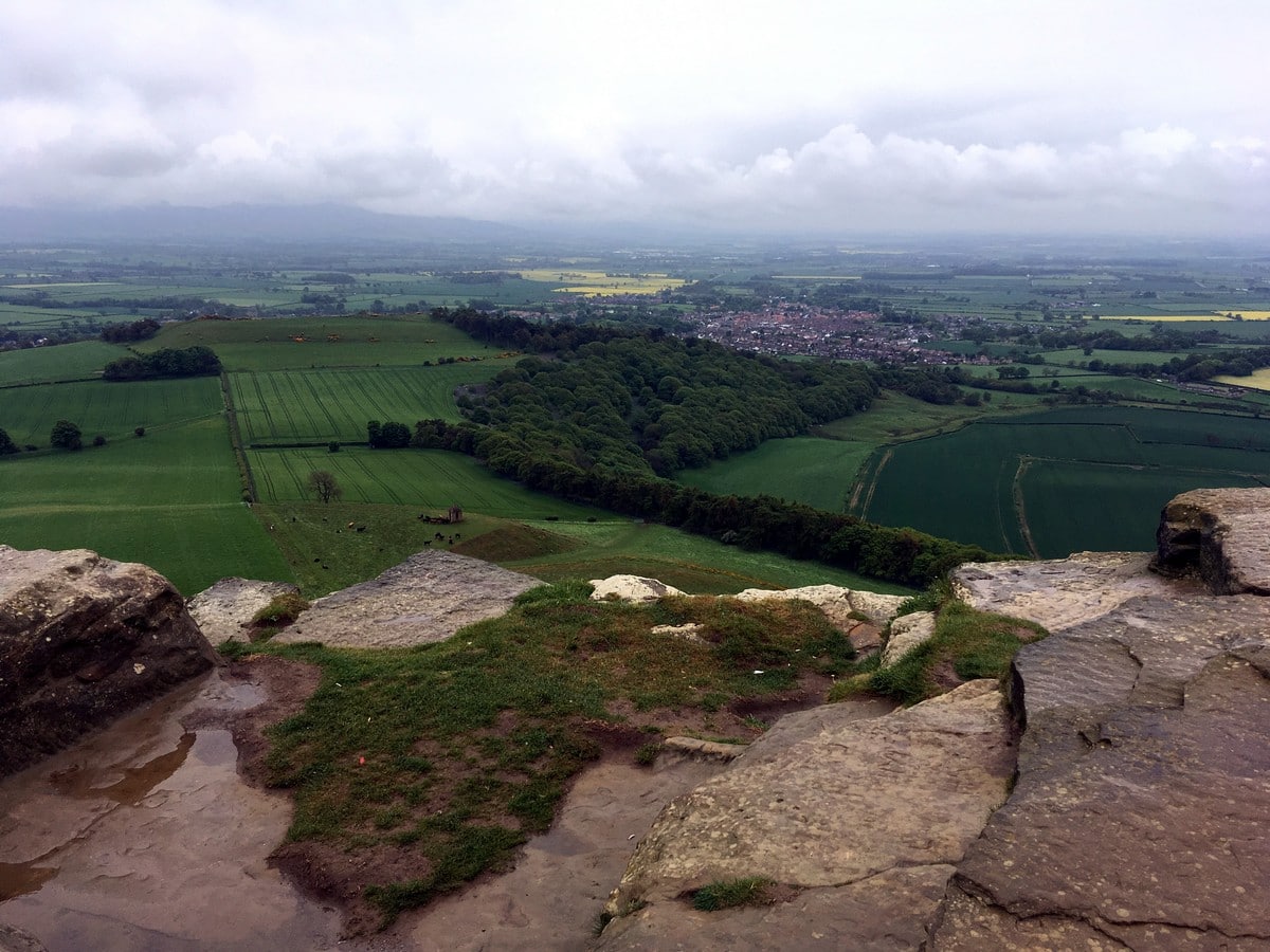
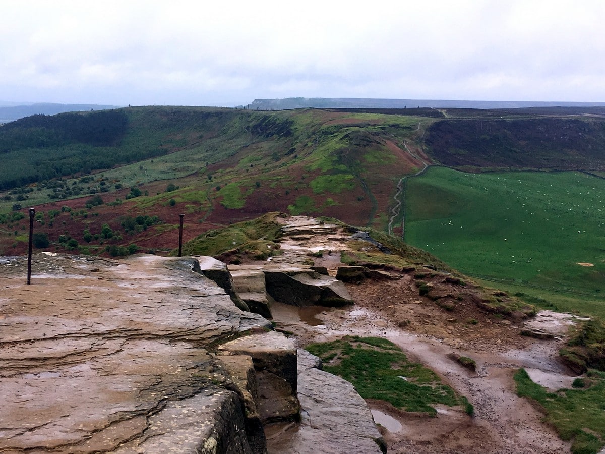
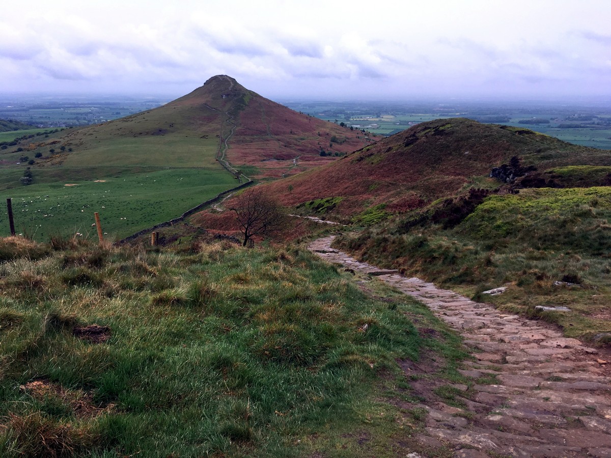
The path now heads straight for Roseberry Topping and gradually steepens. There are several options to the top, some steeper than others – but all obvious! From the summit, enjoy the splendid views down across Teesside, Guisborough and out to the North Sea. To the south you can pick out the Cook Monument and the Cleveland Plain as it rises to meet the moorland.
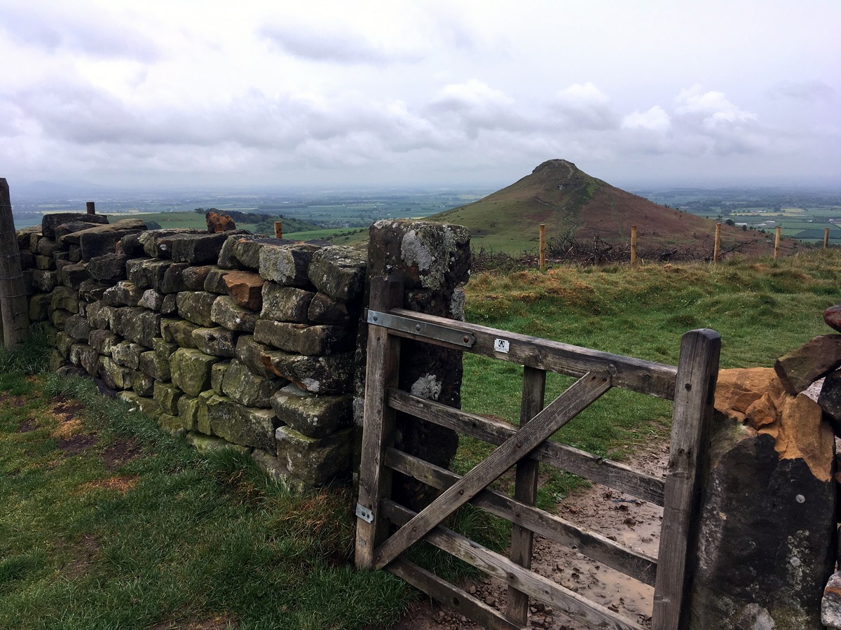
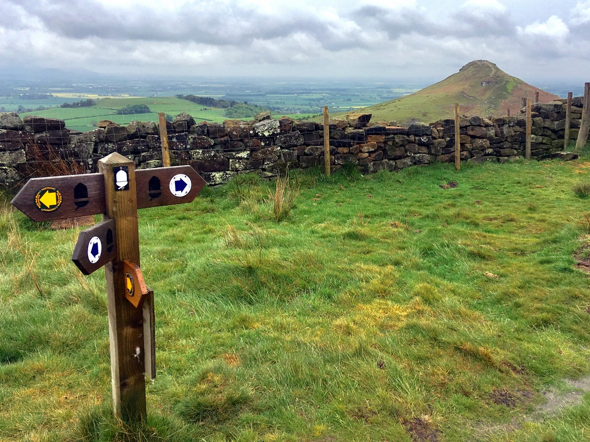
From the trig point head along the ridge of Roseberry Topping, then drop steeply down to the saddle of Roseberry Common. Continue ahead to climb to the ridge, following the path as it runs alongside a stonewall leading you quite steeply uphill. Upon reaching a gate on the ridge continue through, before bearing right at the fork following the National Trail acorn symbol. Follow the well-marked broad trail along the crest for almost 1.2mi. Follow signs as the path exits the moorland, drops down to the lane and returns to the parking area below.
Hiking Trail Highlights
Roseberry Topping
This distinctive hill is nestled in North Yorkshire, England. You’ll know you’ve arrived when you spot the unique half-cone top and jagged cliffs that resemble those of the Swiss Alps. This popular hiking spot is a true uphill climb, but the views at the top are certainly worth the trek!
From the summit, hikers can take in views across the entirety of the Cleveland plain and onwards to the magical Pennines on clear and sunny days. From here, you also get superb views overlooking the Captain Cook’s Monument at Easby Moor.
Captain Cook’s Monument
Captain James Cook is a notable English figure, who was once a man of many hats–a British explorer, navigator, cartographer, and captain in the British Royal Navy. He is perhaps best known for chartering New Zealand and the Great Barrier Reef of Australia.
In 1827, the Captain Cook Monument was erected in the memory of the famed explorer, who spent his childhood in Great Ayton. The structure stands in the Easby Moor and makes for an easy walk from Great Ayton.
Find more amazing walks in North York Moors National Park:
Insider Hints
Post-walk, head to Great Ayton for a pastry treat from D Petch or grab fish and chips from the local chippy.
If hiking with young kids or you’ve got tired legs, opt for an out and back route to the Captain Cook’s Monument.
For a touch of culture, head to the Great Ayton museum and find out more about the legend of Captain Cook.

Similar hikes to the Roseberry Topping Walk via Captain Cook's Monument hike

Kirkbymoorside and Gillamoor Walk
The Kirkbymoorside and Gillamoor Walk is a great outdoor excursion along the southern edge of North York Moors National Park…

Farndale Railway Walk to Blakey Ridge
The Farndale Railway Walk to Blakey Ridge is a lengthy but easy-going route that will allow you to experience the…

Botton and Blakey Ridge Circular Walk
The Botton and Blakey Ridge Circular Walk is a rugged and beautiful adventure that will allow you to experience the…
Charliechoco 4 years ago
this is pretty cool. the views were amazing.
Jameslove15 4 years ago
For an easy hike, the views are quite fantastic!
Fran Cine 4 years ago
This walk, together with the climb to the top of Roseberry Topping is something you must do. Beautiful views!
Jamsy 4 years ago
Average climb. It's easy and enjoyable.
Mike Elderi 4 years ago
By no means easy if you're not used to hiking uphill. But if you take it easy it's well worth it for the views. Highly recommended.
Joannachan 4 years ago
Such a lovely place! Lot's of photo opportunities as well.
Levi Mcfling 4 years ago
Nice topography! There are plesant views to see.
Milo O. 4 years ago
It was a nice simple hike that we enjoyed a lot.
penny lane 4 years ago
The views of open fields, lush forest and mountains were magnificent!
Jamie Rubies 4 years ago
The walk is lovely and we enjoyed views all of the way to the summit. I really wanted to do this hike and now that I have done it I am really happy. I love walking up here and taking pictures, it is lovely.