
Bank Top and Rosedale Mineral Railway Walk
View Photos
Bank Top and Rosedale Mineral Railway Walk
Difficulty Rating:
The Bank Top and Rosedale Mineral Railway Walk is a pleasant adventure in North York Moors National Park that will take you along an old stretch of rail that was pivotal in the early development of Yorkshire. While out on the trail, you will walk along the edge of the barren moorland and enjoy sweeping views across Rosedale and the rest of the park further afield. This is a great adventure that is suitable for a wide range of walking enthusiasts.
Getting there
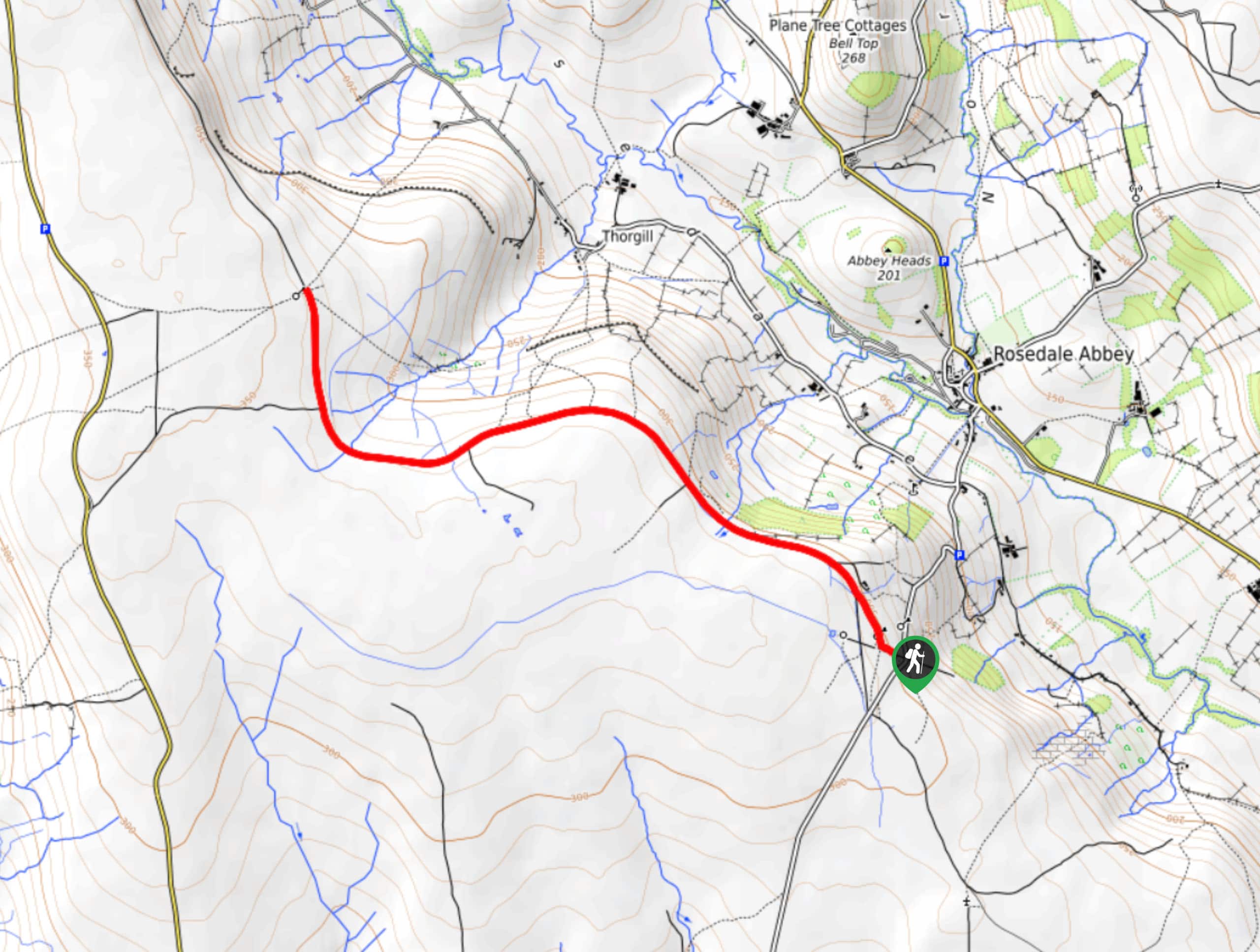
To get to the trailhead for the Bank Top and Rosedale Mineral Railway Walk from Rosedale Abbey, head southwest on Gill Lane for 0.2mi, keeping straight onto Rosedale Chimney Bank for another 0.6mi to arrive at the car park.

About
| Backcountry Campground | No |
| When to do | Year-Round |
| Pets allowed | Yes - On Leash |
| Family friendly | Yes |
| Route Signage | Average |
| Crowd Levels | Moderate |
| Route Type | Out and back |
Bank Top and Rosedale Mineral Railway Walk
Elevation Graph
Weather
Bank Top and Rosedale Mineral Railway Walk Description
The walk along the Bank Top and Rosedale Mineral Railway is a truly fantastic adventure that features little in the way of challenging terrain, but offers spectacular views across moors. This trail utilizes a portion of an old railway that at one time transported raw materials, such as coal and iron, playing a pivotal role in the development of Yorkshire during the industrial revolution.
Setting out from the car park, you will make your way to the west and pass by some kilns and other remnants of the industrial past of the region before continuing along the railway as it skirts alongside the edge of the moor.
Take some time to appreciate the stunning views across Rosedale and the rest of the North York Moors further afield, as you eventually reach the northwesternmost point of the route. From here, you will turn back and retrace your steps, taking in the opposite view of the surrounding landscape as you work your way back to the car park at Bank Top.
Similar hikes to the Bank Top and Rosedale Mineral Railway Walk hike

Kirkbymoorside and Gillamoor Walk
The Kirkbymoorside and Gillamoor Walk is a great outdoor excursion along the southern edge of North York Moors National Park…

Farndale Railway Walk to Blakey Ridge
The Farndale Railway Walk to Blakey Ridge is a lengthy but easy-going route that will allow you to experience the…

Botton and Blakey Ridge Circular Walk
The Botton and Blakey Ridge Circular Walk is a rugged and beautiful adventure that will allow you to experience the…
Comments