
Skyline Trail
View Photos
Skyline Trail
Difficulty Rating:
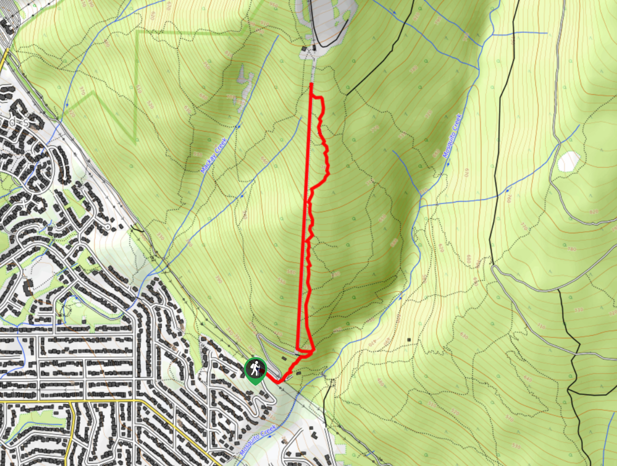
The Skyline Trail is a 2.2mi loop that climbs up a steep slope and descends through a dense covering of West Coast forest. Along the route, there will be scenic views at the top of the old ski run, as well as a historic site marking the location of the US Airforce F-86 crash that occurred in 1954. The steep incline and rocky trail make this hike a great option for getting in a challenging workout, similar to the nearby Grouse Grind and BCMC trails.
Getting there
To reach the trailhead for the Skyline Trail from Vancouver, drive west along Trans Canada Highway/BC-1 W, and take exit 17 for Westview Dr. Continue onto Delbrook Ave for 1.1mi, making a left turn onto Montroyal Boulevard. Turn right after 1985ft onto Skyline Dr. Continue on Skyline Dr for 0.9mi and you will reach the parking area.

About
| When to do | May-November |
| Backcountry Campsites | No |
| Pets allowed | Yes - On Leash |
| Family friendly | Older Children only |
| Route Signage | Average |
| Crowd Levels | Moderate |
| Route Type | Circuit |
Skyline Trail
Elevation Graph
Weather
Skyline Trail Description
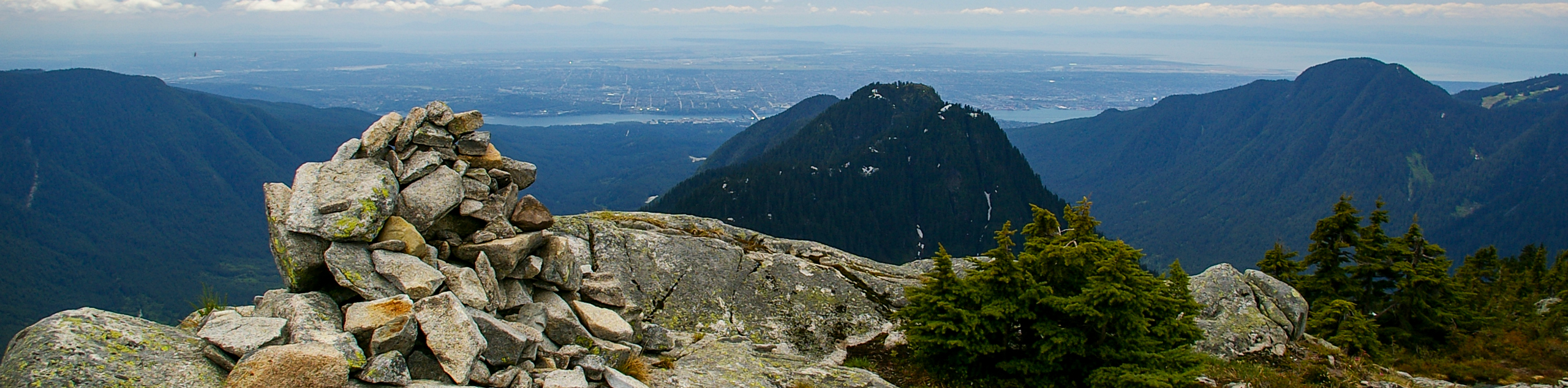
The Skyline Trail is similar to other hiking trails near Grouse Mountain in that it is characterized by a steep incline along a rock/root-covered path. Be sure to wear proper hiking footwear to better traverse the technical trails, as well as microspikes to combat any icy conditions. Besides the beautiful views of Vancouver from the top of the old ski run, there aren’t any other viewpoints for hikers to take advantage of. Instead, the route has a few historical sites scattered throughout its trails.
Along the trail, hikers will find the rusty remnants of the old chairlift that used to take people up Grouse Mountain prior to the installation of the gondola. Near the top of the loop, you will be able to see what is left of the 1954 US Airforce plane crash. Only the engine of the F-86 Sabre Jet remains in the forest, serving as a memorial for Second Lt. Lamar J. Barlow, the pilot who was killed in the accident. The last sights that hikers will experience are the old decrepit cabins that can be found on the mountain, reminiscent of times long gone by. In all, the Skyline Trail is a hiking trail that offers some unique sights and packs a punch as a workout.
To set out on the route, you can either walk up Skyline Drive or follow the Baden Powell Trail to the right of it to make your way up to the Skyline Trail. When you reach the bottom of the chairlift, it is essentially a straight uphill climb along the rocky trail to reach the viewpoint. From here, you will have a beautiful view of the city of Vancouver as you stand atop the old ski run.
Follow the trail to the right as it descends through the forest, keeping straight to reach the F-86 crash site. This portion of the trail can be a bit of a strain on your knees due to the steep slope, so bring hiking poles to soften the impact. Continue on through the dense forest cover, passing by the old cabin as you make your return journey to the parking area on Sunset Drive, having completed the Skyline Trail.
Similar hikes to the Skyline Trail hike
Hike to South Needle
The Hike to South Needle follows along an extension of the trail to Lynn Peak, passing by the viewpoint and…

Lynn Lake Trail
The Lynn Lake Trail is a lengthy hike through the Lynn Headwaters backcountry that is sure to get you off…

Old Buck and Bridle Trail Loop
The Old Buck and Bridle Trail Loop is an amalgamation of the Old Buck, Bridle, and Baden Powell trails that…
Comments