Norvan Falls hike
View Photos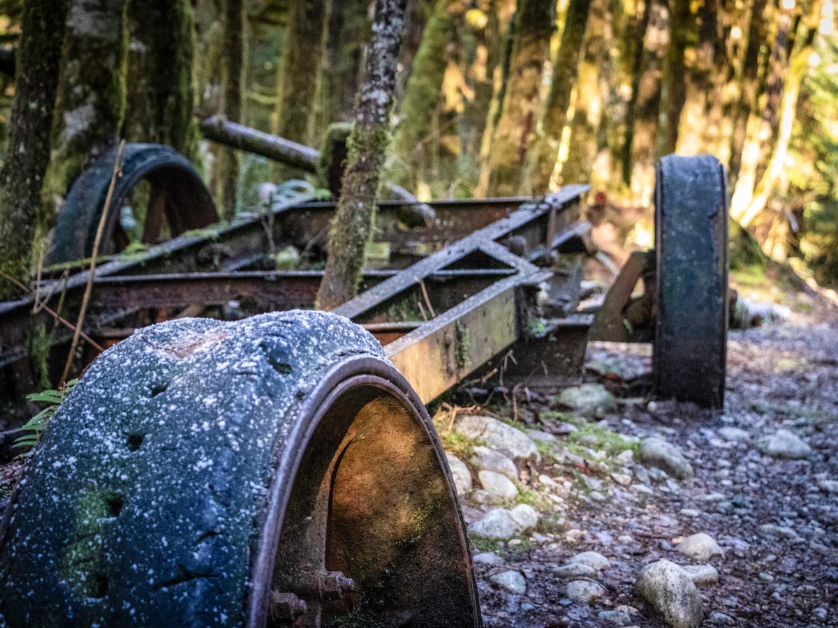
Norvan Falls hike
Difficulty Rating:
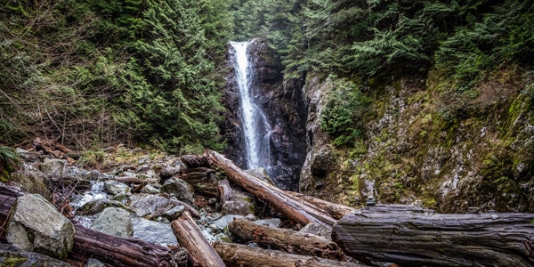
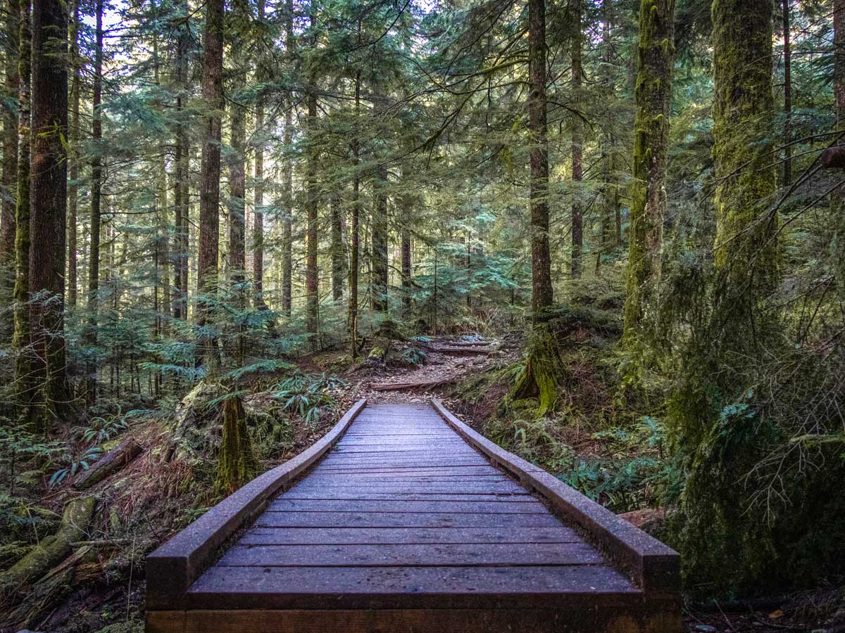
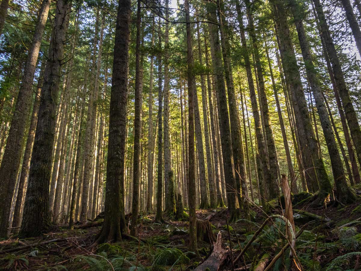
Embark on a hike at Norvan Falls, located in Lynn Headwaters Regional Park, in North Vancouver where a dazzling waterfall awaits at the end of the trail. This trail runs parallel to Lynn Creek and is relatively flat, making for an accessible hike for all and a great spot for trail running. While there is no sweeping vista to enjoy on this hike, the waterfall is beautiful, and the trail through the forest is itself rewarding.
Getting there
From North Vancouver, head out of the city towards Fern St. Continue onto Lillooet Rd, making a slight left to stay on Lillooet Rd for 6.4mi. Arrive at Norval Falls Parking Lot, park in the far end by the trail board.

About
| When to do | All seasons |
| Backcountry Campsites | No |
| Pets allowed | Yes |
| Family friendly | Older Children only |
| Route Signage | Average |
| Crowd Levels | Moderate |
| Route Type | Out and back |
Norvan Falls
Elevation Graph
Weather
Route Description for Norvan Falls
Set out on the Norman Falls hike from the farthest end of the parking lot, where you’ll spot a large map that shows the local hiking trails to become familiarized with the trail route.
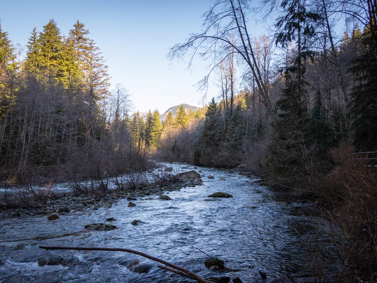
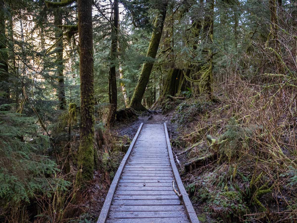
From here, head north to the bridge that goes over Lynn Creek. Here, you’ll find a hiker registration station, where you should fill out a form in case of an emergency. Head left from this registration station onto the wide path. The first section of the trail is well marked and easy to follow. Take the Lynn Loop Trail north through the forest for 1.8 km, until you hit a junction point and a trail sign.
At the junction you have two options, you can head right and upwards to Upper Lynn Loop and Headwaters Trails, which is an alternative route that will eventually take you to Norvan Falls, but makes the hike significantly harder with more elevation gain. Instead, we recommend you follow the trail north along the Lower Lynn Loop Trail. Continue for 1.1mi until you hit the Cedars Mill Trail, staying left and following the creek.
The Norvan Falls trail was once home to an extensive logging trade during the early 1900’s and to this day, there remains artifacts from this time period, such as a four-wheel log transporter that was left among the woods.
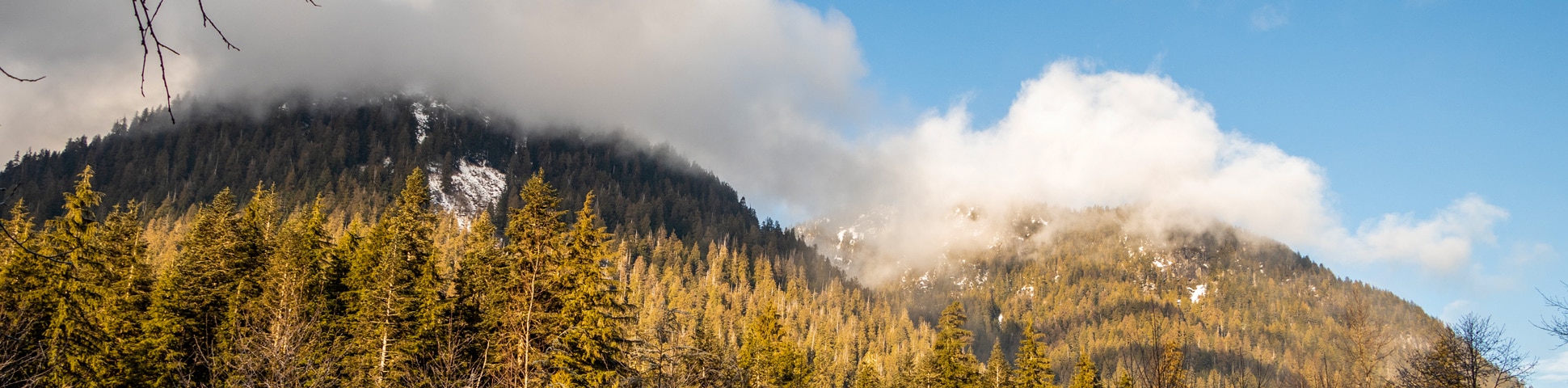
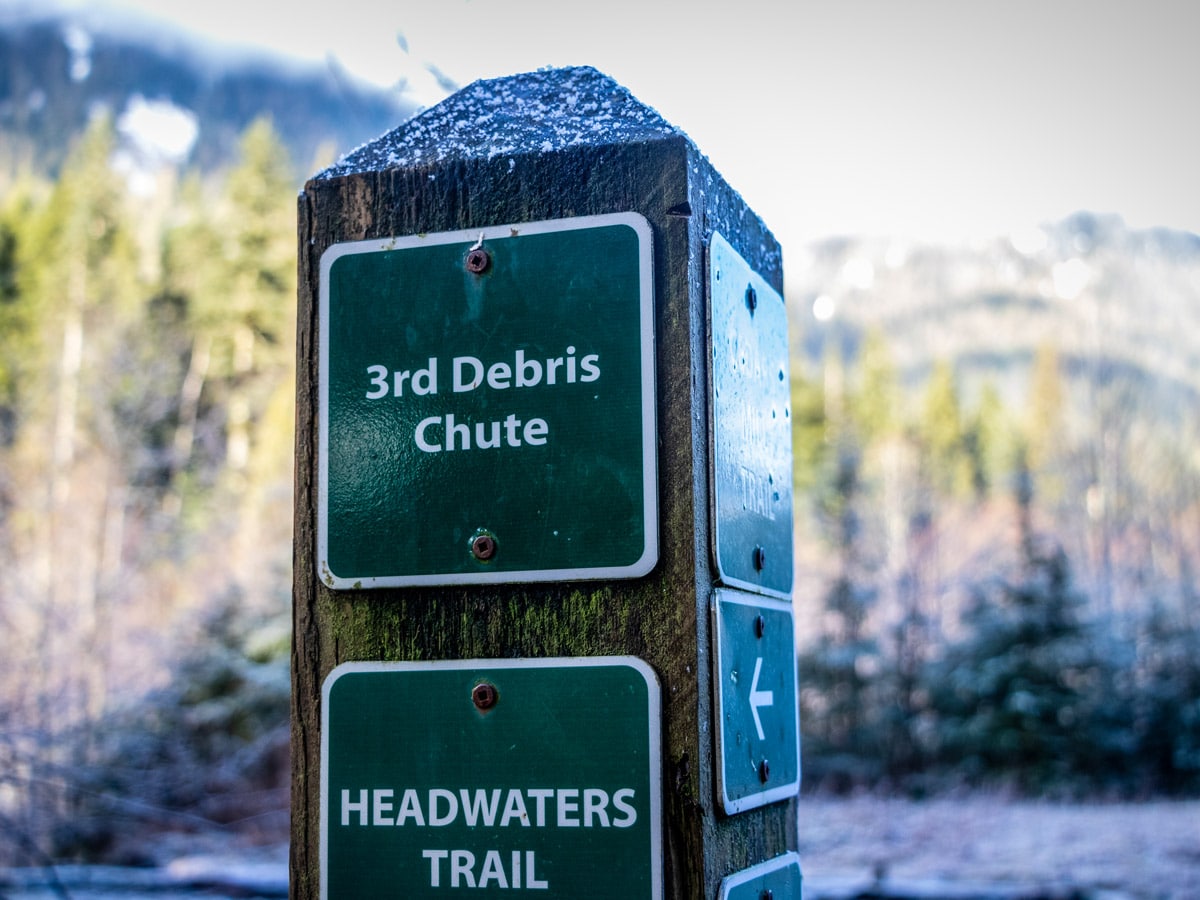
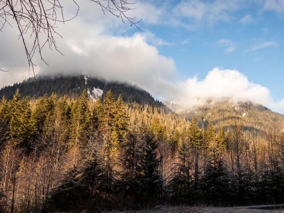
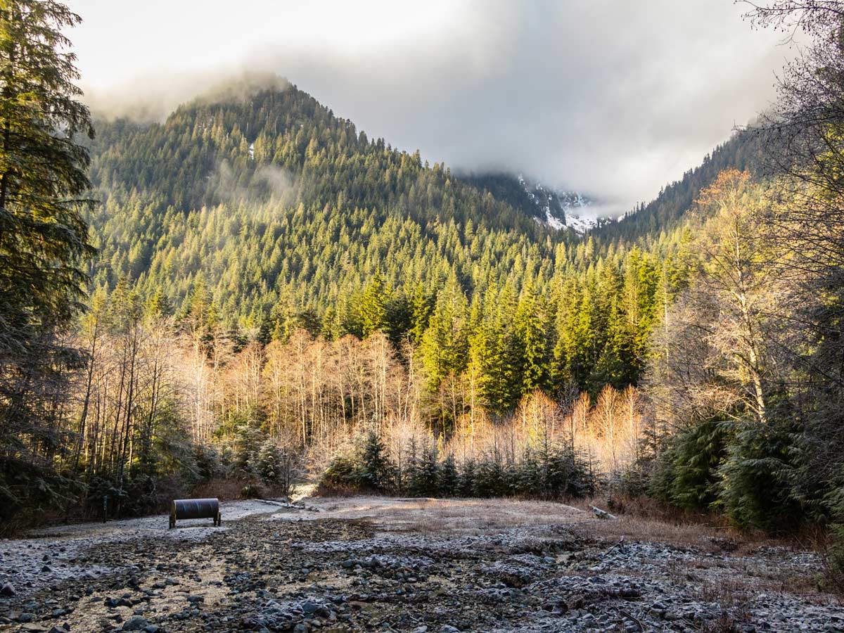
Continue on the hiking trail for about another 1.3mi until you come to an open area, known as Third Debris Chute, which turns into the Headwaters Trail. This is the perfect spot to stop for a rest, have a snack and soak in the mesmerizing view of Goat Ridge and Mount Fromme.
From here, follow the junction north, until the path turns into a single-track and becomes more challenging. Keep hiking north, noting the numerous yellow trail markers. The trail moves further away from Lynn Creek and becomes more rolling, up and down, and even passing over multiple jagged streams.
About 1.9mi from the 3rd Debris Chute, the path once again splits into two options. To the right is Coliseum Mountain – an ambitious undertaking. We’d suggest staying left, until you reach the next junction where you can take a left and cross over a metal suspension bridge to the Hanes Valley Trail and also to Lynn Lake (save this for another day as well).
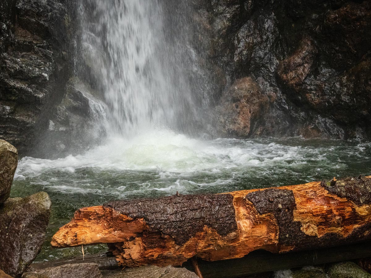
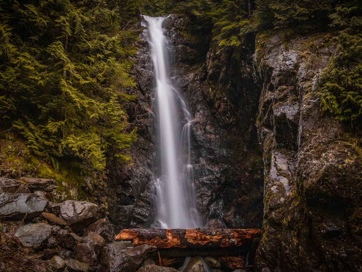
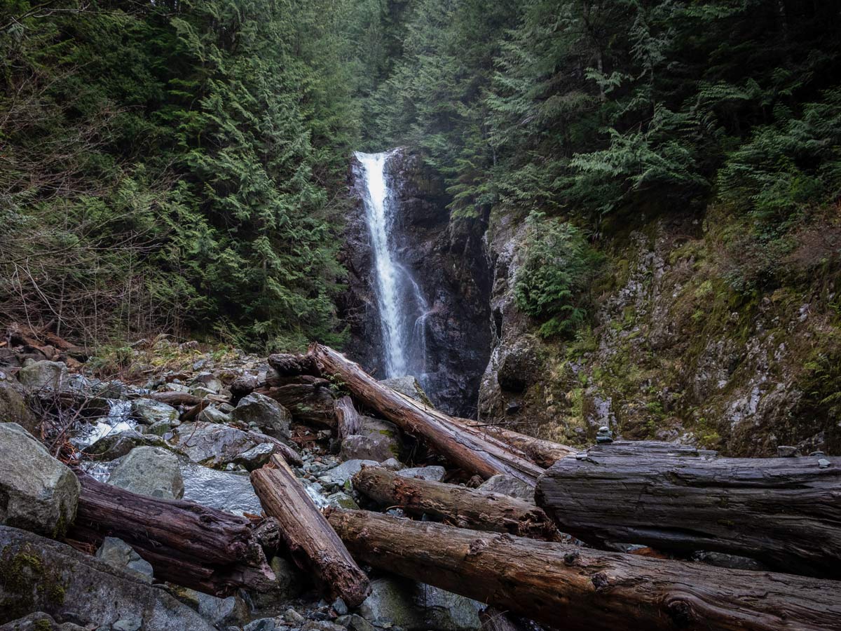
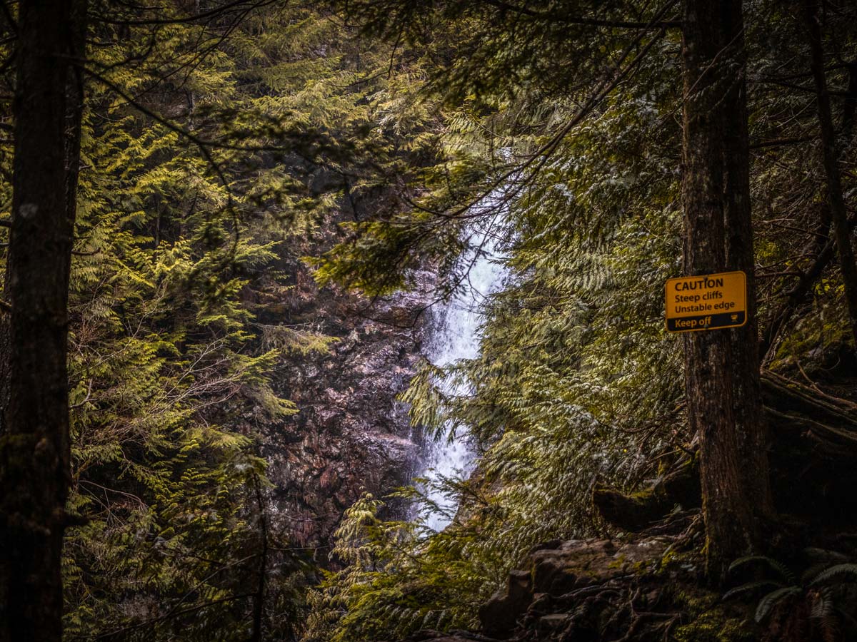
Head right, following the signs for Norvan Falls. From here, tackle the last few hundred meters up a big hill to reach the 98ft high Norvan Falls.
For a photo op, and be careful about this, go to the viewpoint at the very tip top of the trail, but proceed with caution, so as not to fall off the cliff. If you’d like to get closer to Norvan Falls, there are a few safe spots to access the creek further back down the trail, but they are not official paths and should also be proceeded with caution.
Once at Norvan Falls, take a rest before heading back the exact same way you came, until you reach the parking lot.
Insider Hints
If you want to add even more distance to the Norvan Falls hike, you can also start at the Lower Seymour Conservation Reserve and access Lynn Headwaters Regional Park via the Lynn Headwaters Connector Trail, which skirts the west side of Rice Lake.
The Norvan Falls trail has a lot of loose debris, stairs and jagged rocks, we recommend hiking boots over trail runners or sneakers.

Similar hikes to the Norvan Falls hike

Lynn Lake Trail
The Lynn Lake Trail is a lengthy hike through the Lynn Headwaters backcountry that is sure to get you off…

Old Buck and Bridle Trail Loop
The Old Buck and Bridle Trail Loop is an amalgamation of the Old Buck, Bridle, and Baden Powell trails that…

Goldie and Flower Lake Loop
The Goldie and Flower Lake Loop is a short trail that makes its way through the peaceful terrain surrounding these…
Brandon Houston 5 years ago
Great hike! Really enchanting, even on a rainy day. Also, rain makes the waterfall more beautiful.
Jessica G. 5 years ago
It was a lovely hike. Not too difficult, with mild elevation gain, but quite long and a nice workout.
Rixy H. 5 years ago
the hike was very easy...some sections require a bit of extra focus to ensure you don’t slip or fall...overall, enjoyed the stunning views.
Isaac Tomlins 5 years ago
Slightly challenging trail due to tree roots. The trail was extremely muddy as well, so bring some spare shoes!
Dan G. 5 years ago
There is almost no incline. The path is well marked and maintained. The waterfall at the end of the trail is pretty small but still beautiful.
Wade Atkinson 5 years ago
Awesome environment. The glistening water from the falls looks magical.
genevaoftheeast 5 years ago
The trail was forgiving and manageable. The thriving surroundings look fantastic.
2026 years ago
"This trail is superb! Super easy at first, after that it is a bit challenging but manageable.