
Mount Seymour hike
View Photos
Mount Seymour hike
Difficulty Rating:
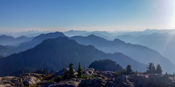
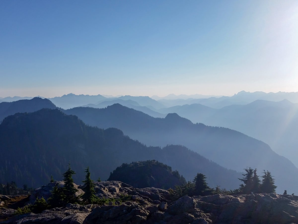
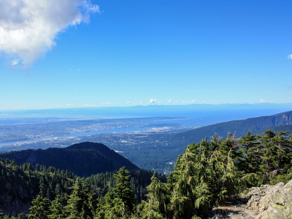
The Mount Seymour hike is home to three unique trails leading to peaks, each offering their own panoramic vista. After a heart-pumping workout to the summit, you’ll be rewarded with views of Vancouver, the Lower Mainland, and the Indian Arm.
Getting there
From North Vancouver, Take Keith Rd E to Lillooet Rd in North Vancouver. Continue on Lillooet Rd, then turn right onto Spur 4. Turn left to stay on Spur 4. The parking lot will be on your right.

About
| When to do | July to October |
| Backcountry Campsites | No |
| Pets allowed | Yes - On Leash |
| Family friendly | No |
| Route Signage | Average |
| Crowd Levels | High |
| Route Type | Out and back |
Mount Seymour
Elevation Graph
Weather
Route Description for Mount Seymour
The Mount Seymour hike is an incredibly popular hiking trail (and often crowded), but the well maintained and marked paths make for an easy hike. Just keep eyes peeled for painted orange rocks, tree-markers and signs.
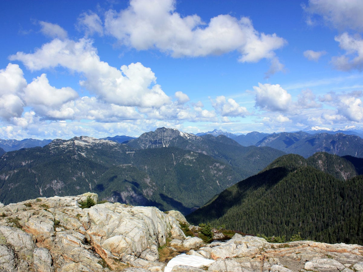
There are three peaks on this hike, the peaks are known as Pump Peak, Tim Jones Peak, and Mount Seymour Peak. Though both Pump Peak and Tim Jones Peak are stunning hikes, it’s the third and final peak, the summit of Mount Seymour that most choose to tackle.
Kick off your hike just north of the Mount Seymour Ski Resort parking lot, near the trail board. To begin, head north up the trail that runs parallel to the Manning ski run. After about 1640ft, you’ll notice a split in the road, follow the marking for Dinky Peak Lookout. Continue straight forward for 295ft, until you reach the First Lake Trail junction. Again, keep going straight, following the marked signage.
Follow the bright orange markers for 0.7mi, until you notice a dirt trail, follow it – you are once again on the Manning ski run. Hike uphill briefly, before returning back onto the dirt trail past Sugar Bowl Pond in about 984ft. The road should look like a single-track trail, don’t mistake it for the steep uphill road to the right, which leads to Mystery Peak.
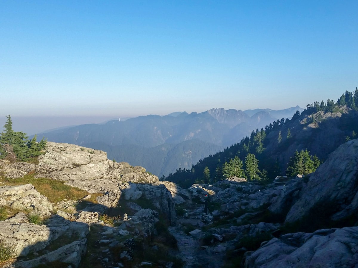
From here, the climb heads uphill and becomes more challenging. For a quick detour option, at the next junction, follow it to the rocky point on your left. This is Brockton Point, and it’s worth the pitstop for the view.
Push forward for 1.9mi until you spot the sign for a turnoff for Elsay Lake and Mount Elsay, which is a much more ambitious undertaking than the trail to Mount Seymour (save those hikes for another day). Instead, take a left and up a steep section, until you reach a crest between Pump Peak and Tim Jones Peak.
Stop here for a rest and a photo op, then head north down the trail towards Tim Jones Peak. Look down to spot the orange paint on the rocks. Prepare for the hardest part of the hike, the ascent up Tim Jones. At the top of the hill, you’ll notice a sign for the detour to the Tim Jones Peak.
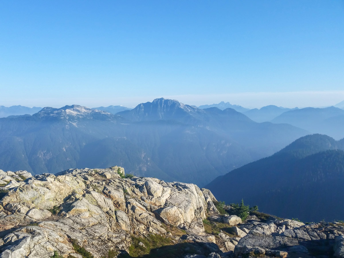
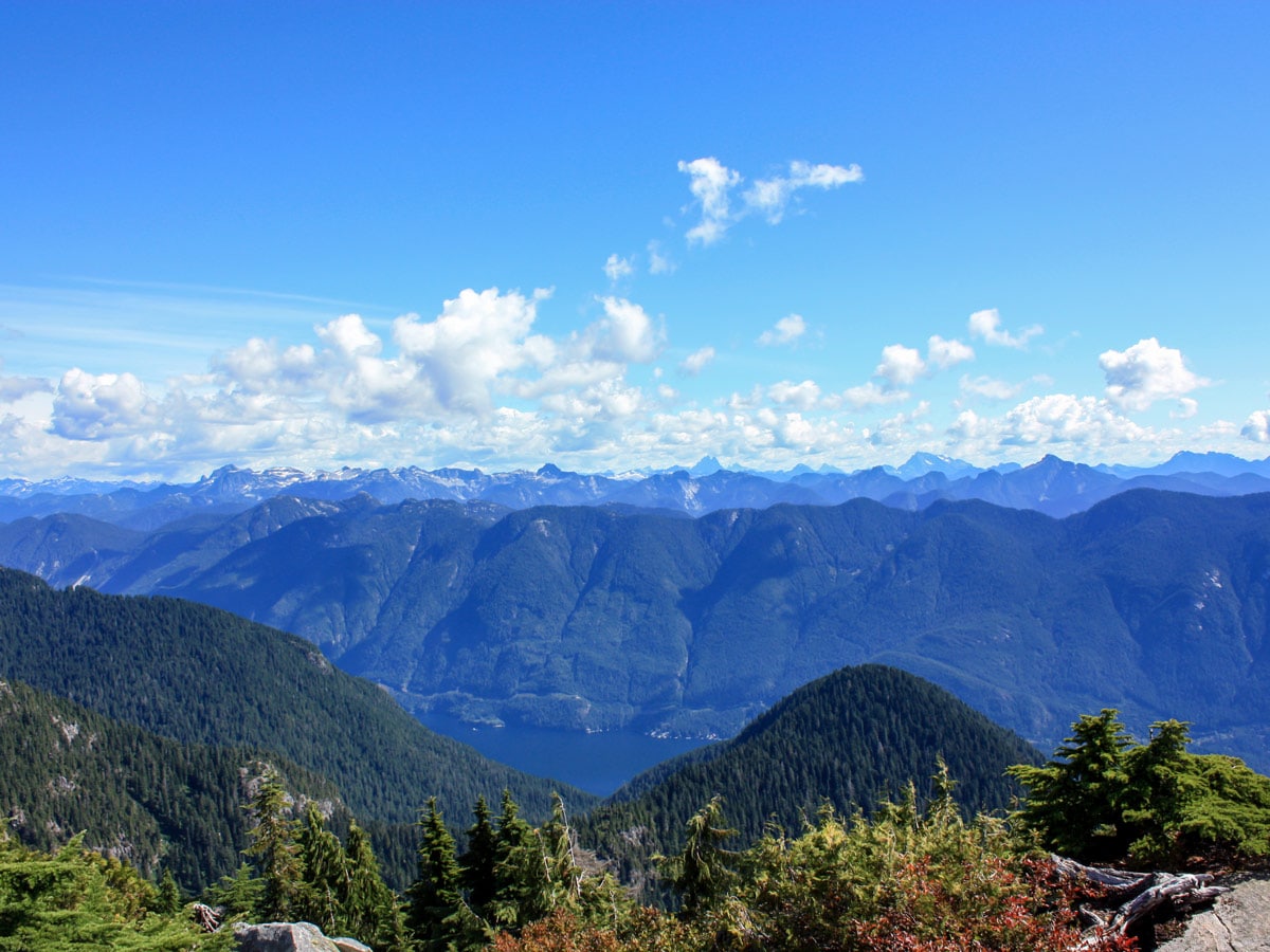
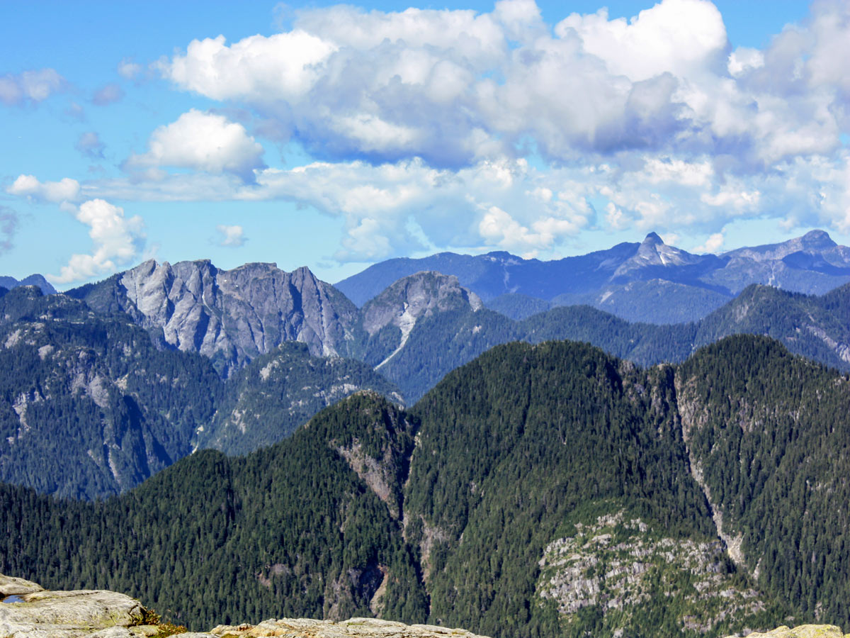
Finally, you’ve arrived at the second peak! Breathe in the fresh mountain air and spot Coliseum Mountain, Crown Mountain, Lynn Peak and South Needle off in the distance. From here, you’ll spot your final destination, the third and final peak, Mount Seymour Summit.
Depending on the season, the final ascent to Mount Seymour can be dangerous. If there is snow or ice on the trail during the shoulder season, wait until the summer to tackle the final climb.
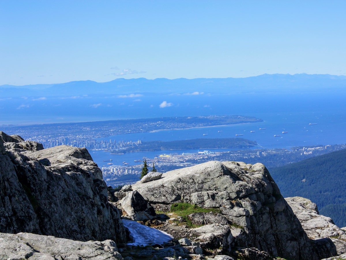
If safe to do so, follow the trail as it drops about 328ft in elevation down to a saddle, then turns into an exposed section of rock you will need to scramble up. As you climb up the final ascent towards Mt. Seymour, a nice view of Vancouver opens up behind you.
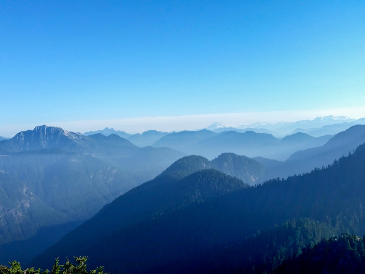
Celebrate, you’ve made it to the Mount Seymour Summit! Here, you’ll be rewarded with 360-degree views, while you stop and rest on the rounded plateau. To the west, you can see Lynn Ridge, South Needle, Mount Fromme, Crown Mountain, and all the way to Vancouver Island if it’s clear. To the east, you can see as far as Golden Ears. And directly north you can see Mount Elsay and Mount Bishop immediately in front of you.
After you’ve rested enough and taken a mental (or physical) photo, prepare to carefully follow the same route down, keeping eyes peeled for those orange rocks.
Insider Hints
There are plenty of alternative trail routes that can make this into a longer, even multi-day hike. We recommend looking at a trail map prior to your hike.
This is probably one of the most popular routes in all of the North Shore, so we’d avoid this trail on weekends if possible.

Similar hikes to the Mount Seymour hike

Lynn Lake Trail
The Lynn Lake Trail is a lengthy hike through the Lynn Headwaters backcountry that is sure to get you off…

Old Buck and Bridle Trail Loop
The Old Buck and Bridle Trail Loop is an amalgamation of the Old Buck, Bridle, and Baden Powell trails that…

Goldie and Flower Lake Loop
The Goldie and Flower Lake Loop is a short trail that makes its way through the peaceful terrain surrounding these…
David L. 4 years ago
great place to hike and hang out. nice to walk around even if it's the colder season. very spacious and beautiful scenery.
Glori S. 5 years ago
It may take a while, but the views from the peak are amazing. It's just beautiful. Have fun on this trail, and stay safe.
Rixy H. 5 years ago
this is a short and easy hike in mount seymour that offers an incredible view of vancouver on a clear day...the trail is a bit deceiving, requiring careful steps along several sections that are covered with slippery tree roots..
Isaac Tomlins 5 years ago
Lovely moderate hike. The path tends to be quite muddy and wet in some areas. Great view, but I don't see myself doing this one again.
Kenneth D. 5 years ago
A fantastic hike indeed. Probably one of my favorite of the North Shore mountains. A challenging hike because of its steepness.
Heinrich P. 5 years ago
I enjoyed my hike in this place a lot. It has a beautiful trail even on days with no view. The trail was very quiet so you'll have the feeling of solitude.
Wade Atkinson 5 years ago
Such an amusing hike, so beautiful with the views of the vista.
EthelB. 5 years ago
Gorgeous trail, amazing sights. Absolutely recommend it.
loneranger 5 years ago
My friends told me I should do this hike, glad I did because it was awesome! I highly recommend this one.
Amethyst S. 5 years ago
The signages help a lot. Wish other hikes are like this.