Mount Harvey Trail
View Photos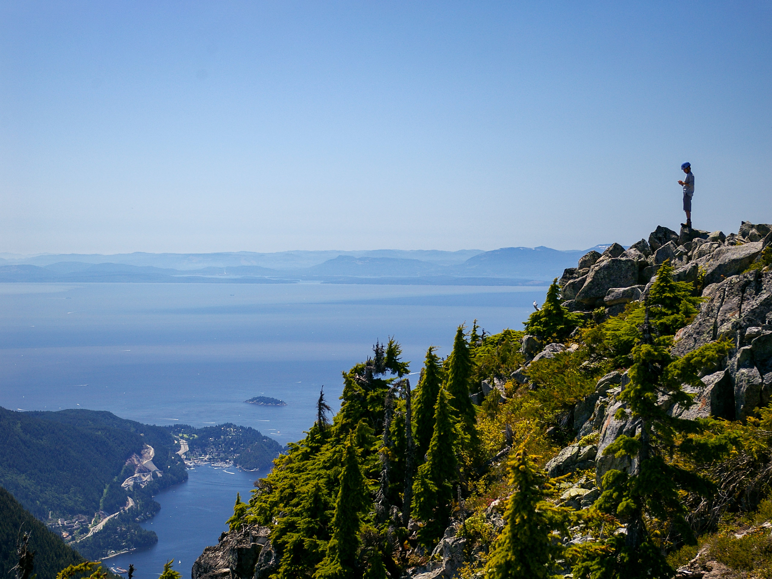
Mount Harvey Trail
Difficulty Rating:
The Mount Harvey Trail is a 6.6mi out-and-back with steep sections of trail and stunning views of the Lions and Brunswick Mountain. The route is rated as difficult due to the steep slopes and technical trail, but the easy, non-exposed scramble near the summit is a fun way to cap off your adventure. Considered by some as one of the best peaks on the North Shore, this trail is less-travelled than some of its nearby counterparts, but the views are just as spectacular.
Getting there
To reach the Mount Harvey trailhead, drive north along BC-99 and take the exit for Lions Bay Ave. Continue onto Oceanview Rd, turning left on Crosscreek Rd. After 427ft, make a right turn onto Centre Rd and a quick left turn onto Bayview Rd. Continue on for 0.7mi, where you will approach Mountain Dr. After turning left, drive for 984ft until you get to Sunset Drive. Make another left turn, and you will find the trailhead straight ahead in 492ft.

About
| When to do | July-October |
| Backcountry Campsites | No |
| Pets allowed | Yes - On Leash |
| Family friendly | No |
| Route Signage | Average |
| Crowd Levels | Moderate |
| Route Type | Out and back |
Mount Harvey Trail
Elevation Graph
Weather
Mount Harvey Trail Description
The Mount Harvey Trail is a difficult uphill climb over some uneven terrain, so be prepared for a steep incline, with a large elevation gain of 4593ft packed into a relatively short window of 3.7mi. There are some flat sections throughout the 6.6mi trail, but make no mistake, this is a seriously tough hike. Be sure to wear proper hiking footwear and bring microspikes to combat any potentially icy trail conditions that you may encounter. Additionally, this route shares a trailhead with several other major hiking trails in the area, such as the Lions and Brunswick Mountain, making parking a bit scarce. Arrive early to secure a spot at the trailhead, or travel a short distance to the overflow parking lot at Lions Bay Elementary School.
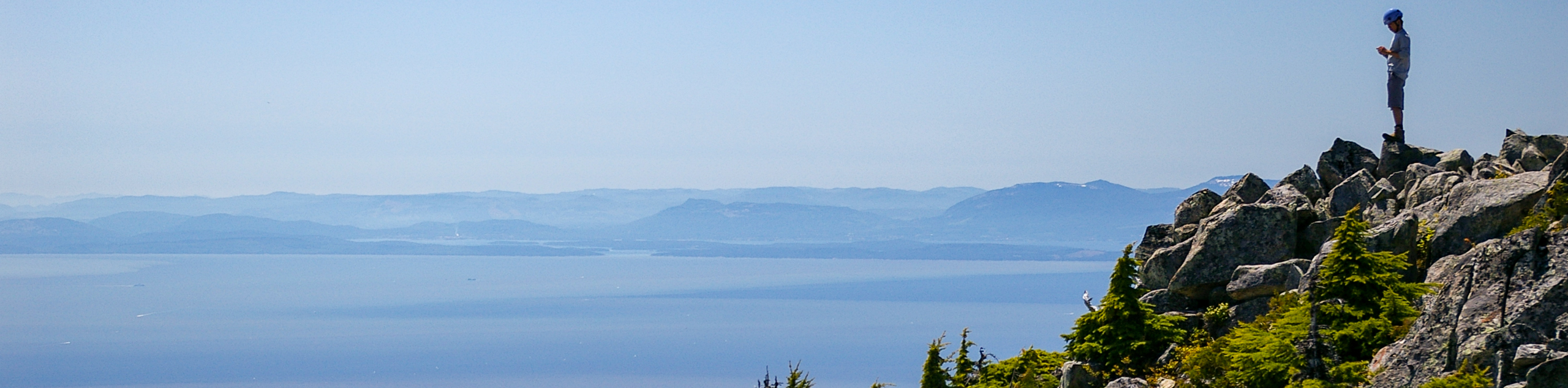
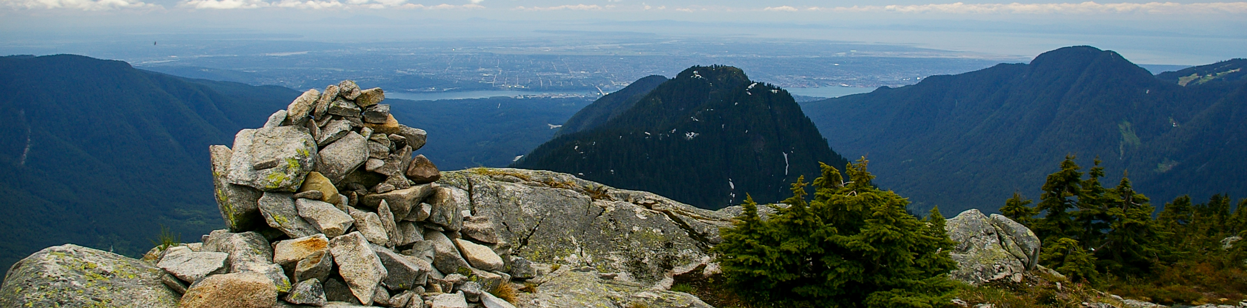
For all of its steepness and intensity, this trail is an amazing day hike for anyone looking to push themselves toward the ultimate reward that is the stunning view from atop Mount Harvey. Considered by some to be the best peak along the North Shore, once you climb over the final rock to reach the summit, you will be greeted with a panoramic 360° view of the Lions and Unnecessary Mountain to the south, Howe Sound and the islands out to the west, the entirety of the Capilano Watershed to the east, and the expanse Garibaldi Provincial Park off in the distance to the north. Don’t let anyone fool you; the slog up to the summit is gruelling, but the views from the peak are good enough to be almost incomprehensible.
Setting off from the trailhead at the end of Sunset Drive, pass through the yellow gate and travel along the wide gravel pathway as it meanders uphill. Keep straight along the gravel road, following it through a series of switchbacks, as the trail gains in elevation. Pass by any junctions that you encounter along this initial portion of the trail, continuing on the gravel access road until you reach a fork in the trail approximately 1.2mi from the trailhead. The path to the left will lead up to Brunswick Mountain, so you can ignore this and take the trail to the right to head towards Mount Harvey.
After climbing to the top of the hill, you will notice the trail level out. Continue along this flat stretch of the trail, passing by a junction on your left before reaching another fork in the trail near Alberta Creek. Keep left at the fork to continue on the route to Mount Harvey as it skirts alongside the creek for a short distance.
As the trail heads into the trees, it will begin the steep climb up to Mount Harvey. This is roughly the halfway point of the ascent, but the last half will feel a lot longer due to the gruelling uphill battle. Keep working your way along the path as you make your way through the dense tree cover. Unfortunately, there aren’t any real views through this portion of the hike, but you can take solace in the fact that there will be plenty of beautiful views to be experienced from atop the peak.
As you finally break through the tree cover, you will come out onto the ridge and be greeted with an incredible view of the Lions in front and Howe Sound behind you. Make your way to the left and follow along the ridge toward the summit of Mount Harvey. From here, you will need to navigate an easy scramble over the rocky terrain to reach the summit. This section is technical, but not exposed, making it a fun way to cap off the grueling ascent.
After reaching the top of Mount Harvey, take a few breaths of the crisp mountain air and soak up the 360° views of the beautiful North Shore. On a clear day, you will have a near-limitless view of the many backcountry mountains that dot the landscape, as well as the waters of Howe Sound and the islands floating off to the west. After enjoying the view, break out your trekking poles (your knees will thank you) and head back along the same trail, having conquered Mount Harvey.
Hiking Route Highlights
The Lions
Arguably the most recognizable natural landmark in the area around Vancouver, the Lions are a distinct rock formation of pointed peaks that are unique among all mountains on the North Shore. Standing tall at over 5249ft, these famous peaks inspired the naming of the Lions Gate Bridge, as well as the BC Lions football team.
Howe Sound
An historically important waterway for the Squamish and Shishalh indigenous peoples, the area was first explored in 1791 by Spanish explorers and named Boca del Carmelo. In 1792, it was renamed Howe Sound by George Vancouver and dedicated to his friend, British Admiral Richard (Earl) Howe. This triangular body of water opens into the Strait of Georgia and stretches northeast for 26.1mi toward Squamish.
Insider Hints
Arrive early for parking ($3 per hour), as there are not many spaces, and the trailhead is shared with the Lions and Brunswick Mountain trails.
Additional parking can be found at the nearby Lions Bay Elementary School.
Bring hiking poles for the return trip, as the steep slope isn’t very knee-friendly.
Wear proper hiking footwear, and bring microspikes for traversing icy patches.
The trail can be buggy near the top, so bring bug spray.
Similar hikes to the Mount Harvey Trail hike
Hike to South Needle
The Hike to South Needle follows along an extension of the trail to Lynn Peak, passing by the viewpoint and…

Lynn Lake Trail
The Lynn Lake Trail is a lengthy hike through the Lynn Headwaters backcountry that is sure to get you off…

Old Buck and Bridle Trail Loop
The Old Buck and Bridle Trail Loop is an amalgamation of the Old Buck, Bridle, and Baden Powell trails that…
Comments