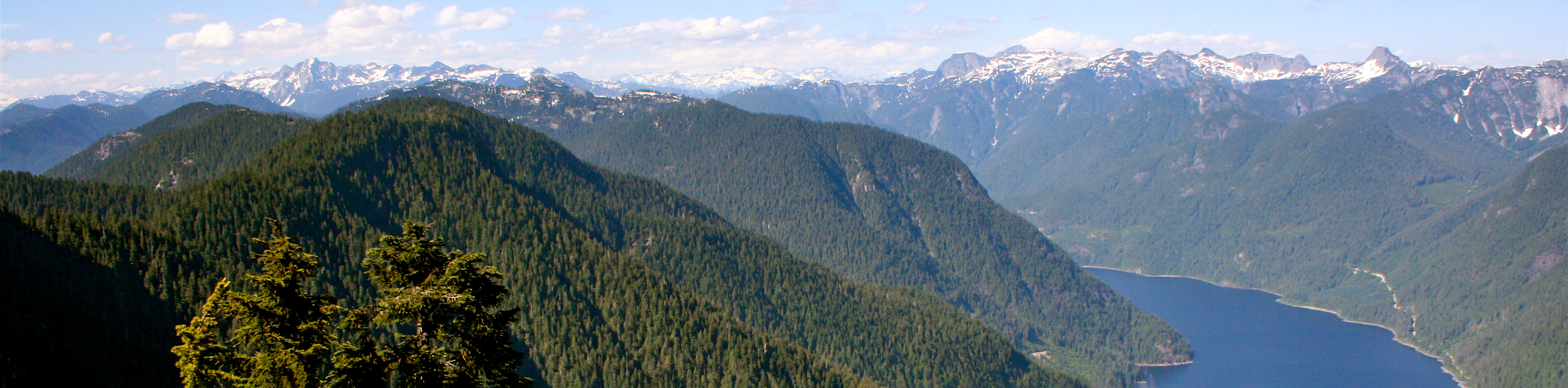
Indian Arm Trail
View Photos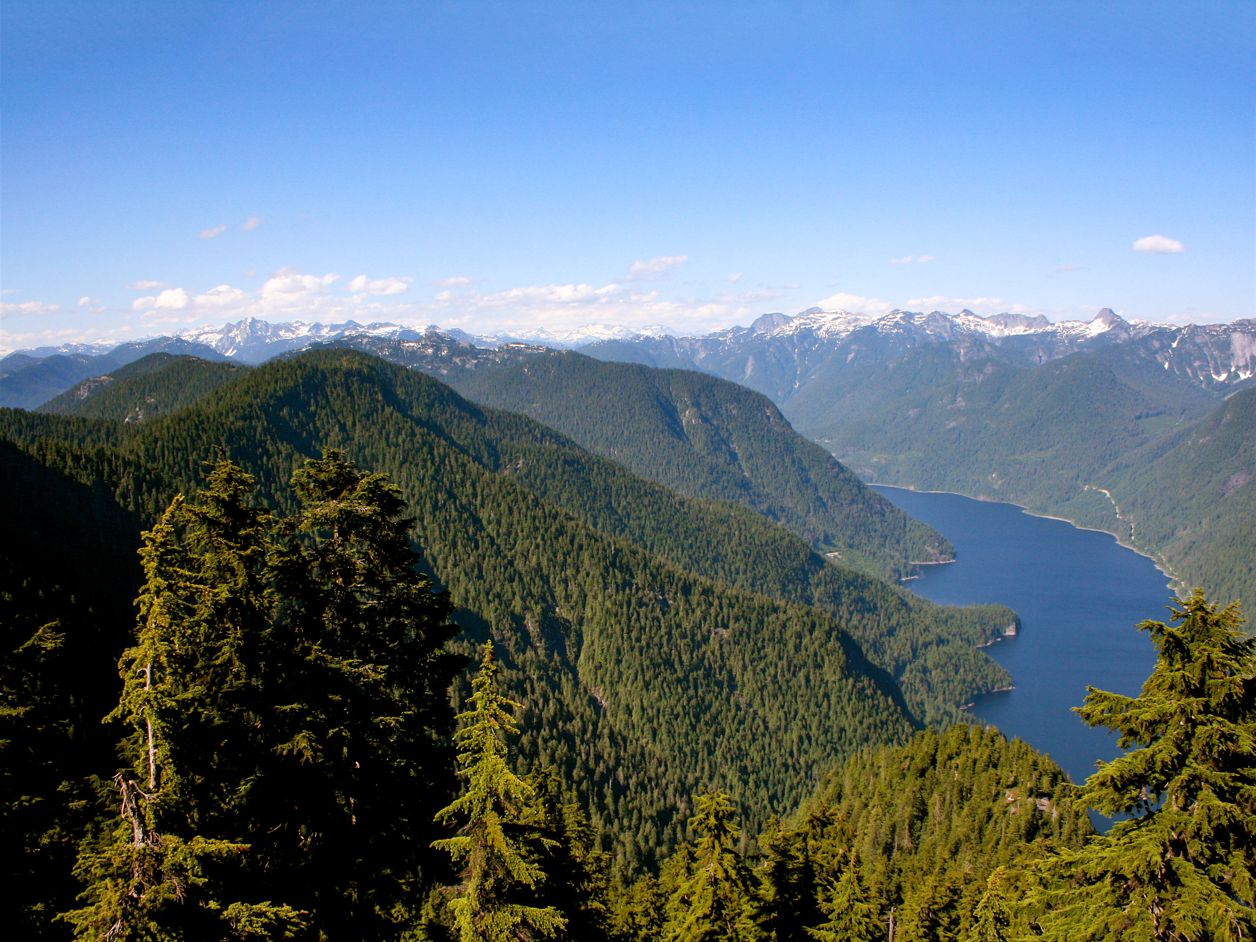
Indian Arm Trail
Difficulty Rating:
The Indian Arm Trail is a very lightly-trafficked out-and-back route that sets out from Deep Cove and works its way into Mount Seymour Provincial Park. This route doesn’t have many views, but it does pass through an absolutely beautiful stretch of West Coast rainforest for the entirety of the trail, making it a great option if you are looking for a bit of solitude. Make sure to bring a GPS for this one, as there are many routes that split off from the main trail and route signage isn’t the greatest.
Getting there
To reach the parking area for the Indian Arm Trail from Vancouver, drive north on Trans Canada Highway/BC-1 W and cross the Ironworkers Memorial Bridge. Take exit 22B toward Mount Seymour Parkway, following it for 3.4mi. Make a left turn onto Deep Cove Road, keeping on it for 0.7mi. As the road veers to the right it will become Gallant Avenue. Turn left after 328ft onto Panorama Drive and you will find the parking lot on your right.

About
| When to do | Year-Round |
| Backcountry Campsites | No |
| Pets allowed | Yes - On Leash |
| Family friendly | No |
| Route Signage | Poor |
| Crowd Levels | Low |
| Route Type | Out and back |
Indian Arm Trail
Elevation Graph
Weather
Indian Arm Trail Description
The Indian Arm Trail is a very lightly-trafficked route and should be treated with a slight degree of caution if you are unfamiliar with the area. Make sure to bring a GPS or familiarize yourself with a good trail map, as the area is full of side trails, and trail markers can be sparse. Additionally, hikers should wear proper hiking footwear, as the lightly-trafficked nature of the route means that it is fairly rugged and technical when compared to other nearby trails.
This trail largely consists of dense tree cover, making it a great day hike for those looking to escape into the forest for a bit of solitude. There aren’t any spectacular views, but the forest of tall Western Red Cedar and Douglas Fir trees is almost magical on a damp morning, and the numerous creek crossings along the technical trail offer enough variation to keep the hike interesting. You likely won’t run into many other hikers along this route, so bring the GPS and get ready for a quiet day along the Indian Arm Trail.
Set out from the parking lot at Panorama Park and head north to cross over Panorama Drive, walking along it until you see a sign on the left just before the creek that marks the trail. Walk along the driveway and toward the wooden steps to reach the trailhead.
After climbing the stairs and traversing the root-covered path, follow along the trail as it enters the forest. You will soon cross over a bridge that spans Panorama Creek, at which point the trail will begin to level out. As you continue on the trail, there will be slight changes in elevation until you come to another bridge across Cove Creek.
Make your way over the wooden bridge and take a right turn at the next junction to follow on the Holly Goes Lightly Trail. From here, travel north until the trail meets up with Indian River Drive. Cross over the street and walk along it for a few meters until you reach a bend. On the outside corner of the bend there will be two trails that split off to the left, the first being the Baden Powell Trail and the second being the Three Chop Trail. Take the Three Chop Trail, as it continues to head north through the dense tree cover.
After 2297ft, hikers will make their way across Francis Creek, coming to a series of junctions in the trail. Keep an eye on your GPS and take the fourth trail on your right, making your way northeast along the Old Elsay Lake Trail.
Follow along the Old Elsay Lake Trail through the forest, keeping straight as it passes over three creek crossings. When you reach a fourth crossing right before Scott-Goldie Creek, there will be a junction in the trail that splits off into two separate arms, making up the end of the “out” portion of this out-and-back trail. Follow the trail to the left to begin an uphill climb through the forest that gains a few hundred meters of elevation before ending near Sunshine Creek. Head back down the trail to the junction, passing straight through and over Scott-Goldie Creek to wrap up the lower arm, as it drops in elevation and ends near Percy Creek.
From this point, hikers will turn back and travel uphill along the same trail, keeping an eye on the GPS as they pass through the dense and secluded forests to return to Deep Cove, having completed the Indian Arm Trail.
Hiking Route Highlights
Francis Creek Crossing
The stretch of trail near the Francis Creek Crossing has several junctions that split off from the main trail, making navigation a bit tricky if you aren’t paying attention. Hikers will need to take the fourth junction on the right to pick up the Old Elsay Lake Trail, so keep an eye on your GPS to make sure that you are on the right route.
Insider Hints
Arrive early to secure parking, as Deep Cove can be a particularly busy spot on peak days.
Bring a GPS to stay on track and avoid splitting off from the main trail.
This route is lightly trafficked and technical. Areas of the trail might be overgrown, rocky, and covered in roots, so make sure to wear proper hiking footwear.
Look out for the trailhead on the left side of Panorama Drive. Hikers will need to walk along a residential driveway to reach the stairs at the base of the trail.
Similar hikes to the Indian Arm Trail hike

Lynn Lake Trail
The Lynn Lake Trail is a lengthy hike through the Lynn Headwaters backcountry that is sure to get you off…

Old Buck and Bridle Trail Loop
The Old Buck and Bridle Trail Loop is an amalgamation of the Old Buck, Bridle, and Baden Powell trails that…

Goldie and Flower Lake Loop
The Goldie and Flower Lake Loop is a short trail that makes its way through the peaceful terrain surrounding these…
Comments