Hike to Lynn Peak
View Photos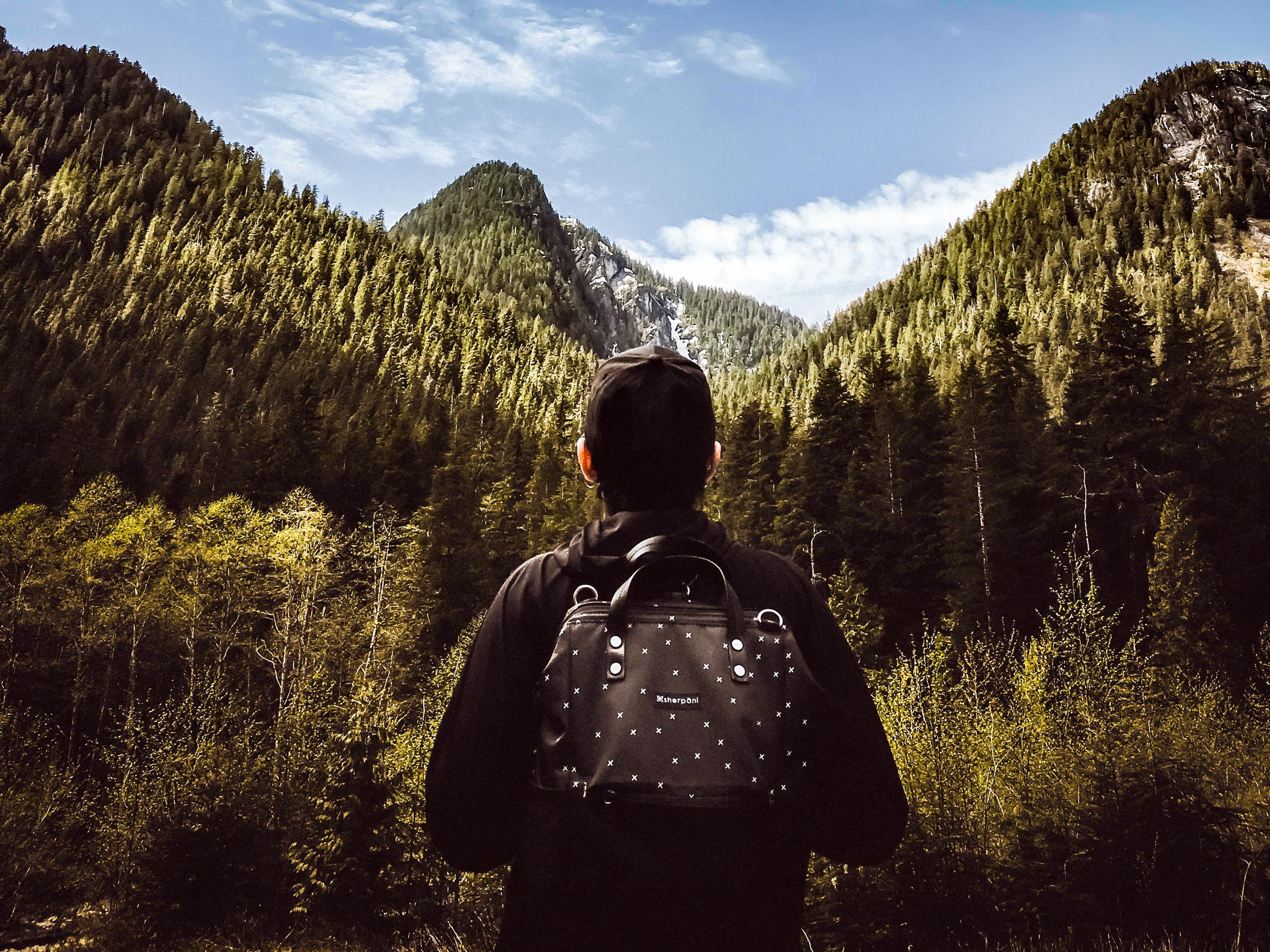
Hike to Lynn Peak
Difficulty Rating:
The Hike to Lynn Peak is a challenging trail for hikers looking to push themselves through a tough elevation gain. Climbing 3343ft along a rugged ridge line, this trail offers scenic views of the surrounding mountains and a series of drops that are sure to get your heart pumping as you ascend to North Lynn Peak. Get ready for the toughness of the Grouse Grind, without the fuss of the crowds.
Getting there
To get to the parking lot at the Lynn Peak trailhead from Vancouver, travel north along the Trans Canada Highway/BC-1 W, making your way over the Ironworkers Memorial Bridge. Take the exit on the right for Mountain Highway, and turn right after 1.6mi onto Lynn Valley Rd. Follow this for 3km and you will arrive at the parking area.

About
| When to do | June-October |
| Backcountry Campsites | No |
| Pets allowed | Yes |
| Family friendly | No |
| Route Signage | Average |
| Crowd Levels | High |
| Route Type | Out and back |
Hike to Lynn Peak
Elevation Graph
Weather
Hike to Lynn Peak Description
Like many other mountain trails in this area, the hike to Lynn Peak is often compared to the Grouse Grind due to its steep inclines that offer hikers a great cardio workout.While not as popular as the Grouse Grind, the first portion of this route will have higher foot traffic due to a shared trailhead with the Lynn Loop Trail, so make sure to arrive early to get a decent parking spot close by. Additionally, the intense nature of the route and the muddy terrain caused by mountain streams make this hike a challenging one, so be prepared to test your fitness if you are looking to reach North Lynn Peak.
While the trail is difficult, it is also very rewarding. As you make your way up to Lynn Peak, you will catch glimpses of Mount Seymour to the east, and Grouse Mountain and the Georgia Strait to the west. On a clear day, you might even get some far reaching views of the United States that will make this physically demanding route a worthwhile uphill journey!
To reach the trailhead for the hike to Lynn Peak, make your way to the north end of the parking lot and past the yellow gate. Follow the path beyond the gate that will lead you to a bridge over Lynn Creek. Catch a glimpse of Mount Fromme to your left as you cross over the rushing waters of the creek and head toward the junction in the trail next to the signboard.
Turn right at the junction and follow the gravel road for 1148ft, where you will see a sign on your left for the Lynn Loop Trail. Take this path and follow it as the trail begins a steep climb along the southern edge of the loop.
Here, the trail will begin to flatten out as you make your way through a beautiful mixed forest of cedar and hemlock trees, passing by a sign for a lookout on your left. Hikers that wish to take a brief detour can follow this trail for 656ft to reach a small, rocky lookout where you can see Vancouver Island off in the distance.
Continue on the trail as it winds its way through the forest for 2297ft, where you will reach two successive trail junctions on your right. Ignoring the first trail, take the second trail marked for Lynn Peak to make your way uphill toward the north and south peaks. Watch your footing, as this section of the trail has a number of loose rocks that can easily become dislodged.
As you gain elevation walking through the forest of second generation trees, you will come up on an obstructed vantage point overlooking Mount Seymour to the east that is mostly overgrown with tree cover. Continue down the trail as there will be better views up ahead.
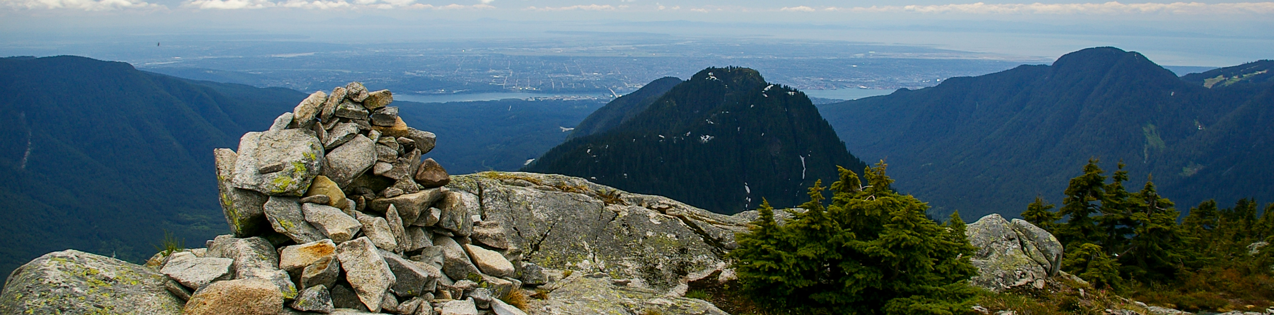
After approximately 1km, a much better picture of Mount Seymour will come into view, allowing you to see the large, red radio transmission towers that broadcast throughout the Vancouver area. Take in the view as you follow the trail along a steep, rocky route uphill for another 600m before getting to the point along the hike with the most scenic views of the day.
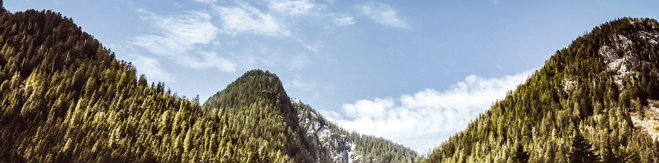
Crossing over the rocky step, you will have a beautiful view to the west that looks out over Lynn Valley. In 328ft, the trail will split, with the path to the right leading to the end of the trail at Lynn Lookout. From here, you will get the most stunning views of the day, being able to spot Mount Seymour and even some parts of the United States if the weather is clear enough. From this point, most hikers would head back on their return journey down the trail, as the extension to the left is less well-marked and follows along a ridgeline to the Southern and Northern Lynn Peaks.
From the main trail, take the path to the left, paying close attention as the trail markers change from orange to pink, highlighting your route as you navigate this extension of the trail along the ridge. After a few hundred meters, you will approach a junction on your left. This leads to a brief detour to South Lynn Peak but can be ignored as it does not offer any viewpoint of the surrounding area. Continue on the main trail as it heads toward North Lynn Peak.
After passing the junction for South Lynn Peak, you will soon approach a 213ft drop along the ridgeline. Be prepared to get your heart rate up, as this is the first of a series of three drops and climbs along the ridge that will take you up to North Lynn Peak.
Following the initial drop, climb up 82ft to reach a flat section of trail along the ridge. Walk along the trail until you reach the second drop of 164ft, followed by another climb of 246ft. Immediately you will reach the final drop in the trail, which is significantly shorter at 66ft. Climb up the remaining ridgeline for the final 230ft of the trail, and you will have finished your ascent of North Lynn Peak at 3330ft.
Similarly to the South Peak, the North Lynn Peak doesn’t offer much in terms of picturesque views. Don’t let that stop you from feeling a great sense of accomplishment at having navigated the rough terrain of the ridgeline, heading past the point where most other hikers would have abandoned the trail and turned back! After a break for lunch and a quick rest, head back along the same path, meeting up with the main trail and follow it back down to the parking lot, having completed the Hike to Lynn Peak.
Hiking Route Highlights
Mount Fromme
At the start of the trailhead, hikers will be able to catch a great view of Mount Fromme in the backdrop as they cross the bridge over Lynn Creek. Mount Fromme is best known for its mountain bike routes, containing a wealth of downhill trails that have helped make a name for the North Shore riding style, but it is home to a network of hiking trails as well.
Mount Seymour
Standing at 4754ft, this mountain is located within Mount Seymour Provincial Park and is named after the second Governor of the Colony of British Columbia, Frederick Seymour.
Insider Hints
The Lynn Loop portion of this trail is popular with hikers and trail runners. Arrive early to secure a parking spot. Alternatively, there are other parking lots further down Lynn Valley Rd.
If you sign in at the trailhead, don’t forget to sign back out as you are leaving.
Be mindful of the change in trail markers if you decide to take the extension to the south and north peaks. They will change from orange to pink.
Wear proper footwear, as the upper portions of the trail can become very muddy and/or icy in the winter.
The trail can be buggy in the summer months. Bring bug spray.
Similar hikes to the Hike to Lynn Peak hike
Hike to South Needle
The Hike to South Needle follows along an extension of the trail to Lynn Peak, passing by the viewpoint and…

Lynn Lake Trail
The Lynn Lake Trail is a lengthy hike through the Lynn Headwaters backcountry that is sure to get you off…

Old Buck and Bridle Trail Loop
The Old Buck and Bridle Trail Loop is an amalgamation of the Old Buck, Bridle, and Baden Powell trails that…
Comments