Brunswick Mountain Trail
View Photos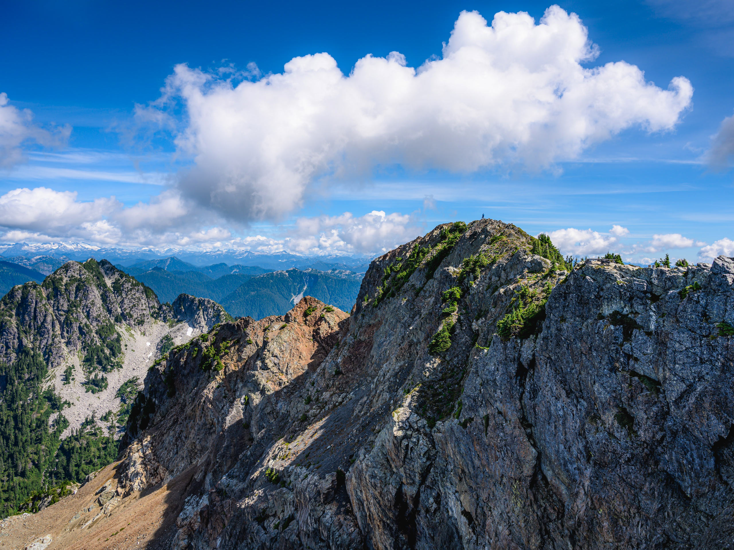
Brunswick Mountain Trail
Difficulty Rating:
The Brunswick Mountain trail is a 9.4mi out-and-back that takes hikers to the highest elevation on Vancouver’s North Shore. From 5866ft, you will be able to see the entirety of the area surrounding Vancouver, stretching out to Vancouver Island. A technical trail with a gruelling finish, this hike will leave you feeling on top of the world.
Getting there
To get to the Brunswick Mountain trailhead from West Vancouver, head north along BC-99 and take the exit toward Lions Bay Avenue. Continue on Oceanview Road, making a left turn onto Crosscreek Road. After 427ft, turn right onto Centre Road and make a quick left onto Bayview Road. Follow this for 0.7mi until you reach Mountain Drive. Turn left, driving for 984ft until you reach Sunset Drive. Turn left and the trailhead will be straight ahead in 492ft.

About
| When to do | July-October |
| Backcountry Campsites | No |
| Pets allowed | No |
| Family friendly | No |
| Route Signage | Average |
| Crowd Levels | Moderate |
| Route Type | Out and back |
Brunswick Mountain Trail
Elevation Graph
Weather
Brunswick Mountain Trail Description
The trek up Brunswick Mountain should not be undertaken by inexperienced hikers, as the final portion of the hike travels along a 656ft stretch of exposed ridgeline, with a very steep slope that will require scrambling. Ensure that you have taken all necessary precautions, check trail and weather conditions before setting out, and pack any required gear (crampons, poles, or microspikes) that will be needed to traverse the narrow ridgeline to the summit.
Although this hike is very difficult, hikers that are able to safely undertake the journey up Brunswick Mountain will be rewarded with a 360° panoramic view from atop the highest peak on the North Shore. From 5866ft, you will experience jaw-dropping views of Brunswick Lake to the north, Howe Sound to the west, and a number of prominent peaks to the south, including the Lions, Mount Harvey, and Grouse Mountain to the southeast. If you can handle the heights along this technical trail, the climb up Brunswick Mountain will be well worth the risk.
Setting off from the trailhead on the north end of Sunset Drive, pass through the gate and follow the wide gravel path as it winds back and forth uphill. After approximately 0.6mi, you will come to a point in the trail where the route splits into a narrow path on the right. Take this trail and continue uphill as the route begins to steepen.
After climbing up the hill and through the trees for another kilometre, you will reach another junction in the trail marked with a colourfully painted signpost. Ignore the route to the right, as this leads to the Lions, and head left along the narrow trail up to Brunswick Mountain.
The trail along this path will be fairly flat for 2297ft, until you reach a series of creek crossings. The second, and larger of the two crossings will span Magnesia Creek, at which point you will need to traverse a log bridge. Utilize the hand ropes to make your way over the makeshift bridge, and follow the orange trail markers to resume along the route.
Shortly after the creek crossing, there will be another junction. Follow this to the right as you begin to climb uphill along an overgrown road. Along this portion of the hike, the trail will begin a series of switchbacks through the overgrown brush, and you will be able to catch some semi-obstructed views of Howe Sound through the trees on your right as the incline begins to intensify. This steep incline will remain constant for the remainder of the hike up to Brunswick Mountain.
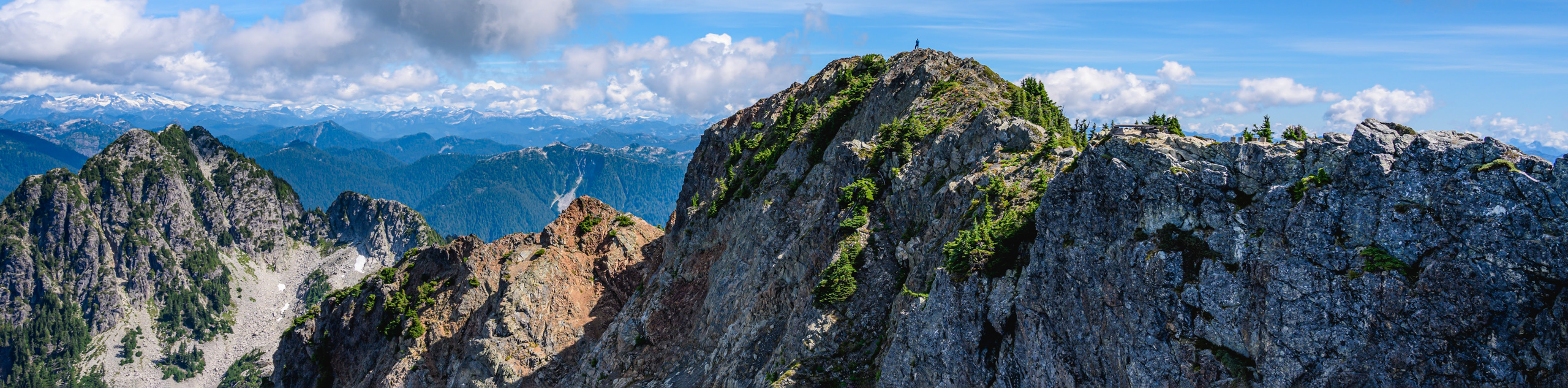
Continue hiking up through the old-growth forest passing by several vantage points with views of Howe Sound and Mount Harvey on your way to the junction with the Howe Sound Crest Trail. Reaching this junction with the HSCT, continue straight along the path, following the trail markings for Brunswick Mountain. This last portion of the trail is very technical, requiring hikers to scramble up the steep slope to reach the summit. Take a few moments to rest up before heading out on this final stretch of the hike.
From this point on, the trail will not be as well-marked, so keep an eye out for markings of orange paint on the rocks that will signify the route to the summit. Carefully continue along the trail, being mindful of any patches of snow or ice that may be lingering on the trail near the top of the mountain. Hikers should also keep an eye on the weather, as the altitude of Brunswick Mountain makes it susceptible to rapid changes in weather patterns.
Keep moving along the trail as you reach the saddle leading up to the summit. Be extremely cautious while scrambling up this final ridge, as the steep slopes are extremely exposed, and one wrong step could be disastrous. After passing by a wooden helicopter pad, you can take solace in having completed the tough ascent of Brunswick Mountain.
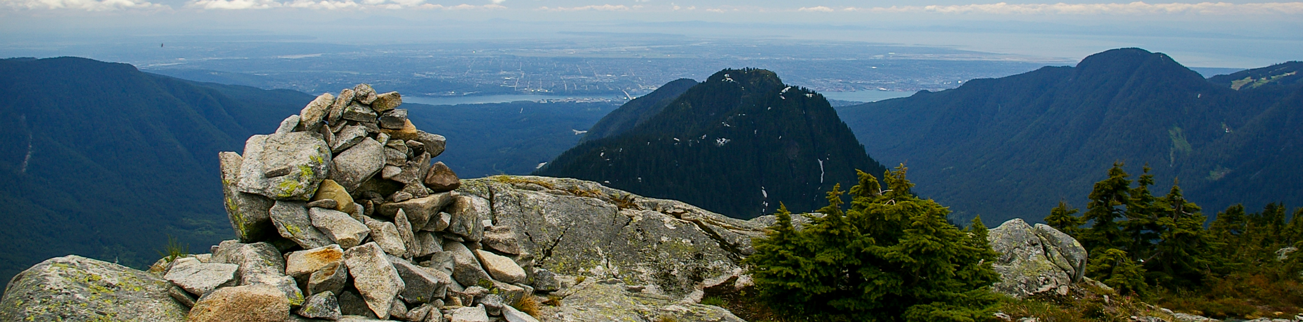
From this vantage point towering over the North Shore, you can truly bask in one of the most beautiful views in southwest British Columbia. A sweeping panoramic vista of water, rock and trees sits before you as you peer over the surrounding area from your mountain-top perch. Breath in the crisp mountain air as you look down on the nearby peaks that include the Lions and Mount Harvey, as well as Crown, Grouse, and Sky Pilot mountains. Scan the area to the west, overlooking the waters and islands of Howe Sound and out into the Georgia Strait all the way to Vancouver Island. It’s hard to sum up just how beautiful it is, as there is so much that you can see from the summit of Brunswick Mountain.
After you’ve had your fill of the jaw-dropping views, carefully retrace the route back along the ridge and pick up the main trail as you make your return journey to the carpark, having completed the Brunswick Mountain Trail.
Hiking Route Highlights
The Lions
The Lions are a notable sight throughout the Vancouver area, as their distinctive pointed peaks stand out amongst the rest of the North Shore Mountains. Standing over 5249ft tall, the Lions are some of Vancouver’s most famous landmarks and have influenced the naming of the BC Lions football team and the Lions Gate Bridge.
Howe Sound
This triangular body of water opens directly into the Strait of Georgia, stretching 26.1mi towards the northeast near Squamish. The area is of great historical importance to the Squamish and Shishalh indigenous peoples that have inhabited the area and travelled its waterways for thousands of years. First explored by the Spanish in 1791, the area was named Boca del Carmelo by the explorer José María Narváez. The next year George Vancouver renamed the sound after British Admiral Richard (Earl) Howe.
Insider Hints
Do not attempt this hike unless you are a seasoned hiker. The last portion of the trail is extremely difficult and technical, with a scramble up a steep slope to the summit.
This hike is not recommended in the winter due to dangerous terrain along the upper portion of the trail.
Bring proper gear such as poles, microspikes and crampons, as the upper portions of the trail can be covered in snow/ice.
Parking at the trailhead costs $3/hour or $24/day. Alternatively, you can park at the nearby elementary school.
This trail can be very buggy in the summer months. Bring bug spray.
Similar hikes to the Brunswick Mountain Trail hike
Hike to South Needle
The Hike to South Needle follows along an extension of the trail to Lynn Peak, passing by the viewpoint and…

Lynn Lake Trail
The Lynn Lake Trail is a lengthy hike through the Lynn Headwaters backcountry that is sure to get you off…
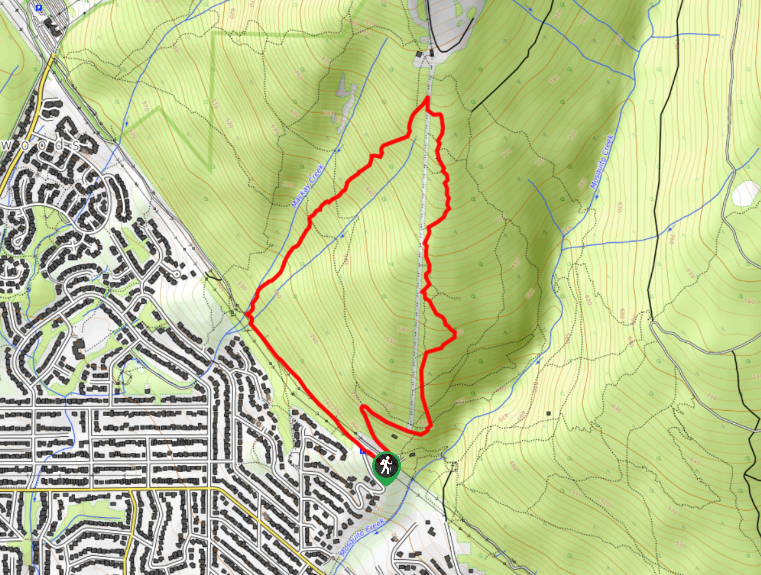
Mackay Creek Trail Loop
The Mackay Creek Loop Trail is an intense workout for hikers that love a steep incline along a short route.…
Comments