
Potlatch Canyon Trail
View Photos
Potlatch Canyon Trail
Difficulty Rating:
The Potlatch Canyon Trail is a lovely day hike in the Clearwater National Forest that affords hikers of all skill levels and ages a great time. This pleasant trail winds through open meadows sometimes decorated with grazing cattle and through mixed woodlands that border the peaceful Potlatch River.
Getting there
The Potlatch Canyon Trail departs from the Potlatch River Trailhead off Park Road.

About
| Backcountry Campground | No |
| When to do | April-October |
| Pets allowed | Yes - On Leash |
| Family friendly | Yes |
| Route Signage | Good |
| Crowd Levels | High |
| Route Type | Lollipop |
Potlatch Canyon Trail
Elevation Graph
Weather
Potlatch Canyon Trail Description
Escape into the fresh air and reconnect with nature as you wander the Potlatch Canyon Trail. This beautiful adventure progresses through some scenic settings that will undoubtedly impress. This adventure’s relative accessibility and easy-going nature attracts quite a crowd, notably on sunny summer weekends. Those seeking a more tranquil experience are encouraged to head out on weekday mornings for optimal seclusion. Cattle sometimes graze in the meadowed sections of the hike, which adds to the rustic ambiance, but it also means you’ll have to be mindful of your footing—if you know what we mean. Additionally, the mosquitos are quite relentless, so bug repellent is a game-changer. Note: there is a shooting range nearby, so you may hear the echo of gunshots.
The Potlatch Canyon Trail is one of our top 10 hikes in the Clearwater National Forest, and though we do our best to depict its beauty, nothing can compare to experiencing it in real-time. The varied scenery, wildlife, and lush greenery make this adventure top tier. Wind through forests of ponderosa pines, grand firs, and cedars and explore meadows abundant with monkshood, honeysuckle, paintbrush, and daisies, among other wildflowers and underbrush. If you are lucky, you may spot moose or grazing cattle along your adventure! With a modest elevation change, you will get your heart rate up without over-exhausting yourself. Just don’t forget to bring your camera, the scenery is quite photogenic!
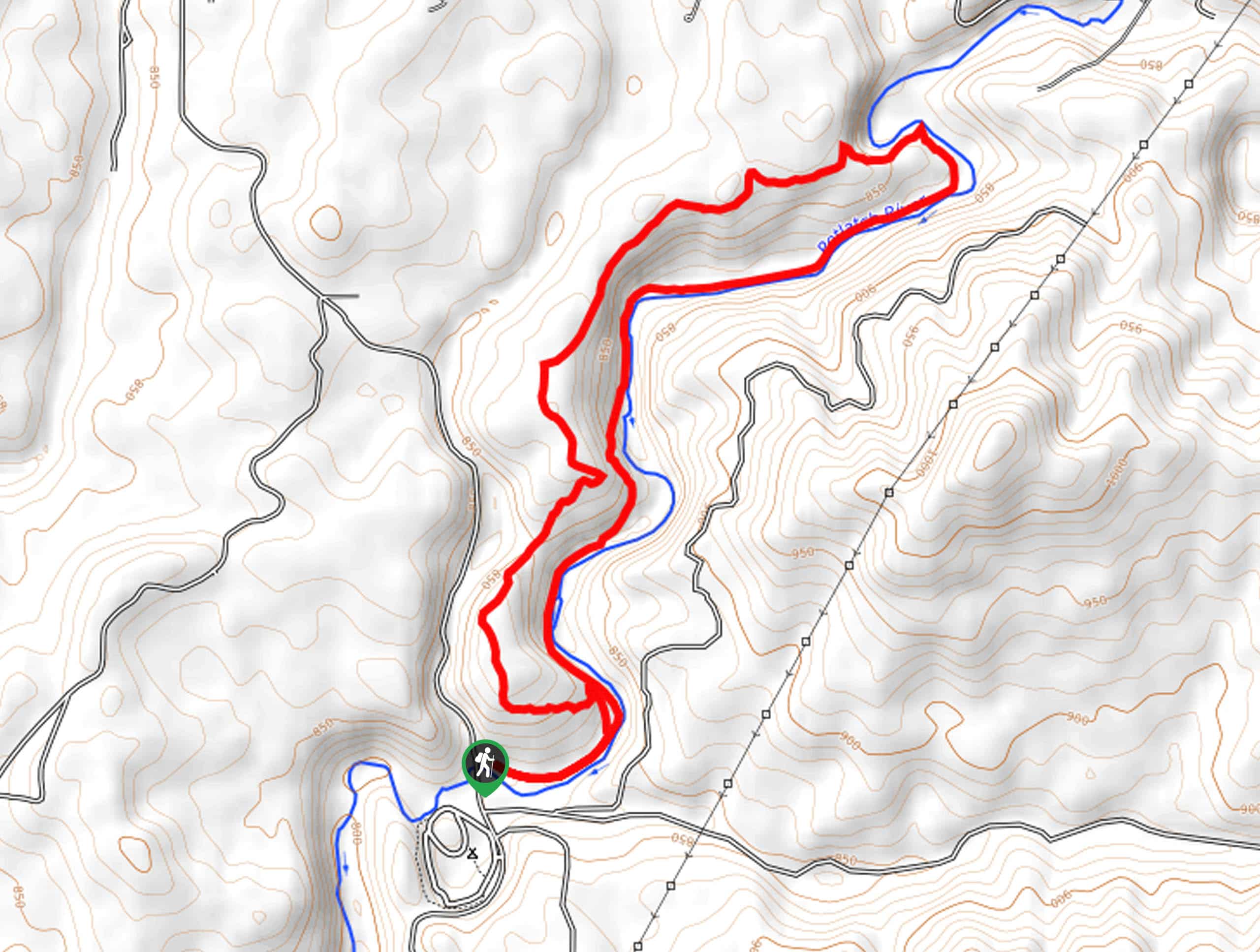
With plenty of water and your camera in tow, begin your journey along the Potlatch Canyon Hike from the trailhead off Park Road. Setting out from here, the Potlatch River Trail will guide you eastward along a paved section of path. Enjoy the level trail and the uninterrupted views of the lazy river. After some hiking, the trail will begin to curve north, delivering you to an intersection. While you can complete the loop from either direction, we went clockwise, turning left here off the paved path. Beyond this point, the terrain will begin to climb into the woodlands, demanding a modest effort but nothing too taxing. Enjoy the shade that the mixed pines and spruce boast, and keep an eye out for wildlife here.
Wandering beneath the tree canopy, the single-track trail will eventually open into a lush meadow that offers interrupted views of the surrounding forested foothills. Admire the vibrant overlook, then continue along through the wooded corridor. Now gradually descending back into the canyon, the trail will weave through exposed and shaded sections of terrain before ultimately delivering you back to the riverbanks. Appreciate the beauty of the wildflowers that decorate the forest floor and enjoy the sounds of the running water. While most of the riverside is protected by brush, there are a few spots where you will be granted pleasant views of the inviting waters.
The westbound trail will pass through luxuriant meadows where cattle and moose are sometimes spotted. At this point, the trail is fairly level with a few mild undulations. Relish in this immersive natural experience as you meander along the curves of the river. After some time, the path will reroute southward, demanding a steep climb up a forested ridge before plunging back down to the riverside. When you eventually reconnect with the paved route, you are near the end of your adventure. Continue along the maintained route all the way back to the trailhead.
Trail Highlights
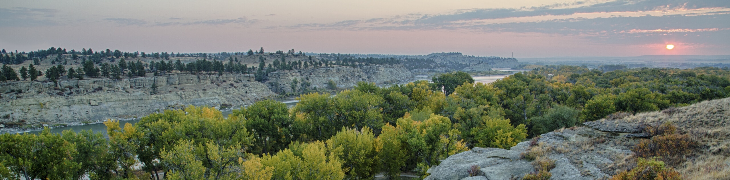
Potlatch River
The Potlatch River is located in Idaho, in the Nez Perce- Clearwater National Forest. Sourced from the Hoodoo Mountains, the river runs 56.0mi through arid grasslands and the foothills of the Rocky Mountains and is a tributary to the Clearwater River and the Snake River. While the Potlatch Canyon Trail does not run the entire length of the river, it boasts wonderful scenery of the lazy river.
Insider Hints
The unpaved sections of the trail are muddy after rainfall, so don’t wear your new white runners!
Cows are often found grazing along the path, be respectful and do not disturb the wildlife
Bring bug repellent, the mosquitos are relentless!
There is a gun range nearby, so your hike might be polluted by some noise
When exploring in the winter months bring a pair of snowshoes
Note only a section of the trail is paved
Similar hikes to the Potlatch Canyon Trail hike
Lewis and Clark Trail
The Lewis and Clark Trail is an excellent hike for those seeking an easy-going meander or a doable hike for…
Mount Sampson and Cannon Ball Mountain Hike
Treat yourself to spellbinding views of the Seven Devil Mountains along the Mount Sampson and Cannon Ball Mountain Hike. This…
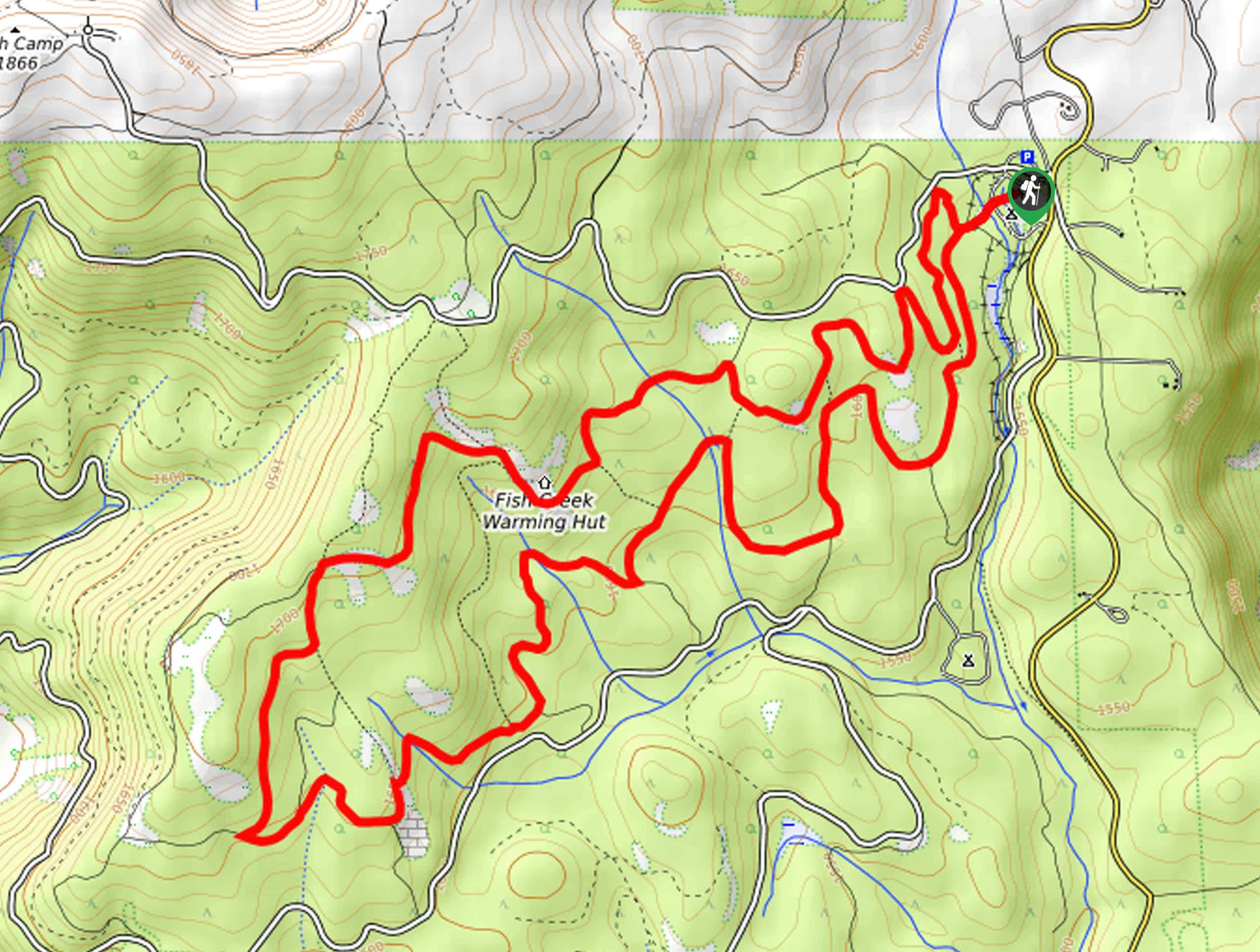
Fish Creek Loop Hike
The Fish Creek Loop Hike is a wonderful adventure in the Nez Perce National Forest that boasts a peaceful and…
Comments