Lewis and Clark Trail
View Photos
Lewis and Clark Trail
Difficulty Rating:
The Lewis and Clark Trail is an excellent hike for those seeking an easy-going meander or a doable hike for families with younger children. While the route is short, it is chock full of wonderment, yielding picture-perfect views of the forested river valley.
Getting there
Access this hike from the trailhead off Employee Blvd.

About
| Backcountry Campground | |
| When to do | April-October |
| Pets allowed | Yes - On Leash |
| Family friendly | Yes |
| Route Signage | Average |
| Crowd Levels | Moderate |
| Route Type | Out and back |
Lewis and Clark Trail
Elevation Graph
Weather
Lewis and Clark Trail Description
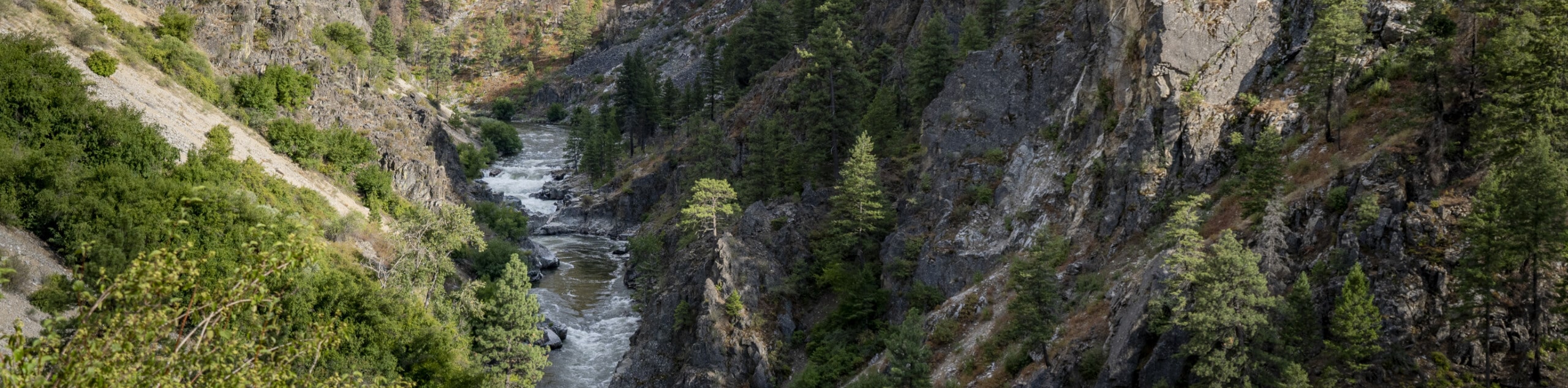
Get your daily dose of fresh air along the Lewis and Clark Trail. Nestled amongst Idaho’s forested mountains in the Clearwater National Forest, this lovely trail is family-friendly, exploring lush forestlands before opening to the riverbanks of the Lochsa River. While this route is tolerable for even younger children, it is important to note that there is a steep descent into the river valley, which inevitably requires a climb back up—so we suggest bringing plenty of water and snacks.
Embark on your journey into the Lochsa River valley from the trailhead off Employee Blvd. Setting out from here, adventurers will be led northeastward into the woodlands, which demands a short climb. Shortly after leaving the trailhead, the terrain will plateau, and you will be able to enjoy the enchanting ambiance of the wooded trail. While there will be intersecting routes, it is important to maintain along the Lewis and Clark Trail.
After some hiking, the tree canopy will open, and the trail will begin to descend towards the river banks. Mind your footing on the descent, and you will ultimately reach the trail’s end at the White Sand Campground. From here, we encourage you to visit the Lochsa’s riverside, which grants incredible views of the forested canyon. Simply retrace your steps back to the trailhead when you are ready to head back.
Similar hikes to the Lewis and Clark Trail hike
Mount Sampson and Cannon Ball Mountain Hike
Treat yourself to spellbinding views of the Seven Devil Mountains along the Mount Sampson and Cannon Ball Mountain Hike. This…
Fish Creek Loop Hike
The Fish Creek Loop Hike is a wonderful adventure in the Nez Perce National Forest that boasts a peaceful and…
Skookum Butte Hike
What the Skookum Butte Hike lacks in distance, it makes up for in elevation gain. This short but scenic adventure…
Comments