
McRea Cabin Hike
View Photos
McRea Cabin Hike
Difficulty Rating:
Immerse yourself in the Rapid River Valley along the McRea Cabin Hike. This demanding adventure through the Nez Perce National Forest exhibits a diversity of flora and fauna and offers spellbinding views of the Seven Devils Mountains rising above.
Getting there
Access this hike from the Rapid River Trailhead off Hackberry Flat Road.

About
| Backcountry Campground | Backcountry Camping |
| When to do | April-September |
| Pets allowed | Yes - On Leash |
| Family friendly | No |
| Route Signage | Average |
| Crowd Levels | Low |
| Route Type | Out and back |
McRea Cabin Hike
Elevation Graph
Weather
McRea Cabin Hike Description
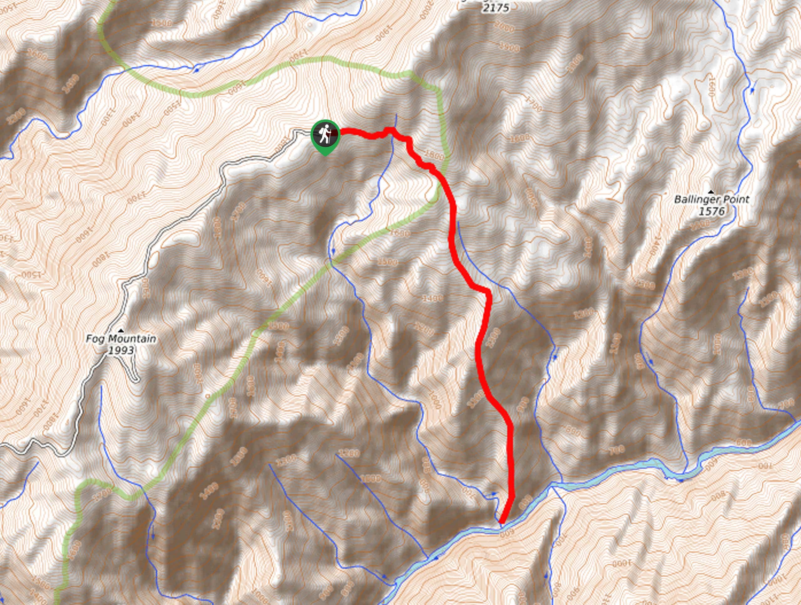
The McRea Cabin Trail offers seclusion and scenery. This demanding day hike will test your limits—guiding adventurers through exposed terrain, up rocky ridges, and along single-track trails. While this route is sweat-inducing, the gorgeous setting negates the effort. The unshaded route offers great views but also warrants extreme conditions, so dress in layers and wear sun protection to avoid overexposure. Note wildlife is abundant in the area, so keep an eye and ear out as you wander.
Your adventure into the wilderness begins from the Rapid River Trailhead. Setting out from here, you will be guided southwestwardly along the West Fork Rapid River Trail. Beyond this point, the path will consistently climb into the backcountry. After some hiking, you will encounter an intersection, keep left here, crossing a footbridge over the water. Now traveling south along the riverbanks, you will be woven through lush grasslands abundant with wildflowers, thickets of pine trees, and past rocky ridges. Eventually, you will cross another bridge over the river.
Soon after, you will be confronted with yet another crossroad, turn right and hike through the forested river valley all the way to Bridge Creek, the subsequently, McRea Creek. Here you will get the opportunity to explore the grounds of the historic McRea Cabin. When you are ready, head back along the path the way you came to the trailhead.
Similar hikes to the McRea Cabin Hike hike
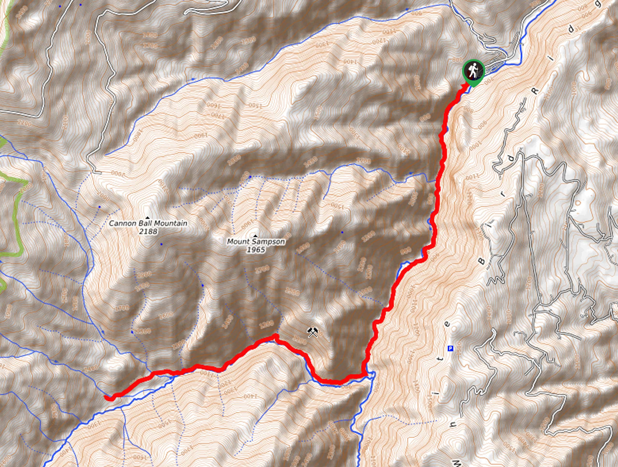
Upper Cannon Lake Hike
The Upper Cannon Lake Hike is a long and involved adventure into the Seven Devils Mountains in the Nez Perce…
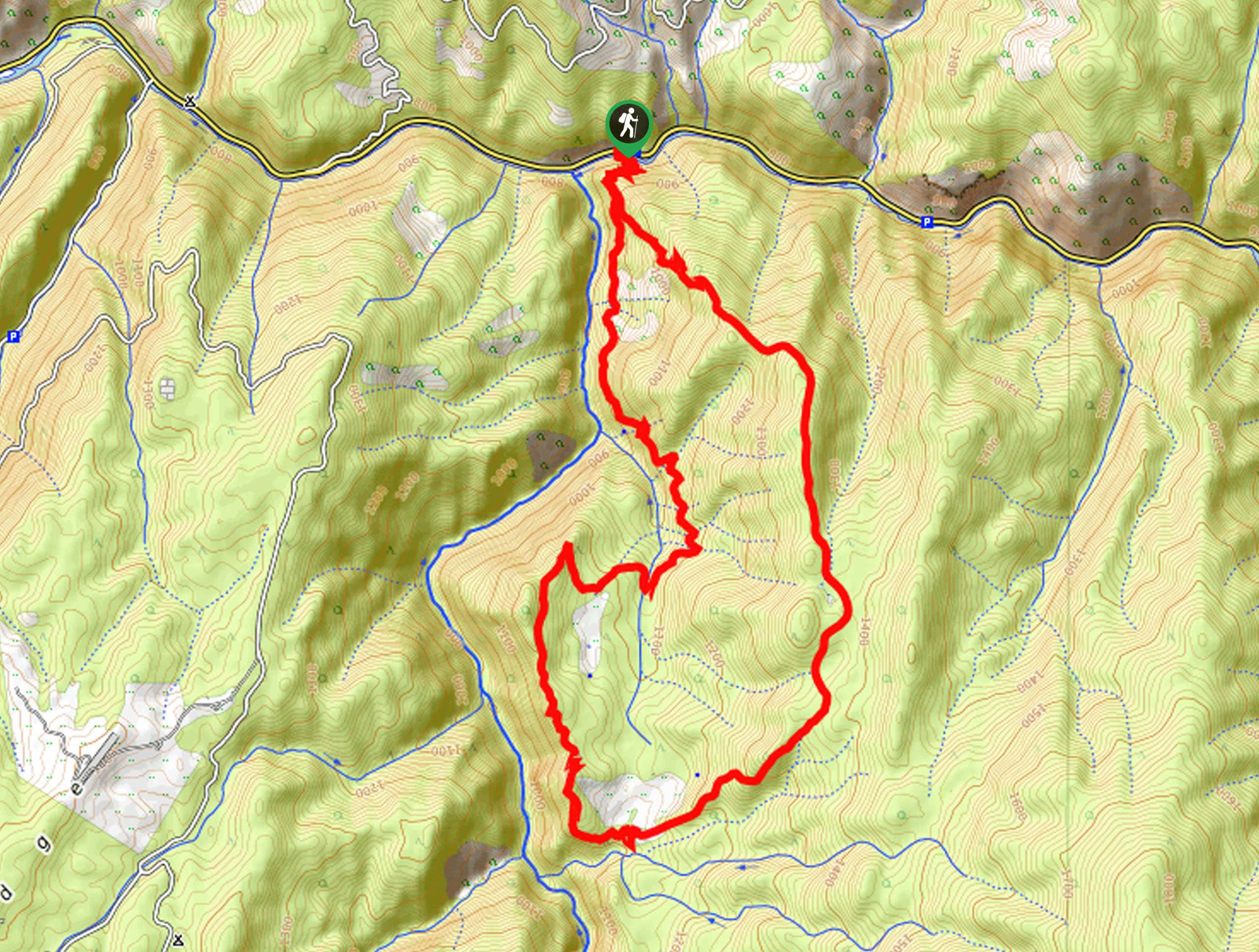
Johns Creek Loop Hike
Immerse yourself in an old-growth forest along the Johns Creek Loop Hike. While this route is long, the incredible mountainous…
Cupboard Creek Trail
The Cupboard Creek Trail is a beautiful trail that leads intrepid adventurers into the Selway River Canyon. The wild character…
Comments