Upper Cannon Lake Hike
View Photos
Upper Cannon Lake Hike
Difficulty Rating:
The Upper Cannon Lake Hike is a long and involved adventure into the Seven Devils Mountains in the Nez Perce National Forest. While demanding, this spectacular trail rewards its conquerors with an idyllic lake hidden amongst the snow-capped crags.
Getting there
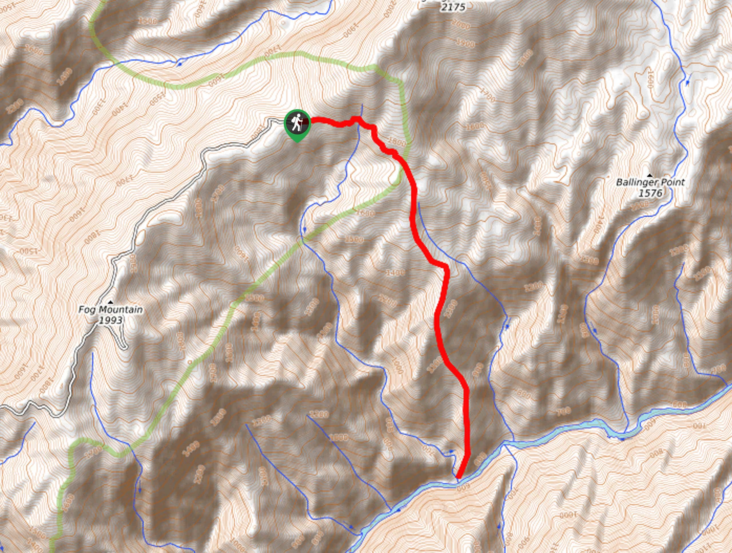
Access this hike from the Windy Saddle Trailhead off Seven Devils Road.

About
| Backcountry Campground | Backcountry Camping |
| When to do | April-October |
| Pets allowed | Yes - On Leash |
| Family friendly | No |
| Route Signage | Average |
| Crowd Levels | Moderate |
| Route Type | Out and back |
Upper Cannon Lake Hike
Elevation Graph
Weather
Upper Cannon Lake Hike Description
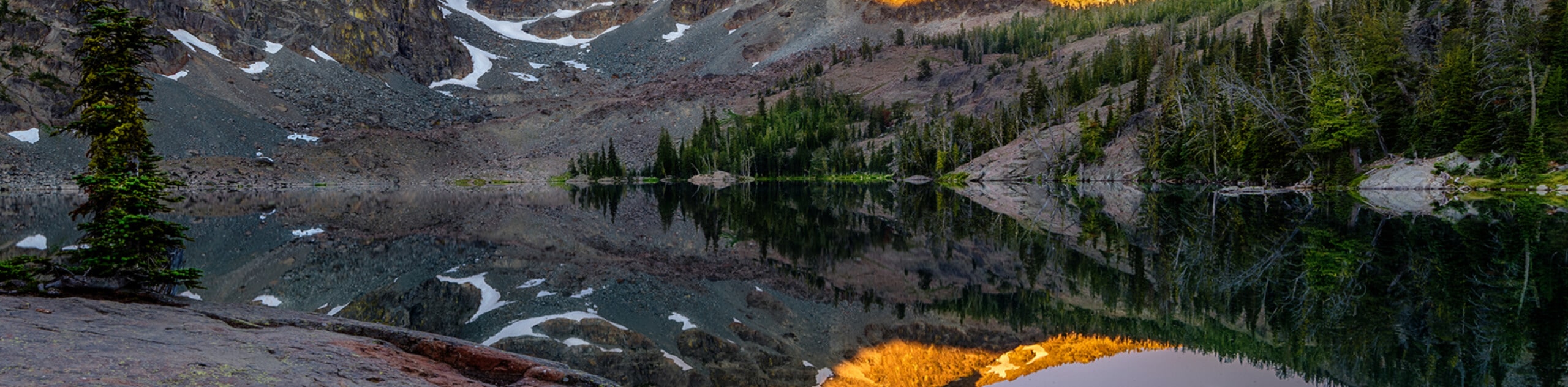
The Upper Cannon Lake Hike is a high-demand, high-reward type of expedition into the high country. Explore a variety of beautiful environments, including montane meadows, rock gardens, and lush woodlands. Exhibiting gorgeous views of the towering Seven Devil Mountains, vibrant wildflowers, and crystalline pools, the scenery along this route is unrivaled, so make sure you bring your camera. As the trail travels to high altitudes, it is essential to dress in layers as insurance against varying conditions. Don’t forget plenty of water to stay hydrated!
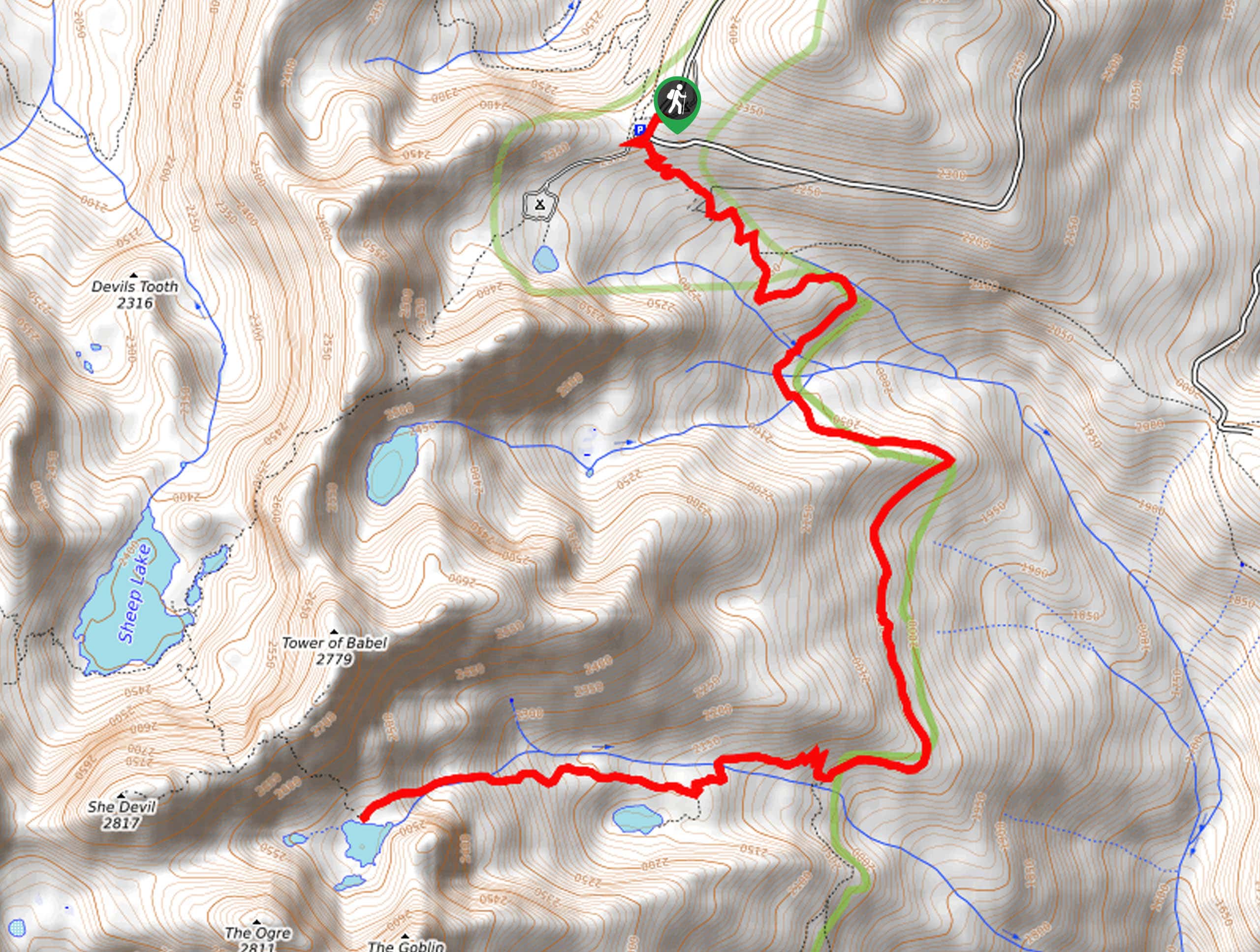
Your expedition into the mountains begins from the Windy Saddle Trailhead. Setting out from here, you will follow the South Boise Trail southeastward, descending from the saddle, contouring the eastern slopes of the Tower of Babel. After some hiking, you will reach an intersection at Cannon Creek. Here, veer left, and you will be diverted onto the Cannon Lakes Trail. Beyond this point, the path will steeply climb into the mountains. After some hiking, the path will cross over the creek, delivering you to the shoreline of Lower Cannon Lake. While the scene is breathtaking, we urge you to continue hiking up to Upper Cannon Lake.
Soon you will enter the mountain cirque adorned with the beautiful alpine lake. Notice the Tower of Babel in the north, She Devil in the west, The Ogre in the southwest, and The Goblin in the south. Marvel at the grandeur of the craggy summits that encircle you. When you are rested and through reveling in the spellbinding scenery, then retrace your footing back down to the trailhead.
Similar hikes to the Upper Cannon Lake Hike hike
Johns Creek Loop Hike
Immerse yourself in an old-growth forest along the Johns Creek Loop Hike. While this route is long, the incredible mountainous…
Cupboard Creek Trail
The Cupboard Creek Trail is a beautiful trail that leads intrepid adventurers into the Selway River Canyon. The wild character…
Sheep Lake Hike
The Sheep Lake Hike is a long and involved, arduous climb into the Seven Devils Mountain. While taxing, the conquerors…
Comments