
23 Connector Trail
View Photos
23 Connector Trail
Difficulty Rating:
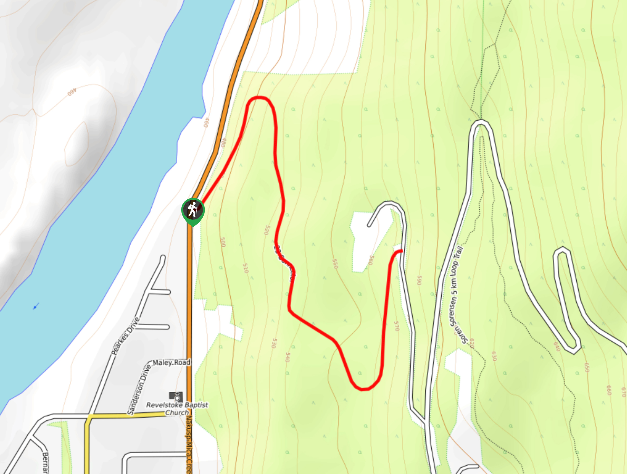
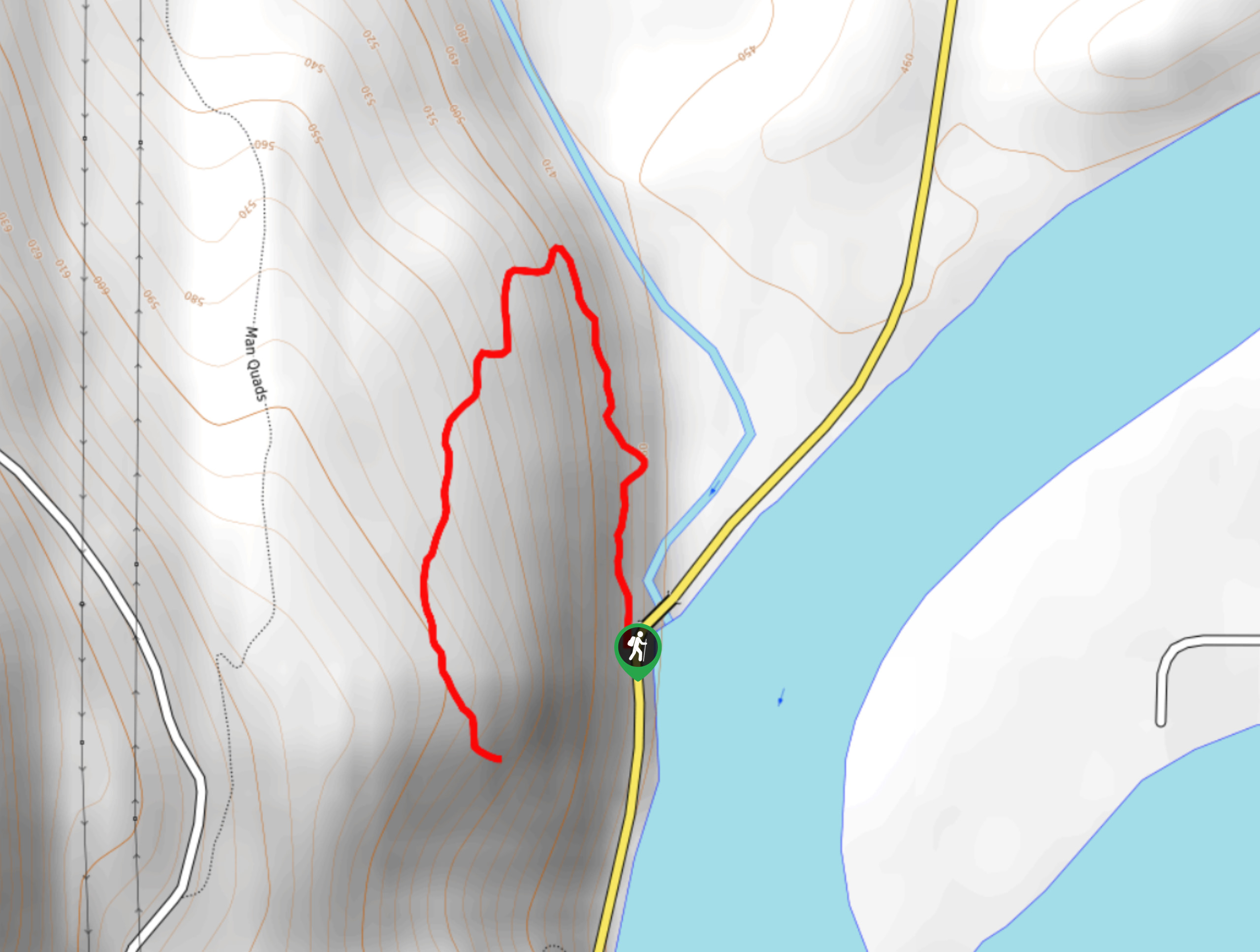
The 23 Connector Trail is a short 0.9mi out-and-back hiking route in Mount Revelstoke National Park that descends along a forested trail to reach the base of the mountain, before climbing back up to the trailhead. This is a multi-use route that is primarily used by hikers and mountain bikers, so keep an eye out for anyone passing by. Along the trail, you will experience scenic forest views and the occasional glimpse across the valley.
Getting there
To reach the parking area for the 23 Connector Trail from the Trans Canada Highway in Revelstoke, take the exit toward Mount Revelstoke N.P. and drive along the Meadows in the Sky Parkway for 0.8mi. Turn left here and you will find the trailhead on the left in 1312ft

About
| When to do | May-October |
| Backcountry Campsites | No |
| Pets allowed | Yes - On Leash |
| Family friendly | Older Children only |
| Route Signage | Average |
| Crowd Levels | Moderate |
| Route Type | Out and back |
23 Connector Trail
Elevation Graph
Weather
23 Connector Trail Description
The 23 Connector Trail is mainly utilized as a mountain bike trail, but it is possible to hike the trail as well. The route descends through the dense forest cover along the lower slopes of Mount Revelstoke to eventually reach the base of the mountain near the banks of the Columbia River. While the initial stretch of the trail is a pure downhill descent, the return leg will see you climb uphill for an elevation gain of 328ft. The trail isn’t overly difficult or technical, but there are some sections with exposed roots and/or rocks, so be careful as you make your way along this woodland path. As previously mentioned, keep an eye out for any passing bikers or hikers and share the trail so that everyone can use it safely. This quick hike is a great option if you aren’t concerned with spectacular views and just want to get out for a nice walk through the woods.
Similar hikes to the 23 Connector Trail hike
Nels Nelson Trail
The Nels Nelson Trail is a 0.7mi hiking route on the lower slopes of Mount Revelstoke that climbs…
First Footsteps Trail
The First Footsteps Trail is a quick 0.5mi hiking route atop Mount Revelstoke that will allow hikers to…
Boulder Mountain Lookout
The Boulder Mountain Lookout is a quick 1.5mi out-and-back hiking route in Revelstoke that leads up to a…
Comments