
Ptarmigan Ridge hike
View Photos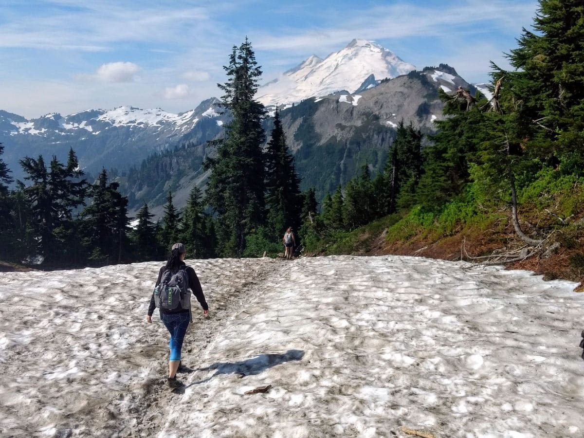
Ptarmigan Ridge hike
Difficulty Rating:
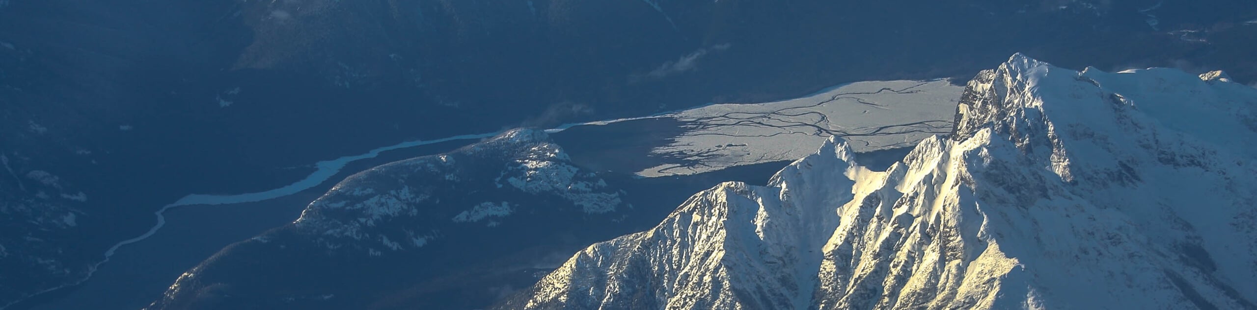
The wildest trail accessible from Artist Point, Ptarmigan Ridge is a hike for solitude-seekers. In addition to wildflowers, berries, and wildlife-spotting potential, this climbing route offers fantastic close-up views of Mount Baker.
Getting there
From Glacier, drive east on Mount Baker Highway to the end of the road at Artist Point parking area. A Northwest Forest Pass is required. The road is closed from fall through to early summer.

About
| When to do | August to October |
| Backcountry Campsites | Yes, at Kaiser Camp |
| Toilets | Yes, Artist Point trailhead |
| Family friendly | No |
| Route Signage | Average |
| Crowd Levels | Moderate |
| Route Type | Out and back |
Ptarmigan Ridge
Elevation Graph
Weather
Route Description for Ptarmigan Ridge
Note: This trail can be dangerous. With steep, rocky slopes and numerous snowfield crossings that linger well into summer. Ptarmigan Ridge is not a safe hike for children or pets. Only experienced hikers should attempt to cross the permanent snowfields, and be very careful, especially when they are icy. Consider having microspikes, poles and/or an ice axe.
Begin along the Chain Lakes trail, which starts at the northwest corner of Artist Point parking area. Follow the Chain Lakes trail for just over a mile, with views of Mount Baker ahead and Mount Shuksan behind.
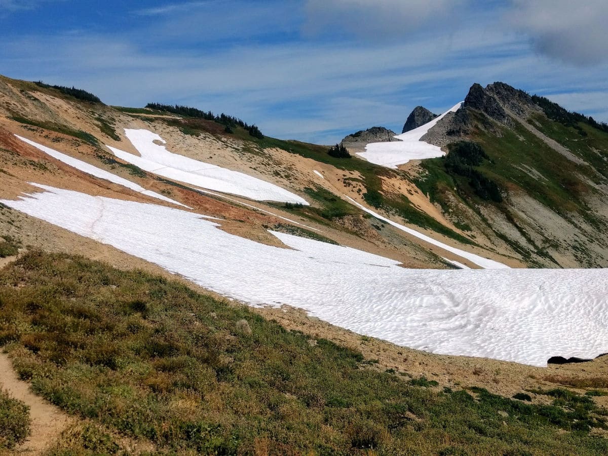
At 1.1mi, turn left at the signed junction for Ptarmigan Ridge. The trail loses some elevation here. You will skirt beneath Happy Bunny Butte before meandering through some lupine flowers.
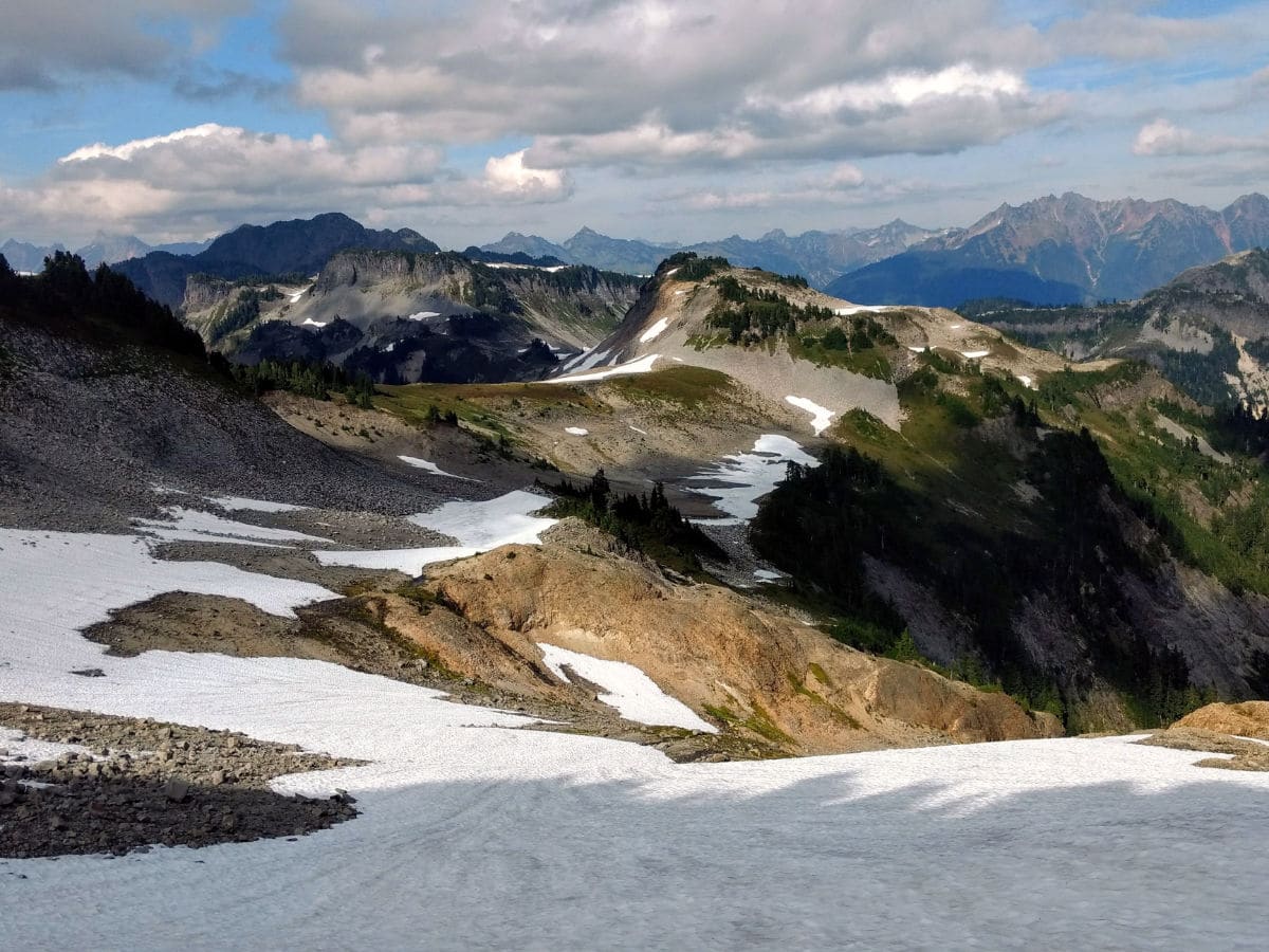
Much of the route here is rocky and exposed. Streams trickle from permanent snowfields – a few of which you’ll be crossing.
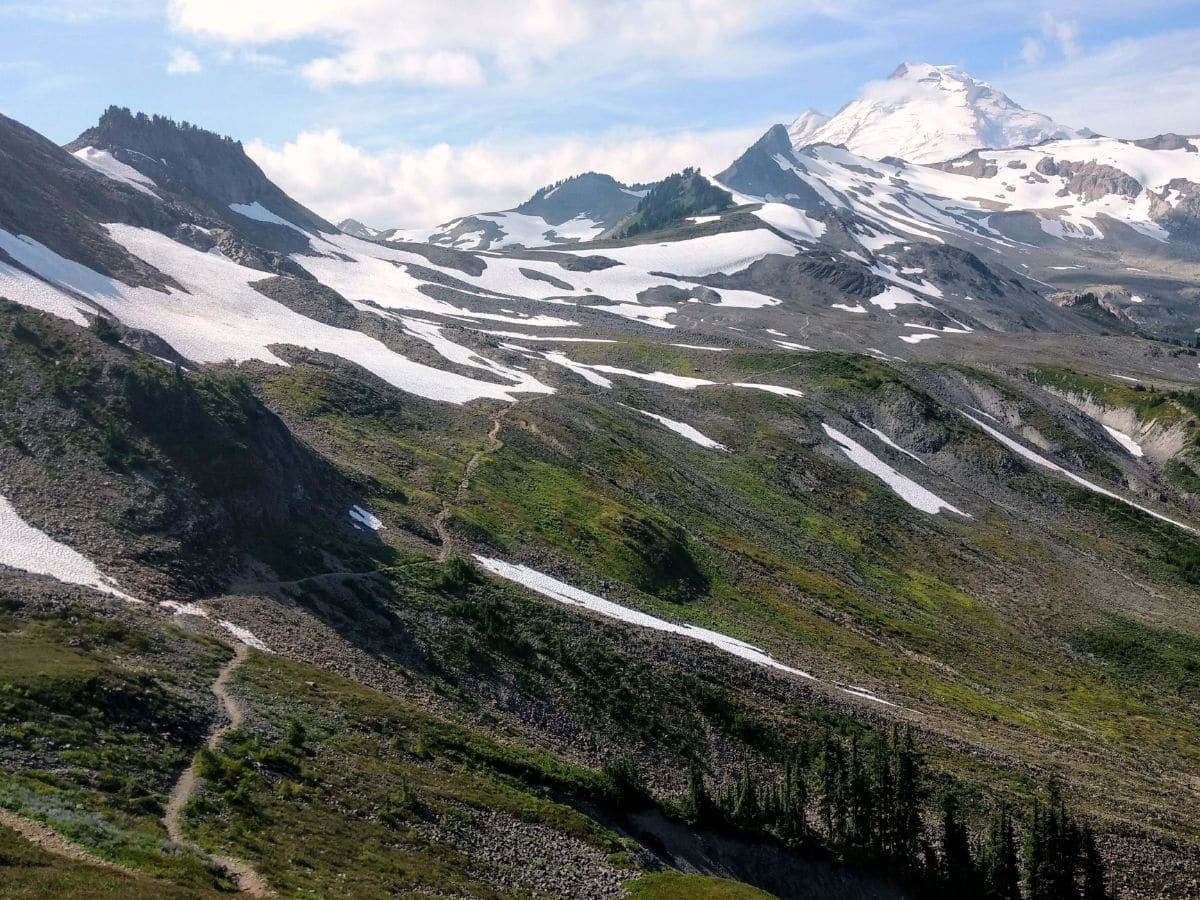
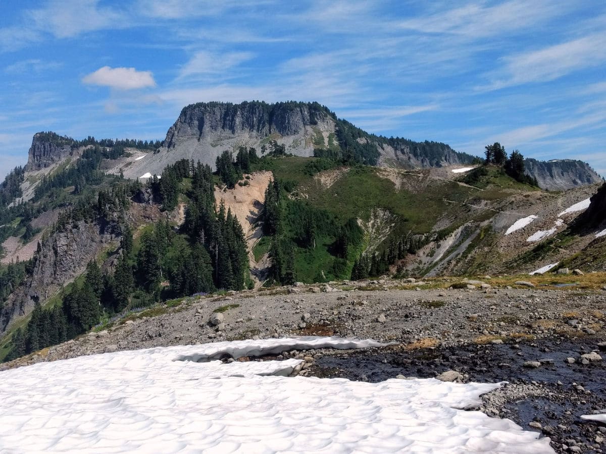
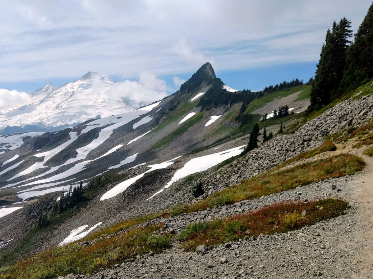
At 1.7mi, go right at an unsigned junction. The trail begins to climb steadily from here on out. At 2.3mi, reach a vast, boulder-topped viewpoint. This 5400ft overlook is just the toe of the ridge: a sample of what’s to come. Great views of Mount Shuksan and Table Mountain pair well with a snack here.
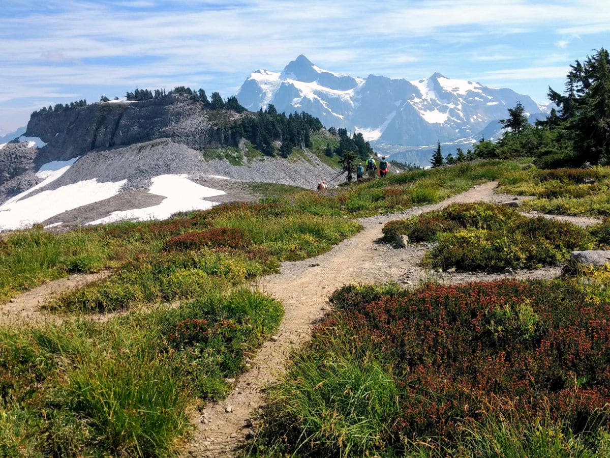
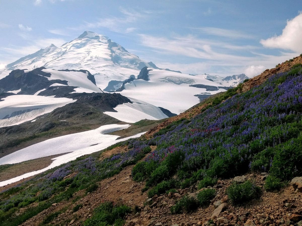
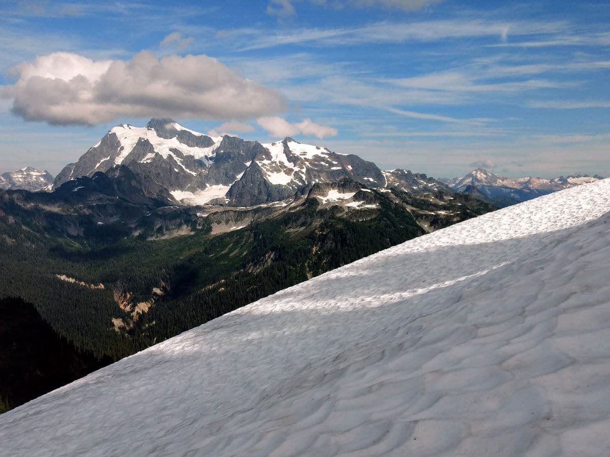
Crest the ridge at 3.0mi. Here the trail turns sharply west (stay right). Panoramic views from Shuksan to Baker will dominate your field of view. This is an excellent turnaround point for an abbreviated hike. To continue, follow the trail towards Coleman Pinnacle – rising sharply in front of Mount Baker.
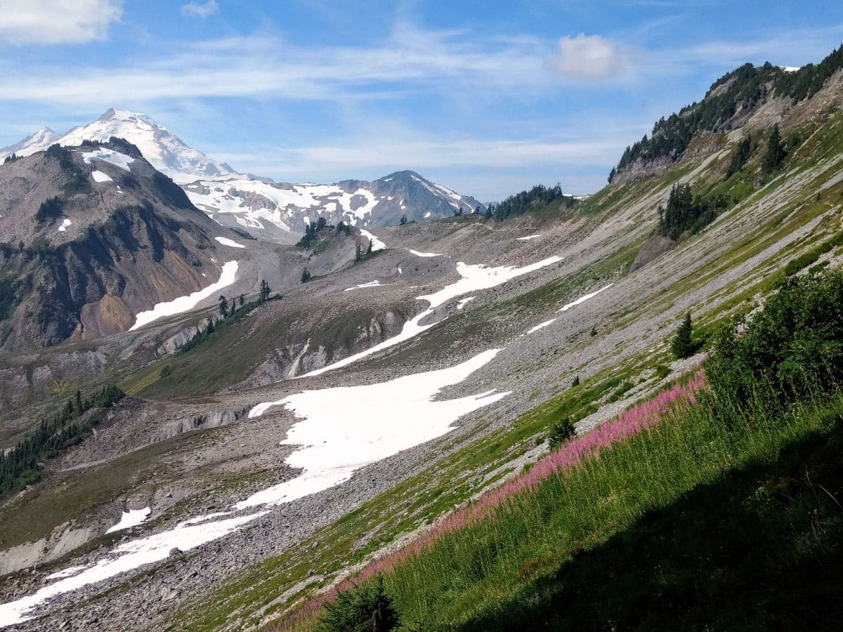
At 3.9mi reach an unsigned junction. The route to the left drops down to the beautiful blue-green Goat Lake, but our trail keeps right. As you stay right, you’ll continue onto Ptarmigan Ridge trail as it rounds beneath Coleman Pinnacle.
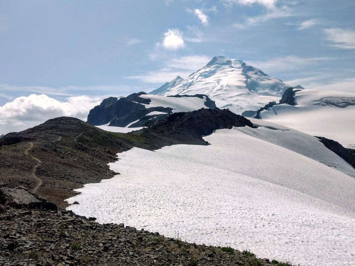
You’ll reach a high point of 6145ft at 4.1mi before dropping into the Camp Kaiser area. Mountain goats can often be seen hanging out on the snowfields below, while pika and marmots call from the rocks.
At 4.7mi, a rocky spine provides a nice turnaround point with a view of Mount Baker and Sholes Glacier. The trail continues to the Portals from here, but only climbers and experienced hikers should follow it further, as route-finding may be necessary. Return the way you came.
Would you like to see more hikes in Mount Baker? Check out the Yellow Aster Butte, Chain Lakes Loop, Skyline Divide Trail or Heliotrope Ridge.
Insider Hints
Despite the occasional cobbled together fire ring, no fires are allowed on Ptarmigan Ridge Trail (Mount Baker Wilderness).
The snowfields can be dangerous on this hike, especially when they are icy early in the morning. Trekking poles are helpful for stability when crossing the snowfields as are microspikes. As an additional precaution, some hikers bring an ice axe.
Bring sunscreen. Burns develop easily here due to open exposure and reflective snowfields.
Be sure to carry a map and compass, as weather changes quickly here and can create whiteout conditions. Review our Required Gear and Hike Safety pages for more information.
Stop by the North Fork Brewery in Deming for post-hike pints and pizza.

Similar hikes to the Ptarmigan Ridge hike
Twin Lakes Trail
Twin Lakes Trail is a 14.7mi hike in the Mount Baker Wilderness that leads you to two picturesque…
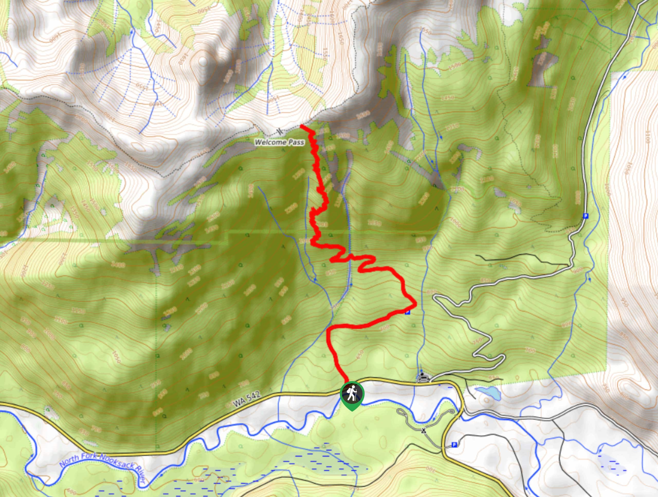
Welcome Pass Hike
The hike to Welcome Pass on High Divide Trail offers fantastic views of the surrounding mountains and lakes too numerous…
Shannon Ridge Trail
Shannon Ridge Trail is a fun, challenging hike that leads you through the forest to a viewpoint over Baker Lake…
Forward 3 years ago
One of my favorite hikes in the area. It can be challenging when snow is still present but after the snow meals, the trail is of moderate difficulty and easy to follow. Amazing views and some pretty good camping along the trail.
Miranda Q. 4 years ago
Sensational views! I dislike the rocky slopes though.
Papa smurph 4 years ago
Great hike. Stunning views! Absolutely amazing
E.david 4 years ago
This is a lovely hike with wonderful scenery.
T Rob 4 years ago
Amazing day, beautiful views and definitely well worth it
Lambert O 4 years ago
Best hike ever! You don't need to exert so much effort to this trail but the reward are spectacular!
Aleysha C. 4 years ago
Stunning views and easy hike. Views are breathtaking.
Meighan 4 years ago
Views are gorgeously overwhelming!
Abra Pepel 4 years ago
Most of the trails are toilsome and rocky, but the beautiful views compensated for all our hardships.
dylanm 4 years ago
Just Perfect!! One of the most beautiful places I've visited.