Celestine Lake Hike
View Photos
Celestine Lake Hike
Difficulty Rating:
Getting to the Celestine Lake trailhead might be the most difficult part of this trail as it is accessed by a rough dirt road that requires planned one-way travel. You will take the North Boundary Trail to Celestine Lake for an authentic wilderness experience away from Jasper’s crowds.
Getting there
To get to the Celestine Lake trailhead, you will need to take Highway 16 towards Hinton from the town of Jasper. Turn left onto Snaring Road and continue for 8.7mi. The Celestine Road begins here. Please note that the Celestine Road is a one-way dirt road that requires users to travel during specific times. Users travelling into the trailhead may use the road from 8-9am, 11-12pm, 2-3pm, and 5-6pm. Users heading back out to the Snaring road may travel along the road from 9:30-10:30am, 12:30-1:30pm, 3:30-4:30pm, and 6:30-7:30pm. The times are posted on the sign at the entrance of the road. The trailhead lies at the end of the 8.7mi road.

About
| When to do | June-September |
| Backcountry Campsites | Celestine Lake |
| Pets allowed | Yes - On Leash |
| Family friendly | Older Children only |
| Route Signage | Average |
| Crowd Levels | Moderate |
| Route Type | Out and back |
Celestine Lake Hike
Elevation Graph
Weather
Celestine Lake Trail Description
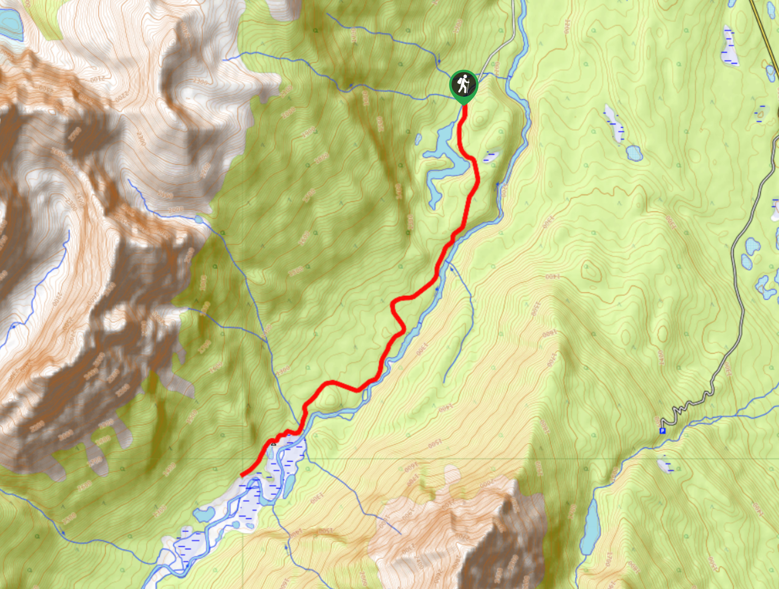
The parking lot for Celestine Lake Hike is also the trailhead for the North Boundary Trail and Snake Indian Falls. Begin your hike from the trailhead sign, where an obvious trail leads up a fire road to the Celestine Lake Trail. With only 1388ft of elevation gain, you will find this trail to maintain a gradual grade that is manageable for families with older children.
After 1312ft, the Snake Indian River will come into view as you leave the forest to cross a bridge over the water. Follow along the sidehill, admiring the river below before you reach some switchbacks. You’ll gain some elevation here and be able to spot the Roche De Smet range. Re-enter the forest and continue hiking through the woods until you reach the lake. Come to Princess Lake on your left after roughly 6km. Pass a junction that leads to the Devona Lookout Trail, and continue onwards to Celestine Lake.
You’ll find a beautiful backcountry campground here, which can be booked through Parks Canada in advance if you choose to stay the night.
Similar hikes to the Celestine Lake Hike hike
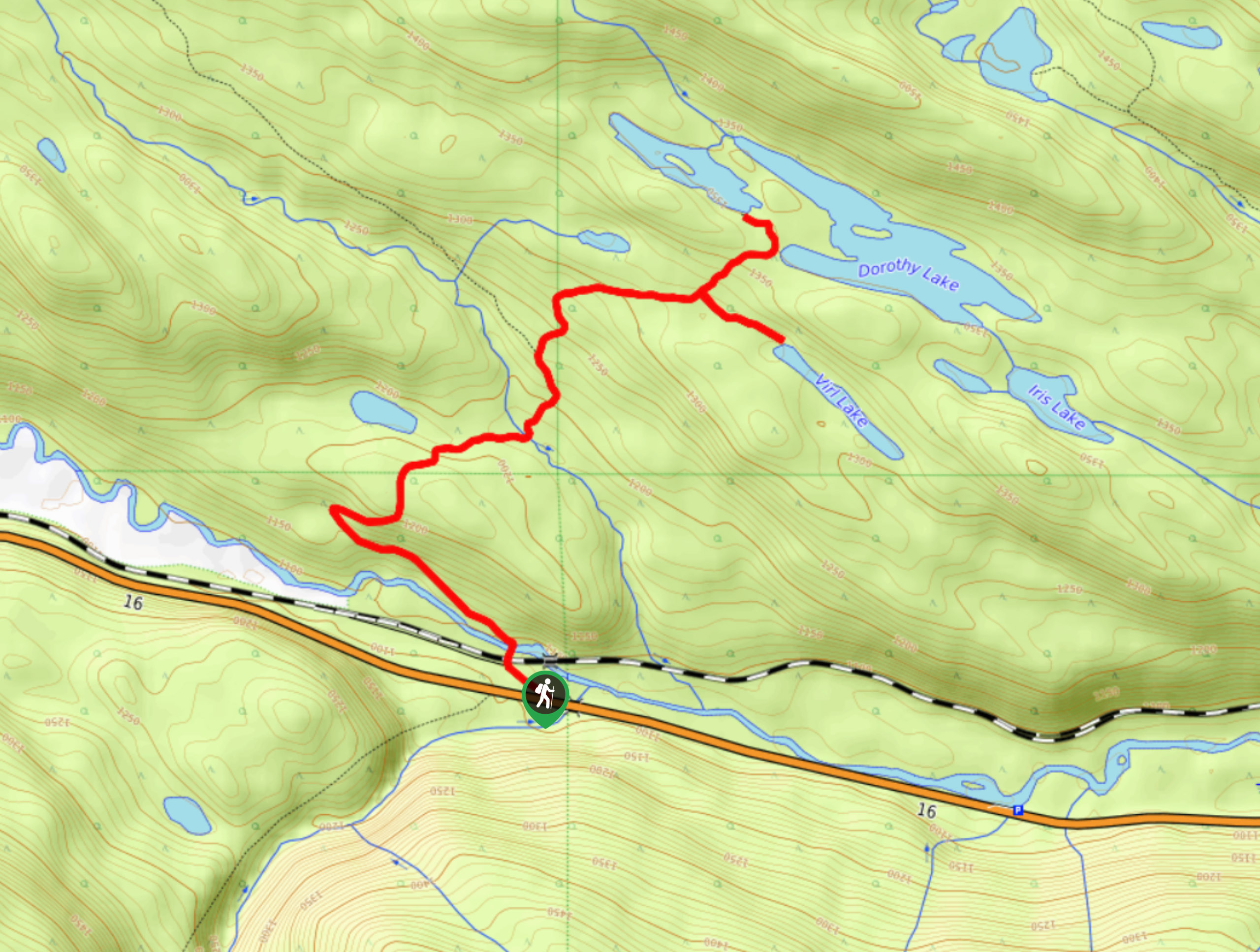
Dorothy and Christine Lakes Hike
The Dorothy and Christine Lakes trail is a beautiful forested trail west of Jasper. It features stunning lakes and has…
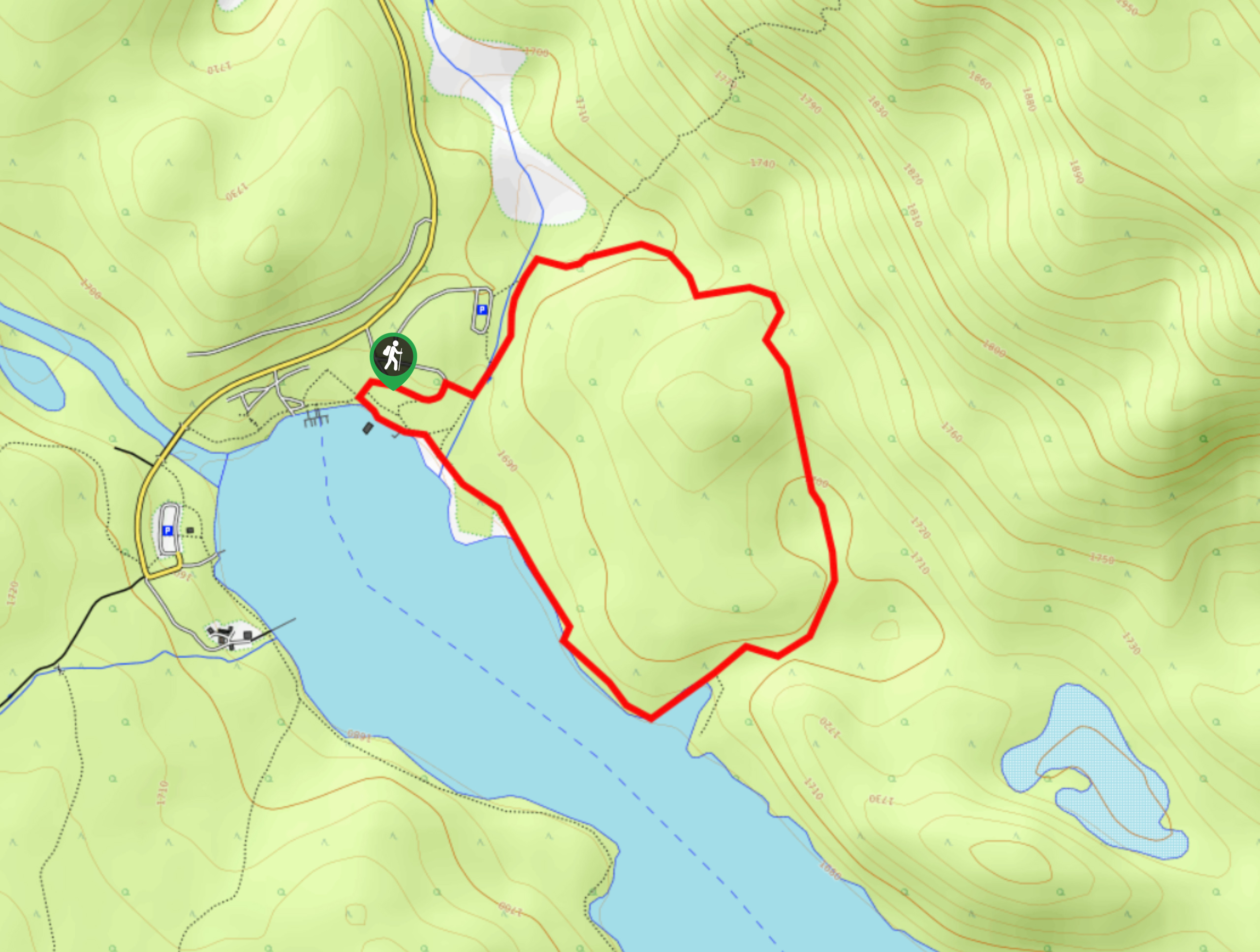
Mary Schaffer Loop Trail
The Mary Schaffer loop trail is a gentle circuit that explores the shores of Maligne Lake, offering interpretive signage and…
Whirlpool Valley Fire Road Trail
Taking the Whirlpool Valley Fire Road up towards the Whirlpool backcountry campground is a great day out that can be…
Comments