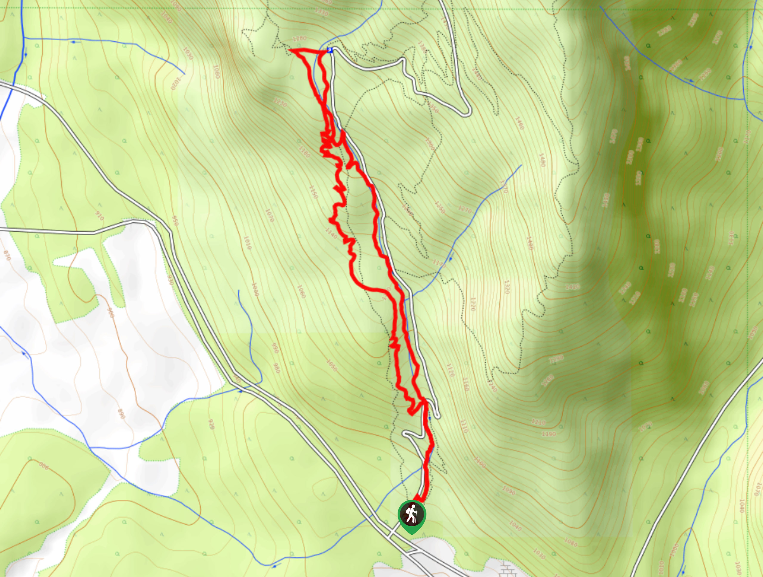
Hunter’s Way
View Photos
Hunter’s Way
Difficulty Rating:
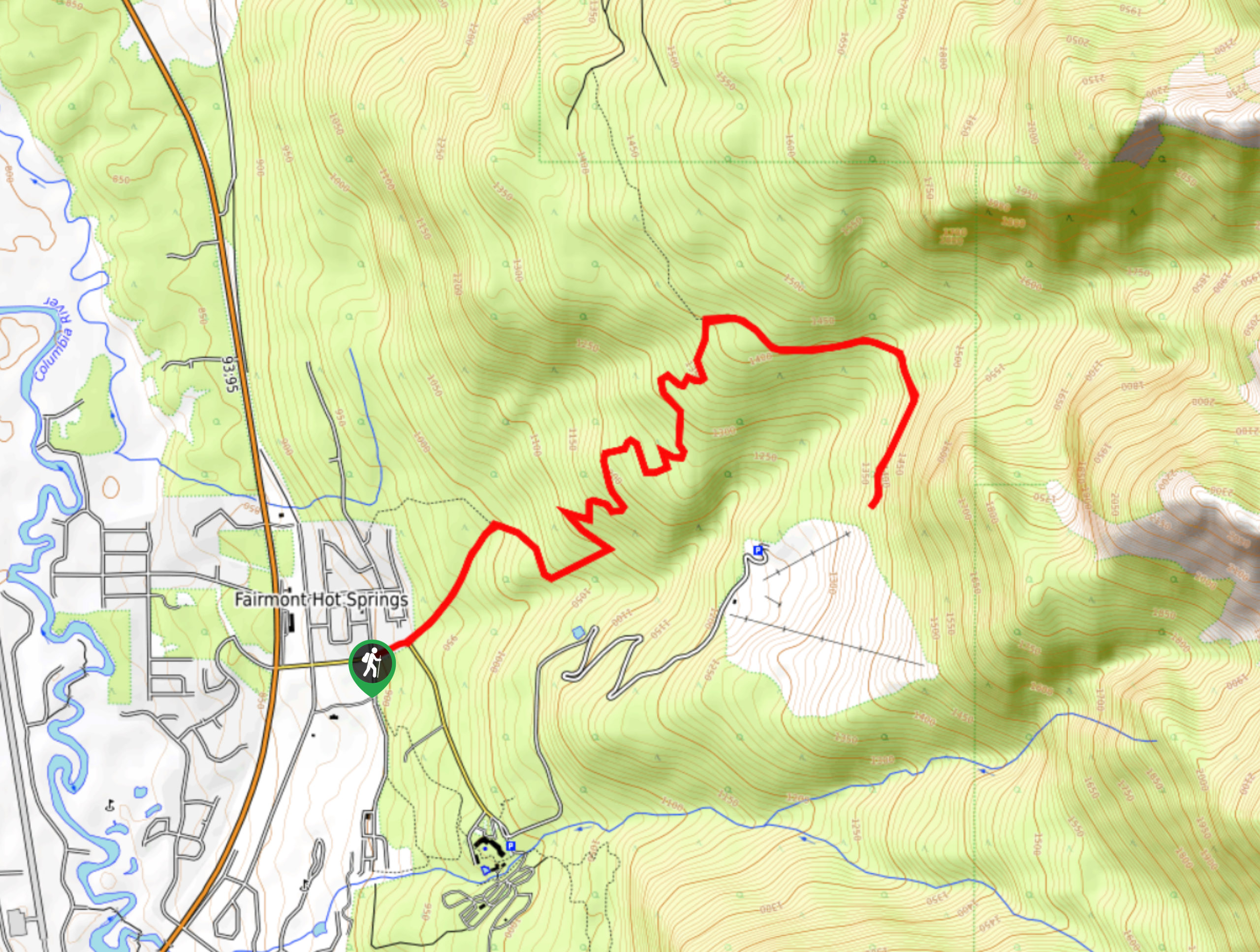
Hunter’s Way is an 7.2mi out-and-back hiking route near Invermere that will take you along a wide forest service road to access some nice views overlooking the Columbia Valley. While the trail isn’t overly difficult, it does pack a moderate amount of elevation gain, so be prepared for an uphill grind. Pack microspikes for the shoulder seasons as the trail can become fairly slippery due to ice.
Getting there
To get to the trailhead for Hunter’s Way from Invermere, head south on Highway BC-93 for 14.1mi and take a left on Wills Road. After 1640ft, take another left on Mountain View Drive, followed by a right on Mountain Ridge Road. You will find the trail straight ahead in 249ft.

About
| When to do | May–November |
| Backcountry Campsites | No |
| Pets allowed | Yes - On Leash |
| Family friendly | Older Children only |
| Route Signage | Average |
| Crowd Levels | Moderate |
| Route Type | Out and back |
Hunter’s Way
Elevation Graph
Weather
Hunter’s Way Description
Hunter’s Way is a scenic hiking route through the beautiful forests near Fairmont Hot Springs that will allow you to disconnect from the world around you and enjoy the beauty of the outdoors. While there are only a few decent lookouts over the Columbia Valley, the serene forest atmosphere is more than enough to turn this route into an enjoyable experience in the woods.
The trail climbs uphill along a wide forest service road and meanders through the trees towards the Fairmont Hot Springs Resort Ski Area. From the top of the trail, you will have a nice sightline looking out across the valley to the rugged Purcell Mountains to the west. After taking in the views, head back down the same route to return to the trailhead where you began your hike.
Similar hikes to the Hunter’s Way hike
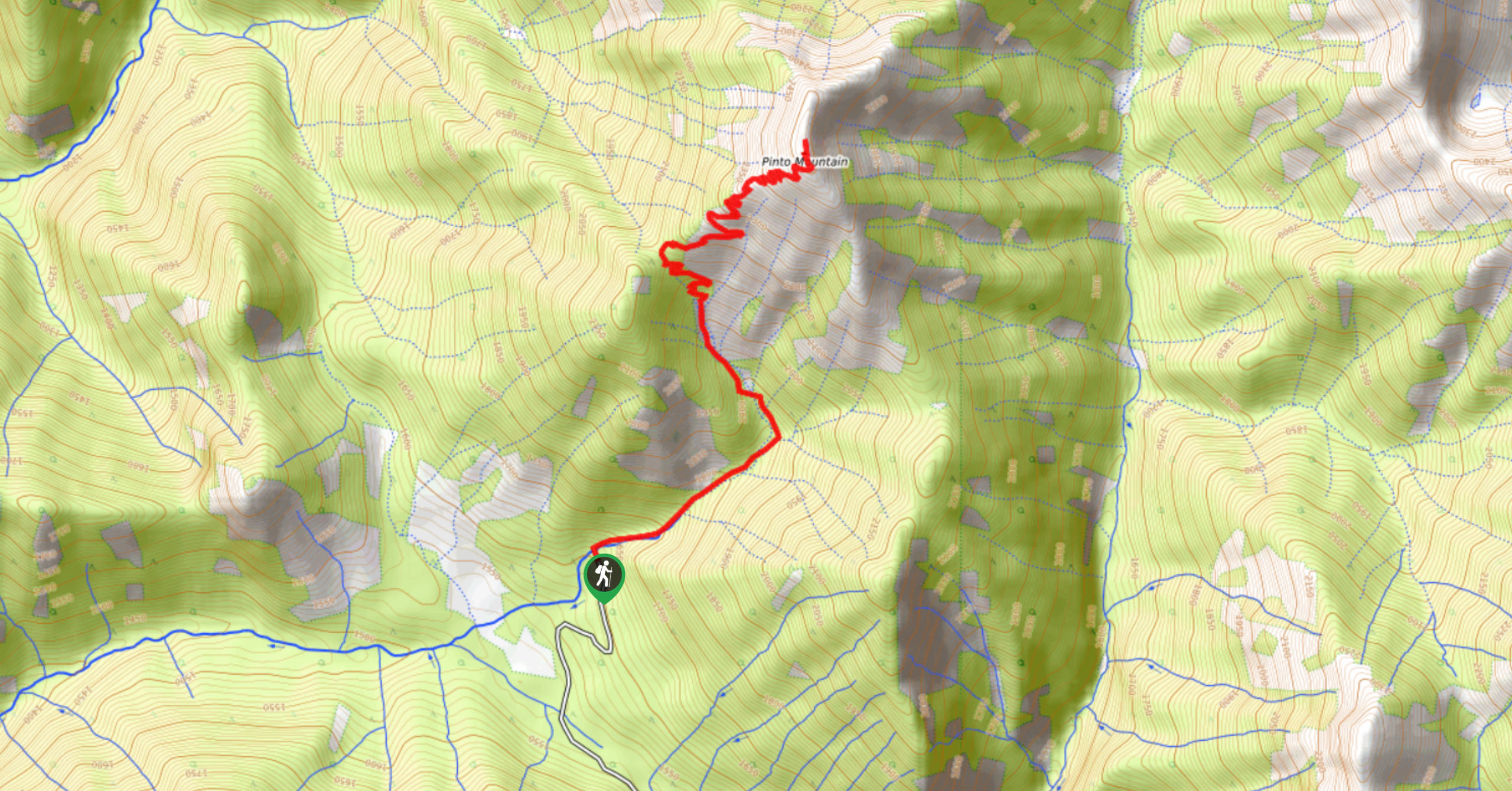
Pinto Mountain
The trail to the summit of Pinto Mountain is an 5.4mi out-and-back hiking route that will lead you…
Mount Swansea Tower
Mount Swansea Tower is a 3.8mi lollipop hiking route in the Swansea Mountain Recreation Site near Invermere that…
Conrad Kain Hut Trail
The Conrad Kain Hut Trail is a 5.6mi out-and-back hiking route near Invermere, BC, that climbs through beautiful…
Comments