Lone Eagle Peak Hike
View Photos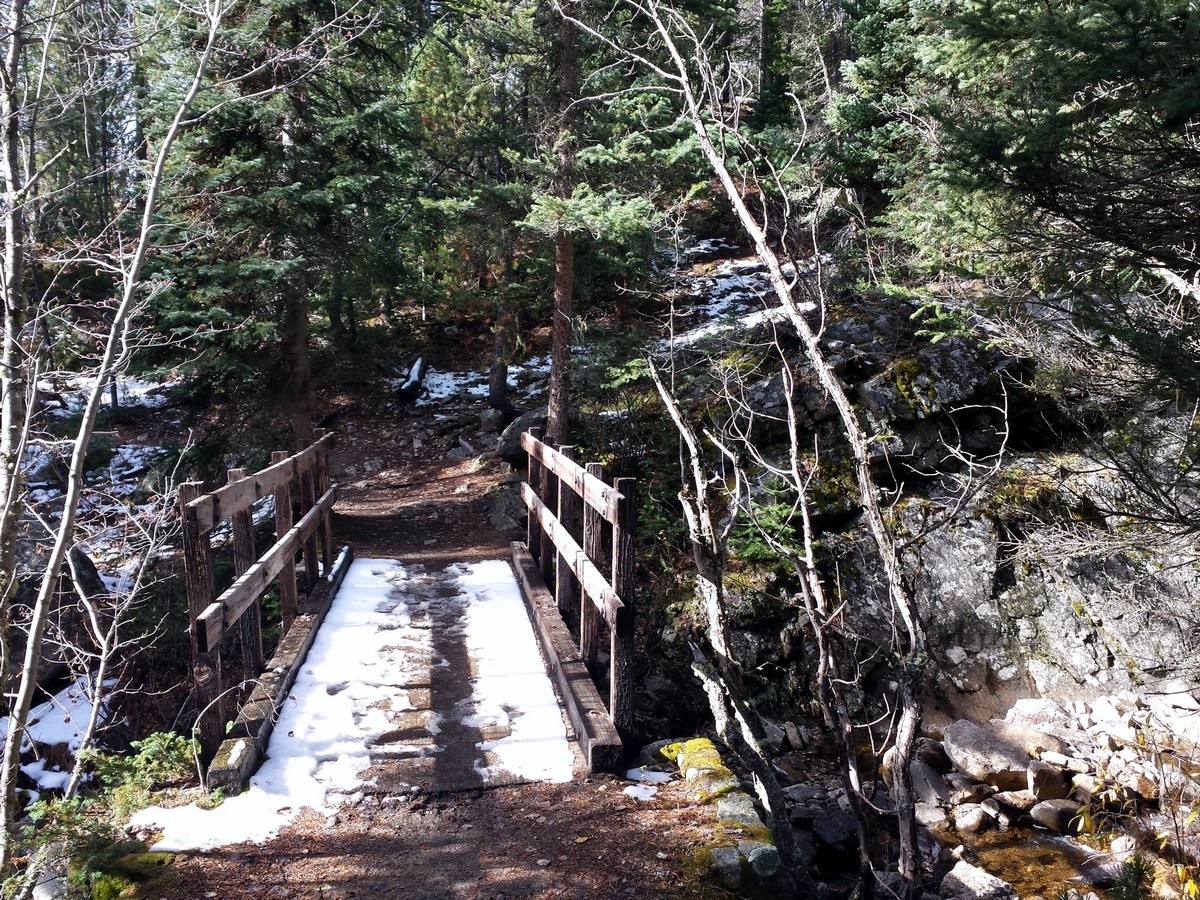
Lone Eagle Peak Hike
Difficulty Rating:
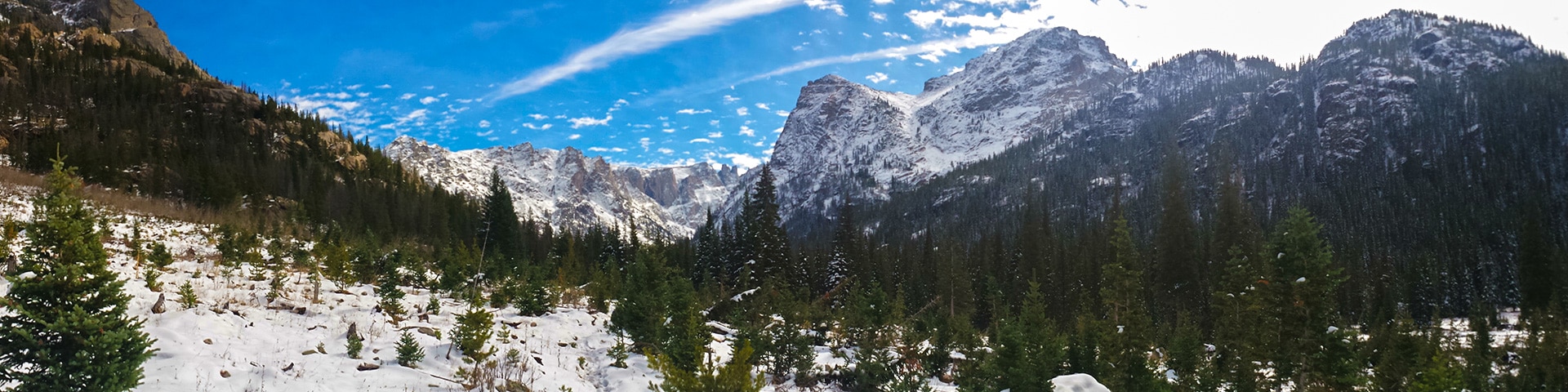
Lone Eagle Peak is a rugged hike, but it’s also one of the best hikes in Colorado. You’ll walk past many waterfalls including Cascade Falls. At the end, you’ll see Lone Eagle Peak towering over Mirror Lake and dominating the mountain landscape. This beautiful reflection makes it one of the most scenic views in Colorado.
Getting there
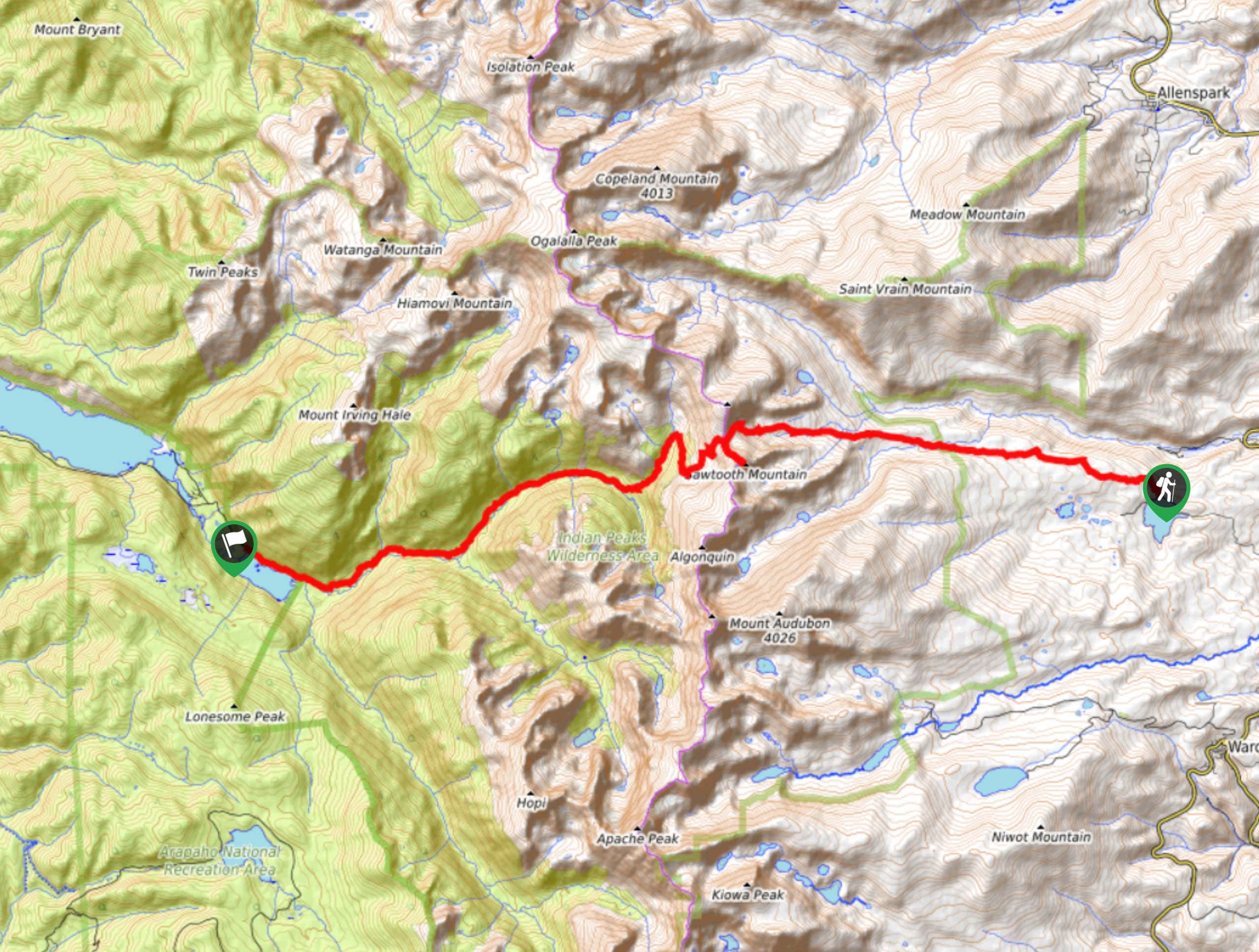
From the town of Granby, on US-40, find the exit onto US-34 E. This goes to the South shore of Lake Granby. Turn right onto CO Hwy 6; the gravel road dead-ends at the parking.

About
| When to do | Early June to Late September |
| Backcountry Campsites | Yes |
| Toilets | Yes |
| Family friendly | No |
| Route Signage | Average |
| Crowd Levels | High |
| Route Type | Out and back |
Lone Eagle Peak Hike
Elevation Graph
Weather
Route Description for Lone Eagle Peak Hike
The Lone Eagle Peak hike starts out at Monarch Lake Trailhead via Cascade Creek Trail. The trail follows along the north side of Monarch Lake until it veers up along Buchanan Creek.
The trail gains elevation on moderate switchbacks for a while, and then it’ll begin to follow Cascade Creek. After crossing a wooden bridge, you are met with the first of many beautiful waterfalls.
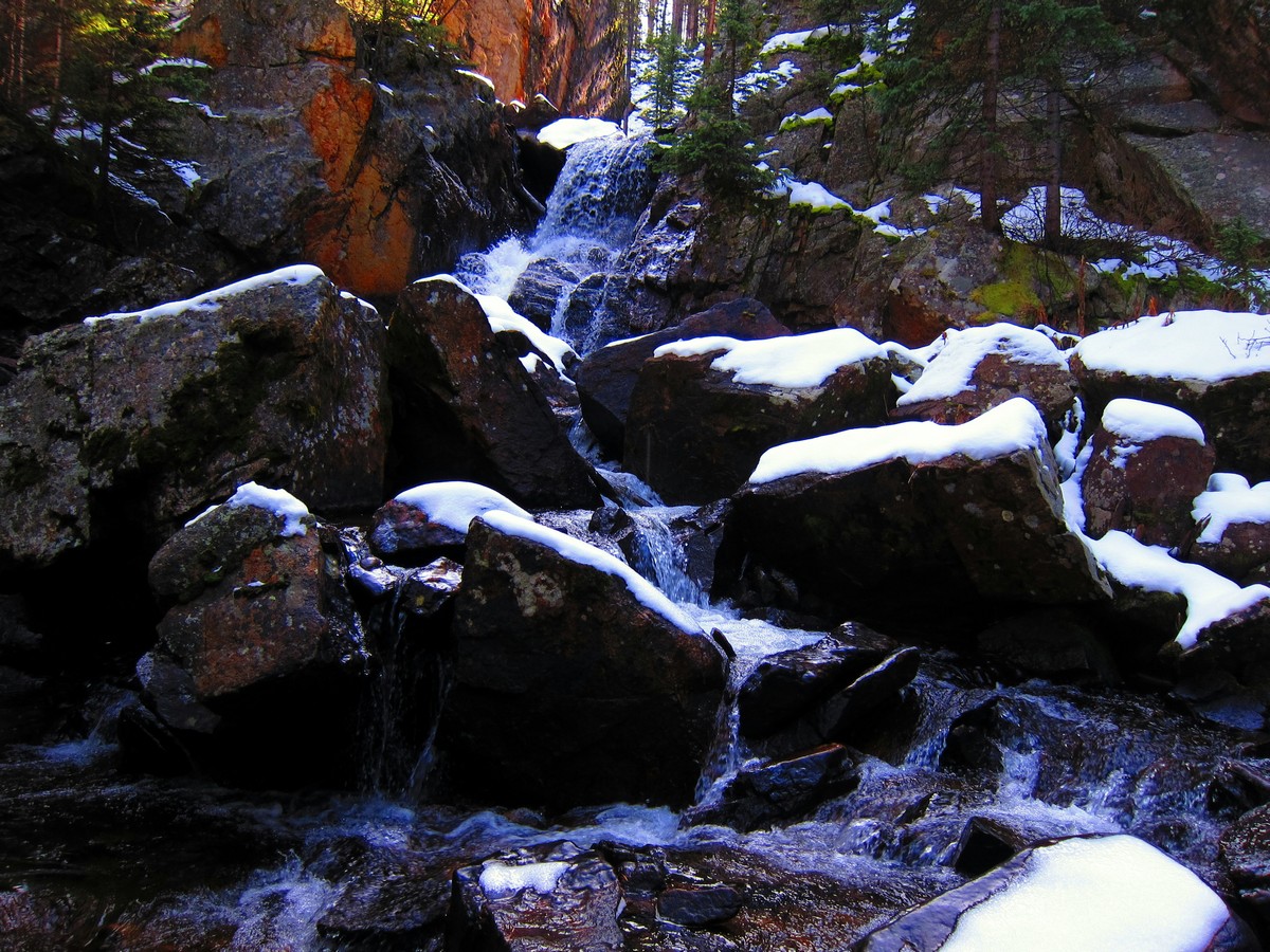
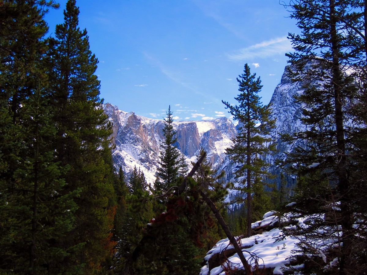
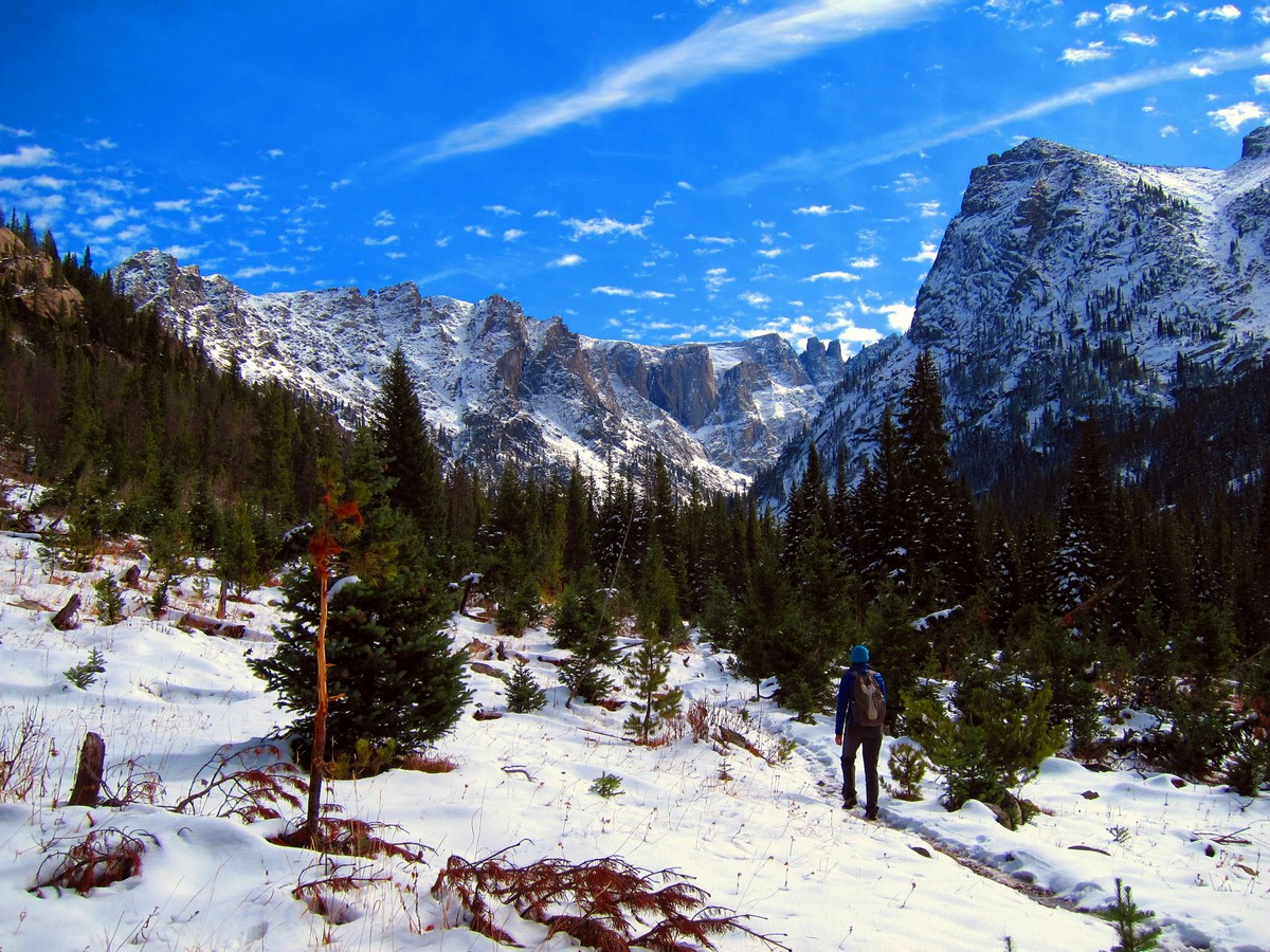
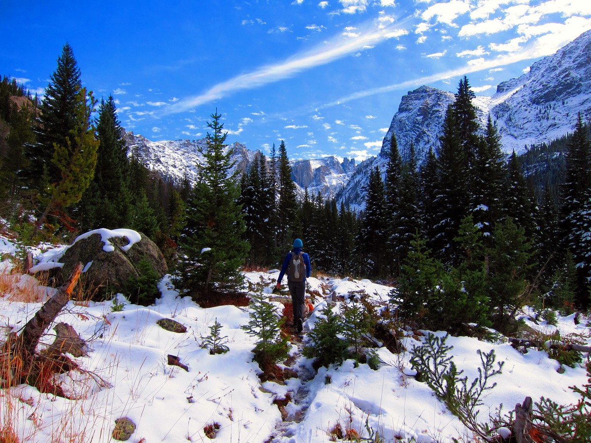
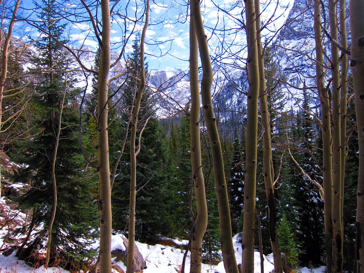
Continuing along the Lone Eagle Peak trail, you gain additional elevation as the valley opens up to reveal breathtaking views of the mountain range as well as multiple waterfalls. Cascade Falls is the largest waterfall on this hike and is comprised of four separate waterfalls!
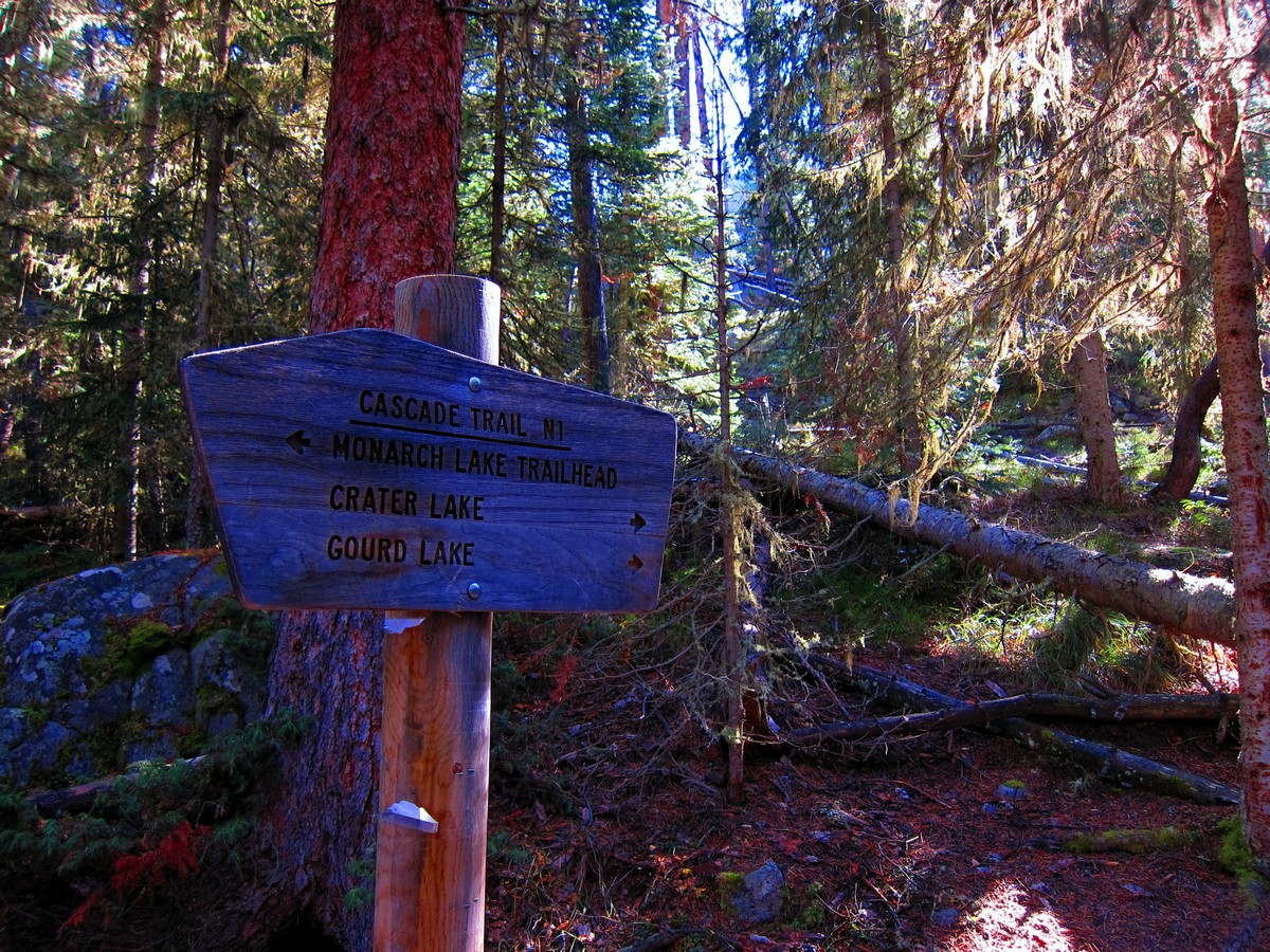
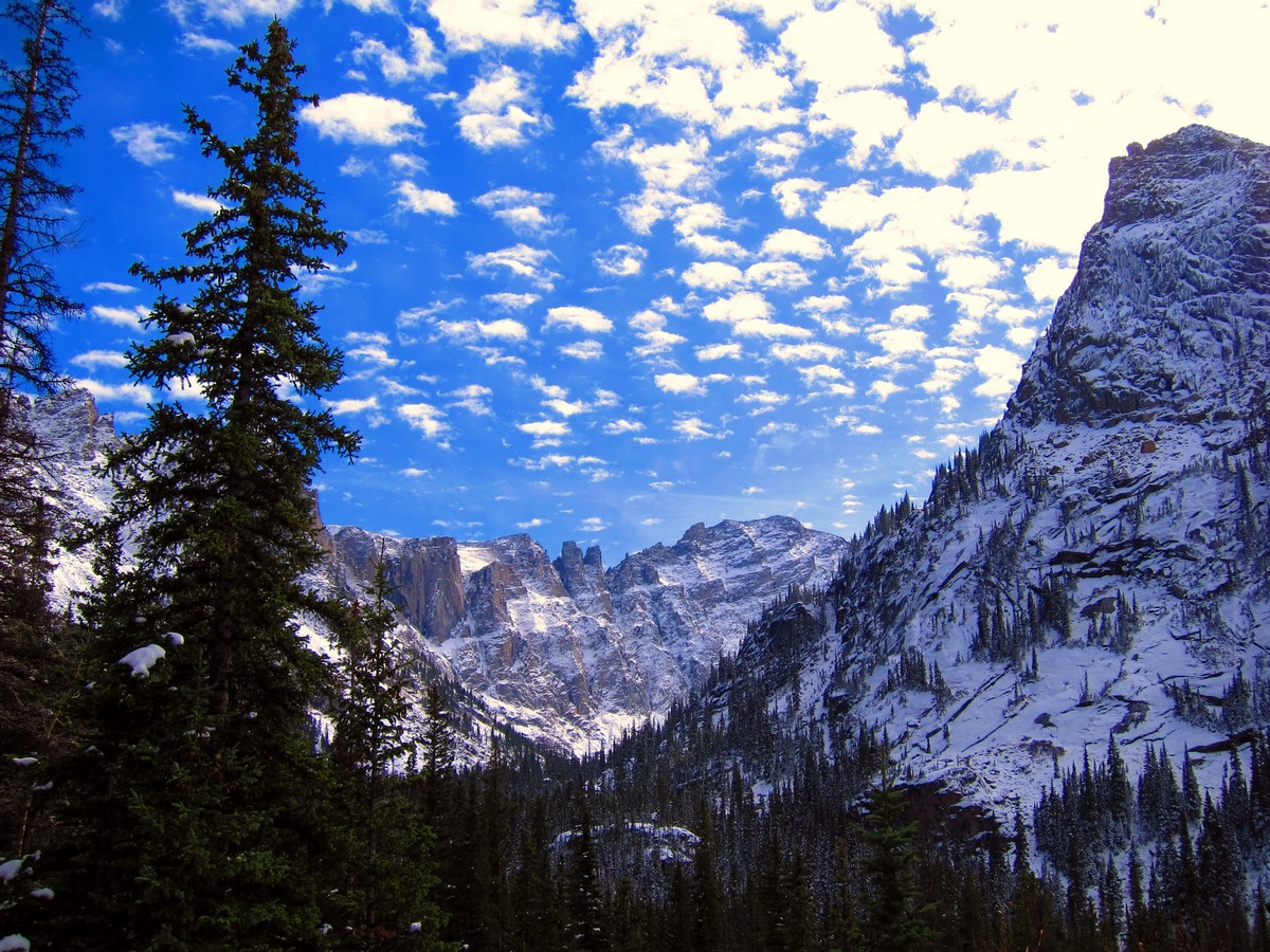
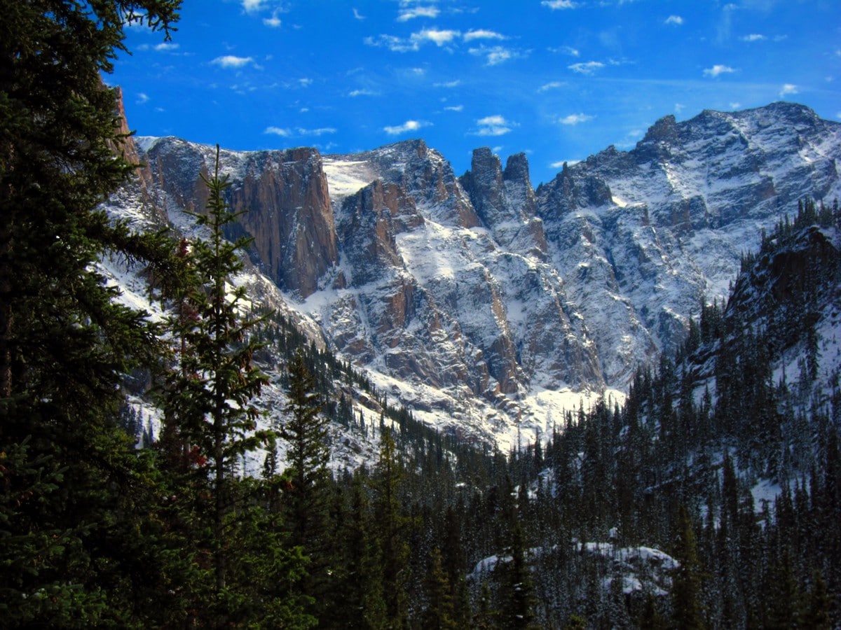
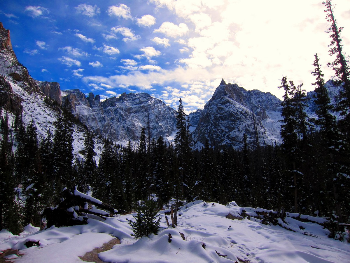
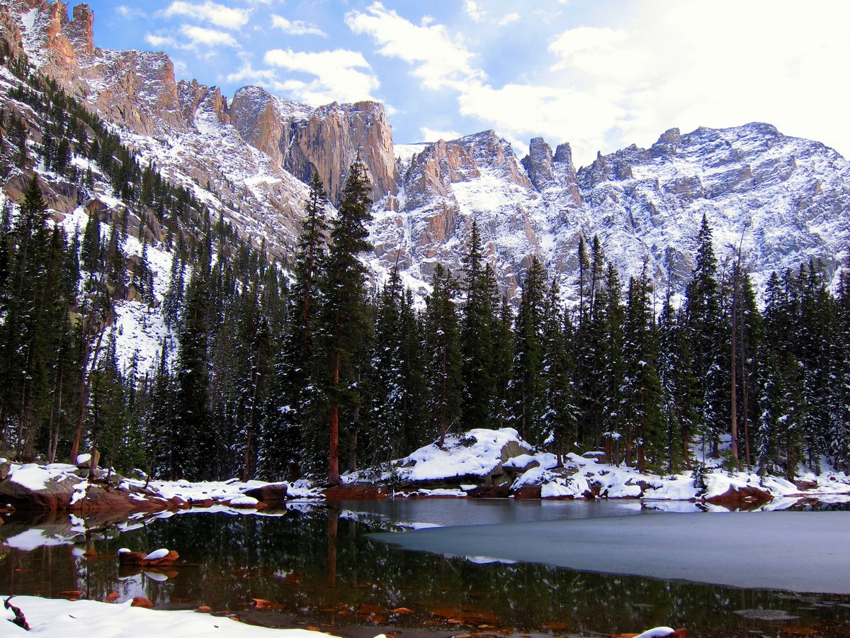
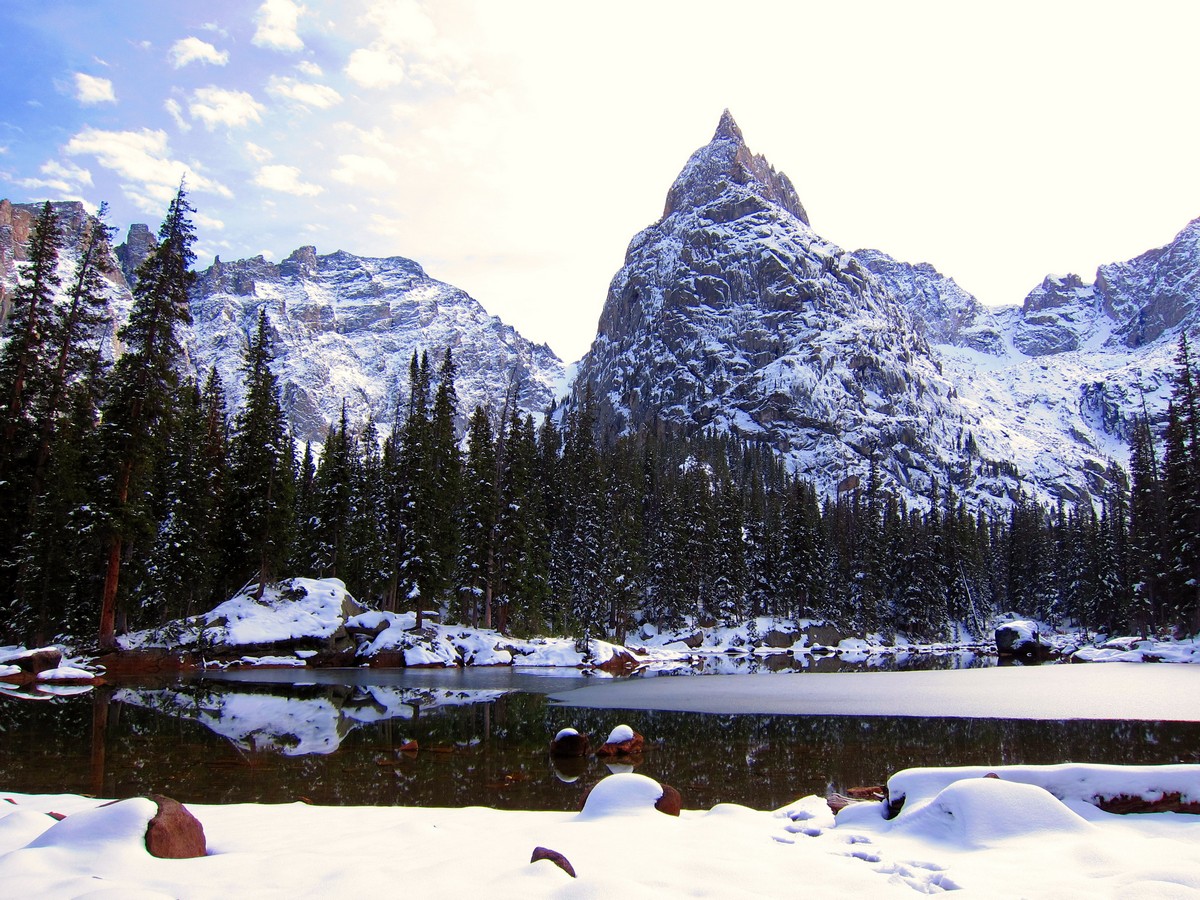
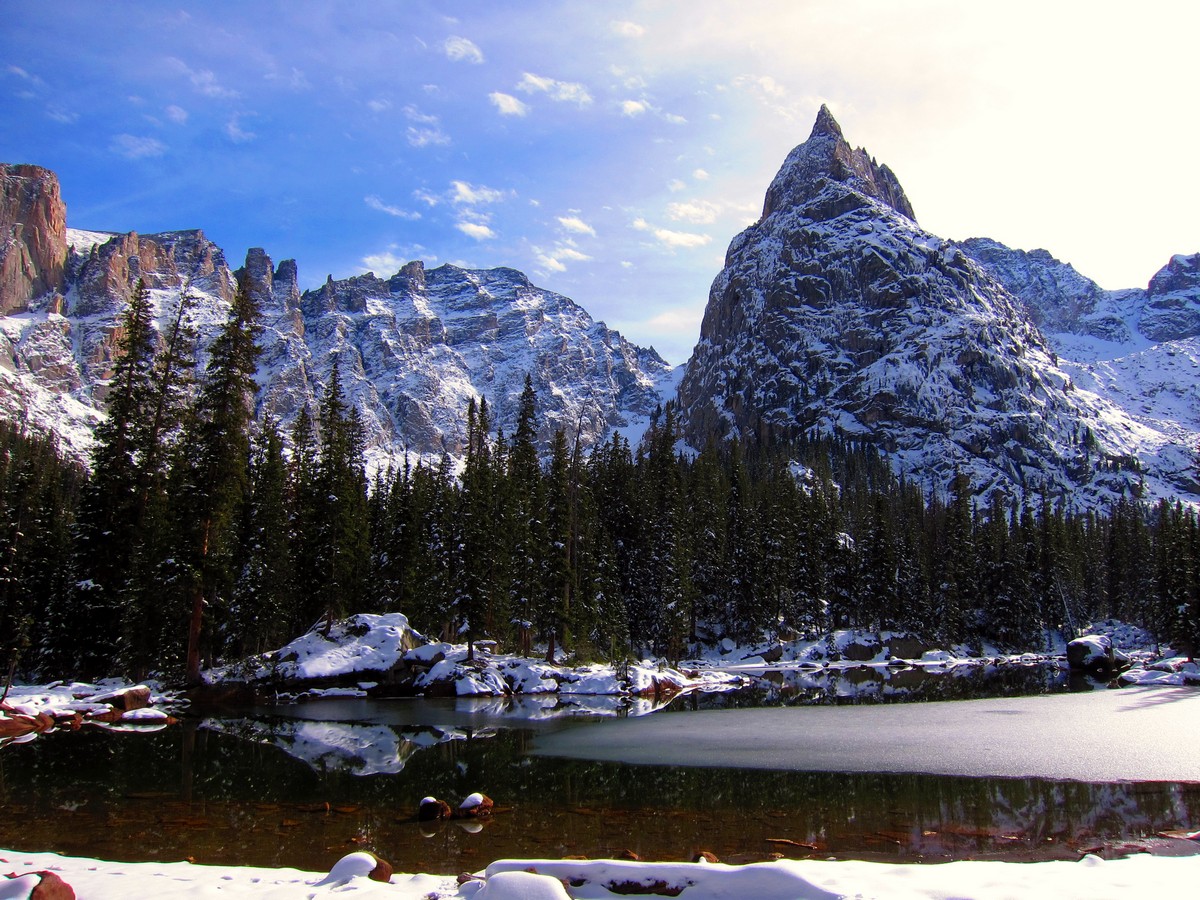
After Cascade Falls, the trail comes to a junction and a trail marker; continue onto Crater Lake Trail. A final push up steep switchbacks places you directly in front of Lone Eagle Peak and Mirror Lake. This is one of the most scenic views in all of Colorado. For an added bonus, located further up the trail is Crater Lake (a large glacier-fed alpine lake with a stunning waterfall in the far corner). Fair Glacier is to the lake’s left and Peck Glacier is to the right.
Our map takes you as far as Mirror Lake, and for most people, this is a good place to turn around.
If you feel adventurous, the Lone Eagle Peak hike is a long and rugged trail. Cairns are used to mark the trail when traveling over rugged, rocky sections. The hike is not technical, but the length and elevation gain make it a challenge for even seasoned hikers.
When you are finished, you can head back the way you came in.
Hiking Trail Highlights
Lone Eagle Peak

Lone Eagle Peak is part of the Indian Peaks Wilderness area, south of Rocky Mountain National Park in Colorado. While it isn’t among the tallest of the peaks in this region, at 11,940 ft (3,640 m), its unique shape and rugged granite face make it a dominant feature in the skyline of this remote area. In a state that does not lack for breathtaking mountains, many of which are taller than 14,000 ft (4,267 m), it is notable that Lone Eagle Peak has been called Colorado’s most picturesque mountain.
When the summit was first reached in 1930, the mountain was called Lindbergh Peak, which may be related to aviator Charles Lindbergh’s first solo transatlantic flight in 1927. The name was later changed to Lone Eagle Peak, after one of Lindbergh’s nicknames, “The Lone Eagle.”
A stunning Lone Eagle Peak is one of the Indian Peaks of the Front Range of the Rocky Mountains. With the height of 11,946 ft (3,641 m), the peak is dominating the Indian Peaks Wilderness of Arapaho National Forest. The nearest town to the peak is Frasier in Grand County, Colorado, some 12.4 mi (19.9 km) away. The mountain was named in honor of aviator Charles Lindbergh who was often called a ‘lone eagle.’ The best time to hike this trail is from June until September.
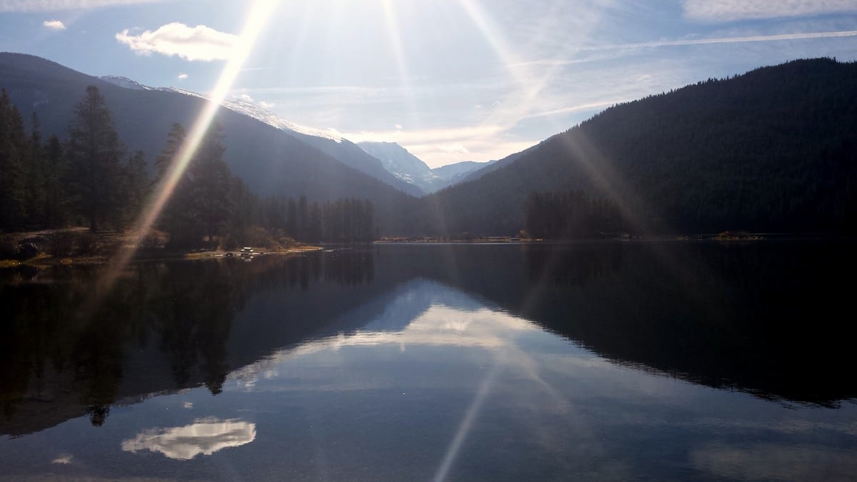
Mirror Lake, Colorado
Visitors to Mirror Lake, Colorado, have little doubt as to how this stunning body of water received its name. If Lone Eagle Peak is Colorado’s most picturesque mountain, then a lake that is perfectly positioned to fully reflect this peak is well-worth the hike. You may want to plan your lunch or snack break for the shores of Mirror Lake to give yourself time to fully enjoy the view.
Crater Lake, Indian Peaks
Just a short distance from Mirror Lake is the beautiful Crater Lake. Not to be confused with the famous Crater Lake in Oregon, or any of the other lakes with the same name, Crater Lake in Indian Peaks is a bowl-shaped lake that also offers spectacular views of Lone Eagle Peak. There are campsites available here (permit required) for those who want to break up their hike over two days, allowing time to see how the changing sun angles change the appearance of Lone Eagle Peak, or perhaps to spend time fishing in Crater Lake.
If you want to find other great hikes in Indian Peaks Wilderness, check out the Lake Isabelle trail, Rainbow Lakes trail or the Arapaho Glacier Trail.
Insider Hints
Permits are required for the Arapaho National Forest between June 1 and September 15. Have $5 in cash with you in case rangers aren’t available to make change. Interagency annual passes are also accepted.
Backcountry camping at Crater Lake is one of the best sites within the Indian Peaks. Plan your trip in advance and secure a permit before they are all gone!
Explore Pawnee Lake if you have multiple days to explore.
Lone Eagle Peak can be accessed from the East side of the Divide via Pawnee Pass Trail. This is only for experienced hikers and is very strenuous, making it ideal for a multi-day backcountry trip.
Overnight permits are required to camp in the Indian Peaks backcountry. Permits are limited and must be obtained in advance for camping dates 6/1-9/15. Visit the Indian Peaks visitor website for more details.
Prepare for traveling over rocks, roots and even shallow water runoff streams. Also along the trail, be aware that there is an abundance of wildlife in this area; moose, elk, and black bears are some of the more common. Be “bear aware” and responsible with food.

Similar hikes to the Lone Eagle Peak Hike hike
Beaver Reservoir to Monarch Lake Hike
Beaver Reservoir to Monarch Lake Hike is a one-way trail in the Indian Peaks Wilderness. We love this hike because…
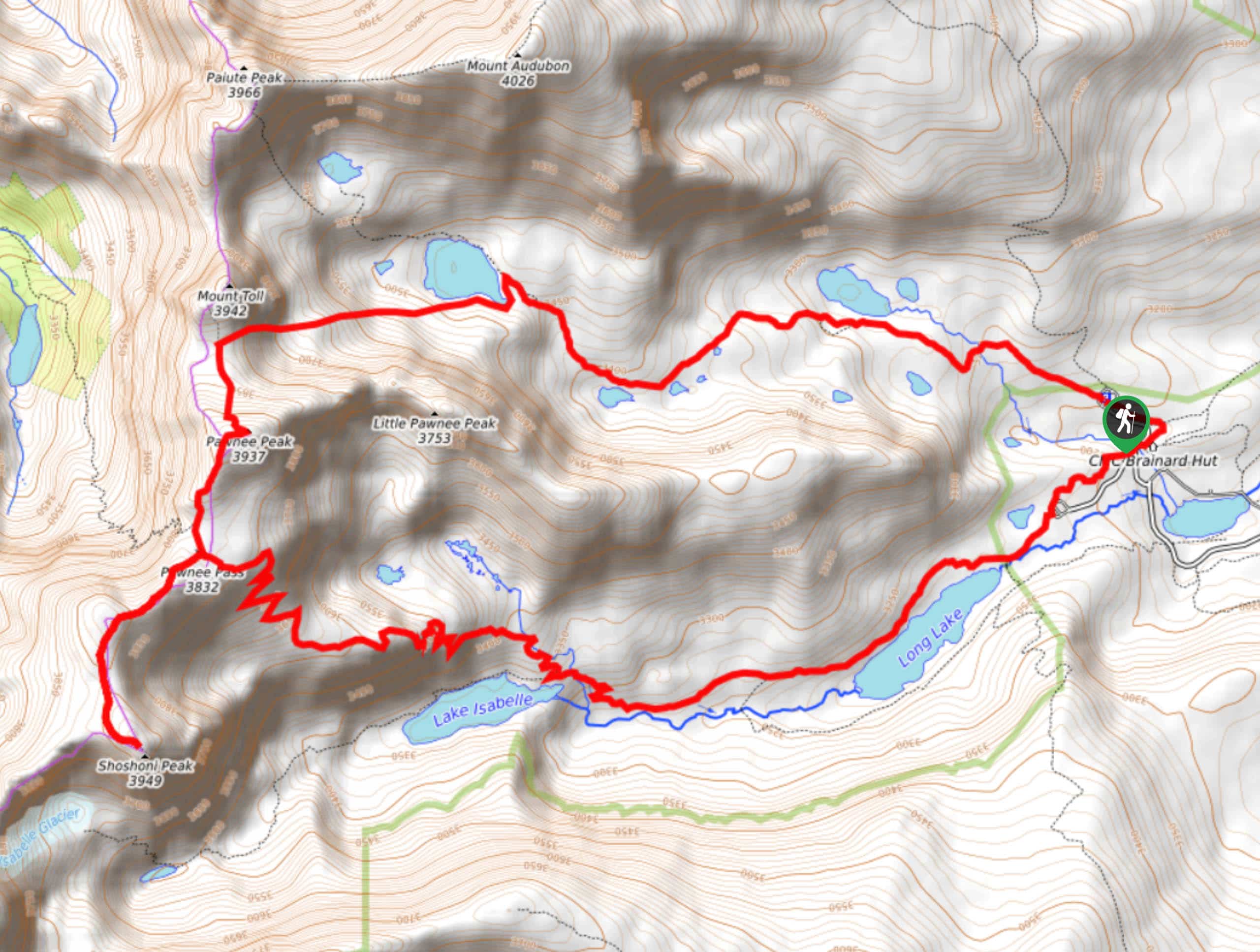
Shoshoni and Pawnee Peaks Hike
Reserved for experienced hikers, this trail will surely get your blood pumping. The Shoshoni and Pawnee Peaks Hike will give…
Arapaho Pass via Monarch Lake Hike
The Arapaho Pass via Monarch Lake Hike is a challenging point to point trail through the Indian Peaks Wilderness. The…
rosevalley 4 years ago
It has remarkable snow-peaked mountains, pine trees, and incredible lake.
TopherSan 4 years ago
The higher we climb, the more remarkable scenery we see.
CandyJ 4 years ago
I did this hike several years ago, and we admire the mesmerizing reflection of the mountain a lot.
Mannymou1 4 years ago
Is the hike 6-8 hours one way or out and back?
Stevie M 4 years ago
This is a great place for day hikes! There are wonderful views of lakes, mountains, and jaw-dropping waterfalls.
merry g. 5 years ago
Cascade falls was the most impressive waterfall among the other falls I've seen. It was tremendously awesome. I absolutely love it.
Jordan A. 5 years ago
Great hike but very crowded. Best to go early to avoid them.
Michael L. 5 years ago
Marvelous hike featuring numerous waterfalls and beautiful landscapes. I was surprised that they were all in just one hike.
Irish L. 5 years ago
Beautiful and tough, at the same time. It was windy when we did the hike. The trail was difficult to navigate, and we almost got lost.
Em L. 5 years ago
Ascending to the top was challenging because of the slippery trail. Wearing some microspikes helps a lot.