
High Lonesome Loop Hike
View Photos
High Lonesome Loop Hike
Difficulty Rating:
The High Lonesome Loop Hike is a strenuous trail in the Indian Peaks Wilderness. This trail is perfect for experienced hikers who are looking for a challenging day hike, or an overnight backpacking excursion. The High Lonesome Trail guides adventurers through the Indian Peaks and up the Continental Divide. Passing through different typographies, this trail will leave the most experienced hikers dumbfounded. The impressive scenery from the Continental Divide makes it all worth the effort. Make sure to add this hike to your Colorado itinerary!
Getting there
The High Lonesome Loop Trail departs from the Hessie Trailhead at the Hessie Carpark.

About
| Backcountry Campground | Yes, permits required. |
| When to do | July-September |
| Pets allowed | Yes - On Leash |
| Family friendly | No |
| Route Signage | Average |
| Crowd Levels | Moderate |
| Route Type | Circuit |
High Lonesome Loop Hike
Elevation Graph
Weather
High Lonesome Loop Hike Description
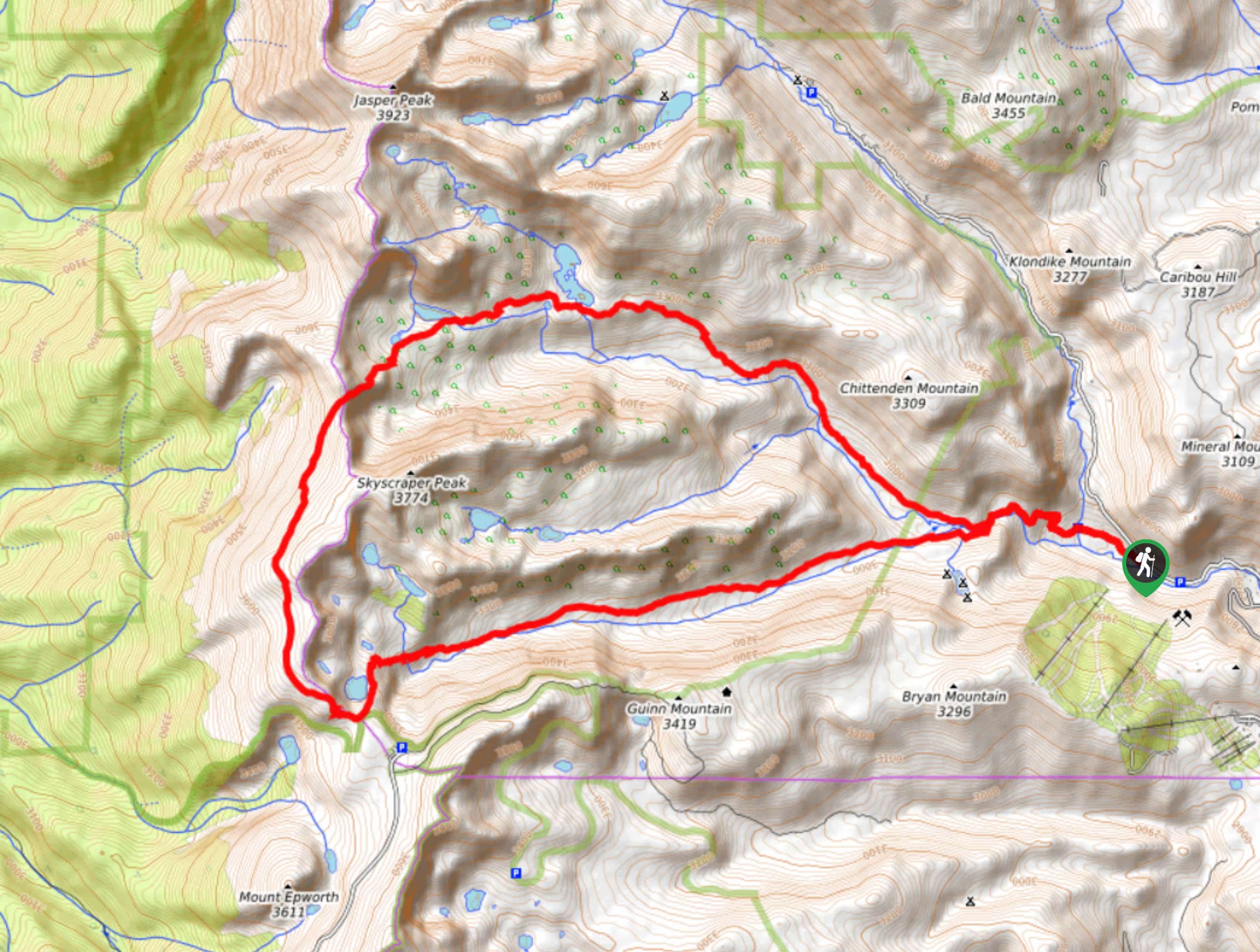
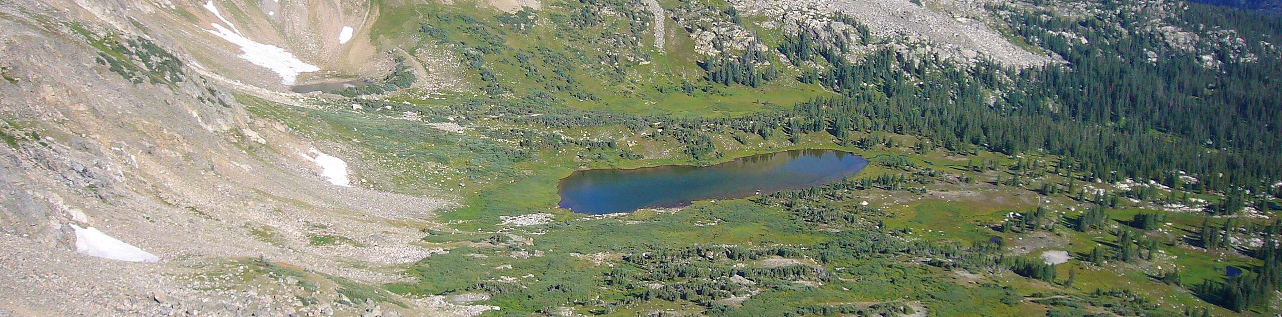
The High Lonesome Loop Hike is a magnificent trail near Nederland, Colorado. This hike can be completed in a day or as a multi-day backpacking adventure. Either way, this trail will deliver astonishing views of the Front Ranges and surrounding alpine lakes. This trail departs from the Hessie Carpark. The small parking lot fills up fast as the Hessie Trailhead provides access to numerous backcountry hikes. Arrive early to beat the crowds or consider taking the RDT free shuttle from the town of Nederland! When planning this adventure, ensure to bring a water filter or plenty of water and snacks, you’ll need to bring your A-game to complete this hike! Additionally, due to the extreme elevation gain of this trail, afternoon storms are common near the Continental Divide, be sure to check the weather and head out early.
Departing from the Hessie Trailhead at the carpark, head west along the Devil’s Thumb Bypass Trail. We recommend completing this hike counterclockwise. Continue along the trail until the first junction and stay right as you merge onto the Devil’s Thumb Trail. Follow along the trail as it guides you through the woods, gradually gaining elevation. At the next junction, turn left, passing along Jasper Lake and the Devil’s Thumb Lake. These lakes have great campsites sheltered from the wind. After passing the lakes, you will begin your steep ascent up the Devil’s Thumb Pass to the Continental Divide.
At this point you will encounter another junction, turn left, heading south along the High Lonesome Trail. This segment of the hike is exposed and windy, so exercise caution. Appreciate the views of the Indian Peaks as you progress along the Continental Divide before navigating switchbacks down to the next intersection. Turn left, diverting you onto King Lake Trail. As you pass the picturesque King Lake the trail will begin to gradually descend. Follow the trail east, staying straight on King Lake Trail. This path will eventually guide you through the alpine woodlands, past vast meadows, across creeks, and back to the Hessie Trailhead and Carpark.
Similar hikes to the High Lonesome Loop Hike hike
Beaver Reservoir to Monarch Lake Hike
Beaver Reservoir to Monarch Lake Hike is a one-way trail in the Indian Peaks Wilderness. We love this hike because…
Shoshoni and Pawnee Peaks Hike
Reserved for experienced hikers, this trail will surely get your blood pumping. The Shoshoni and Pawnee Peaks Hike will give…
Arapaho Pass via Monarch Lake Hike
The Arapaho Pass via Monarch Lake Hike is a challenging point to point trail through the Indian Peaks Wilderness. The…
Comments