Gibraltar Lakes Hike
View Photos
Gibraltar Lakes Hike
Difficulty Rating:
The Gibraltar Lakes Hike is a hidden gem among the hundreds of trails in the Indian Peaks. Hike along the border of the Rocky Mountain National Park, near Saint Vrain Mountain. Conquer this primitive trail in a day or take you time and camp at the lakes overnight, if you have a permit. This hike is a great adventure for experienced hikers looking to explore a more isolated section of the Indian Peaks Wilderness.
Getting there
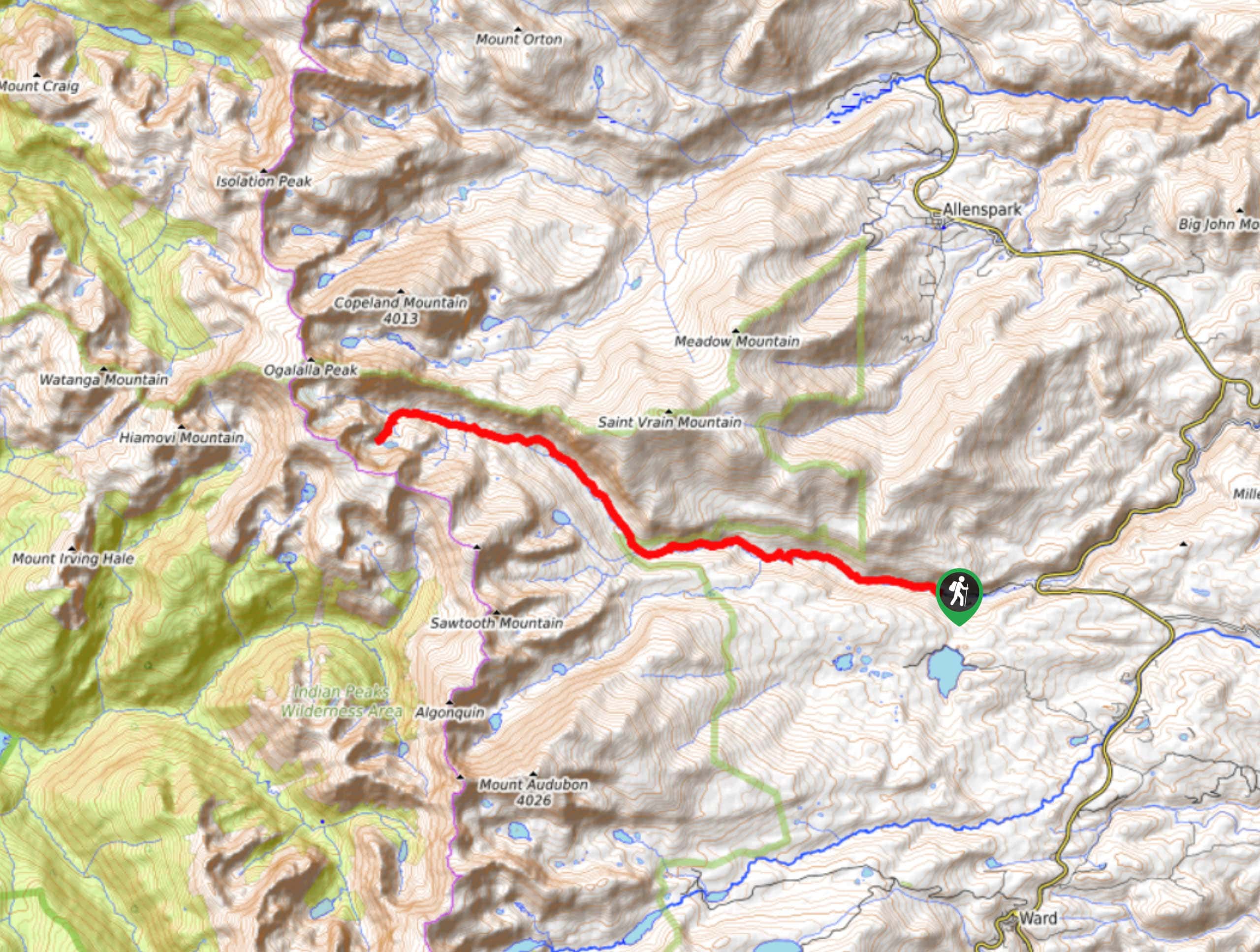
The Gibraltar Lakes Hike begins from the Camp Dick Campground off Country Road 92.

About
| Backcountry Campground | Yes, permits required. |
| When to do | June-October |
| Pets allowed | Yes - On Leash |
| Family friendly | No |
| Route Signage | Poor |
| Crowd Levels | Low |
| Route Type | Out and back |
Gibraltar Lakes Hike
Elevation Graph
Weather
Gibraltar Lakes Hike Description
If you are looking to avoid the crowds, then the Gibraltar Lakes Hike is the right place to be. The initial segment of this hike is well maintained as it branches off to multiple other trails in the area. Once the route diverges off the main channel, then the trail becomes more primitive and overgrown. Make sure you have a trail GPS and a keen sense of adventure for this one! Be wary of bears and moose as you progress along this woodland trail.
The Gibraltar Lakes Hike departs from the Camp Dick Parking Lot, from there get onto Country Road 92J. You will quickly meet an intersection, veer right onto Buchanan Pass Trail. Maintain along this trail as it follows along the curves of the Middle St. Vrain Creek and past cascading waterfalls. Avoid diverting off this trail until you encounter the Saint Vrain Glaciers Trail. Turn right, diverting you onto the Saint Vrain Glaciers Trail. This section of the hike is less maintained and trickier to navigate. Follow this route up the glacial valley as you ascend the timberline. This trial will guide you west before curving south down to the Gibraltar Lakes. Nestled amongst craggy peaks, these little lakes are the perfect spot to stop for a rest or set up shop for the night.
Whether you make this hike a backpacking excursion or finish it in a day, return the way you came. Retrace your footsteps all the way back to the parking lot.
Similar hikes to the Gibraltar Lakes Hike hike

Caribou Pass Hike
The Caribou Pass Trail scales the west side of the Continental Divide. This short but steep hike will get your…

Beaver Creek Trail
Beaver Creek Trail is a great wooded hike through the Colorado wilderness. With picturesque babbling brooks and past vast wildflower…
Beaver Reservoir to Monarch Lake Hike
Beaver Reservoir to Monarch Lake Hike is a one-way trail in the Indian Peaks Wilderness. We love this hike because…
Comments