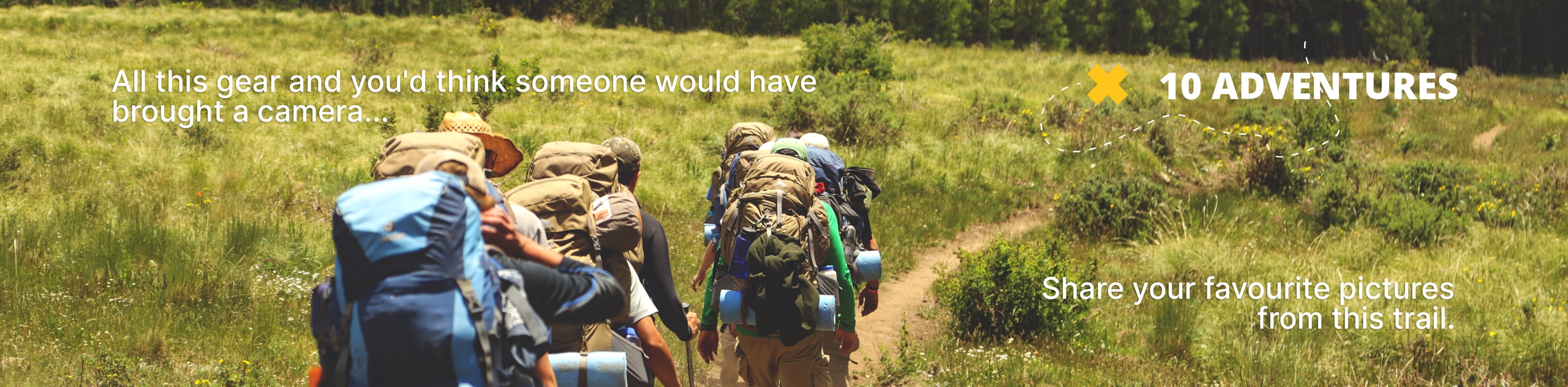
Columbine Lake via Caribou Pass Hike
View Photos
Columbine Lake via Caribou Pass Hike
Difficulty Rating:
Looking for a hike that will get your blood pumping but won’t exhaust you? Columbine Lake via Caribou Pass Hike is a fantastic moderate hike in the Indian Peaks Wilderness. Though steep in places, this hike is not overwhelmingly challenging. The path will guide you through quintessential Colorado terrain: lush aspen forests, babbling brooks, and over a rocky talus field to Columbine Lake.
Getting there
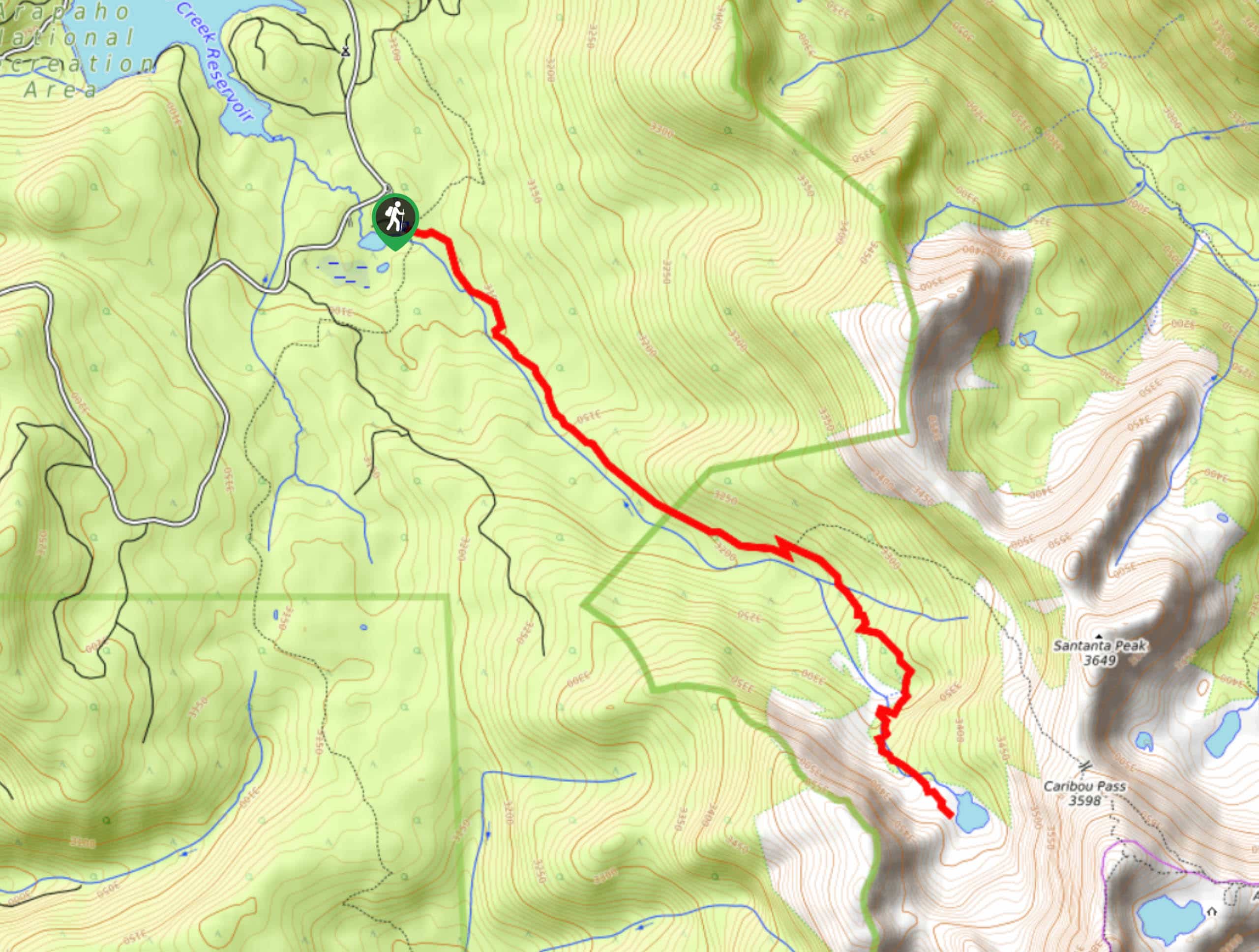
Columbine Lake via Caribou Pass Hike begins at the Lake Junco Trailhead. The trailhead is located off Country Road 84 in the Arapaho National Recreation Area. Passes are required and can be purchased online or on-site. Note that Country Road 84 closes seasonally from mid-November to mid-June.

About
| Backcountry Campground | Yes, permits required. |
| When to do | June-November |
| Pets allowed | Yes - On Leash |
| Family friendly | Older Children only |
| Route Signage | Average |
| Crowd Levels | High |
| Route Type | Out and back |
Columbine Lake via Caribou Pass Hike
Elevation Graph
Weather
Columbine Lake via Caribou Pass Hike Description
Columbine Lake via Caribou Pass Hike is a great introductory hike in the Indian Peaks WIlderness. The trailhead for the hike off of Country Road 84, which is very rough and has plenty of potholes. Low clearance vehicles may have trouble navigating the road. Go slow and take a vehicle with high ground clearance when possible. Once you park and start the hike do not be surprised if you come across fallen trees, storms and high winds often down them in this area. Additionally, this trail is very rocky with plenty of exposed roots, so wear appropriate shoes. We’d also recommend bringing bug spray, this trail is notoriously buggy!
Begin this hike from the Junco Lake Trailhead. Head east on the High Lonesome Trail and it will shortly merge onto the Caribou Pass Trail. This path will follow along the curves of the Meadow Creek and gain elevation as you progress. Continue through the wooded trail and past the vast meadow before you encounter a fork in the road. Veer right onto Columbine Lake Trail. This path will guide you back into the forest and the terrain will get increasingly rugged as you get closer to the lake. Mind your footing as you navigate the rock field before arriving at Columbine Lake. The gorgeous alpine lake is a reward in itself, but the views of the surrounding peaks are a bonus. You will get an up close and personal view of Mount Neva in the southeast, and views of Satanta Peak in the north!
Explore the shoreline and enjoy the scenery before retracting your steps and heading back. As you descend, ensure to stay left at the first junction and straight at the second.
Similar hikes to the Columbine Lake via Caribou Pass Hike hike

Caribou Pass Hike
The Caribou Pass Trail scales the west side of the Continental Divide. This short but steep hike will get your…

Buchanan Pass Loop
The Buchanan Pass Loop is an awesome adventure trail. Adults and kids alike will enjoy this wildflower-speckled trail as it…

Beaver Creek Trail
Beaver Creek Trail is a great wooded hike through the Colorado wilderness. With picturesque babbling brooks and past vast wildflower…
Comments