Buchanan Pass Trail
View Photos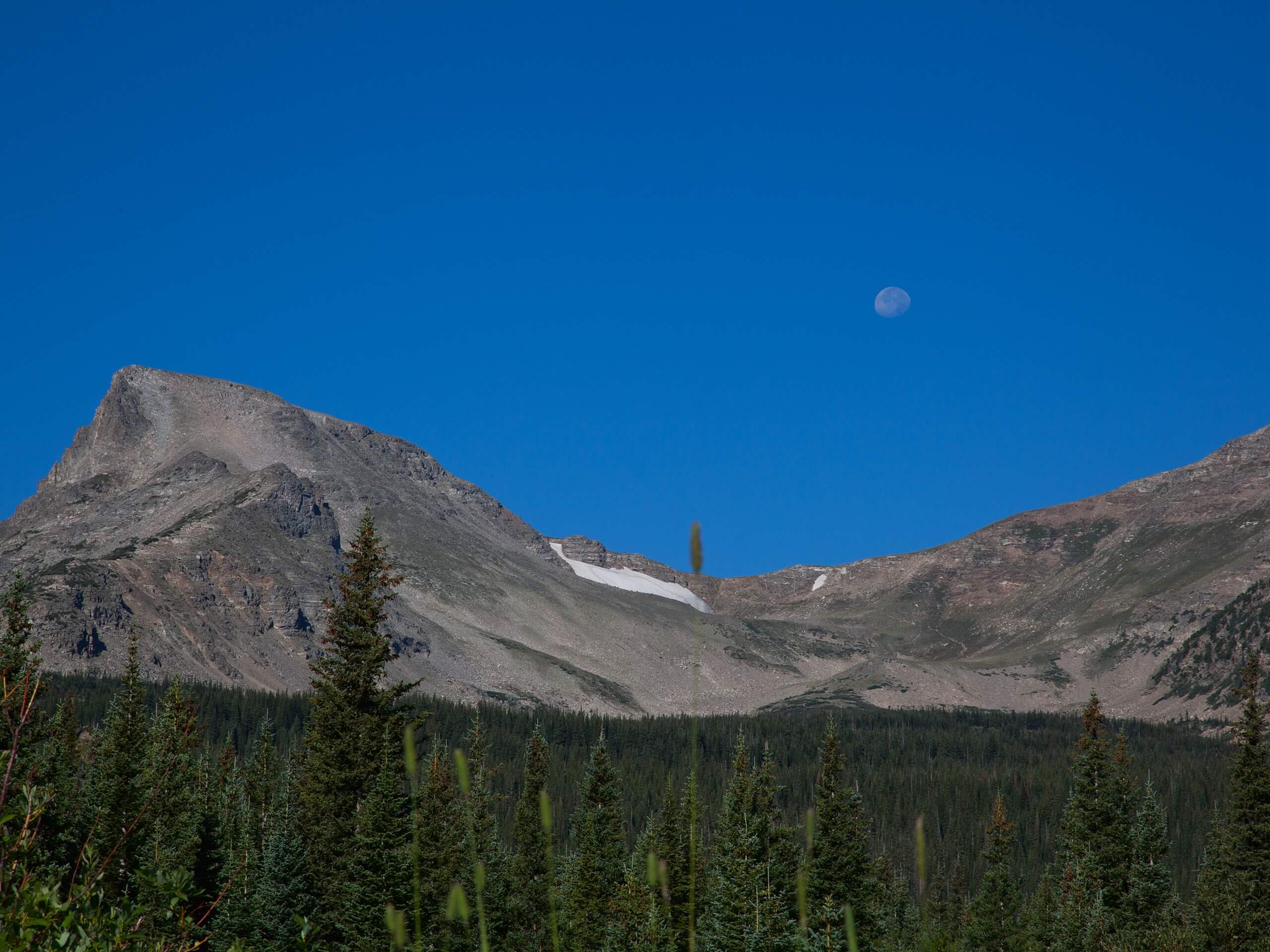
Buchanan Pass Trail
Difficulty Rating:
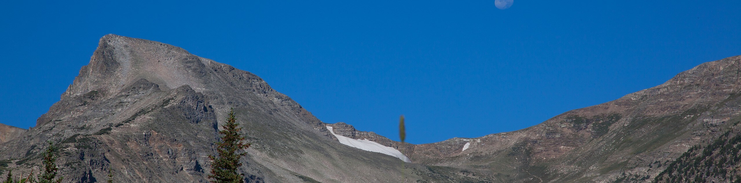
The Buchanan Pass Trail is a demanding adventure through the Indian Peaks Wilderness. This hike is sure to get your blood pumping. If you are seeking a challenge, consider the Buchanan Pass Trail. You will maneuver roots, rocks, and downed trees all before your steep ascent to Buchanan Pass. The jaw dropping views from the pass are well worth the effort.
Getting there
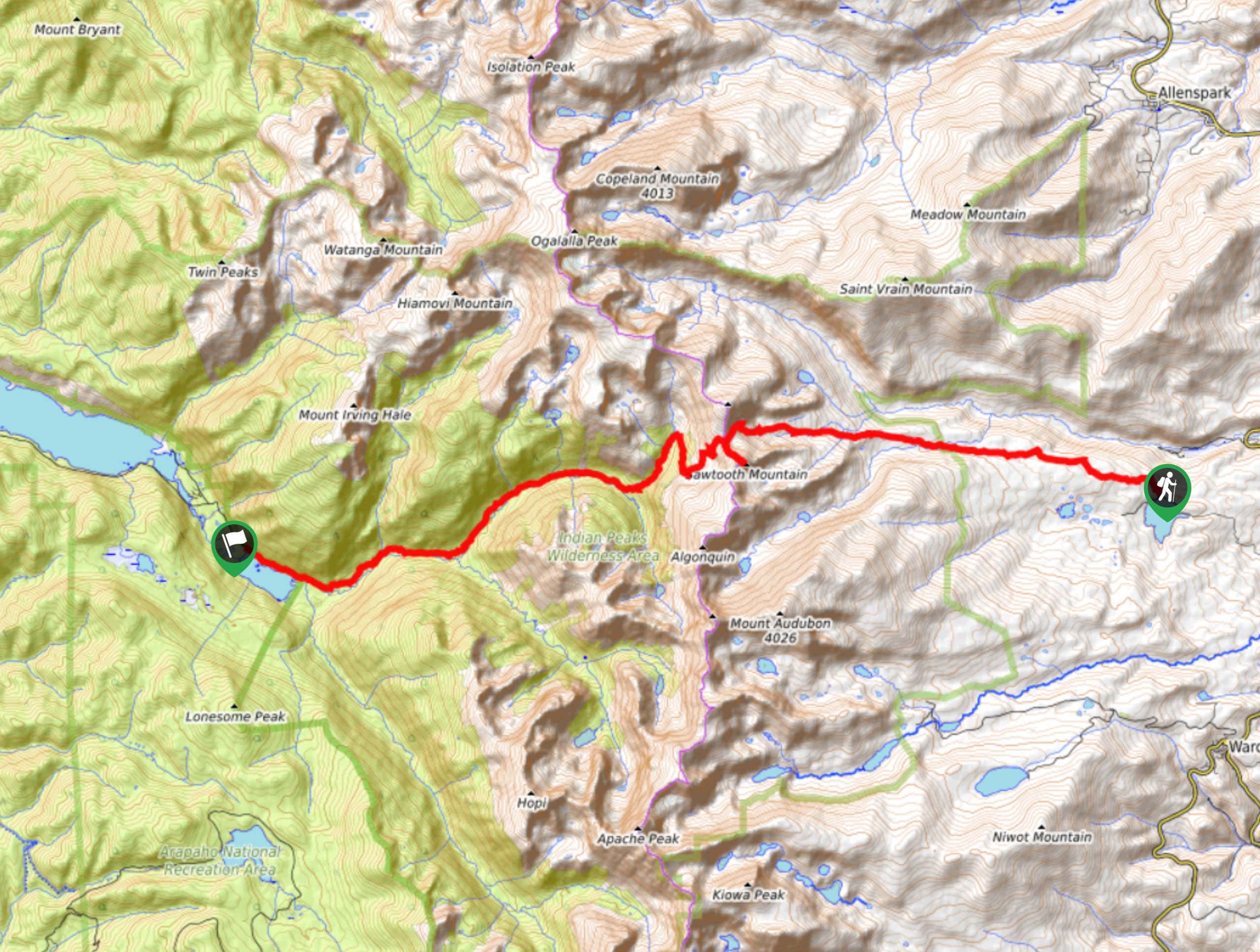
The Buchanan Pass Trail is located in the Arapaho National Recreation Area off Country Road 6. Passes are required and can be purchased online or on-site. Note that the access road to the trail closes seasonally from mid-November to mid-June.

About
| Backcountry Campground | Yes, permits required. |
| When to do | June-November |
| Pets allowed | Yes - On Leash |
| Family friendly | No |
| Route Signage | Poor |
| Crowd Levels | Moderate |
| Route Type | Out and back |
Buchanan Pass Trail
Elevation Graph
Weather
Buchanan Pass Hike Description
We could not recommend the Buchanan Pass Hike enough. This beautiful hike through the picturesque Colorado wilderness is challenging, but manageable. The elevation gain is extreme, but fairly gradual until the rearmost segment of the trail, which ridges the pass. Shared with mountain bikers, this trail is fairly popular, but signage is lacking. We recommend having the trail GPS handy as you hike. As always, as you gain elevation and summit the pass, expect bitter weather and wear layers to stay warm!
Begin this hike from the Monarch Lake Trailhead. Head east on the Cascade Creek Trail that borders Monarch Lake. You will arrive at a fork in the road, bear left, continuing on the Cascade Creek Trail. This section of the trail will guide you through the woodlands, along Buchanan Creek and past waterfalls. Follow this trail until you encounter a junction, veer left onto Buchanan Pass Trail. This section of the trail will begin to climb steeper as you curve along the ridge of Thunderbolt Peak. Stay straight on Buchanan Pass Trail. At this point, the trail will become increasingly rocky and exposed as you navigate switchbacks to Buchanan Pass. Once on the Continental Divide you will be rewarded with panoramic views of the Indian Peaks. Revel in the scenery before heading back.
If you still have some gas in the tank, consider summiting Sawtooth Mountain via the Sawtooth Mountain Trail in the south. It is a short but steep ascent to the peak. If you are ready to return, retrace your steps down the Buchanan Pass Trail and back onto the Cascade Creek Trail until you reach the parking lot.
Similar hikes to the Buchanan Pass Trail hike

Caribou Pass Hike
The Caribou Pass Trail scales the west side of the Continental Divide. This short but steep hike will get your…

Beaver Creek Trail
Beaver Creek Trail is a great wooded hike through the Colorado wilderness. With picturesque babbling brooks and past vast wildflower…
Beaver Reservoir to Monarch Lake Hike
Beaver Reservoir to Monarch Lake Hike is a one-way trail in the Indian Peaks Wilderness. We love this hike because…
Comments