South Bass Trail
View Photos
South Bass Trail
Difficulty Rating:
The South Bass Trail is a 12.0mi tough hike on the South Rim of the Grand Canyon. This hike is a ways away from the beaten path as far as the South Rim goes, so it’s a nice choice if you want lighter crowds. This is a hard trip that can be done in a day by very strong hikers who get an early start, but we recommend breaking it up with a night on the trail. This route is on the Havasupai reservation, so be prepared to pay a fee to access it. Expect light traffic.
Getting there
The trailhead for South Bass Trail is on Forest Road 328.

About
| Backcountry Campground | No |
| When to do | April-October |
| Pets allowed | No |
| Family friendly | No |
| Route Signage | Average |
| Crowd Levels | Low |
| Route Type | Out and back |
South Bass Trail
Elevation Graph
Weather
South Bass Trail Description
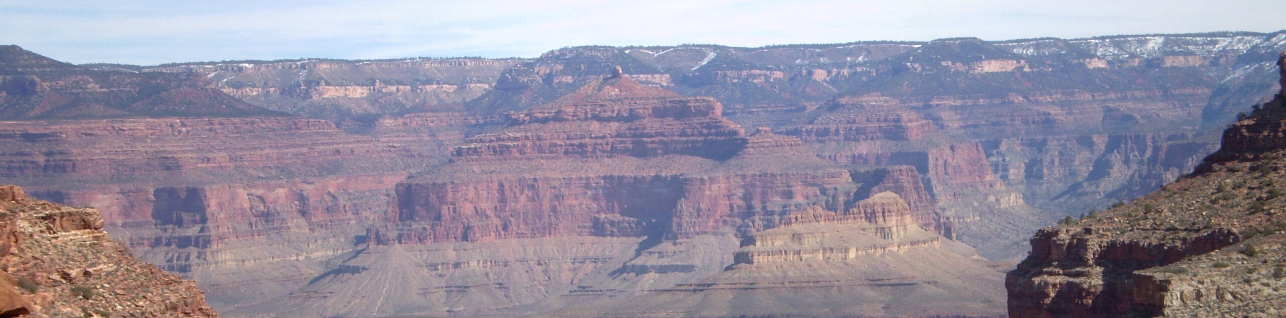
South Bass Trail is a challenging 12.0mi out and back trail in the Grand Canyon. This route takes you from the South Rim on the Havasupai reservation to the Colorado River below. While it can be done in a day by very strong hikers, we recommend spending a night on the trail to break it up. The views are incredible and you likely won’t have to share the trail with too many other hikers.
Since this route is on the Havasupai reservation, you’ll need to pay a fee to access it. Expect $25, which is subject to change. Additionally, the road to the trailhead is in poor condition with deep ruts and washouts. A high-clearance vehicle is essential and 4WD may be required if it’s muddy. Close the cattle gates behind you. Bring plenty of water, food, camping gear, poles, good boots, and GPS navigation.
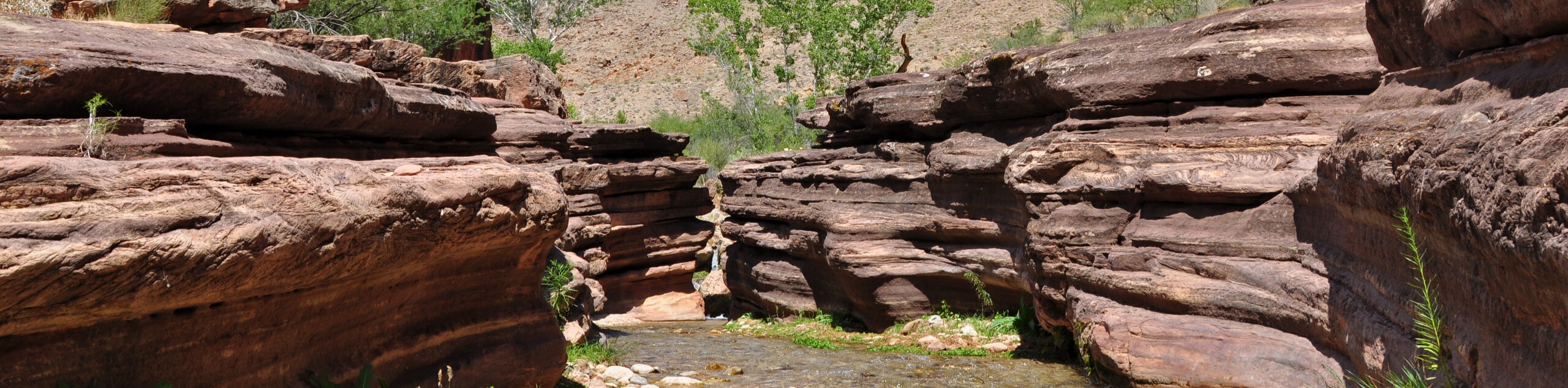
From the trailhead, you’ll descend on a well-defined route. Pass an old fence and hug the rim of the Coconino formation north before heading down through switchbacks to the Esplanade plateau. At the junction with Royal Arch (marked with a cairn), stay right. Traverse for a mile to a steep section dropping off the plateau. Descend into Bass Canyon, hiking above the bed of the canyon before dropping down to the floor at the Tonto Trail junction. You’ll weave across the drainage through the canyon.
At the rockfall, hike west to the large cairn that marks the way through a ravine. If the ravine route is too challenging, you can continue west a few more minutes to a gentler trail. At the river, rest up before retracing your steps.
Similar hikes to the South Bass Trail hike
Deer Creek to Colorado River Hike
The Deer Creek to Colorado River hike is a very challenging 18.0mi hike that leads you from the…
Waldron Trail
Waldron Trail is a hiking trail on the South Rim of the Grand Canyon that’s a bit of a hidden…
Powell Plateau Trail
Powell Plateau Trail is a hiking trail in the northwestern arm of the Grand Canyon. This spot in the canyon…
Comments