Ribbon Falls via North Kaibab Trail
View Photos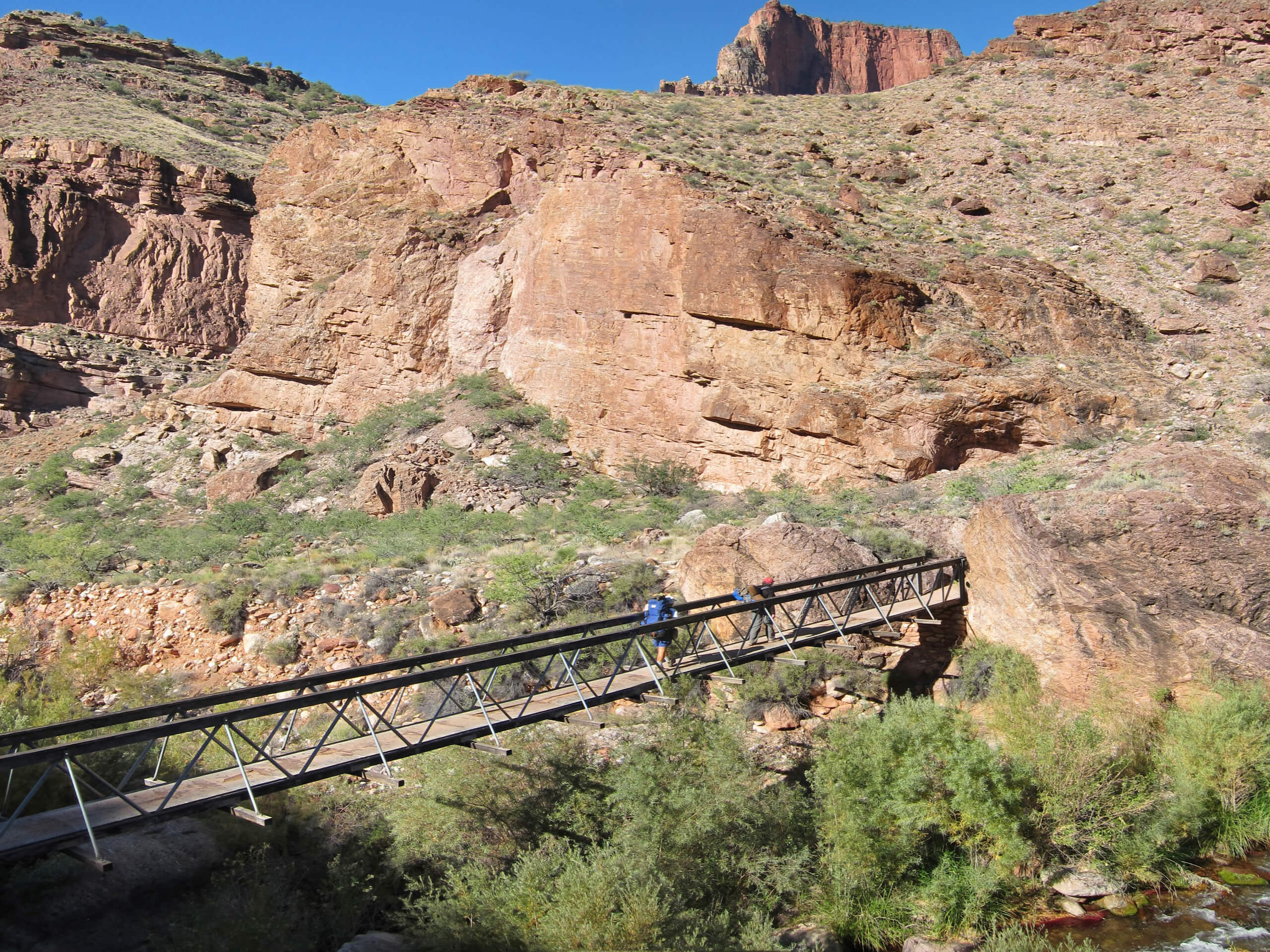
Ribbon Falls via North Kaibab Trail
Difficulty Rating:
The North Kaibab Trail is the most thrilling of the three maintained routes in the Grand Canyon, and the hike to Ribbon Falls on this route is an adventure you’ll remember for years to come. This is a big trek, taking you down from the rugged North Rim, through tunnels blasted into the rock, past viewpoints, along the canyon floor, and to a waterfall. The out and back trip is 17.0mi long, so while this hike can be done in a day by experienced, fit groups, we do recommend splitting it up with a stay at Cottonwood.
If you plan to hike to Ribbon Falls in a day, we recommend getting a very early start to avoid the heat of the day, packing lots of nutrition, electrolytes, and water, and having the right gear to take you through. It’s a big trip to say the least! If you’ll be backpacking, book your stay at Cottonwood as far in advance as you can, normally 4 months ahead of time.
Getting there
The trailhead for the North Kaibab Trail is off the Grand Canyon Highway.

About
| Backcountry Campground | Cottonwood Campground |
| When to do | April-October |
| Pets allowed | No |
| Family friendly | No |
| Route Signage | Average |
| Crowd Levels | Moderate |
| Route Type | Out and back |
Ribbon Falls via North Kaibab Trail
Elevation Graph
Weather
Ribbon Falls via North Kaibab Trail Description
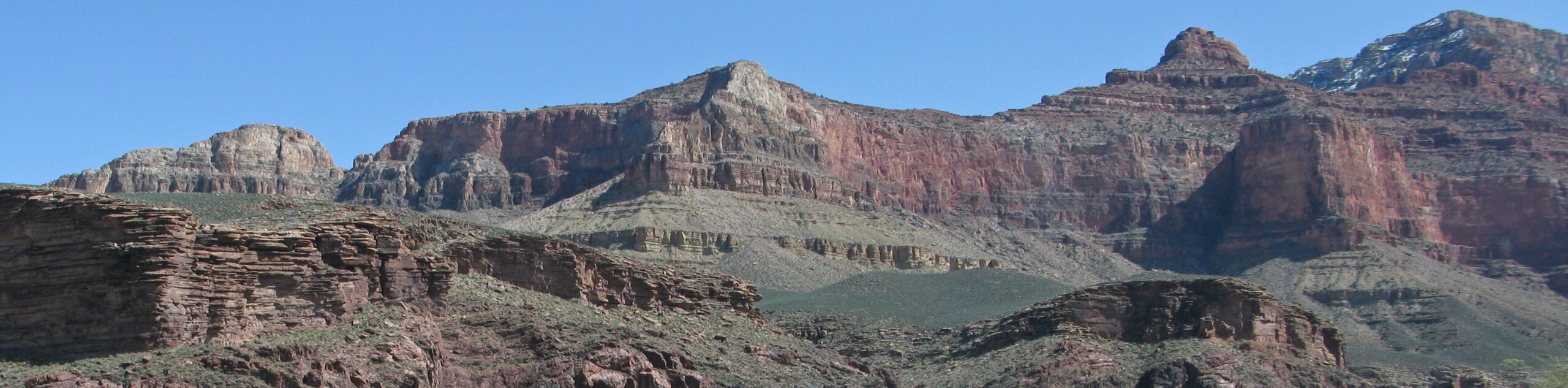
The North Rim of the Grand Canyon is a less-visited gem for hikers who want all the scenery with far lighter crowds. This quieter side of the canyon is home to a hike that definitely competes when it comes to the best day hikes in the Grand Canyon. The hike to Ribbon Falls on North Kaibab Trail is a 17.0mi hike that leads you through unforgettable scenery as you scale down the wall of this mighty canyon.
You’ll pass breathtaking viewpoints, hike through tall tunnels blasted into the rock, and dip your feet as you trace the creeks that run towards the Colorado River. There are some very thrilling sections on this trail too, so be prepared to hike next to sheer drop offs and have wide-open views.
There are water refill stations on this route, but make sure you have a large reservoir. Poles and good boots are essential and you should prepare for the varied weather at the North Rim. It can be very hot in the summer and very snowy in the winter.
While users have been able to do this route in a day, it’s an extremely challenging effort. If you plan to hike it in a day, a very early start to avoid the heat of the day on your climb back up is essential. If doing it all in a day sounds like a Herculean effort (because it is!), book a night at Cottonwood to break up the journey.
From the trailhead, you’ll descend down into Bright Angel Canyon. Three-quarters of a mile in, stop at the Coconino Overlook to look down into the Roaring Springs Canyon. From here, it’s on to the Supai tunnel, where there’s a water station and rest stop.
The tunnel is quite interesting, with a passageway blasted right through the thick pink limestone. Continue along a sometimes tree-lined and sometimes open trail as it switchbacks through the rocks. This set of switchbacks is out in the sun, so you’ll want to have a full water bottle before heading down.
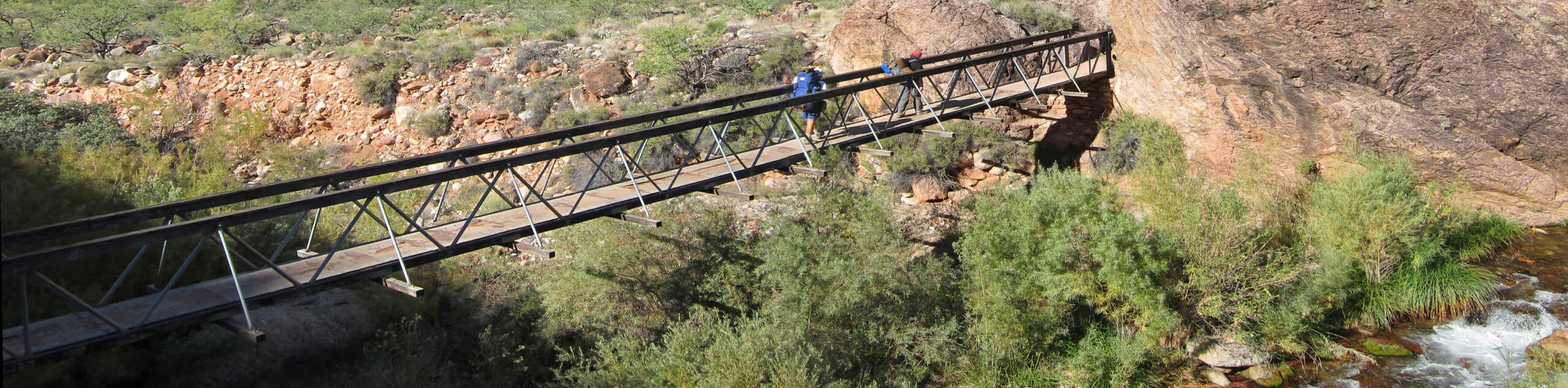
3.4mi in, cross the Redwall Footbridge to get to the west side of the canyon. Peer over the edge to take in the massive canyon. Past the bridge, you’ll hike a dizzying narrow ridge along the canyon wall. This trail was also blasted out of the rock, and it’s quite amazing.
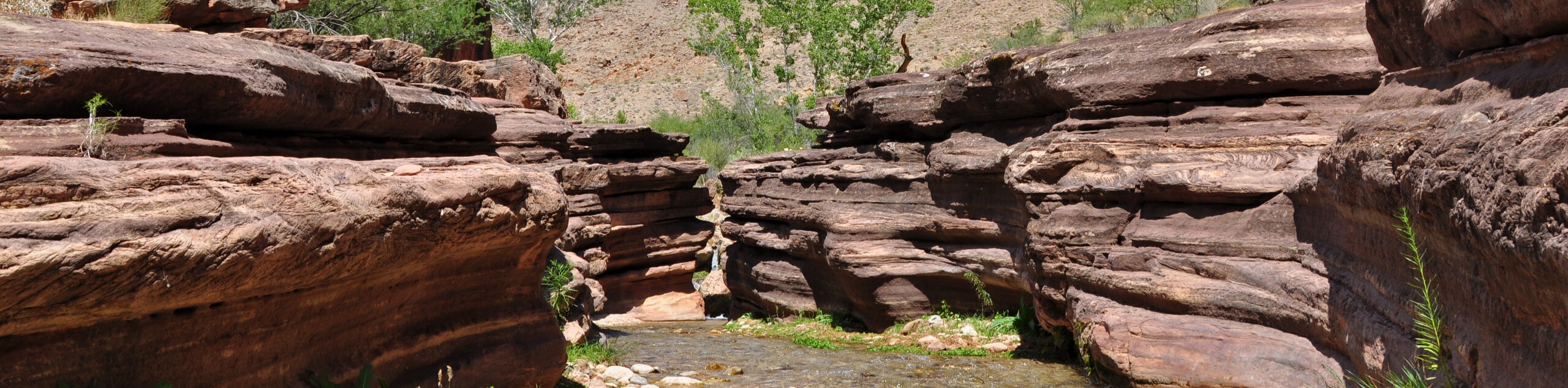
Hike through more switchbacks, after which you’ll start to hear Roaring Springs. Stop for a breather if you want to check them out. Following the creek, pass the campground and continue to a junction. Cross the creek here and stay left, looking for the signage for Ribbon Falls. to find Ribbon Falls.
Enjoy the falls, catch your breath, and then prepare for the hike back up to the trailhead on the same route.
Hiking Route Highlights
Grand Canyon
Revealing millions of years of geological history, the layered and massive Grand Canyon is a 3060 square mile canyon in Arizona. The canyon is 277.0mi long, up to 18.0mi wide and is over 6000ft at its deepest point. Carved by the Colorado River over millions of years, the canyon is now one of the world’s top natural attractions, bringing about 5 million visitors to its rim every year. Indigenous people have inhabited the canyon for many years, some considering it to be a holy site.
Frequently Asked Questions
How long does it take to hike the North Kaibab Trail?
The entire trail is usually done in three to four days. This section is normally done as a two-day hike or sometimes as a very long day hike.
Is the North Kaibab Trail hard?
The North Kaibab Trail is the most difficult of the three maintained trails into the Grand Canyon, so prepare accordingly.
Is the North Kaibab Trail scary?
The trail has some parts that may be difficult for hikers who are afraid of heights. While the trail is safe and there isn’t any scrambling required, some parts have steep, unprotected drop offs.
Insider Hints
You’ll need a pass to visit the Grand Canyon. Passes can be purchased ahead of time online or at the park gates.
Bring layers and sun protection! The trailhead for this route is 1000ft higher than the trailheads on the South Rim.
Bring wading shoes as the bridge to the falls is occasionally out.
Similar hikes to the Ribbon Falls via North Kaibab Trail hike
Deer Creek to Colorado River Hike
The Deer Creek to Colorado River hike is a very challenging 18.0mi hike that leads you from the…
Waldron Trail
Waldron Trail is a hiking trail on the South Rim of the Grand Canyon that’s a bit of a hidden…
Indian Garden Campground via Bright Angel Trail
Of all places to camp, the Grand Canyon is a pretty hard one to beat, to say the absolute least.…
Comments