Lava Falls Trail
View Photos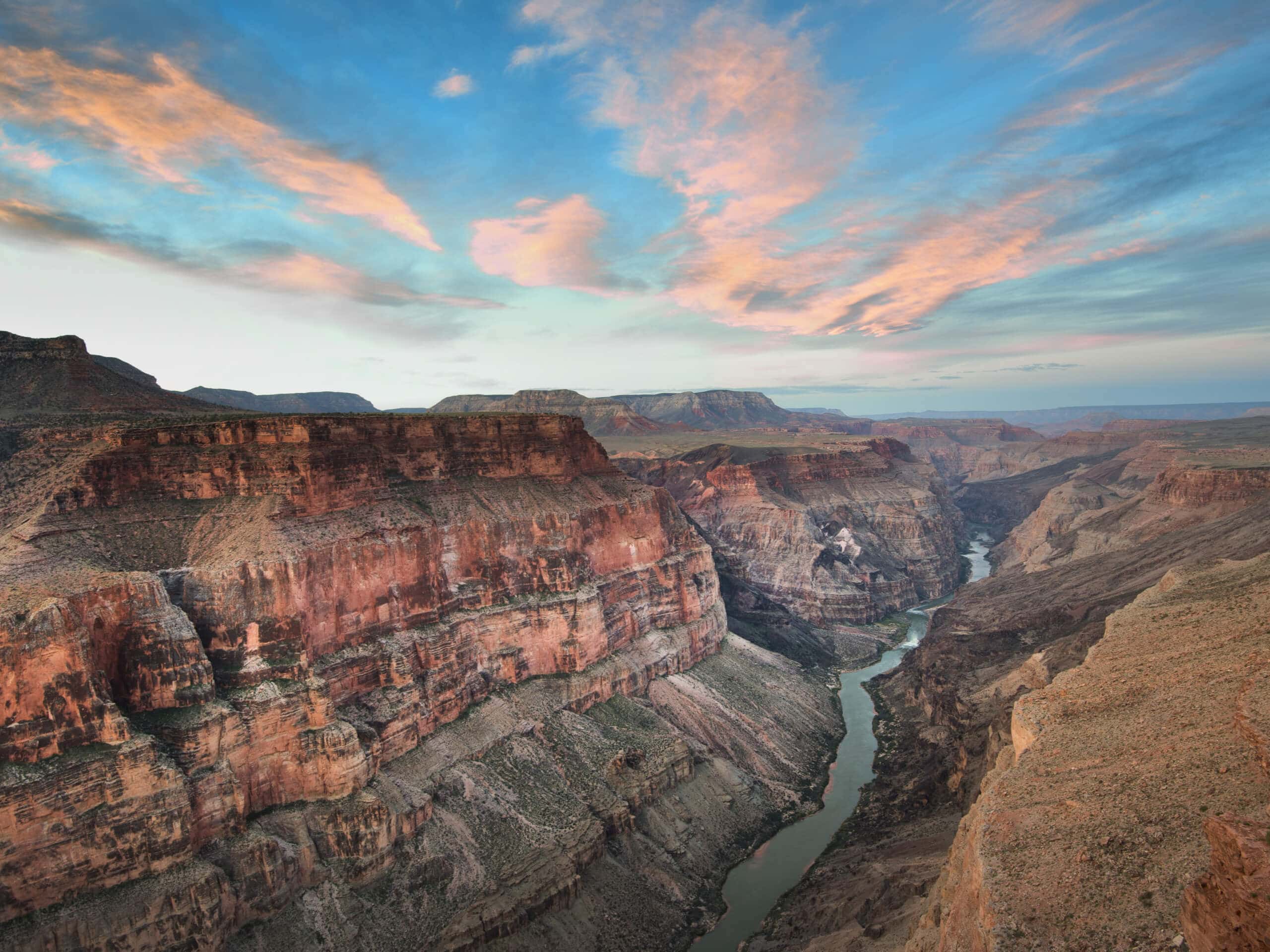
Lava Falls Trail
Difficulty Rating:
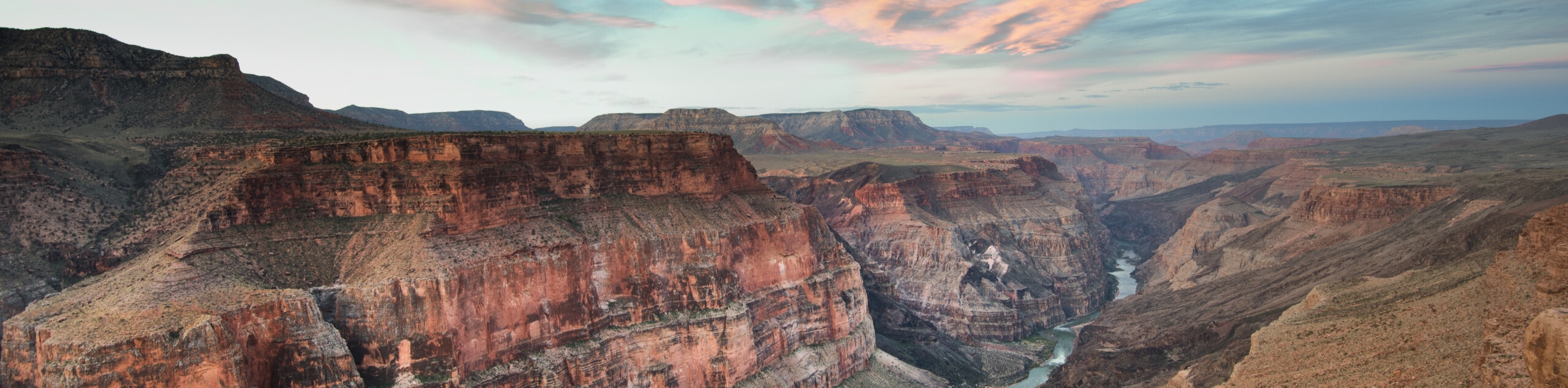
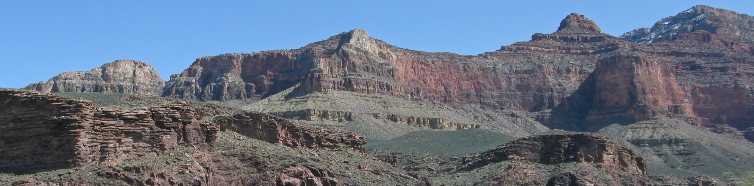
Lava Falls Trail is only 2.6mi long, but it just might be the most intense 2.6mi you’ve hiked in a good while. This route on the North Rim of the Grand Canyon is the shortest rim to river route in the canyon, so as you might guess, there’s a hefty amount of elevation change that happens in that short distance. You’ll drop down underneath an extinct volcano called Vulcans Throne and navigate footing that can be best described as very sketchy, with loose scree and sharp lava blocks.
Come prepared for this hike with sturdy footwear, poles, lots of water (there aren’t any refill stations along the trail), and an intrepid spirit. To climb down to the river and back up to the rim over just a few miles will be an accomplishment you won’t soon forget!
Getting there
The trailhead for Lava Falls Trail is at the Toroweap Overlook at the end of a side trail off Toroweap Point Road.

About
| Backcountry Campground | No |
| When to do | April-October |
| Pets allowed | No |
| Family friendly | No |
| Route Signage | Poor |
| Crowd Levels | High |
| Route Type | Out and back |
Lava Falls Trail
Elevation Graph
Weather
Lava Falls Trail Description
Lava Falls Trail is a hike for the intrepid. And for the ones who don’t mind beating up their knees in exchange for an incredible experience. You’ll drop down beside Vulcan Throne, an extinct volcano on the rugged North Rim of the Grand Canyon, and complete the shortest rim to river route in the entire canyon.
The views are wild, undisturbed, and unforgettable. Make sure you take a moment to appreciate them as you navigate the trail, which comes with its own set of challenges. Expect loose scree and sharp lava rocks in addition to an unforgiving grade.
While it’s a strenuous trip, you’ll have dipped down to the bottom of the canyon and back as fast as anyone can, and you’ll do it all in the serene setting of the much quieter North Rim where only 10% of annual visitors come.
There isn’t a water refill station along this route, so bring more hydration than you think you’ll need. We also recommend good boots and poles. Consider sun protection in the hot summers and avoid the trail altogether if it’s rained or snowed recently.
You’ll take Toroweap Point Road for 7.0mi before taking a side road on the right. 3.0mi later you’ll arrive at the overlook where From the trailhead at the Toroweap Overlook. A 4WD vehicle is strongly recommended as this side road can be in rough shape and quite steep.
There aren’t facilities at the trailhead, but there is a trail map and guide that can be helpful to review before you start. You’ll take the route that descends through a rocky owl before heading over the ledge ahead of you.
You’ll climb down through a steep gully, traverse a few steps east, then settle into switchbacks. Take a moment to rest your knees when you hit a flatter area of red gravel. Watch for cairns as you continue down the steep route. You’ll follow a ridge, duck under a cliff face, and then climb through a very steep ravine.
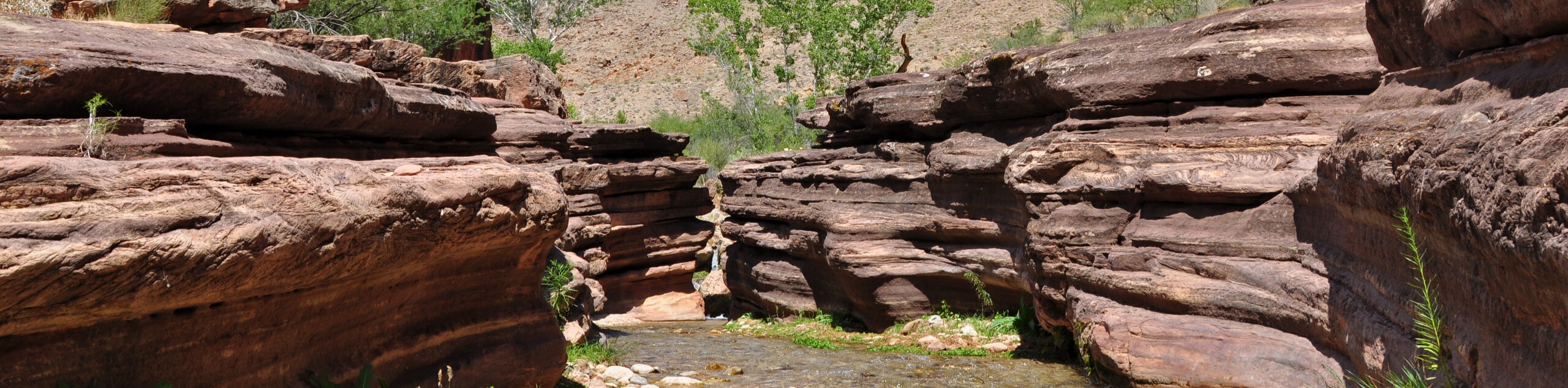
When you’re in the ravine, be very careful and take your time. A slip here could result in significant injury or a rock slide. Once you’ve touched down next to the river, hike east for about 200 yards to find the falls. Cool off at the little beaches, enjoy your slice of paradise, and then begin the heart-pounding ascent on the same route.
Hiking Route Highlights
Grand Canyon
Revealing millions of years of geological history, the layered and massive Grand Canyon is a 3060 square mile canyon in Arizona. The canyon is 277.0mi long, up to 18.0mi wide and is over 6000ft at its deepest point. Carved by the Colorado River over millions of years, the canyon is now one of the world’s top natural attractions, bringing about 5 million visitors to its rim every year. Indigenous people have inhabited the canyon for many years, some considering it to be a holy site.
Frequently Asked Questions
Are there facilities at the Lava Falls trailhead?
This trailhead is more remote and rugged than the ones you’ll find on the South Rim. There’s a small parking area, a route map, and route guides. There is no water and no restrooms.
When should you hike at the North Rim?
The North Rim of the Grand Canyon sees colder weather than the South Rim, but the summers can still be very hot. We recommend planning your hikes for the spring or fall.
Do you still need a pass for the North Rim?
Yes, you’ll still need a pass to go to the North Rim. Thankfully, it’s normally much faster to get through the park gates on this side.
Insider Hints
You’ll need a pass to visit the Grand Canyon. Passes can be purchased ahead of time online or at the gates.
A capable vehicle is required to reach this trailhead.
Similar hikes to the Lava Falls Trail hike
Deer Creek to Colorado River Hike
The Deer Creek to Colorado River hike is a very challenging 18.0mi hike that leads you from the…
Waldron Trail
Waldron Trail is a hiking trail on the South Rim of the Grand Canyon that’s a bit of a hidden…
Indian Garden Campground via Bright Angel Trail
Of all places to camp, the Grand Canyon is a pretty hard one to beat, to say the absolute least.…
Comments