Hermit Trail
View Photos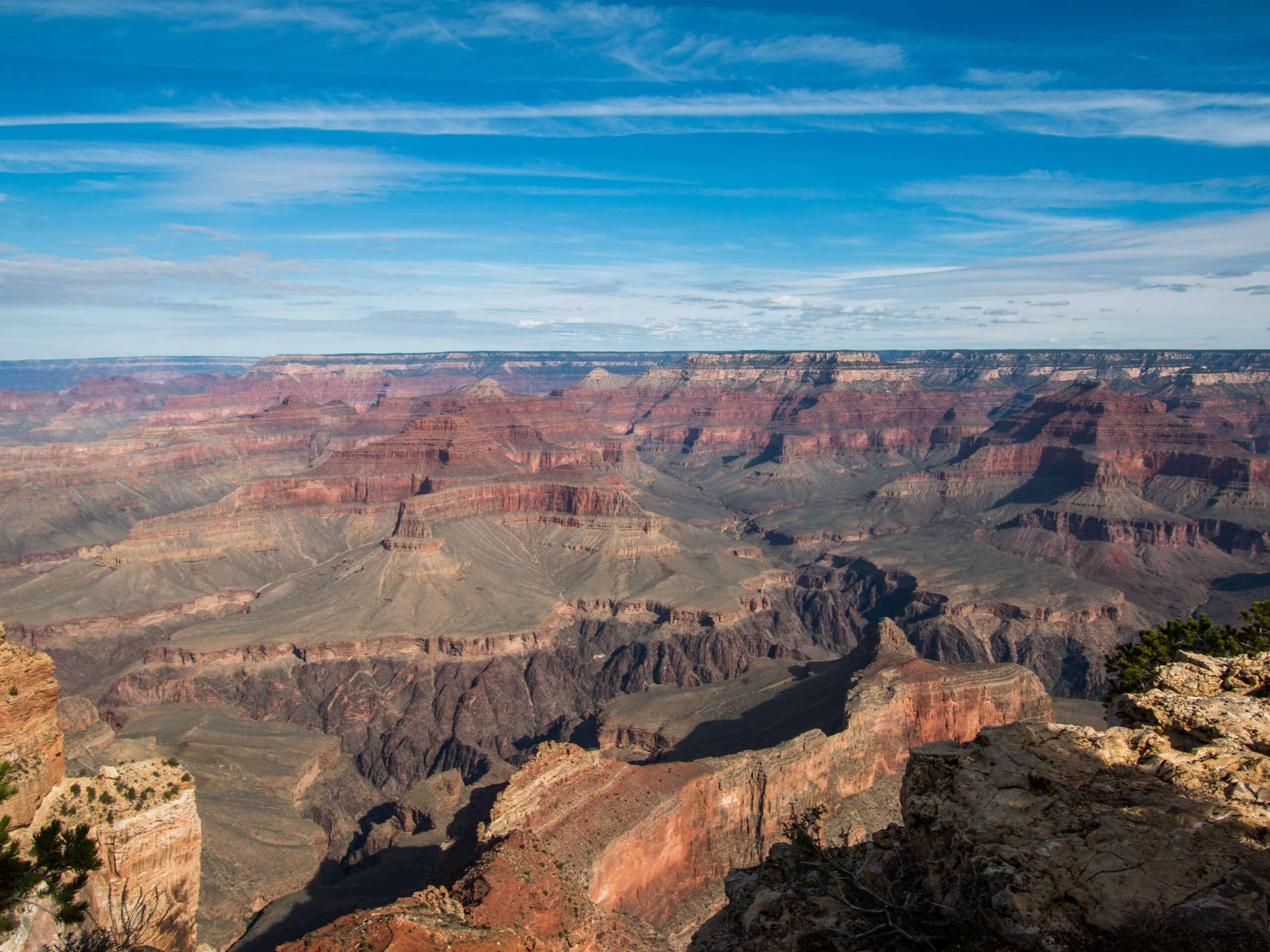
Hermit Trail
Difficulty Rating:
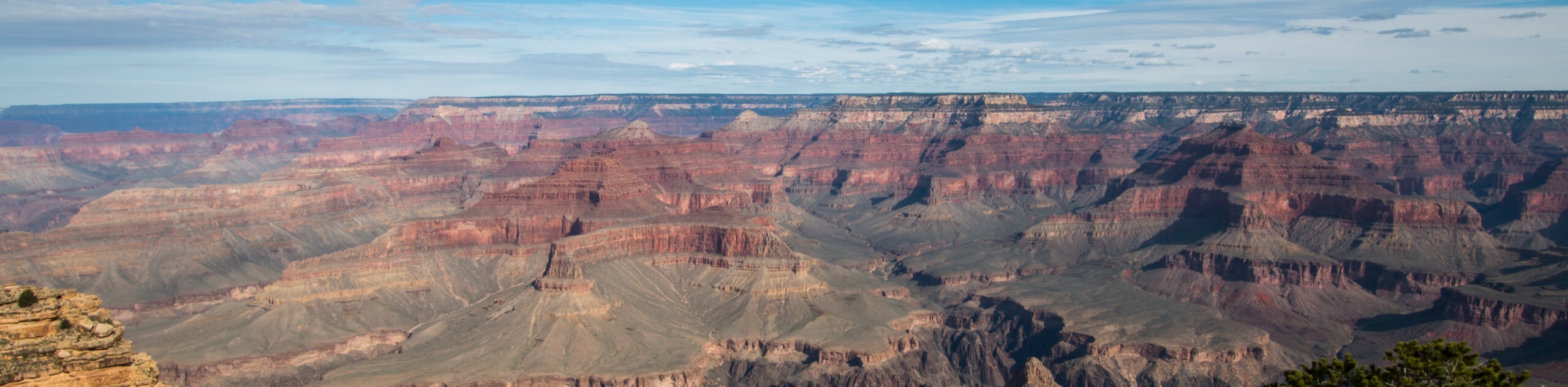
Hermit Trail is a 17.5miout and back hike in the Grand Canyon that reaches from the South Rim at Hermits Rest down into the canyon to the Colorado River. If you do the entire route, it’s a strenuous 17.5mi adventure. You can also make this a backpacking trip with some advanced planning or choose to do a shorter portion of the trail.
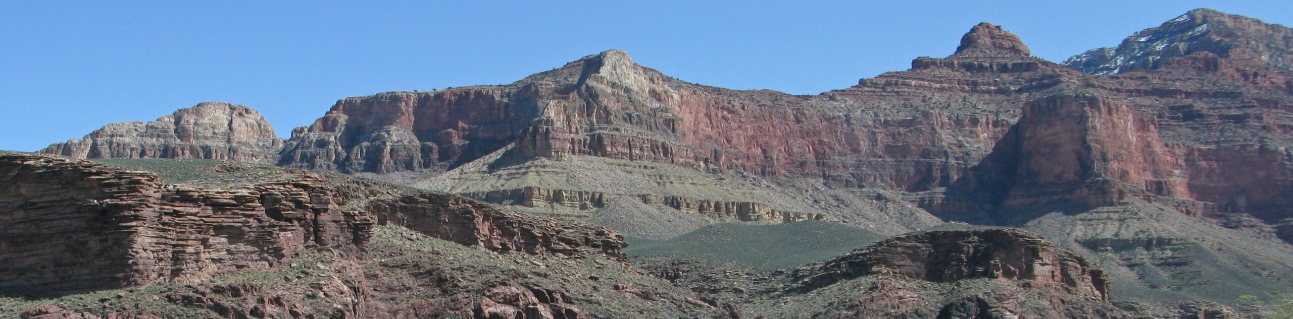
This route has gorgeous scenery, as is the norm in the Grand Canyon. You’ll descend beside Cope Butte, have a view of the Tower of Set and Horus Temple, and then reach the blue-green river snaking through the pink and red canyon. It’s an epic adventure that should be on the list for any strong hiker venturing to the canyon.
Getting there
The trailhead for Hermit Trail is at the Rim Trailhead on Hermit Road.

About
| Backcountry Campground | Hermit Creek |
| When to do | Year-round |
| Pets allowed | No |
| Family friendly | No |
| Route Signage | Good |
| Crowd Levels | Moderate |
| Route Type | Out and back |
Hermit Trail
Elevation Graph
Weather
Hermit Trail Description
Hermit Trail is one of the most exciting routes in the Grand Canyon, reaching from Hermits Rest on the South Rim to the Colorado River far below. The route gives an excellent up-close view of Cope Butte as you traverse underneath it, and you’ll be able to appreciate the Tower of Ra, Tower of Set, Horus Temple, and Osiris Temple across the river.
This hike can be done in a day, but you’ll need to be prepared. It’s a physically demanding hike with a steep, unrelenting ascent. The conditions in the canyon can get very hot, and the weather can change dramatically in a short time. If a day trip isn’t feasible for you, we recommend booking a night at the Hermit Creek Campground or just hiking a portion of the route.
For this route, you’ll want poles, good boots, sun protection, nutrition, and lots of water. There are spots along the trail to refill, but you’ll likely go through more hydration than you think, especially on the return trip.
From Hermits Rest, take the trail past the Hermits Rest Viewpoint over the edge of the plateau. You’ll hike down a gully of Kaibab limestone before switchbacking through the Coconino layer. Hike through a drainage and then underneath a rock face.
Passing Santa Maria Spring, you’ll enjoy a level section of trail for a mile and a half before dropping into the canyon of Hermit Creek. You’ll drop 400ft to a ridge near Lookout Point, which is a perfect spot to stop and take in the view.
Hike through a level traverse over Breezy Point before beginning the steep Cathedral Stairs, switchbacking through boulders before traveling underneath Cope Butte. Continue west at the junction with Tonto Trail.
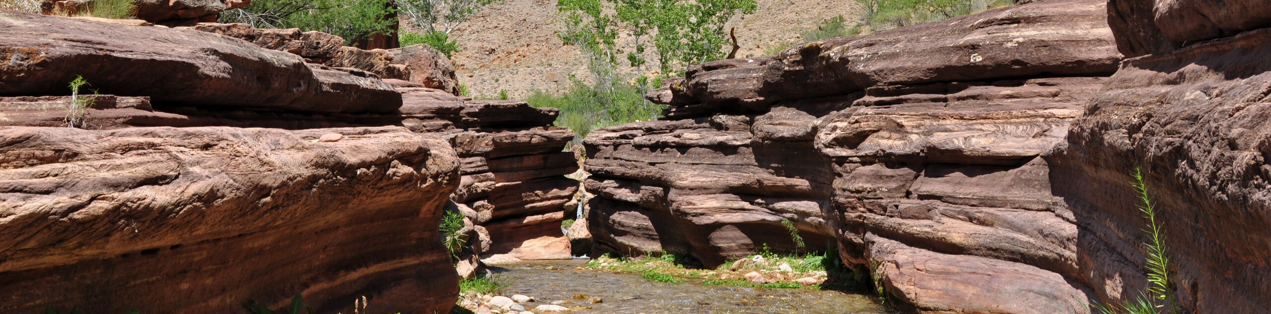
Make your way over hills and ravines as you continue your downward trek, staying left towards Hermit Creek. Hiking through a 100-foot canyon, you’ll hike alongside the green pools to a gorge. Hike further along the stream to where the trail ends in a canyon right next to the Colorado River, with the Hermit Rapids in sight.
The climb back up is the hard part. Prepare for a steep, tough ascent following the same path as before.
Hiking Route Highlights
Grand Canyon
Revealing millions of years of geological history, the layered and massive Grand Canyon is a 3060 square mile canyon in Arizona. The canyon is 277.0mi long, up to 18.0mi wide and is over 6000ft at its deepest point. Carved by the Colorado River over millions of years, the canyon is now one of the world’s top natural attractions, bringing about 5 million visitors to its rim every year. Indigenous people have inhabited the canyon for many years, some considering it to be a holy site.
Frequently Asked Questions
Where do you park for Hermit Trail?
You can park in the main visitor parking at Grand Canyon Village and take the shuttle to Hermits Rest. If you have a backcountry permit, you can park near the trailhead.
Can cars drive on Hermit Road?
You can drive private vehicles on Hermit Trail in the winter only. The rest of the year, you’ll need to use the park’s shuttle service. If you have a backpacking permit, you can use the road after getting the key code for the gate.
What rim is Hermit Trail on?
The Hermit Trail starts from the South Rim of the Grand Canyon.
Insider Hints
You’ll need a pass to visit the Grand Canyon. Passes can be purchased ahead of time online or at the park gates.
It can take a long time to get through the park gates during normal visiting hours, so we recommend planning to arrive a bit early.
The park shuttles run frequently and consistently throughout the day and there’s no charge to use them.
If you plan to camp, book your sites well in advance.
Similar hikes to the Hermit Trail hike
Deer Creek to Colorado River Hike
The Deer Creek to Colorado River hike is a very challenging 18.0mi hike that leads you from the…
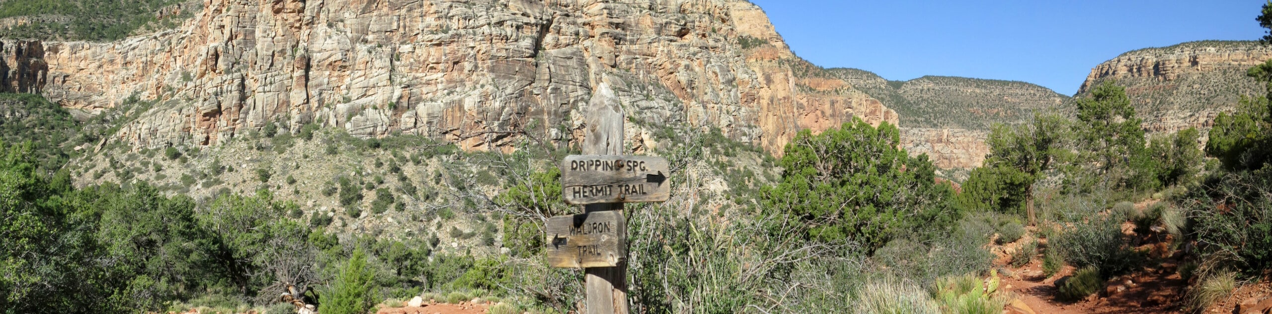
Waldron Trail
Waldron Trail is a hiking trail on the South Rim of the Grand Canyon that’s a bit of a hidden…
Indian Garden Campground via Bright Angel Trail
Of all places to camp, the Grand Canyon is a pretty hard one to beat, to say the absolute least.…
Comments