Sperry Chalet Trail
View Photos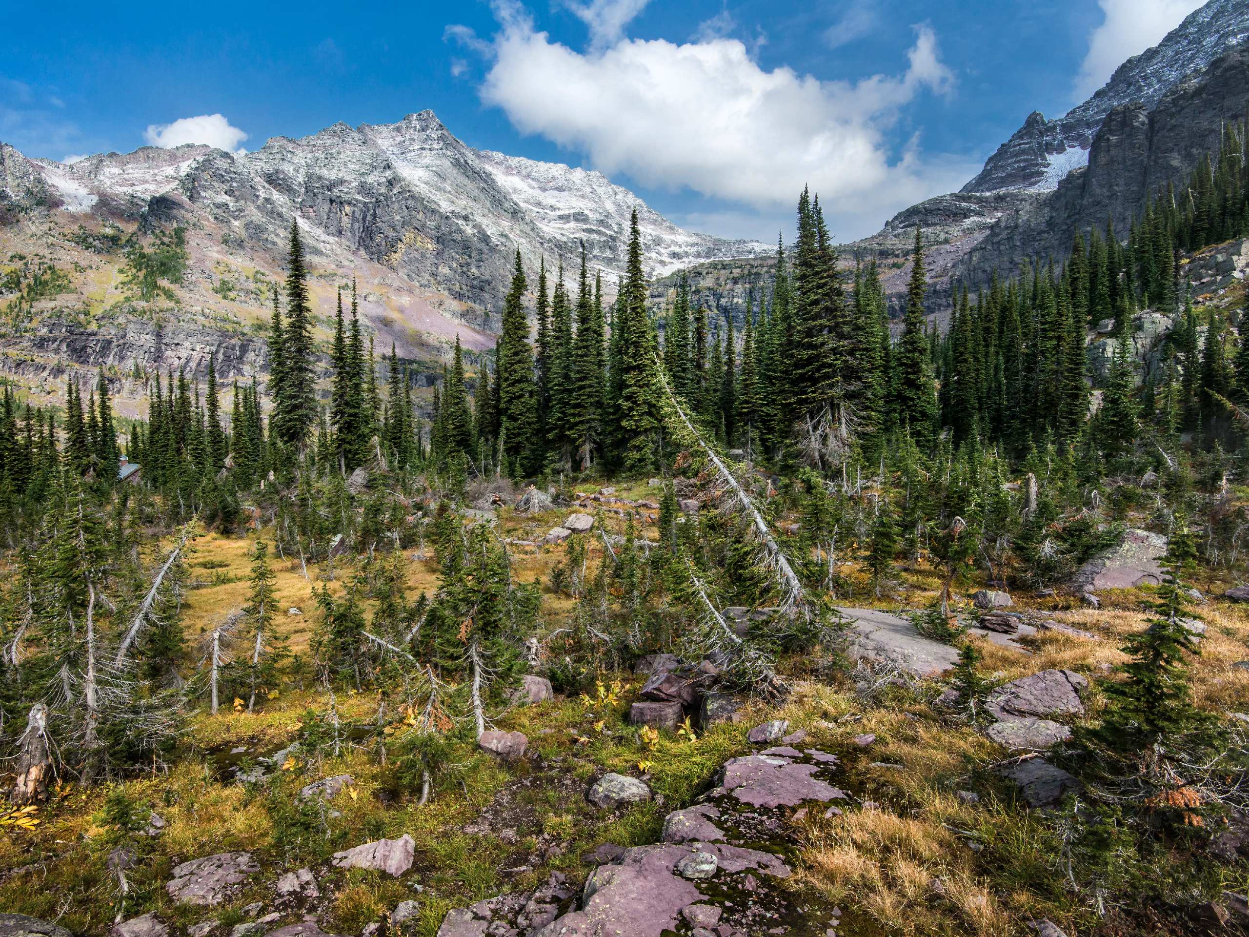
Sperry Chalet Trail
Difficulty Rating:
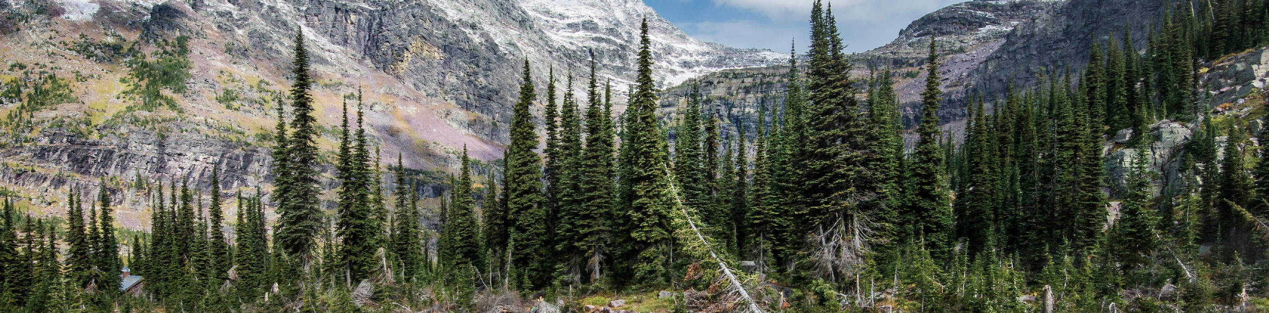
In the beginning of the Sperry Chalet Trail, you wind through the Gunsight Pass Trail and walk through dense steep terrain. Once you emerge from here, you will see the damage that the Sprague fire did when it burned through 16,982 acres in 2017. The fire definitely didn’t take any beauty away from this trail, and many people flock to it to see the magic of Sperry Chalet Trail.
Getting there
To get to Sperry Chalet Trail from Apgar, head North towards the Apgar Loop/Lake View Drive. Turn right onto the loop and then left onto Glacier Route 1/Going-to-the-Sun Road for 8.1mi. Turn left and travel for 0.2mi and Sperry Trailhead will be ahead.

About
| When to do | March - November |
| Backcountry Campsites | No camping, stay at Sperry Chalet |
| Pets allowed | No pets, horses allowed |
| Family friendly | No |
| Route Signage | Average |
| Crowd Levels | Moderate |
| Route Type | Out and back |
Sperry Chalet Trail
Elevation Graph
Weather
Sperry Chalet Trail Description
The Sperry Chalet Trail shares a route with Gunsight Pass Trail, which brings steep and rough terrain, so make sure to wear good hiking shoes. Because of the fires that scorched so many trees, there are areas on the trail where shade is scarce, so plan for that. On this trail, you will find yourself elevating quickly at some points, but the views will be well worth it.
This hike is packed with scenery, and it all begins at the Sperry Trailhead across the road from Lake McDonald Lodge. From here, you will follow the Gunsight Pass Trail, winding through dense spruce fir forest and keep an eye out for horses as they share this trail as well. Continue on, and at 0.8mi, you will begin to see the remnants of the 2017 Sprague fire that claimed 16,982 acres of Glacier National Park and also destroyed the inside of the Sperry Chalet.
When you come to Snyder Rich Trail, veer left and follow Snyder Creek as the trail begins to ascend again, and after a short while it will turn into Sprague Creek Valley. At this time, you will begin to walk through dead areas, where the damage from the fire becomes more apparent, but despite the intense flames, the scenery remains as stunning as ever. After 2.0mi of following Sprague Creek, you will come to an opening that houses Beaver Medicine Falls, and although the trail does not bring you close to the falls, you will see the first signs of Sperry Chalet. At 5.8mi, there is no sign to direct you on where to go. Veer right and follow the footbridge over Sprague Creek, and you will see, in the distance, 5 waterfalls known as Glacier Basin.
Finally, after 0.2mi, you will arrive at Sperry Chalet sitting at 6550ft above sea level. At this point, you can either spend the night or continue your hike back the way you came as this is an out-and-back trail.
Find more epic hikes in Glacier National Park
Insider Hints
When you reach Sperry Chalet, keep an eye out for the goats that live nearby
Stay the night at the Sperry Chalet and continue the hike back the next day
Make sure to wear good hiking shoes for the elevation during this hike
Similar hikes to the Sperry Chalet Trail hike

Fish Lake Trail
Fish Lake Trail is a mix between relaxing and heart pumping. The start of the trail takes you through a…

Quartz Creek Trail
Quartz Creek Trail is a relaxing hike on a remote trail in Glacier National Park. The hike takes you through…

Snyder Ridge Trail
Hiking through Snyder Ridge Trail takes you through a forest for most of the trail that follows the ridge along…
Comments