
Siyeh Pass hike
View Photos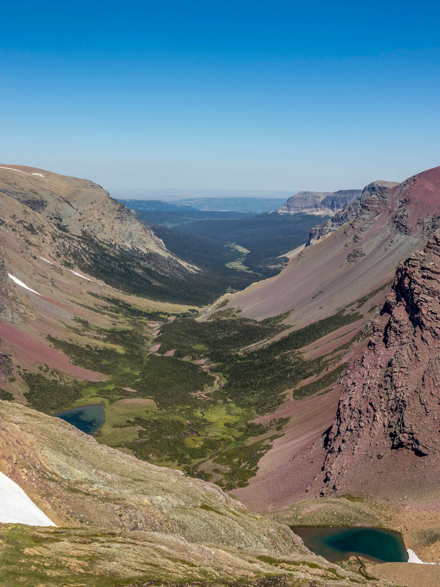
Siyeh Pass hike
Difficulty Rating:
Siyeh Pass Loop is located on the east side of Glacier National Park and is easily considered one of the best hikes in the park. With stunning views of waterfalls, glaciers, and peaks plus a trail through meadows and forests, this is definitely a worthwhile hike in Glacier National Park.
Getting there
From Logan’s Pass in GNP, head 2.2mi east on the GTTSR to reach Siyeh Bend Trailhead.

About
| When to do | March - October |
| Backcountry Campsites | No |
| Pets allowed | No |
| Family friendly | Older Children only |
| Route Signage | Average |
| Crowd Levels | Low |
| Route Type | One Way |
Siyeh Pass
Elevation Graph
Weather
Route Description for Siyeh Pass
Few people dot Siyah Pass, propelling more bears—including grizzly bears—to pepper the landscape. It’s also crucial to note that this trail can experience snow early and later on in the hiking season, so be prepared for all weather conditions!
However, the lack of people spanning the trail only adds to the spectacularity! Glacier National Park becomes a hot hiking commodity throughout the summer, but Siyeh Pass rarely attracts a lot of traffic, granting you a chance to totally bask in nature.
The route starts at Siyeh Bend, and it is a one way, which means you either need to have two cars or take the shuttle from Sunrift Gorge back to Siyeh Bend. If you are taking the shuttle, be sure to start your hike early so you can complete your walk and get the shuttle back.
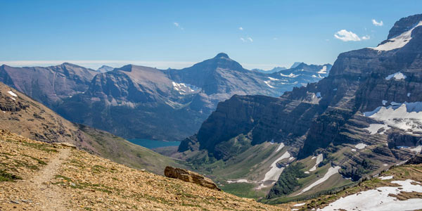
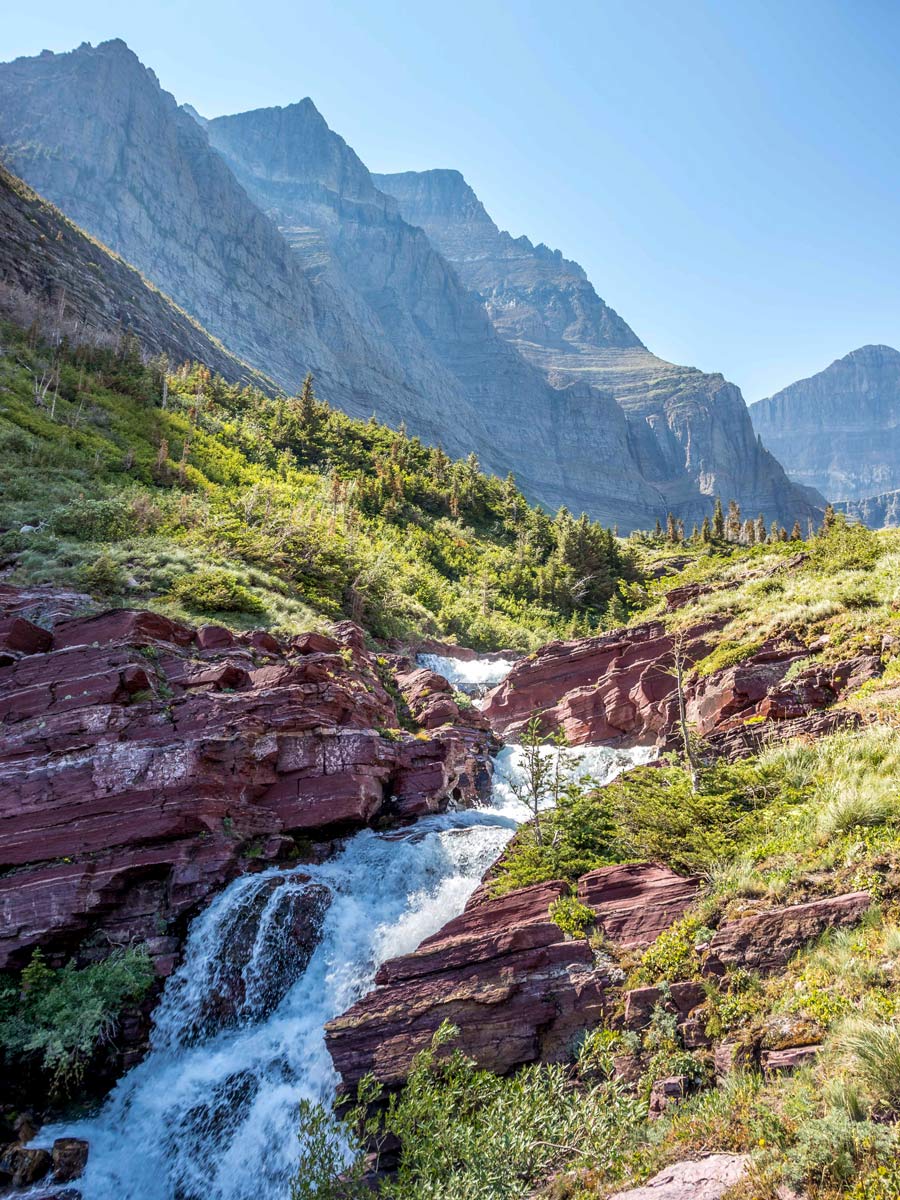
The first part of the trail follows Siyeh Creek before making a sharp right into the forest. After a little less than a mile, there is an intersection with Piegan Pass Trail, to continue towards Siyeh Pass turn left, the trail to the right will take you to the Jackson Glacier overlook.
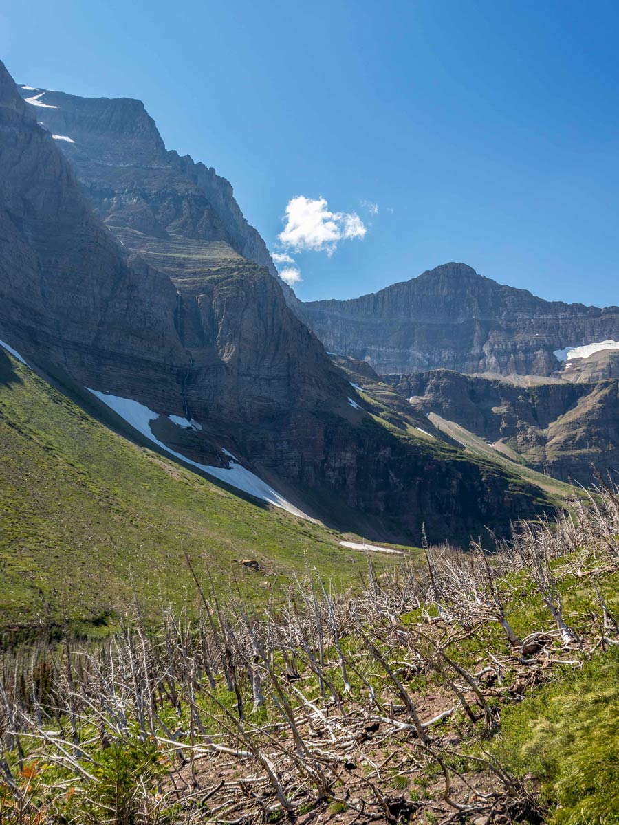
Continuing towards Siyeh Pass, you will spend roughly another 1.5mi in a dense spruce-fir forest before turning right at the Siyeh Pass Trail Junction. Right around this junction, the forest starts to thin, and within 0.2mi of the junction, you will come to a valley full of wildflower meadows known as Preston Park.
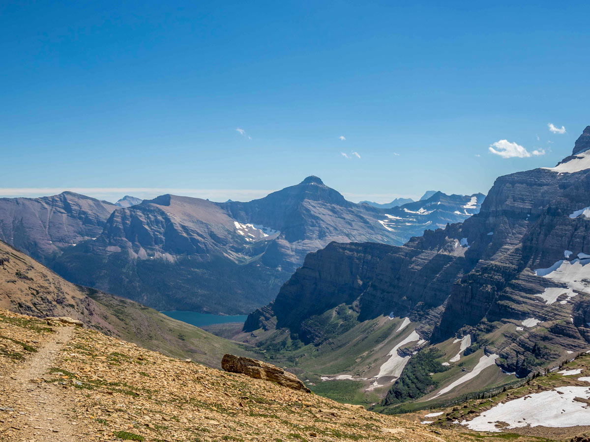
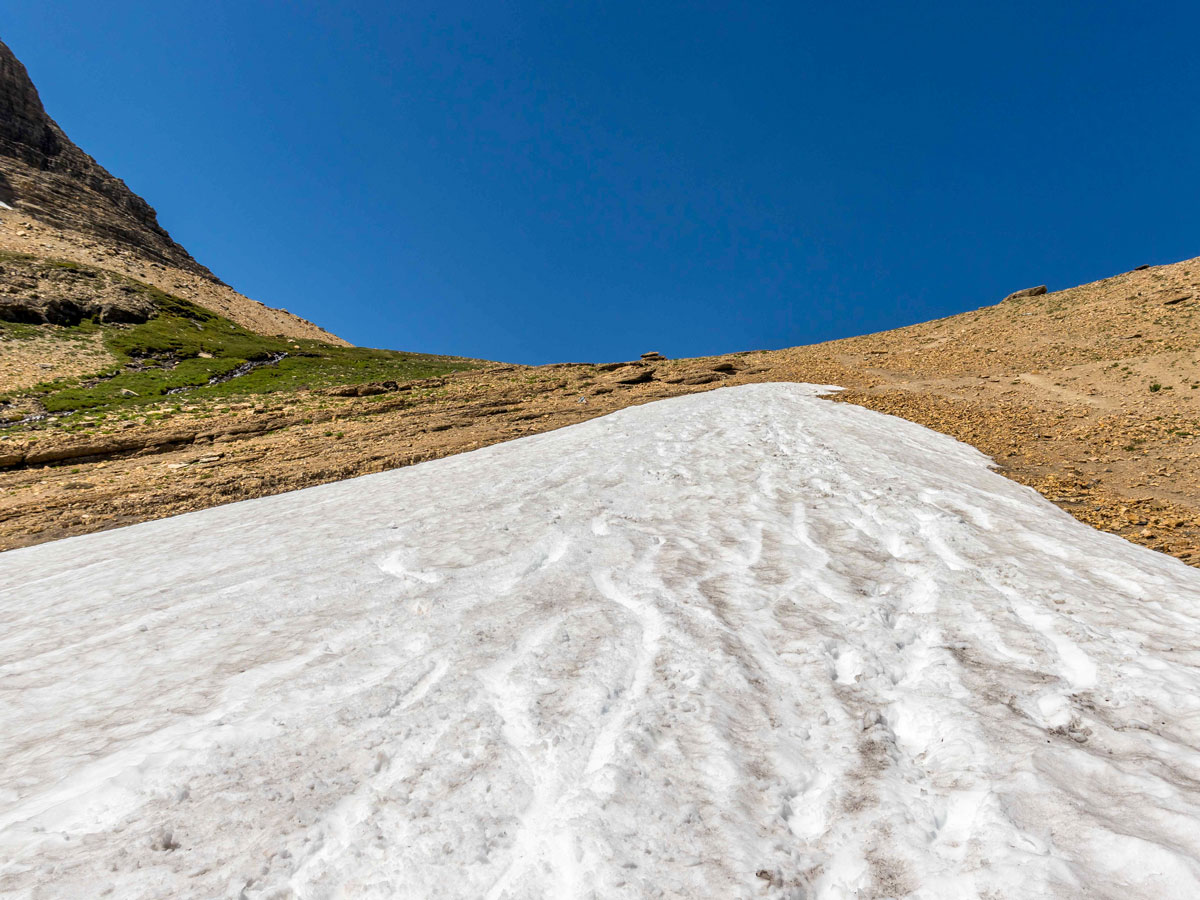
Continue along the path. Eventually, you will cross Siyeh Creek, and shortly after the creek, the main ascent of roughly 1100ft over 1.5mi to Siyeh Pass will begin. This is the toughest part of the hike, but the views from the top of Siyeh Pass are definitely worth the climb.
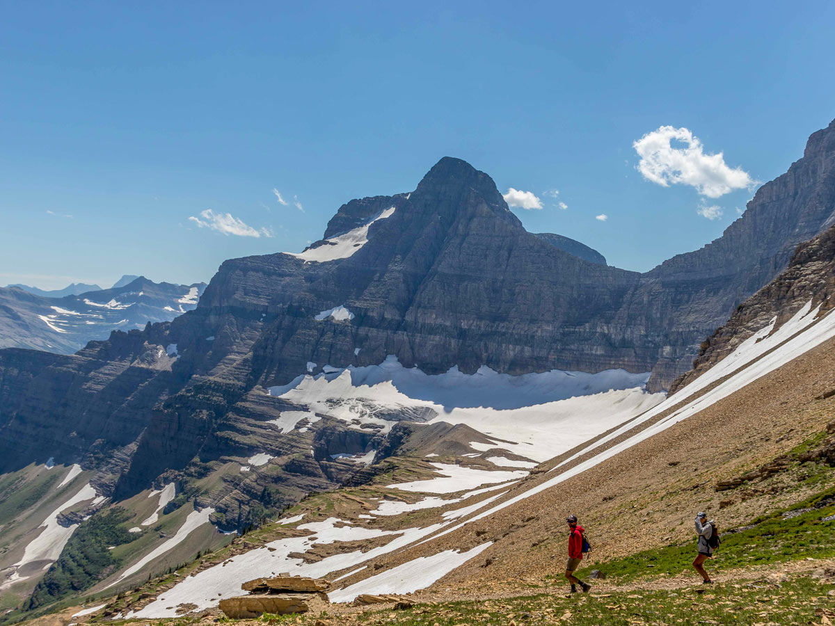
From the top of the pass, follow the trail around Matahpi Peak, where you will find a cairn marking the pass. Find a spot to enjoy a snack and take in the views before beginning the descent to Sunrift Gorge.
The descent drops just over 1400ft in about 2.5mi over a series of steep switchbacks. At the bottom of the 2.5mi, things level out for the remainder of the hike back to the GTTSR where you will either have a car or catch a shuttle back to Siyeh Bend.
Find more epic hikes in Glacier National Park
Insider Hints
This direction takes away a lot of elevation gain, but has you descending steep switchbacks at the end. Depending on how well your knees fair with a steep and long descent, it may be worth going the other direction.

Similar hikes to the Siyeh Pass hike

Fish Lake Trail
Fish Lake Trail is a mix between relaxing and heart pumping. The start of the trail takes you through a…

Quartz Creek Trail
Quartz Creek Trail is a relaxing hike on a remote trail in Glacier National Park. The hike takes you through…

Snyder Ridge Trail
Hiking through Snyder Ridge Trail takes you through a forest for most of the trail that follows the ridge along…
Ben Hanes 4 years ago
I noticed the fir forest getting denser as I get closer to the junctions. Not sure if it's natural, but I appreciate the overall topography of the hike.
supermario 4 years ago
The perfect place for nature lovers!
maxjohanson 4 years ago
Phenomenal and protected - so clean, vast and well managed.
dearkatherine 4 years ago
It was a moderate, stiff hike! I appreciate the scenic surroundings.
Antoanette Lavroutte 4 years ago
Never in my life have I seen such beauty and felt so close to the clouds.
Zoey Mann 4 years ago
This place have it all! Lovely vistas, melting glaciers, stunning waterfalls, lush green meadows, abundant forests and adorable wildlife!
Eli-Tim 4 years ago
Plan where you want to go and pack snacks and lunches to enjoy the day.
masonH. 4 years ago
Amazing hike! Lots of route options, flat and easy to mountainous and strenuous.
Polina Ivanov 5 years ago
I saw lots of mountain peaks covered with snow. They look inspiring. Oh I just love them!