
Otokomi Lake Trail
View Photos
Otokomi Lake Trail
Difficulty Rating:
Otokomi Lake Trail is a stunning maze of cascading waterfalls through Rose Creek canyon, some of which you can see and some you can only hear in the distance. You’ll also find deep red rock mountains that hover over the basin of Otokomi Lake sprawled across this hike. The trail is a mix between dense forest and high vegetation, where you will find different types of berries, so make sure you make some noise to alert any bears in the area. On this hike, always be on the lookout for short side trails as this is where some of the best views are.
Getting there
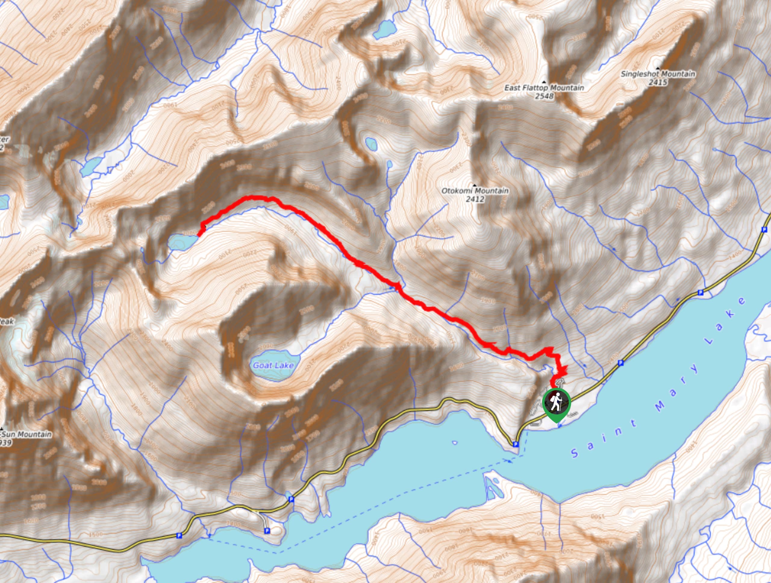
To get to Otokomi Lake Trail from St. Marys, head Northwest on Glacier Route 1/Going-to-the-Sun Road for 9.1mi until you reach your destination.

About
| When to do | May - October |
| Backcountry Campsites | Otokomi Lake Campground |
| Pets allowed | No |
| Family friendly | No |
| Route Signage | Average |
| Crowd Levels | Low |
| Route Type | Out and back |
Otokomi Lake Trail
Elevation Graph
Weather
Otokomi Lake Trail Description
Otokomi Lake Trail is a spectacular hike that takes you through dense forests and then emerges into the cascading waterfalls of Rose Creek, ending with the breathtaking views of the red rock formations above Otokomi Lake. As this hike does go through dense forest and high up vegetation, it is recommended that you make a lot of noise in these areas so you do not surprise a bear and that you carry some bear spray.
The hike to Otokomi Lake starts at Rose Creek trailhead and takes you to the cabins of Rising Sun. After passing these, you will have a steep climb for the next 0.5mi, hiking through dense forest and at 2.3mi, you will emerge and see the waterfalls in the gorge of Rose Creek. From here, you will walk through some high vegetation until you reach 4.3mi, where the vegetation will begin to subside and at 4.8mi, you will see the red rock above Otokomi Lake.
Continue on through the avalanche chutes and at 5.3mi, you will arrive at Otokomi Lake Campground. From here, in 0.1mi, you will reach Otokomi Lake. When you are ready to head back, follow the same route you came on.
Find more epic hikes in Glacier National Park
Similar hikes to the Otokomi Lake Trail hike

Fish Lake Trail
Fish Lake Trail is a mix between relaxing and heart pumping. The start of the trail takes you through a…

Quartz Creek Trail
Quartz Creek Trail is a relaxing hike on a remote trail in Glacier National Park. The hike takes you through…

Snyder Ridge Trail
Hiking through Snyder Ridge Trail takes you through a forest for most of the trail that follows the ridge along…
Comments