
Morning Star Lake Trail
View Photos
Morning Star Lake Trail
Difficulty Rating:
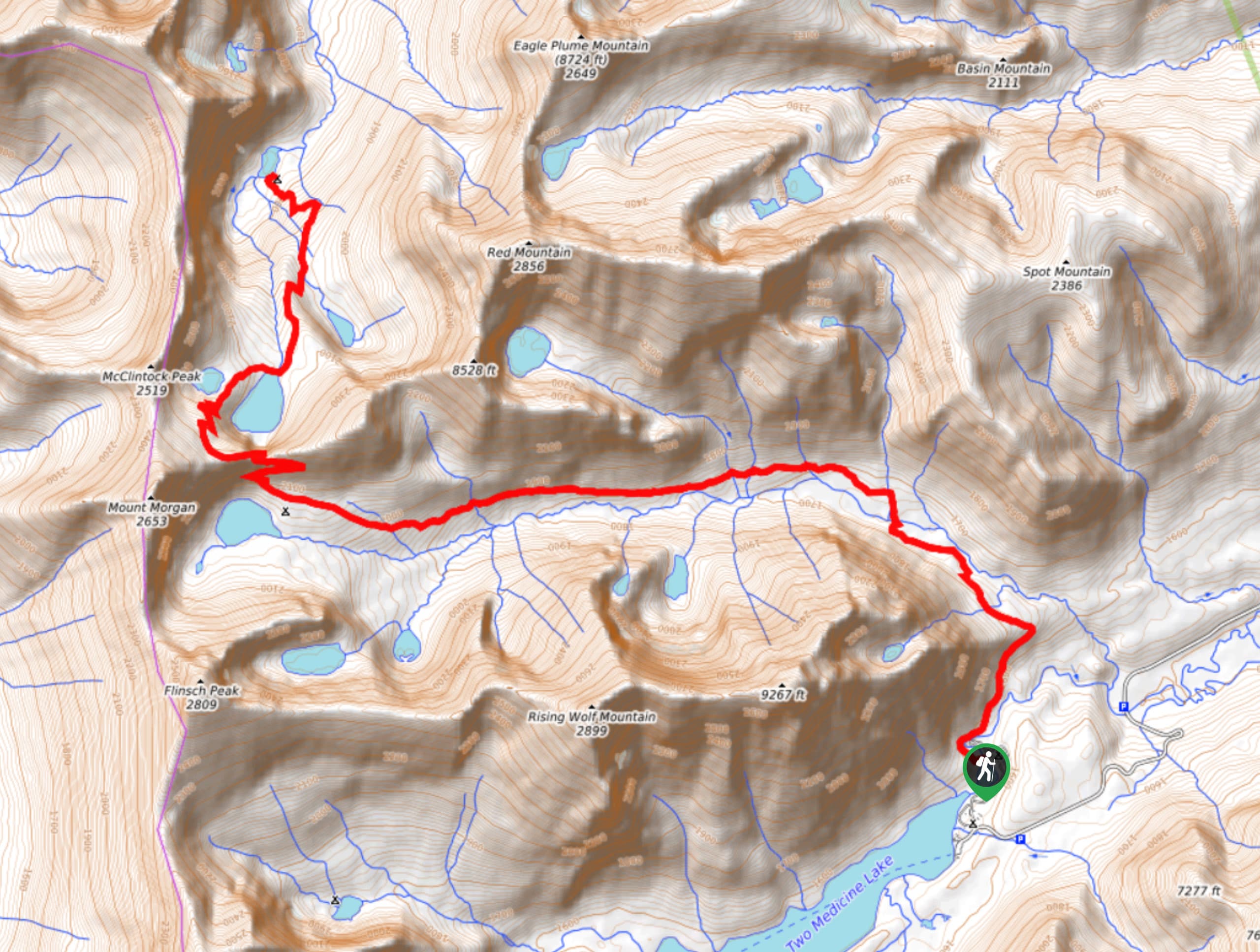
Morning Star Lake Trail is a wonderful hike that takes you through fields of wildflowers, showcases the Atlantic Falls and has you wander down North Fork Cut Bank Creek. Have a picnic lunch at Morning Star Lake and be on the lookout for mountain goats playing on the red cliffs above. This hike does not entail much elevation but is a longer trail that will still get your heart pumping.
Getting there
To get to Morning Star Lake Trail from East Glacier Park Village, head west on Midvale Street toward MT-49 North and turn right. After 2.5mi, follow Two Medicine Road for 7.8mi, and arrive at your destination.

About
| When to do | June - October |
| Backcountry Campsites | Morning Star Lake Campground |
| Pets allowed | No |
| Family friendly | No |
| Route Signage | Poor |
| Crowd Levels | Moderate |
| Route Type | Out and back |
Morning Star Lake Trail
Elevation Graph
Weather
Morning Star Lake Trail Description
Morning Star Lake Hike is a scenic trail that takes you through fields of wildflowers, North Fork Cut Bank Creek and Atlantic Falls. Beginning at the trailhead, follow the North Fork Cut Bank Creek for four miles, and take a left turn at the Pitamakan Pass Trail junction. In 0.2mi, you will arrive at the stunning Atlantic Falls. Continuing on, you will come to Morning Star Lake, and after you are finished enjoying your surroundings, you can head back the way you came as this is an out-and-back trail.
Find more epic hikes in Glacier National Park
Similar hikes to the Morning Star Lake Trail hike

Fish Lake Trail
Fish Lake Trail is a mix between relaxing and heart pumping. The start of the trail takes you through a…

Quartz Creek Trail
Quartz Creek Trail is a relaxing hike on a remote trail in Glacier National Park. The hike takes you through…

Snyder Ridge Trail
Hiking through Snyder Ridge Trail takes you through a forest for most of the trail that follows the ridge along…
Comments