
Mount Proctor Trail
View Photos
Mount Proctor Trail
Difficulty Rating:
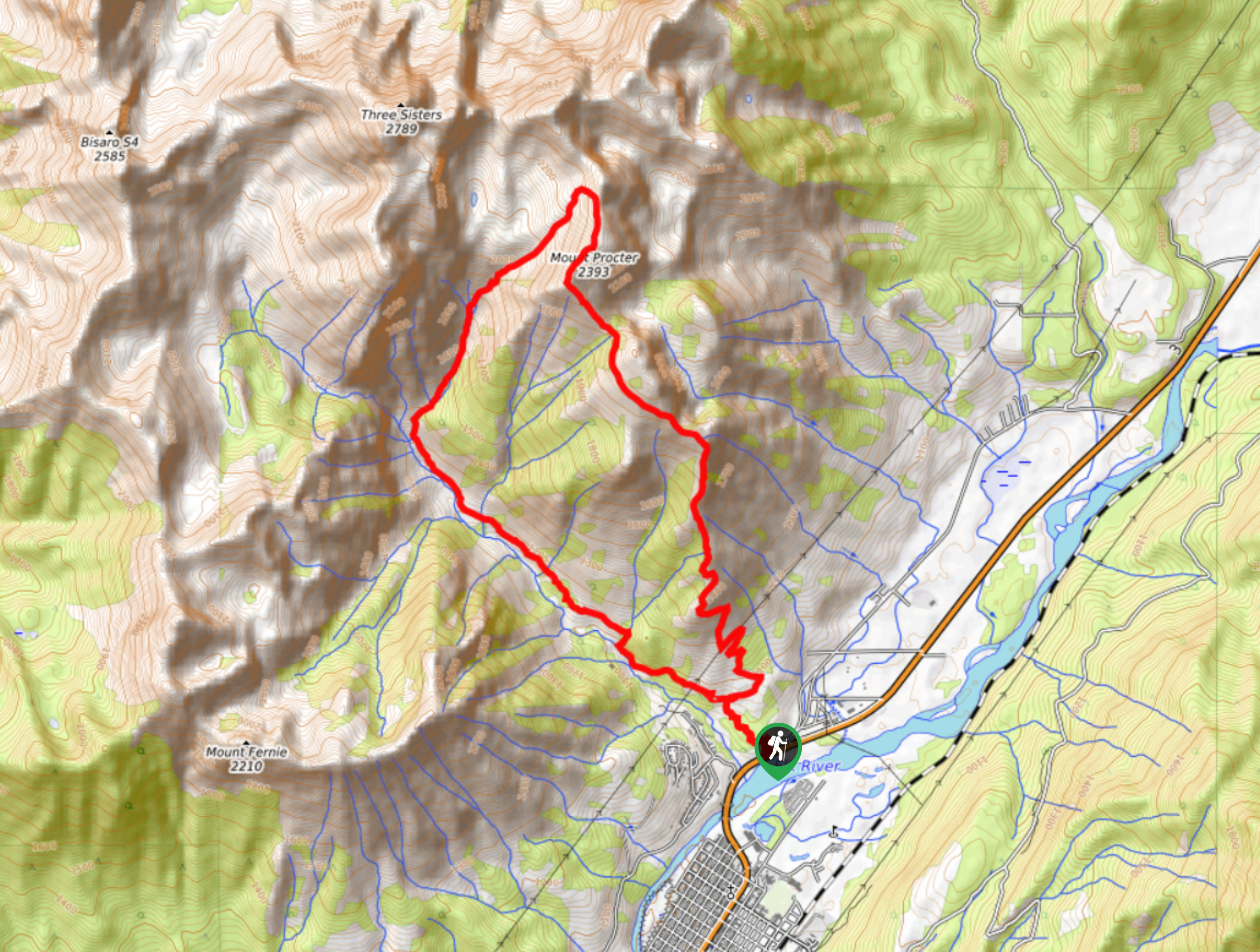
The Mount Proctor Trail is a challenging 9.7mi loop route in Fernie, BC, that will take hikers on a steep uphill climb to the summit. This route is physically demanding and climbs along some exposed sections of the trail, making it more suitable for experienced hikers than beginners. From the summit, you will be able to enjoy fantastic views overlooking the Fernie area, including a sightline over the valley and the beautiful Three Sisters Peak to the northwest and Mount Fernie to the southwest.
Getting there
To reach the trailhead for Mount Proctor from Fernie, head north on BC-3 for 0.9mi and turn left at the Fernie Tourist Information Centre to arrive at the parking area.

About
| When to do | June–November |
| Backcountry Campsites | No |
| Pets allowed | No |
| Family friendly | No |
| Route Signage | Average |
| Crowd Levels | Moderate |
| Route Type | Lollipop |
Mount Proctor Trail
Elevation Graph
Weather
Mount Proctor Trail Description
Due to the physically demanding nature of the Mount Proctor Trail, it is best left for more experienced hikers or a casual hiking party with someone that has experience on the mountain. The route isn’t challenging, but it does climb up a steep slope and has some exposed sections of trail that can be daunting for those unfamiliar with the terrain. While it can be completed in either direction, a counterclockwise approach to the summit is considered the easier route.
Make sure to wear proper hiking footwear and bring hiking poles to help with your balance along the uneven and exposed terrain. This trail also passes through a dense network of hiking and mountain bike routes, making sure to bring a trail map or GPS to stay on the correct path. Additionally, bring plenty of water and snacks to stay fueled up on the steep uphill climb.
Setting out on the trail from the Fernie Tourist Information Centre, make your way behind the building and head left when you reach the first junction. Coming to a junction with the Swine Flu Trail, follow it to the right to begin the long uphill climb to the summit. During this initial stretch of the hike, you will pass through some heavily forested terrain before breaking out of the tree cover onto the exposed ridgeline to the summit. From the top of Mount Proctor, hikers will have sweeping views looking out over Fernie as it sits nestled far below in the valley. From here, follow the trail as it heads around the backside of the mountain and descends through the forest alongside the flowing waters of Fairy Creek. Eventually, you will pass by the cascading water of Fairy Creek Falls before returning to the Fernie Tourist Information Centre.
Similar hikes to the Mount Proctor Trail hike
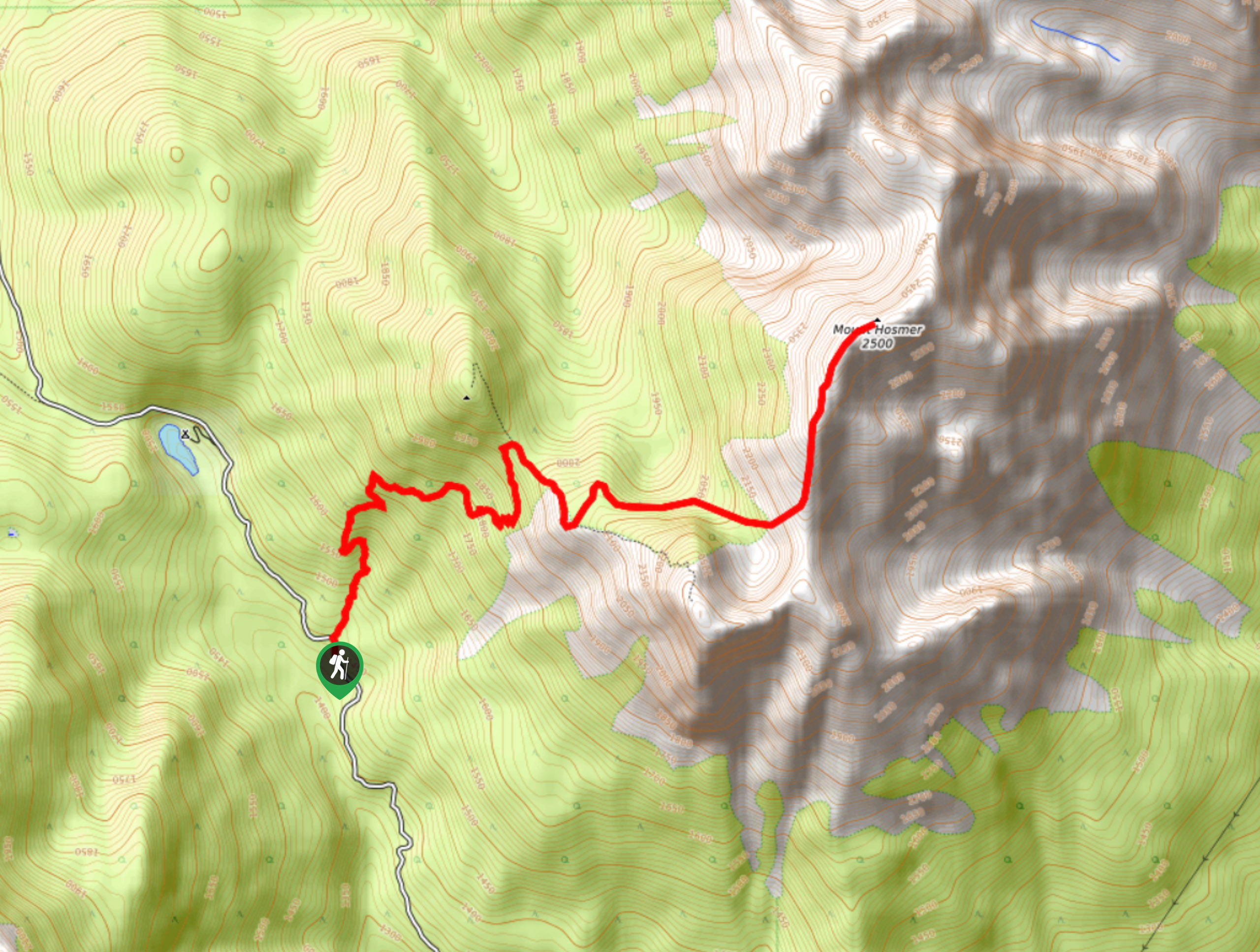
Mount Hosmer Trail
The Mount Hosmer Trail is a 6.5mi out-and-back hiking route near Fernie that will both challenge your resolve…
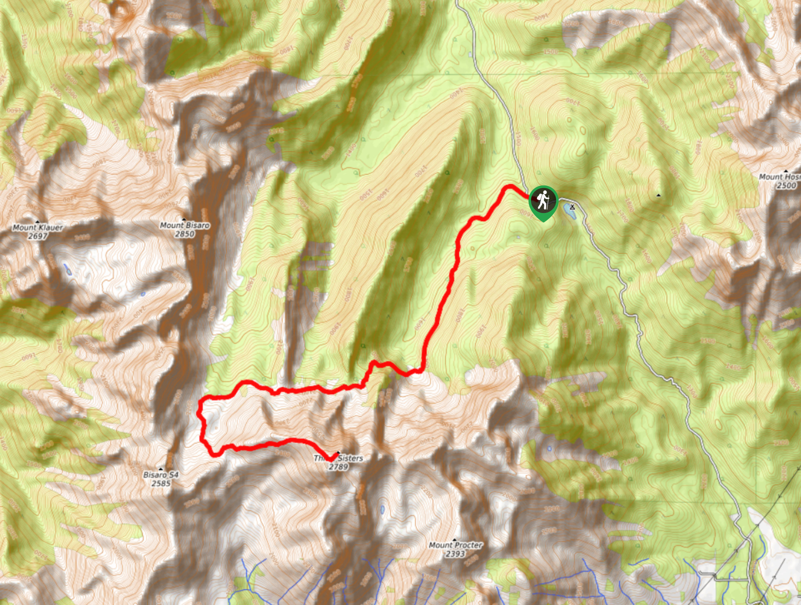
Three Sisters Trail
The Three Sisters Trail is a 13.1mi out-and-back hiking route near Fernie, BC, that will take you through…
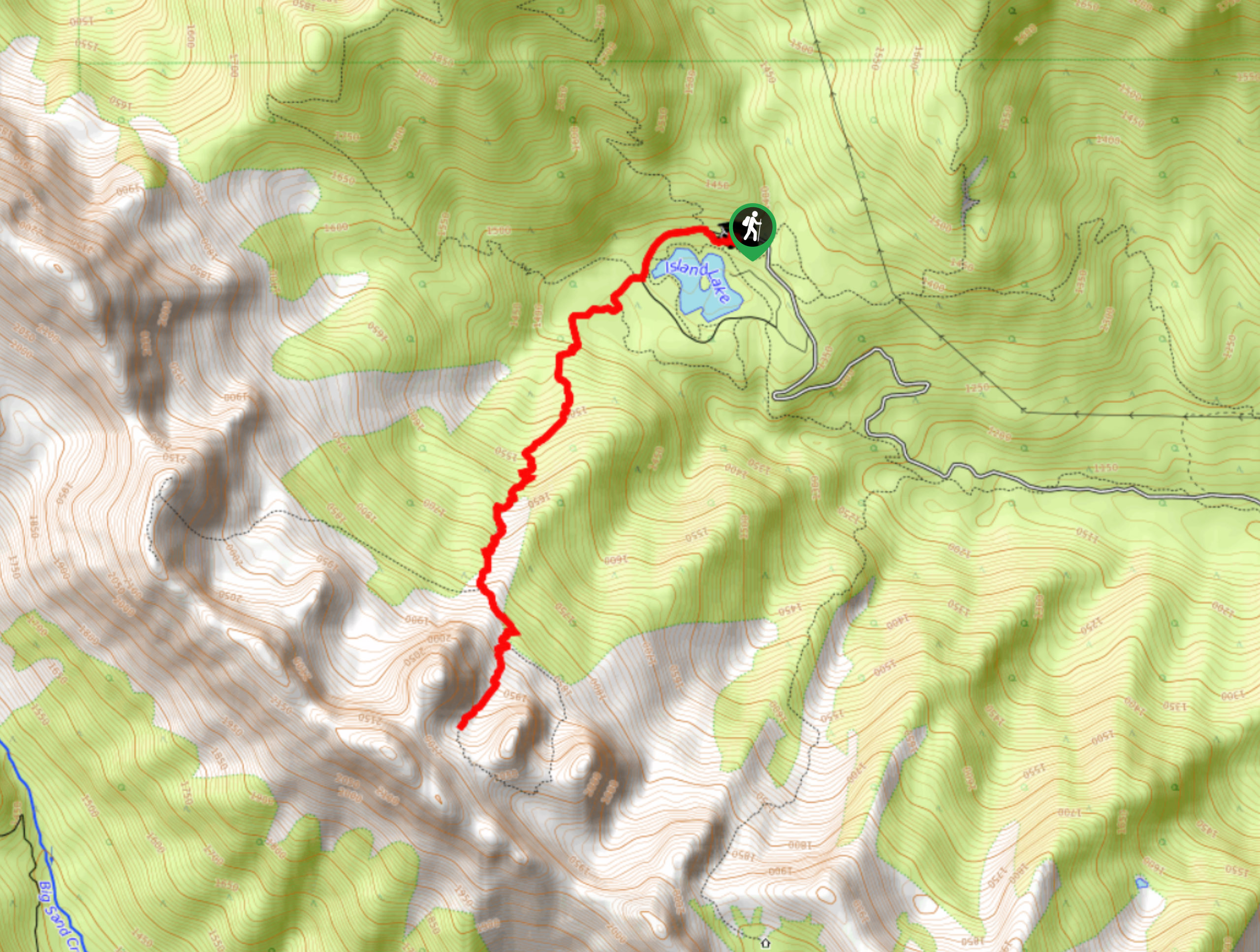
Spineback Trail
The Spineback Trail is a 4.5mi out-and-back hiking route near Fernie, BC, that will take you from the…
Comments