
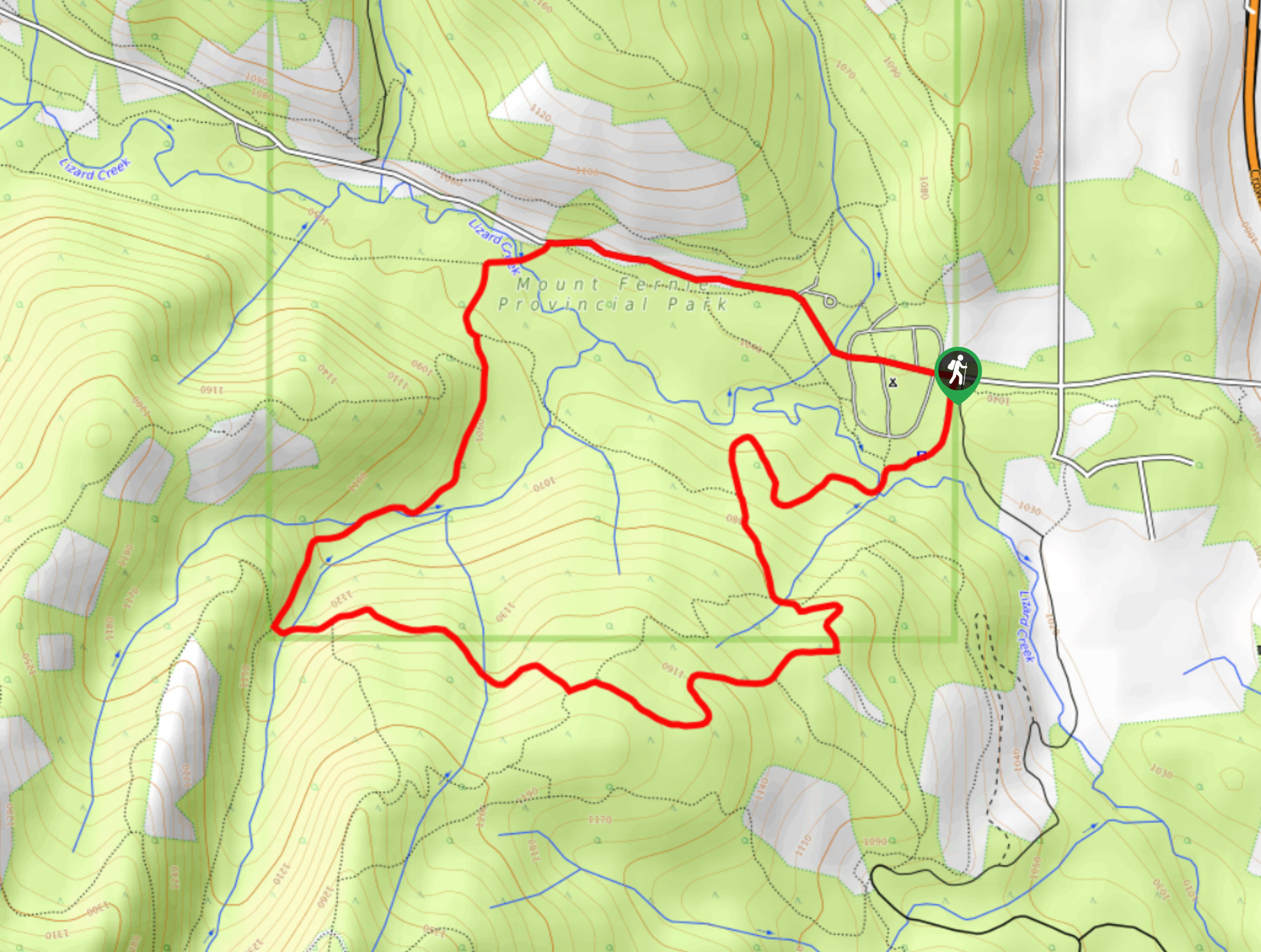
Gorby Trail Loop
View Photos
Gorby Trail Loop
Difficulty Rating:
The Gorby Trail Loop is a 3.4mi hiking route through Mount Fernie Provincial Park made up of several different trails to form a continuous loop through the woodland landscape. Along the trail, hikers will pass through beautiful stretches of the forest landscape and cross over several creeks as they make their way along the easy terrain. This is a great trail for hikers of all skill levels.
Getting there
To reach the parking area for the Gorby Trail Loop from Fernie, make your way to the southwest on BC-3 for 1.5mi and turn right onto Mount Fernie Park Road. After 2789ft, you will reach the parking area on your right.

About
| When to do | June-October |
| Backcountry Campsites | Mount Fernie Campground |
| Pets allowed | Yes - On Leash |
| Family friendly | Yes |
| Route Signage | Average |
| Crowd Levels | Moderate |
| Route Type | Circuit |
Gorby Trail Loop
Elevation Graph
Weather
Gorby Trail Description
Hiking along the Gorby Trail Loop is a great way to spend the day exploring the forests of Mount Fernie Provincial Park. Whether completing this trail on its own or pairing it up with a longer hike up through the valley, this trail offers a wealth of picturesque forest scenery that you won’t want to miss. Due to the volume of trails within the park, make sure to bring a trail map or GPS to stay on the correct route.
From the parking area at the campground, you will need to hike along the road for about 1km to reach the beginning of the trail. Here, you will immediately cross over Lizard Creek before entering into the dense cover of the forest. After roughly 0.8mi of hiking, you will come to a junction with the Old Goat Trail. Follow this to the left to continue along the southern portion of the loop through the serene woodland atmosphere. Keep an eye on your GPS as you hike along the forested trails so that you don’t get lost within the park. After crossing over several streams and one larger crossing over Lizard Creek, you will eventually arrive back at the location where you parked your vehicle.
Similar hikes to the Gorby Trail Loop hike
Fernie Rail Trail
The Fernie Rail Trail is a 4.3mi out-and-back hiking trail found just west of Mount Fernie Provincial Park…
New South Castle Trail
The New South Castle Trail is a 8.2mi hiking route in Fernie that loops through a dense network…
Mad Cow and Swine Flu Loop
The Mad Cow and Swine Flu Loop is a combination of multi-use trails in Fernie that create a scenic loop…
Comments