Lynmouth to Brendon Walk
View Photos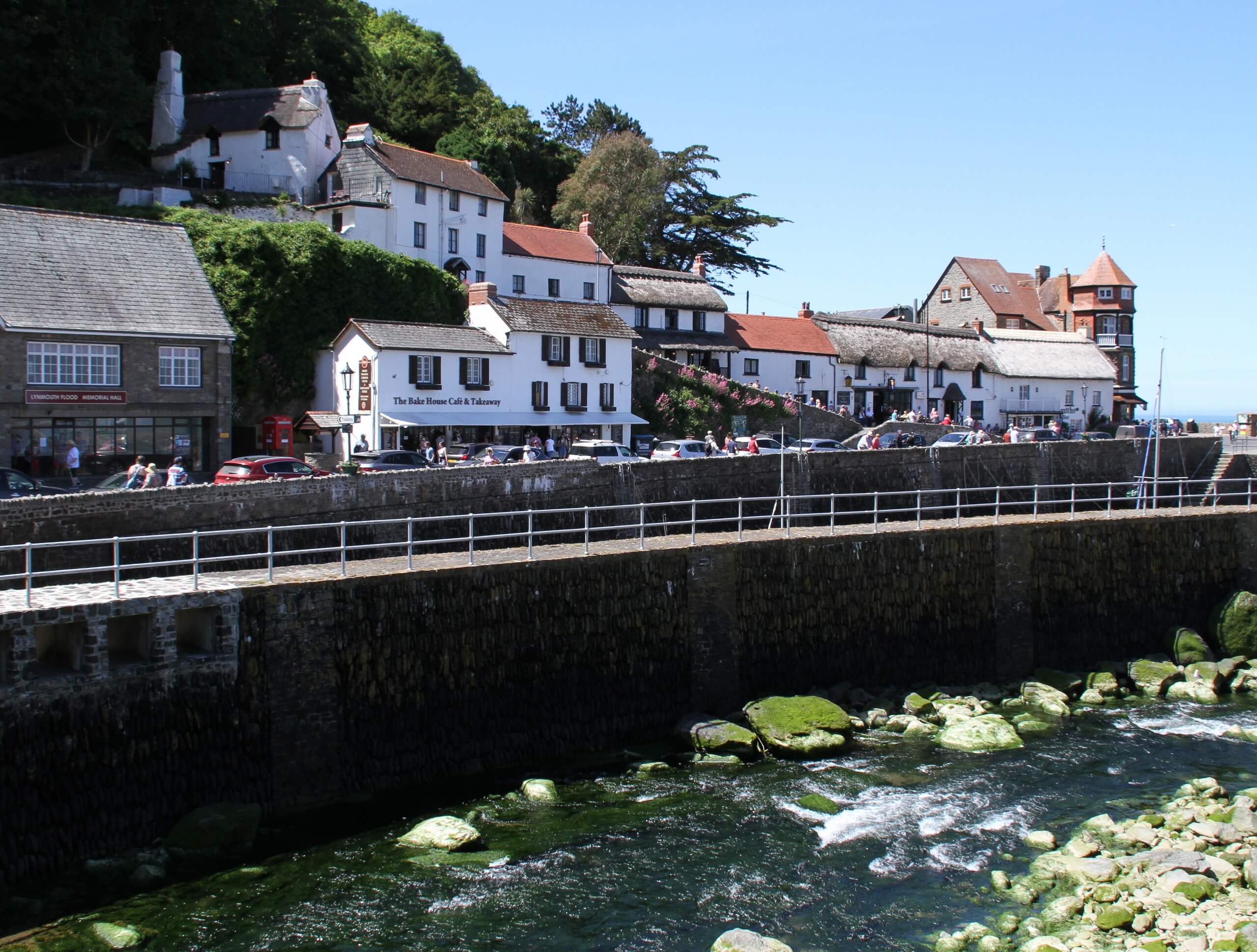
Lynmouth to Brendon Walk
Difficulty Rating:
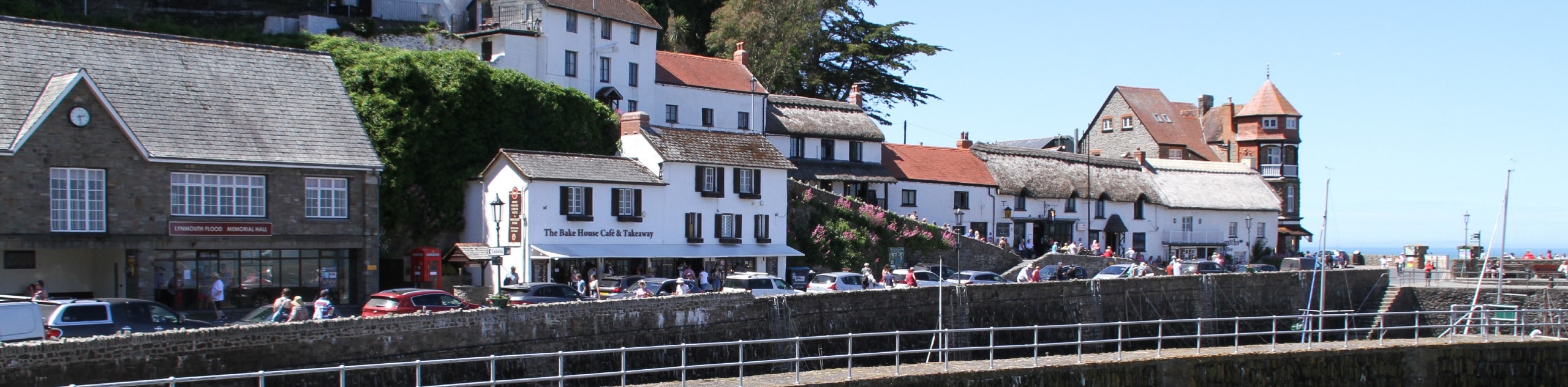
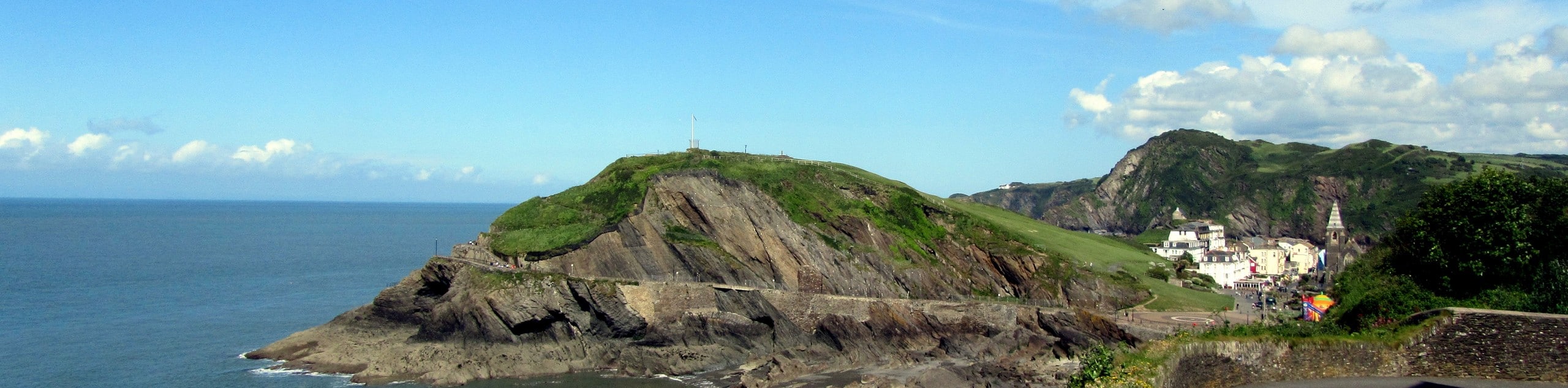
The Lynmouth to Brendon Walk is a fantastic adventure along the North Devon coast that will lead you through some rugged terrain and expose you to local wildlife. The trail sets out from the fishing village of Lynmouth and travels through the East Lyn River Gorge, traversing the undulating landscape along the water’s edge before climbing uphill for views of the Bristol Channel and South Wales. This is a fairly challenging trail with some steep climbs and descents, but the views are definitely worth the effort.
Getting there
To reach the trailhead for the Lynmouth to Brendon Walk from the visitor centre in Lynton, drive northeast on Lee Road for 0.2mi and continue straight onto Church Hill for another 195ft. Keep left onto Castle Hill and follow it for 0.2mi before making a left onto Lynmouth Hill/B3234. After 0.3mi, continue straight onto Watersmeet Road and make a left turn after 80ft to enter the car park. From here, continue on foot across the East Lyn River to reach the trailhead.

About
| Backcountry Campground | No |
| When to do | Year-Round |
| Pets allowed | Yes - On Leash |
| Family friendly | Older Children only |
| Route Signage | Average |
| Crowd Levels | High |
| Route Type | Circuit |
Lynmouth to Brendon Walk
Elevation Graph
Weather
Lynmouth to Brendon Walk Description
Walking the trail from Lynmouth to Brendon is an amazing experience in Exmoor National Park; however, there are some challenging aspects of the trail that should be taken into consideration before setting out on your adventure. Be sure to wear sturdy walking boots with good ankle support, as there are some fairly steep sections of trail here that are often uneven underfoot. Additionally, the trail’s proximity to water and its location in the bottom of a gorge means that there will likely be mud and mosquitoes along the route. Remember to bring bug spray and consider wearing water-resistant footwear if you are walking after a good rainfall.
All things considered, this is a spectacular walking route if you are looking for beautifully scenic views with a spot of challenging terrain along the way. The peaceful riverside setting within the East Lyn River Gorge presents a great opportunity to disconnect from the outside world, while the uphill climb out of the gorge is sure to get your heart pumping. Throw in a quick mid-walk rest at the Watersmeet House Tea Room and stunning views across the Bristol Channel, and you have a great contender for one of the best all-around walks in Exmoor National Park.
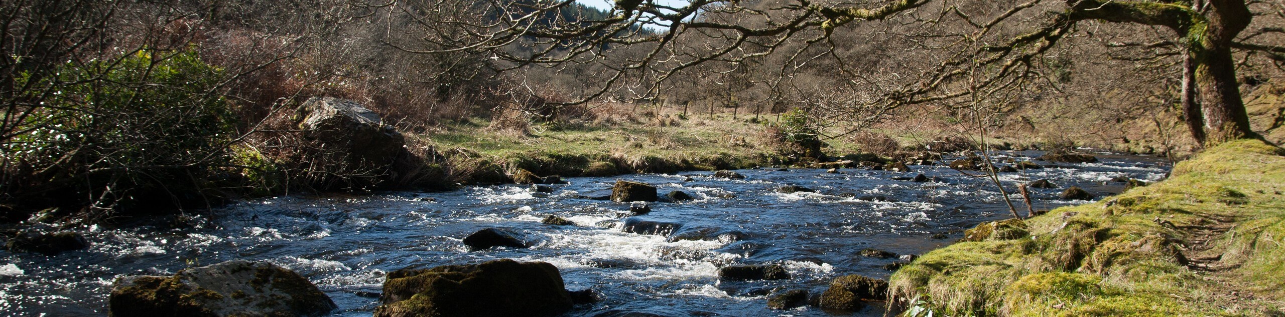
Setting out from the trailhead, make your way southeast along Tors Road for 0.3mi, where the road will transition into a footpath and enter into the cover of the forest. Follow the trail for the next 0.5mi, as it meanders along the edge of the East Lyn River and brings you further into the gorge to arrive at a fork. Take the path on the right and continue along the water’s edge, crossing over a bridge in short order to walk along the opposite bank of the river for the next 0.5mi.
Here, you will meet with a lane and head left, following it along the edge of the water for 0.2mi. Don’t cross the bridge heading over the river. Instead, pick up the footpath branching off to the right and follow it south through the forest for 0.1mi. At the junction, head to the left and make your way over the charming bridges that span Hoar Oak Water and the East Lyn River at the site known as Watersmeet. Here, you can pop into Watersmeet House, an old fishing lodge from 1832 that has been repurposed as a tea house.
After pressing pause on your walk for some lovely refreshments, you will pick up the trail leading to the southeast and follow it for 0.1mi, turning left at the junction to begin making your way up the steep hillside and out of the forested gorge. After 0.4mi, you will exit out of the tree cover and arrive at a junction, at which point, you should take the path on the left.
Follow this path to the northwest for the next 0.4mi to work along the top of the gorge, where you will come to a junction in the path. Turn right here and continue on past Dew Pond, where you will very quickly reach the edge of the road. Don’t cross over the road here. Instead, make a sharp left just before it to make your way to the southwest along a footpath. Keep right along this path for the next 1.3mi, traversing the undulating terrain of Wind Hill and Tor Head to arrive at a junction.
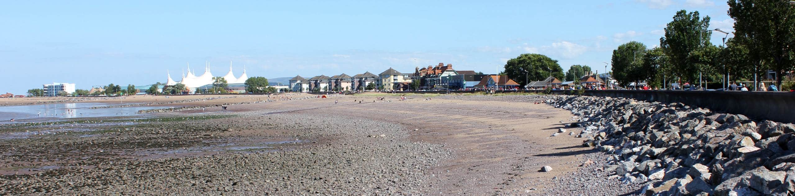
Turn left here to begin your descent of the hillside towards the beautiful waters of the Bristol Channel, crossing over to the opposite side of the road and following the path on the left. Continue heading downhill to the west, where you will enjoy breathtaking views across the water that stretch out to South Wales on a clear day. Very quickly, you will pass through the village of Lynmouth and arrive at Blacklands Beach, which is a nice place to lay out in the sun after a long day of walking. From here, you can follow the trail as it loops around the beach to the southeast, bringing you back to the trailhead having completed the Lynmouth to Brendon Walk.
Trail Highlights
Watersmeet House
Located 1.8mi east of Lynmouth, Watersmeet House is a former fishing lodge that is situated at the confluence of the East Lyn River and Hoar Oak Water. Built in 1832, the building is nestled within a scenic riverside setting at the bottom of a deep gorge and is now used as a tea house. It has been in the ownership of the National Trust since 1936.
Insider Hints
Wear proper walking boots that are ideally water-resistant, as certain parts of the trail are steep and often muddy.
Toilets and a water station can be found at Watersmeet House.
Make sure to pop into the Watersmeet House for some mid-walk refreshments at a historic tea house.
As a good portion of the trail is situated close to the water, you will likely want to bring bug spray.
Similar hikes to the Lynmouth to Brendon Walk hike
South West Coast Path: Minehead to County Gate
Walking the South West Coast Path: Minehead to County Gate is a wonderful long-distance route that will provide stunning views…
Badgworthy Water and Doone Country Loop
The Badgworthy Water and Doone Country Loop is an amazing trail that will allow you to experience a variety of…
South West Coast Path: Trentishoe to Ilfracombe
The South West Coast Path: Trentishoe to Ilfracombe is a lengthy walk along the coast of North Devon that will…
Comments