
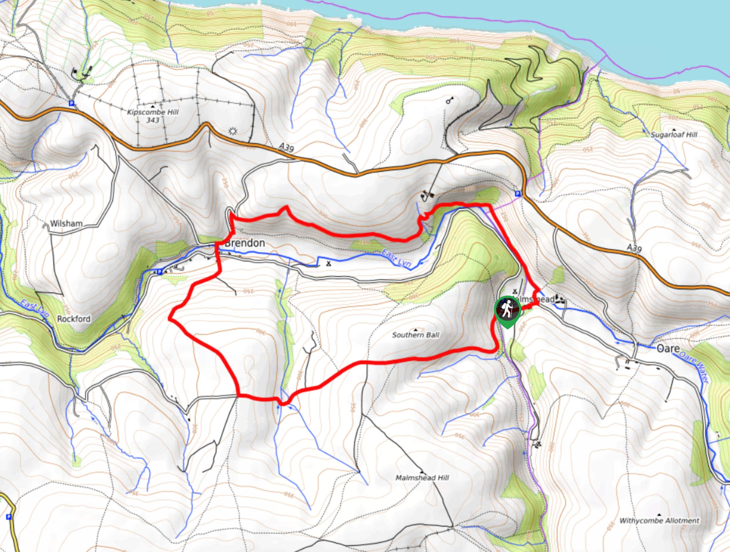
Malmsmead and Brendon Walk
View PhotosMalmsmead and Brendon Walk
Difficulty Rating:
The Malmsmead and Brendon Walk is a beautifully scenic journey that will expose you to a variety of terrain and landscapes that can be found within Exmoor National Park. Along the trail, you will climb uphill across a stretch of moor and descend back into the valley before climbing uphill for some views of the East Lyn River and surrounding landscape. This walk is strenuous and a bit overgrown at times, but that is all a part of the adventure!
Getting there
To reach the trailhead for the Malmsmead and Brendon Walk from the Staghunters Inn in Brendon, drive northeast on Church Hill for 0.2mi and continue straight onto Leeford Lane for another 2.1mi. Turn left here onto Hookway Hill and you will arrive at the car park in 102ft.

About
| Backcountry Campground | Leeford Farm Riverside Camping, Lorna Doone Campsite |
| When to do | Year-Round |
| Pets allowed | Yes - On Leash |
| Family friendly | Older Children only |
| Route Signage | Average |
| Crowd Levels | Moderate |
| Route Type | Circuit |
Malmsmead and Brendon Walk
Elevation Graph
Weather
Malmsmead and Brendon Walk Description
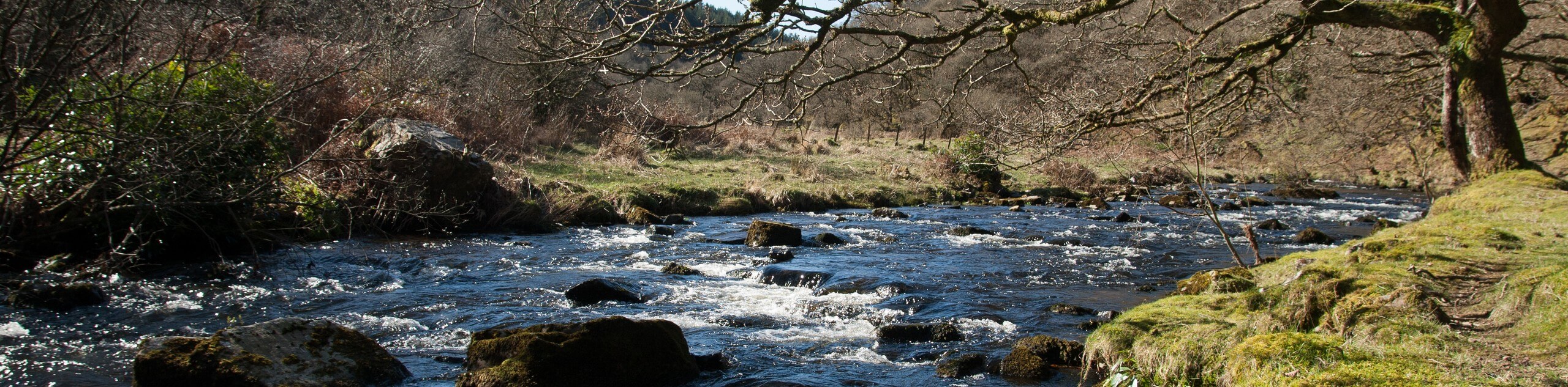
While there are some steep and overgrown sections of trail, the Malmsmead and Brendon Walk is a fascinating walk that will allow you to relax while roaming the countryside and experiencing the varied landscapes within Exmoor National Park. From the trailhead, you will climb uphill to the west to experience the rugged terrain of the moor before descending into the valley to cross over the winding East Lyn River. From here, you will climb uphill above the valley and make your way east while enjoying the stunning views overlooking the surrounding farms, moor, and forests. Eventually, you will descend through the forest and follow along the river, as it will lead you back towards the trailhead where you began.
Similar hikes to the Malmsmead and Brendon Walk hike
South West Coast Path: Minehead to County Gate
Walking the South West Coast Path: Minehead to County Gate is a wonderful long-distance route that will provide stunning views…
Valley of the Rocks and Lynton Outer Loop
The Valley of the Rocks and Lynton Outer Loop is a wonderful excursion in Exmoor National Park that will lead…
Badgworthy Water and Doone Country Loop
The Badgworthy Water and Doone Country Loop is an amazing trail that will allow you to experience a variety of…
Comments