Whetstone Vista Loop
View Photos
Whetstone Vista Loop
Difficulty Rating:
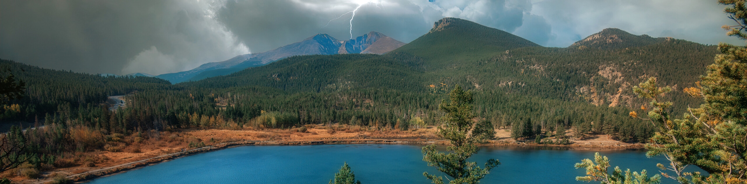
The Whetstone Vista Loop is a pleasant hiking route in Crested Butte, Colorado that will see you traverse a forested hillside for views across the Slate River Valley. While out hiking the trail, you will meander uphill along the lower slopes of Crested Butte Mountain, passing through the tree cover to enjoy beautiful views of nearby Whetstone Mountain. The latter portion of this trail does follow alongside the road, so make sure that you are being mindful of passing vehicles, especially if children or dogs are present.
Getting there
The trailhead for the Whetstone Vista Loop can be found 3mi east of Crested Butte along Brush Creek Road.

About
| Backcountry Campground | No |
| When to do | April-September |
| Pets allowed | Yes - On Leash |
| Family friendly | Yes |
| Route Signage | Average |
| Crowd Levels | Moderate |
| Route Type | Circuit |
Whetstone Vista Loop
Elevation Graph
Weather
Whetstone Vista Loop Description
While the Whetstone Vista Loop is a fairly laidback and easy-to-navigate hike, finding the trailhead can be a bit of a challenge. After parking your vehicle, keep an eye out for a trailhead sign next to a dirt path. Additionally, parking here can be hard to come by, particularly during peak times, so try arriving early to get as close to the trailhead as possible.
Even though it can be a bit tricky to locate the starting point of this hike, once you are on the trail it is a fairly straightforward adventure. Along the trail, you will experience a lovely woodland setting, as well as stunning views across the river valley that include the surrounding Elk Mountains, making for an excellent day on the trails, no matter your skill level.
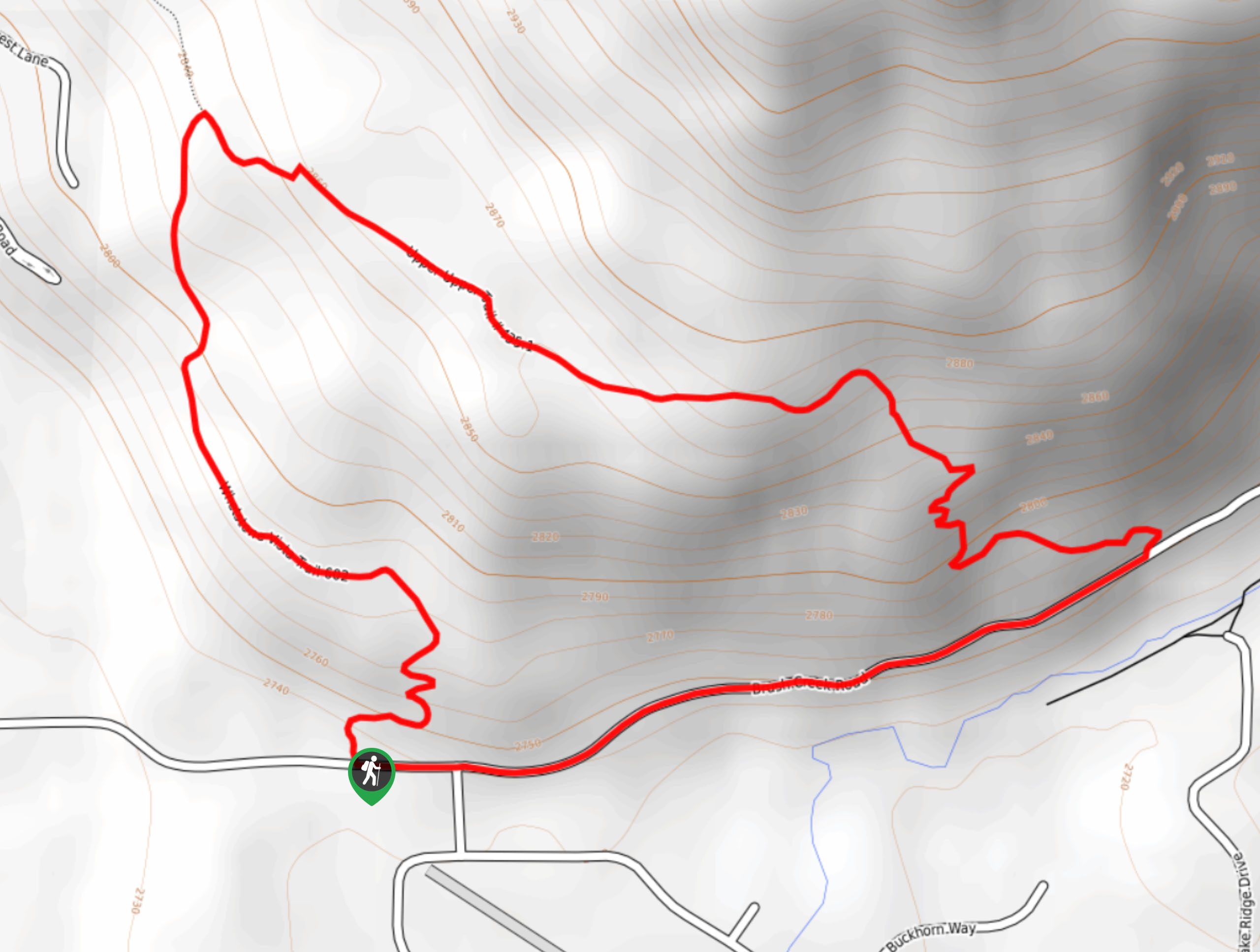
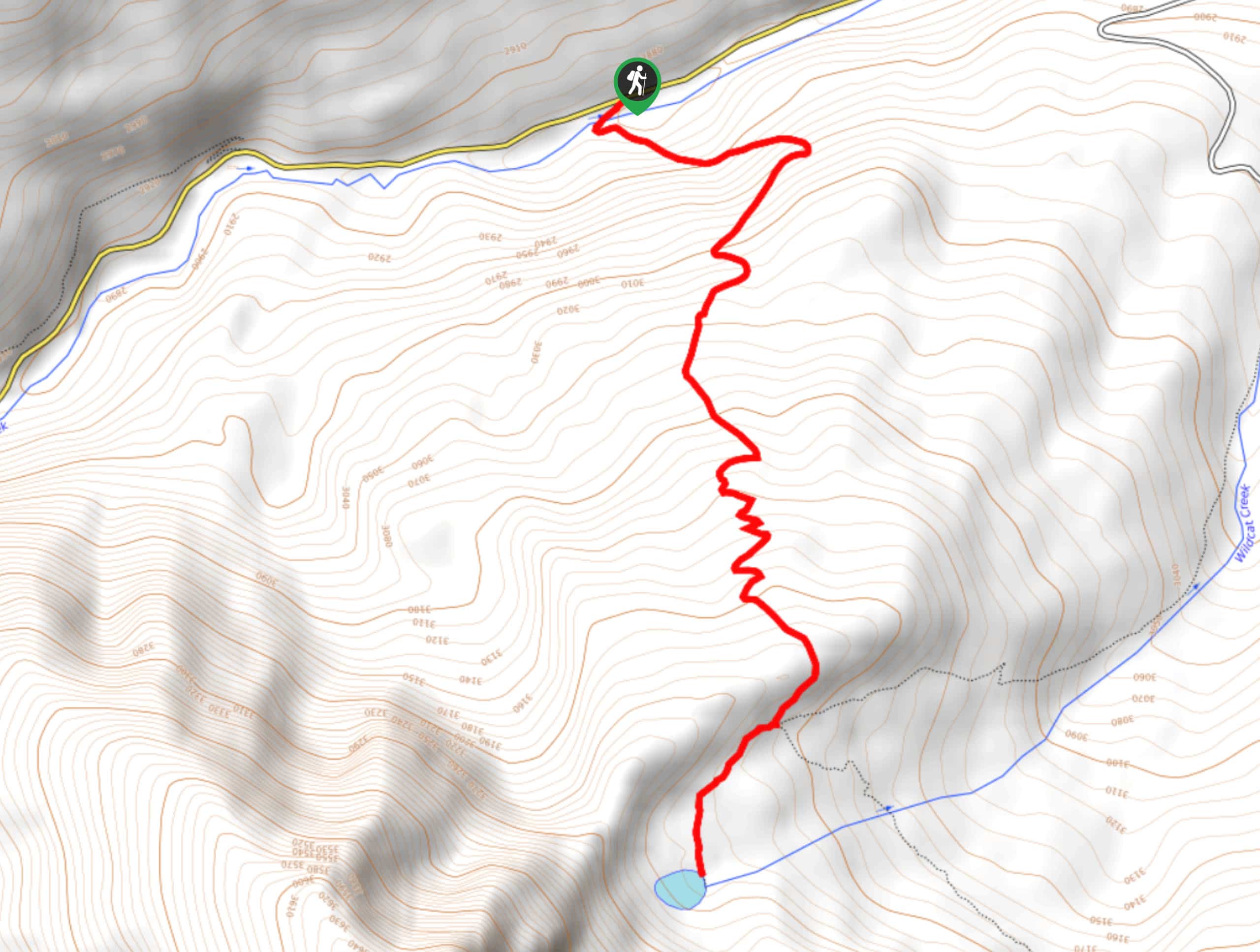
Setting out from the trailhead along Brush Creek Road, you will head north along the dirt footpath next to a private residence driveway. Here, the path will wind back and forth to the north, as you enter into the tree cover and cross over the driveway to work around the house.
Following along the woodland path for the next 0.5mi, you will meander through the forest and enjoy intermittent views of the surrounding valley through the breaks in the tree cover, before arriving at a junction in the trail. For those that want to extend the overall length of their hike and visit Grant Lake, you can turn left and make a detour to visit the water’s edge to the northwest. If not, simply keep to the right here.
Making your way east across the lower slopes of Crested Butte, you will pass through several meadows and enjoy views looking out across the Slate River Valley towards Whetstone Mountain. Here, the trail will descend to the southeast and bring you to the edge of Brush Creek Road.
Turning to the right, you will follow along Brush Creek Road for 0.7mi as it leads you to the west. Make sure to keep an eye out for passing vehicles, as you continue along the road until you arrive back at the starting point of the Whetstone Vista Loop.
Trail Highlights
Whetstone Mountain
Situated in the West Elk Mountains, a subrange of the Rocky Mountains, Whetstone Mountain is a prominent peak with an elevation of 12527ft. The mountain is categorized as a laccolith and features several cirques on its north side that are the result of glaciation.
Insider Hints
Arrive early to secure parking at the trailhead.
The trailhead can be easy to miss, but it is marked with a sign along the dirt path, right next to a private driveway.
Wear proper hiking boots to better traverse the trail.
The hike can be extended to the northwest if you want to visit the shores of Grant Lake.
Similar hikes to the Whetstone Vista Loop hike
Prospector Trail
The Prospector Trail is a fun hiking adventure near Crested Butte, Colorado that will take you uphill for beautiful views…
Lily Lake Trail #639
The Lily Lake Trail #639 is an easy-going hiking route in the Elk Mountains of Colorado that will lead you…
Green Lake via Carbon Trail
The Green Lake via Carbon Trail is an amazing experience in Crested Butte, Colorado that will take you to a…
Comments