Brush Creek Trail
View Photos
Brush Creek Trail
Difficulty Rating:
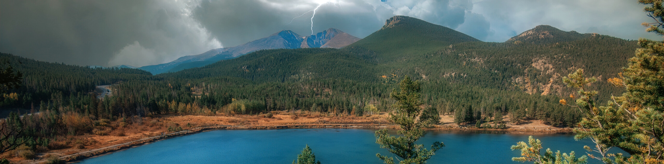
The Brush Creek Trail is a great family-friendly hiking route near Crested Butte, Colorado that will lead you through a valley for beautiful views of the surrounding mountains. While out on the trail, you will traverse the lower slopes of Crested Butte and follow along the banks of the East River, enjoying views across the valley that encompass nearby peaks like the Teocalli and White Rock Mountains. This is a laidback route that will certainly make for a fun day outdoors.
Getting there
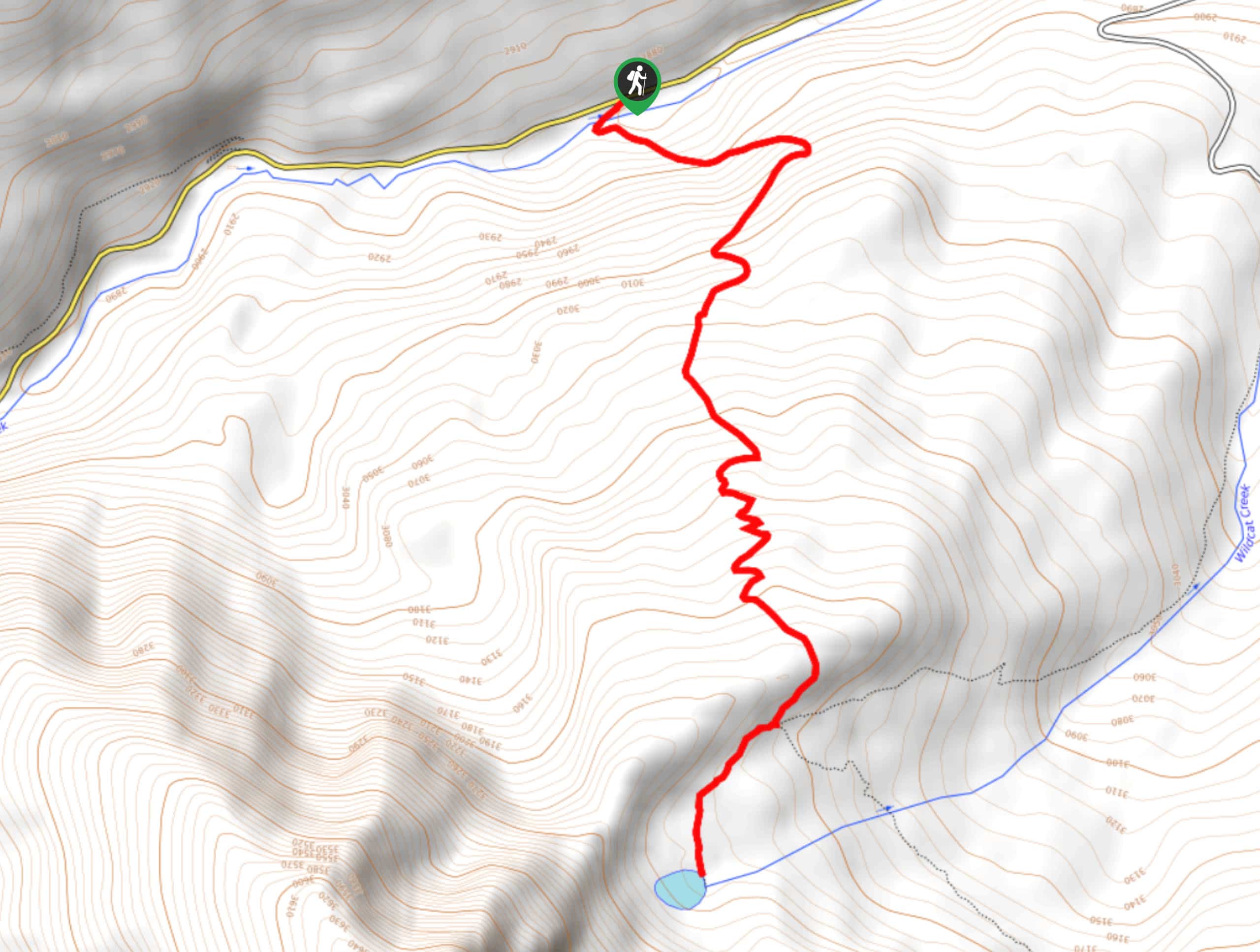
The Brush Creek Trailhead can be found 4.4mi east of Crested Butte along Brush Creek Road.

About
| Backcountry Campground | No |
| When to do | May-October |
| Pets allowed | Yes |
| Family friendly | Yes |
| Route Signage | Average |
| Crowd Levels | High |
| Route Type | Out and back |
Brush Creek Trail
Elevation Graph
Weather
Brush Creek Trail Description
Hiking the Brush Creek Trail is a laid back experience as far as routes in the Elk Mountains go; however, you will still want to wear comfortable hiking shoes to better traverse the trail. The parking lot at the trailhead is also quite small, so you will want to arrive early to secure a space, as there will likely be plenty of other hikers out utilizing this trail. Lastly, this route is exposed to the sun, so be sure to wear sunscreen.
Although there really isn’t much in the way of challenging terrain, that does not mean that the Brush Creek Trail is any less scenic than others in the area. Here, you will experience stunning views across the East River Valley that include several dramatic mountain peaks as a backdrop. If you are looking for an easy-going, family-friendly route with stunning views, this will be the perfect trail.
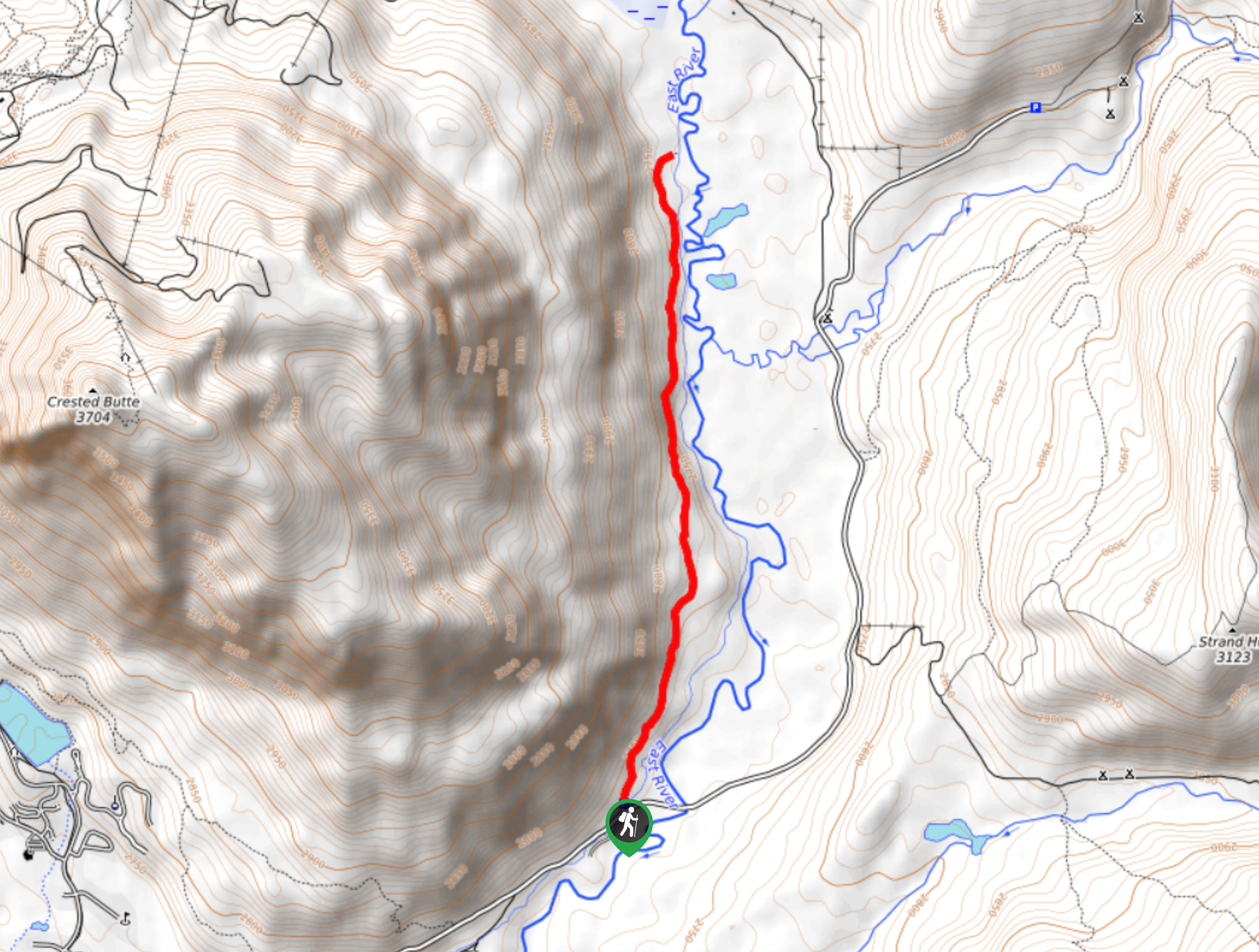
Setting out from the Brush Creek Trailhead parking lot, you will make your way to the north along the East River Trail, traversing the lower slopes on the eastern flank of Crested Butte Mountain. Here, you will be hiking parallel to the East River as it snakes across the valley floor.
As you meander along the laidback trail, take some time to appreciate the picturesque scenery surrounding you, including the winding riverbank, the steep slopes of Crested Butte on your left, and the rugged peaks of the Teocalli and White Rock mountains to the north across the valley.
After passing the point where Brush Creek converges with the East River, you will continue on to the north and pass by two small bodies of water on your right. Shortly after this, you will arrive at the northern terminus of the route. Take a few moments to pause for a quick rest, before turning back along the trail to retrace your steps to the Brush Creek trailhead where you started your adventure.
Trail Highlights
Crested Butte
Located in the Elk Range of the Rocky Mountains, Crested Butte is a prominent peak with an elevation of 12168ft. The mountain overlooks a town of the same name and features a ski resort on its northern slopes.
Frequently Asked Questions
How long is the Brush Creek Trail?
The Brush Creek Trail is 4.8mi long.
Where is Brush Creek located?
Brush Creek is located along the lower slopes of Crested Butte Mountain, just outside of Crested Butte, Colorado.
Insider Hints
Wear comfortable walking shoes.
Arrive early to secure parking at the trailhead, or time your hike during off-peak hours.
Be sure to wear sunscreen, as a good portion of the trail is exposed.
Similar hikes to the Brush Creek Trail hike
Prospector Trail
The Prospector Trail is a fun hiking adventure near Crested Butte, Colorado that will take you uphill for beautiful views…
Lily Lake Trail #639
The Lily Lake Trail #639 is an easy-going hiking route in the Elk Mountains of Colorado that will lead you…
Green Lake via Carbon Trail
The Green Lake via Carbon Trail is an amazing experience in Crested Butte, Colorado that will take you to a…
Comments