
Scales Lake Hike
View Photos
Scales Lake Hike
Difficulty Rating:
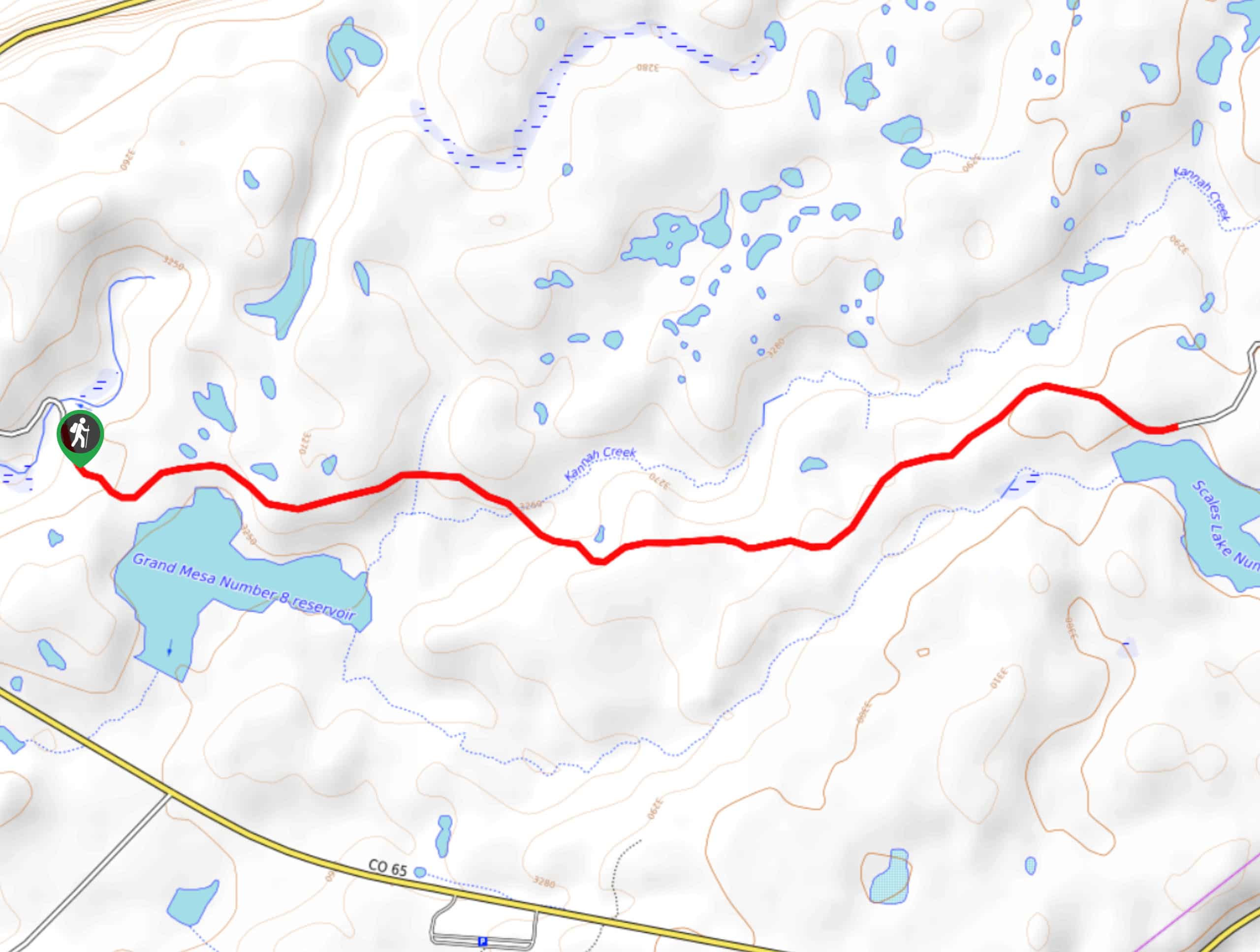
The Scales Lake Hike is an easy-going intermediate length trail near Mesa Lakes, Colorado that will lead you through the forest to the shores of a charming lake. While out hiking the trail, you will traverse a well-maintained forest service road that cuts through the forests and meadows of the surrounding area to arrive at the scenic shores of Scales Lake. This is a great route for beginner hikers that do not wish to traverse the rugged terrain of the backcountry trails nearby.
Getting there
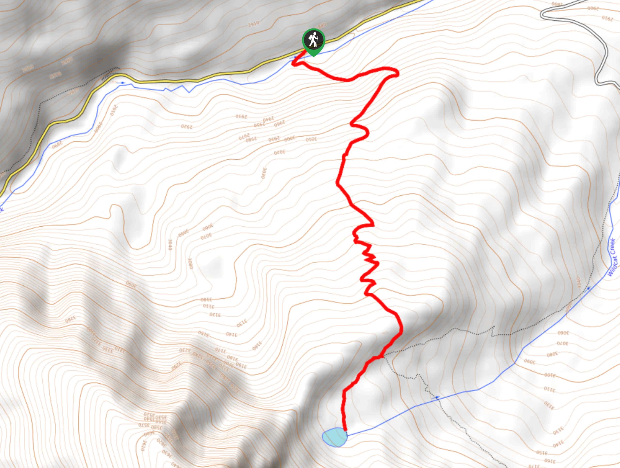
The trailhead for the Scales Lake Hike can be found at the Grand Mesa Nordic Council Warming Hut on Forest Service Road 118.

About
| Backcountry Campground | No |
| When to do | March-October |
| Pets allowed | Yes - On Leash |
| Family friendly | Yes |
| Route Signage | Average |
| Crowd Levels | Moderate |
| Route Type | Out and back |
Scales Lake Hike
Elevation Graph
Weather
Scales Lake Hike Description
Cutting across some lovely woodland terrain to the southeast of Mesa Lakes, the Scales Lake Hike is a great option for beginner hikers or families with children that are looking to avoid the challenge of traversing more rugged terrain.
Setting out from the parking area, you will follow along Forest Service Road 118 as it heads to the southeast and crosses over Reservoir Creek. Shortly after this, you will pass by the shores of Grand Mesa No. 8 Reservoir, before climbing slightly uphill to the east through forests and open meadows. Eventually, you will arrive at the terminus of the route and enjoy scenic views looking out onto Scales Lake. After taking in the scenery, simply head back along the road to return to your vehicle.
Similar hikes to the Scales Lake Hike hike
Prospector Trail
The Prospector Trail is a fun hiking adventure near Crested Butte, Colorado that will take you uphill for beautiful views…
Lily Lake Trail #639
The Lily Lake Trail #639 is an easy-going hiking route in the Elk Mountains of Colorado that will lead you…
Green Lake via Carbon Trail
The Green Lake via Carbon Trail is an amazing experience in Crested Butte, Colorado that will take you to a…
Comments