Lost Lake and Mesa Lakes Hike
View Photos
Lost Lake and Mesa Lakes Hike
Difficulty Rating:
The Lost Lake and Mesa Lakes Hike is a fantastic outdoor excursion in Colorado that will lead you around the shores of several woodland lakes. While out hiking the trail, you will meander past Mesa Lake and Mesa Lake south, before climbing slightly uphill to reach the secluded Lost Lake. Hikers should take note that, although the trail is fairly laid back, there are still some sections of uphill walking along rugged terrain that will require proper footwear.
Getting there
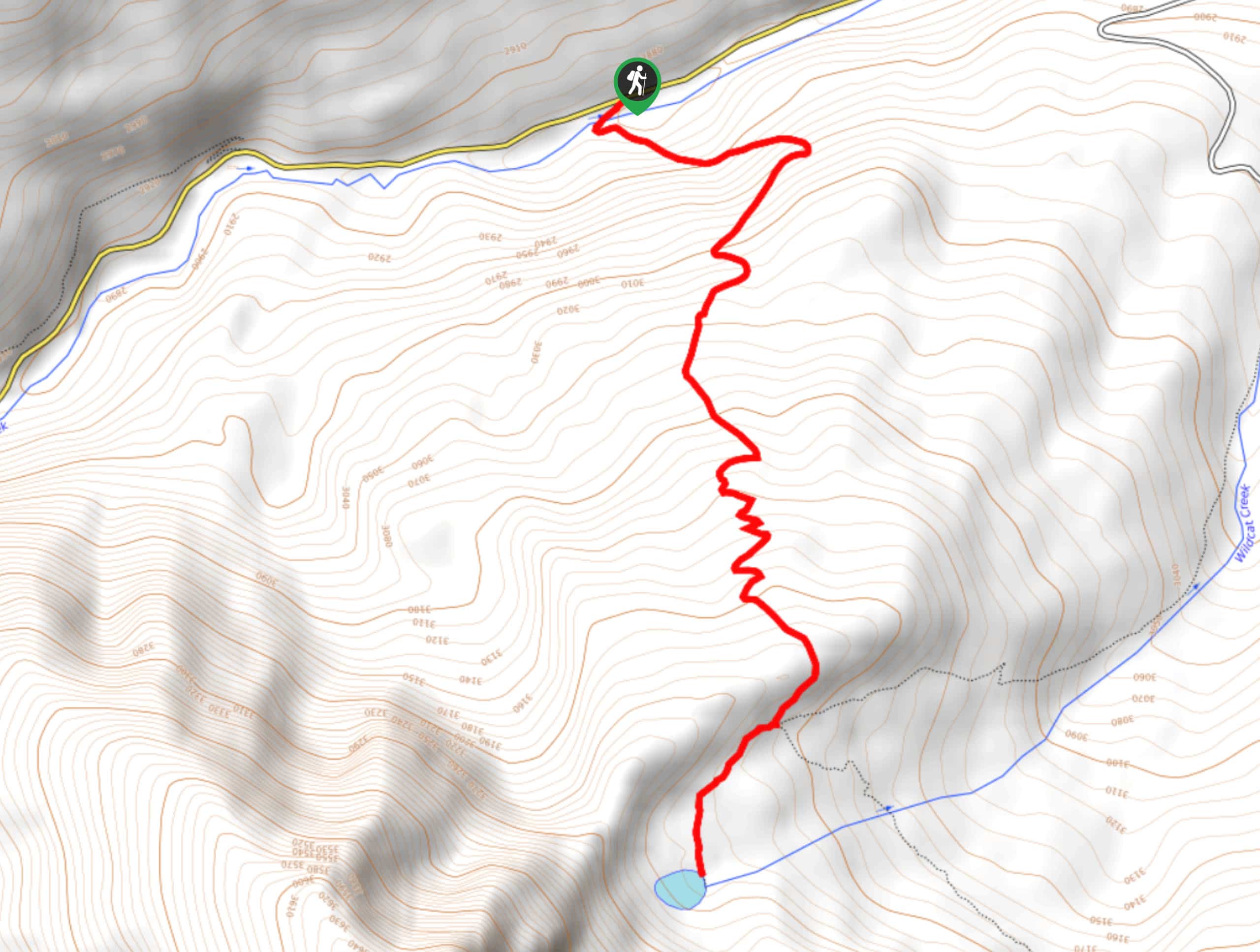
The trailhead for the Lost Lake and Mesa Lakes Hike can be found at the Mesa Lakes Trailhead car park.

About
| Backcountry Campground | No |
| When to do | March-October |
| Pets allowed | Yes - On Leash |
| Family friendly | Yes |
| Route Signage | Average |
| Crowd Levels | Moderate |
| Route Type | Out and back |
Lost Lake and Mesa Lakes Hike
Elevation Graph
Weather
Lost Lake and Mesa Lakes Hike Description
Hiking the Lost Lake and Mesa Lakes trail is the perfect outdoor activity for beginner hikers and families with children, as the route is easy enough to traverse but will still provide a great sense of adventure. In addition to exploring a beautifully scenic stretch of forest, you will also be able to enjoy stunning views across three different lakes, making this an excellent option for a fun day of exploring the wilderness of Colorado.
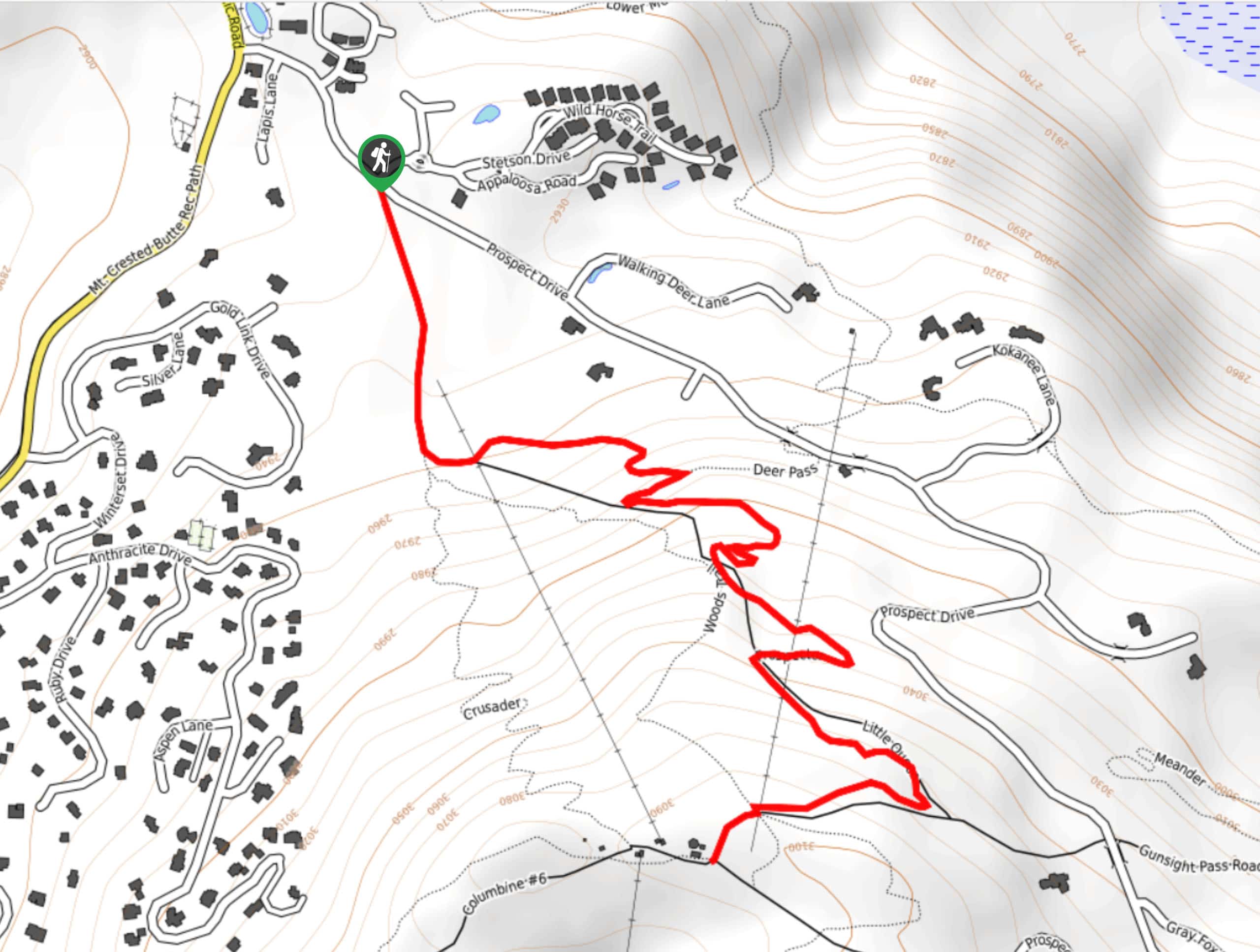
Setting out from the parking lot, you will head to the south and pass by Mesa Creek, quickly arriving at a junction in the trail next to the edge of Mesa Lake. Keep left along the trail here to enjoy some lovely views across the water, and head right at the next junction on a path towards the other two lakes.
Here, you will work your way through the forest and climb slightly uphill, arriving at the shores of South Mesa Lake for some beautiful views. After skirting around the eastern side of the lake, you will once again climb slightly uphill, following the trail as it bends to the southwest to arrive at Lost Lake. After visiting this secluded body of water nestled in between two hills, make your way back along the same route to return to the car park.
Similar hikes to the Lost Lake and Mesa Lakes Hike hike
Prospector Trail
The Prospector Trail is a fun hiking adventure near Crested Butte, Colorado that will take you uphill for beautiful views…
Lily Lake Trail #639
The Lily Lake Trail #639 is an easy-going hiking route in the Elk Mountains of Colorado that will lead you…
Green Lake via Carbon Trail
The Green Lake via Carbon Trail is an amazing experience in Crested Butte, Colorado that will take you to a…
Comments