Lupine, Gunsight, Connection, and Lower Loop Trail
View Photos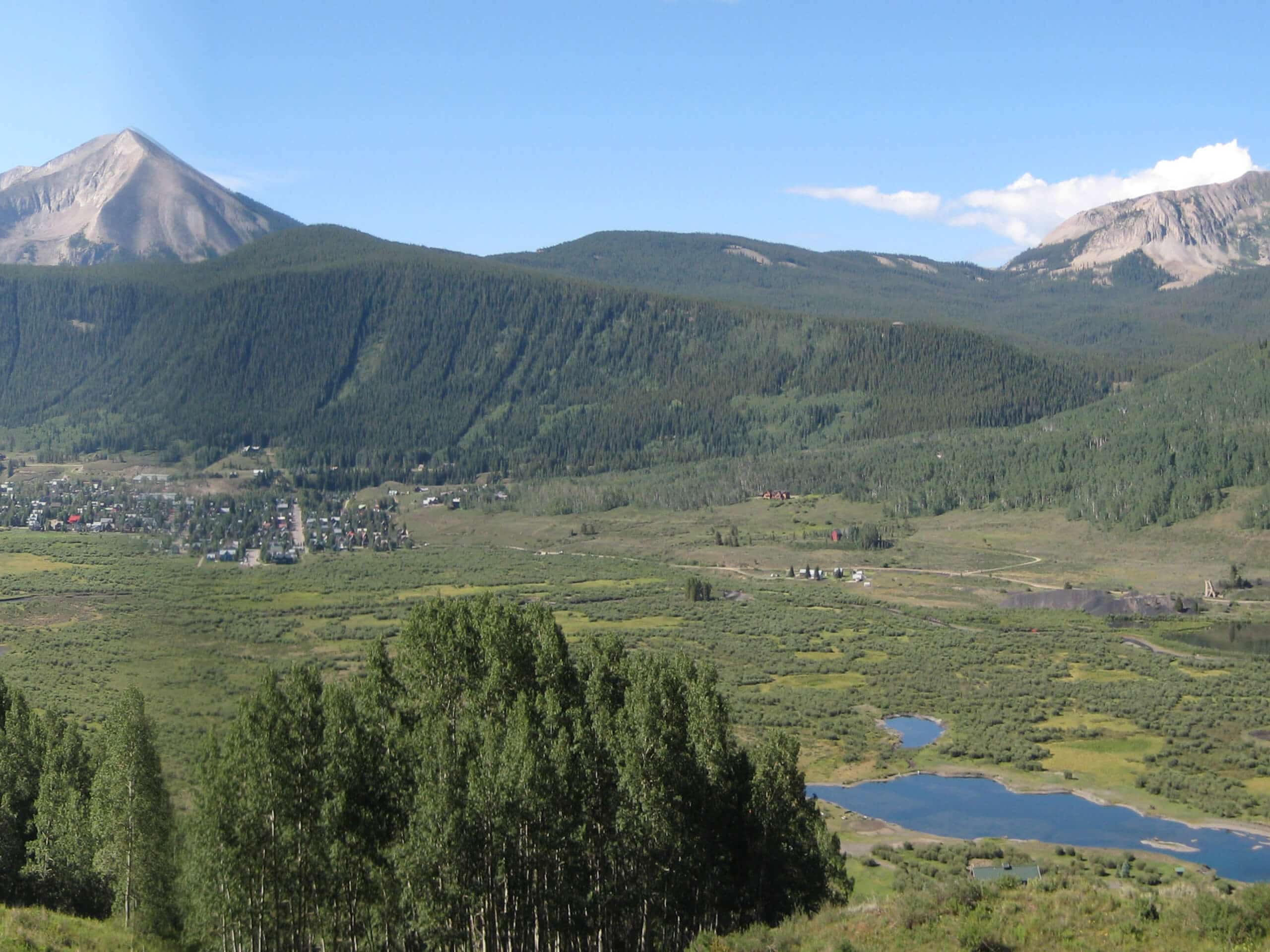
Lupine, Gunsight, Connection, and Lower Loop Trail
Difficulty Rating:
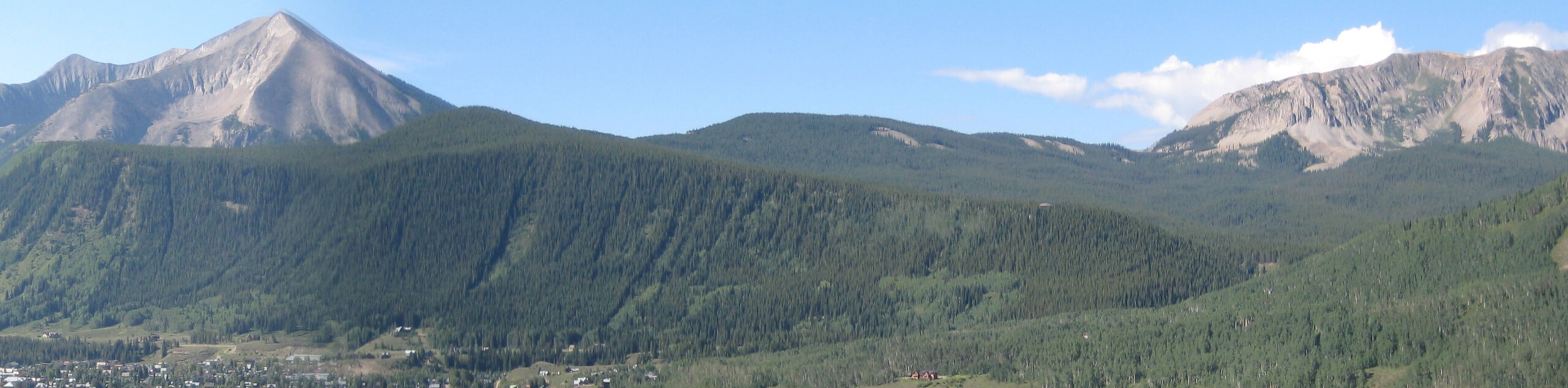
The Lupine, Gunsight, Connection, and Lower Loop Trail is a lengthy adventure in the Elk Mountains of Colorado that will take you around the edges of a valley for scenic views. While out hiking the trail, you will leave the town of Crested Butte behind and head to the northwest, enjoying the views of Mount Emmons and other nearby peaks as you loop around the valley and traverse the slopes on either side. While this is a long hike, it can also be broken up into a multi-day adventure with an overnight stay at the Oh Be Joyful Campground.
Getting there
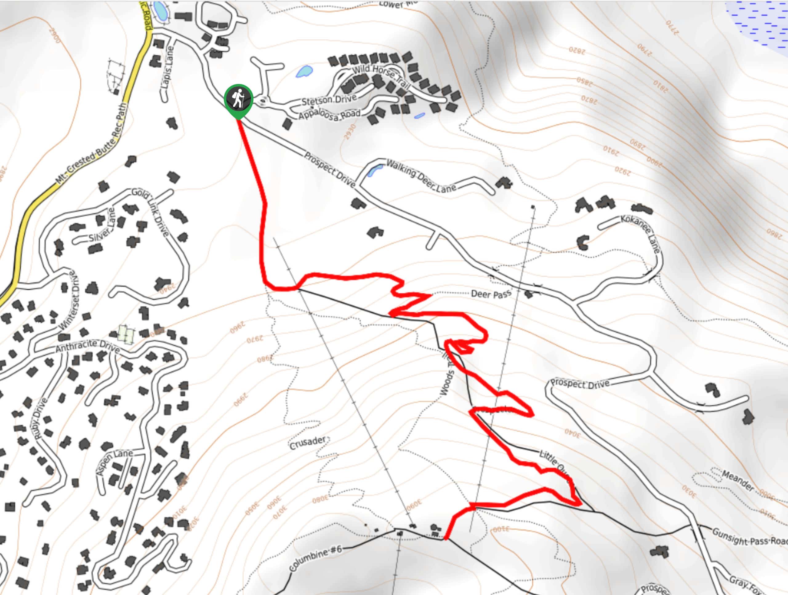
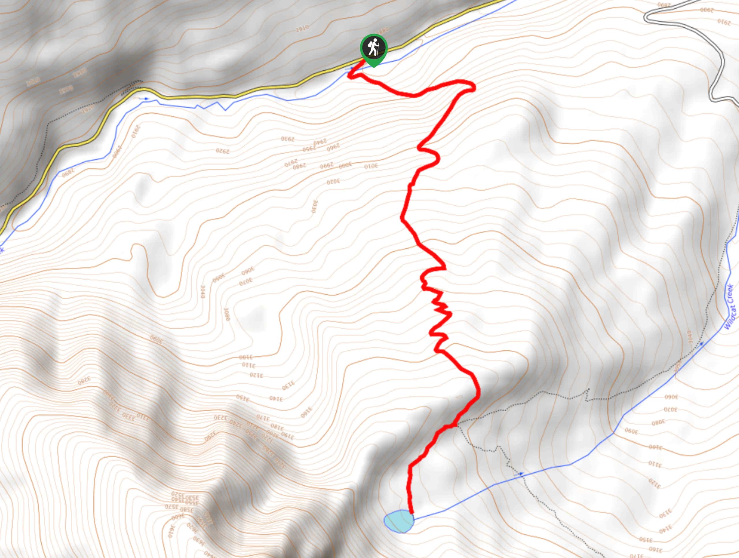
The trailhead for the Lupine, Gunsight, Connection, and Lower Loop Trail can be found at the car park on Elk Avenue in Crested Butte.

About
| Backcountry Campground | Oh Be Joyful Campground |
| When to do | April-October |
| Pets allowed | Yes - On Leash |
| Family friendly | No |
| Route Signage | Average |
| Crowd Levels | Moderate |
| Route Type | Lollipop |
Lupine, Gunsight, Connection, and Lower Loop Trail
Elevation Graph
Weather
Lupine, Gunsight, Connection, and Lower Loop Trail Description
If you are looking for a long distance hiking route near Crested Butte, Colorado that will allow you to take in the natural beauty of the Slate River Valley and its surrounding mountain peaks, then you will certainly want to explore the terrain along the Lupine, Gunsight, Connection, and Lower Loop Trail.
Setting out from the parking lot in Crested Butte, you will head east out of town and quickly cross over the banks of the Slate River. Here, you will climb uphill to the north and cross over the highway, before heading to the northwest along the eastern slopes of the Slate River Valley.
Take some time here to enjoy the stunning views of the surrounding mountain peaks, as well as the snaking banks of the river as it cuts across the valley floor. After reaching the northern terminus of the route, you will follow a wide switchback trail down into the valley, before crossing over Slate River Road and the river itself. Once you are on the opposite bank, you will make your way to the southeast along a route that runs parallel to the river, enjoying the views of Snodgrass Mountain and Crested Butte on the opposite side of the valley as you work your way back into Crested Butte where you began your adventure.
Similar hikes to the Lupine, Gunsight, Connection, and Lower Loop Trail hike
Prospector Trail
The Prospector Trail is a fun hiking adventure near Crested Butte, Colorado that will take you uphill for beautiful views…
Lily Lake Trail #639
The Lily Lake Trail #639 is an easy-going hiking route in the Elk Mountains of Colorado that will lead you…
Green Lake via Carbon Trail
The Green Lake via Carbon Trail is an amazing experience in Crested Butte, Colorado that will take you to a…
Comments