South West Coast Path: Salcombe to Kingswear
View Photos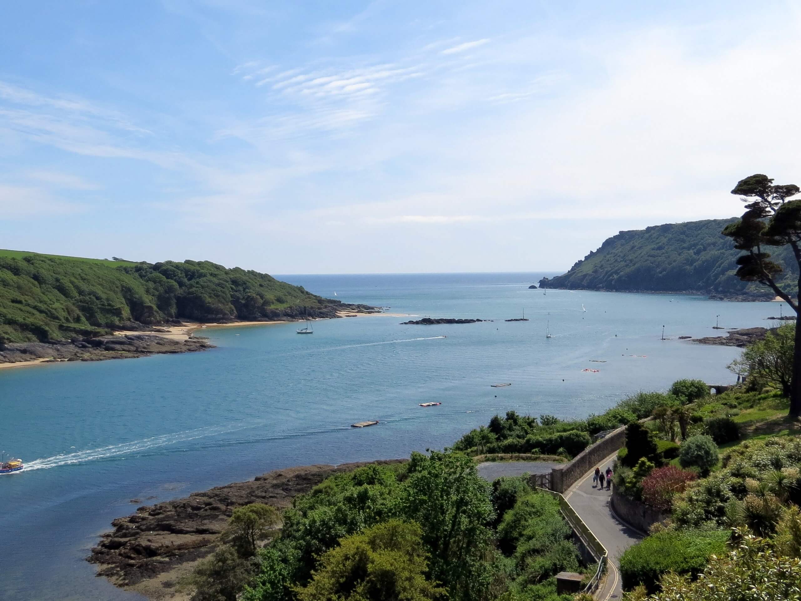
South West Coast Path: Salcombe to Kingswear
Difficulty Rating:
The South West Coast Path: Salcombe to Kingswear is an exhaustingly long, yet wonderfully scenic walking route that will reveal the natural and historical beauty of Devon. While out on the trail, you will explore the rugged coastal terrain while experiencing beautiful views across the English Channel and historical sites such as the Salcombe and Dartmouth Castles. This route is often split up into multi-day adventures that utilize campsites along the trail.
Getting there
To reach the South West Coast Path: Salcombe to Kingswear trailhead from the Salcombe Maritime Museum, head south along Fore Street for 0.1mi and turn left to reach the ferry crossing. From here, you will make your way across the water to reach the trailhead.

About
| Backcountry Campground | Maelcombe House Campsite, Slapton Sands |
| When to do | March-November |
| Pets allowed | Yes - On Leash |
| Family friendly | No |
| Route Signage | Average |
| Crowd Levels | Moderate |
| Route Type | One Way |
South West Coast Path: Salcombe to Kingswear
Elevation Graph
Weather
Salcombe to Kingswear Trail Description
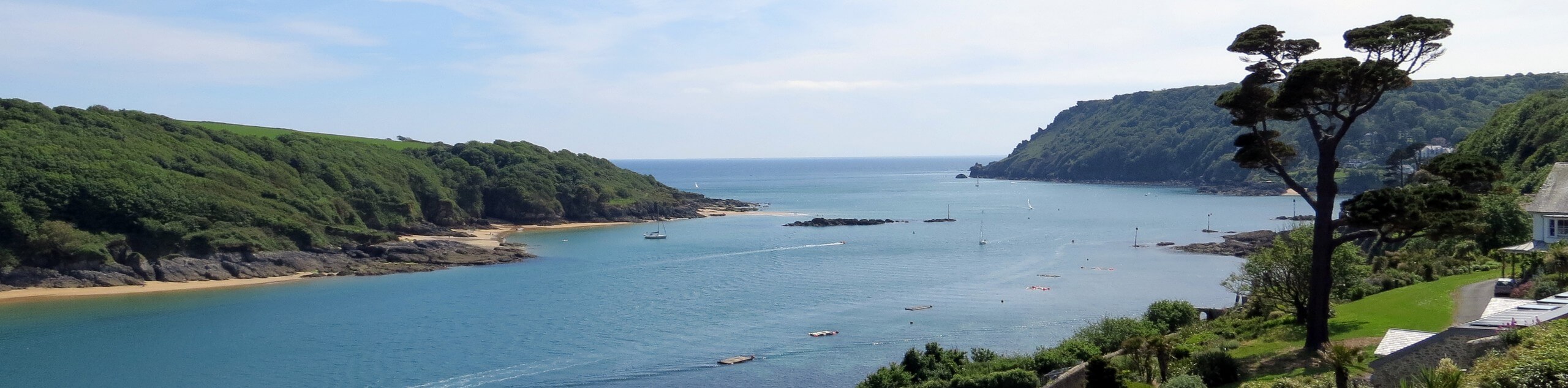
If you are looking to try your hand at an extremely long walking route that will push you to your physical limits, or simply want to experience the beauty of the South Devon coast over a multi-day period, then the South West Coast Path: Salcombe to Kingswear is a great option. At 22.6mi long and featuring 3655ft of elevation gain throughout the route, this walk is most often split up into a multi-day excursion with a stop at one of the campsites along the way. Still, if your physical fitness level is exceptional, you can always attempt to shoehorn the entire trail into one day!
Setting out from the trailhead, you will make your way south along the coast and enjoy lovely views across the water towards the historic Salcombe Castle. From here, you will make your way to the southeast, traversing the rugged terrain on the way to Prawle Point, where you will experience a great sightline across the English Channel.
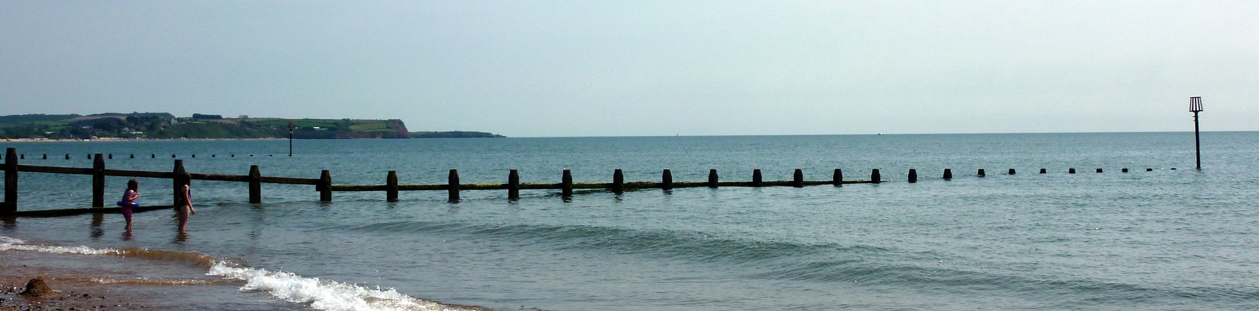
At this point, the trail will turn to the northeast and pass by several campsites that are great options if you are looking to spend a few days along the trail. Continue along the coast to pass by scenic coves and eventually round Start Point. From here, you will head to the north along the popular beaches at Beesands, Torcross, and Slapton while taking in the amazing seaside atmosphere of the Devon coast. Following along the rugged coastline, you will eventually pass by the 14th Century Dartmouth Castle before completing the final leg of the walk into the ferry crossing in Dartmouth that will take you over to Kingswear.
Similar hikes to the South West Coast Path: Salcombe to Kingswear hike
Exmouth and Dawlish Warren Walk
Walking the Exmouth and Dawlish Warren Trail is a beautifully scenic but physically demanding excursion in Devon that will see…
Stoke Woods Circular Walk
The Stoke Woods Circular Walk is a quick and fairly easy adventure near Exeter that will expose you to some…

Ottery Saint Mary Woodland Walk
The Ottery Saint Mary Woodland Walk is a great excursion in Devon that features some relatively easy to manage terrain…
Comments