
North Table Mountain and Tilting Mesa Trail
View Photos
North Table Mountain and Tilting Mesa Trail
Difficulty Rating:
Explore the unique geological feature that is the North Table Mesa on the North Table Mountain and Tilting Mesa Trail. Ascend the flattop mountain that reveals panoramic vistas of the diverse Colorado wilderness. Notice Denver in the east, the Flatiron Mountains in the north, and Front Range snow-capped peaks in the west. On the boundary of the Front Range Foothills, this unique adventure is a must add to your Denver to-do list.
Getting there
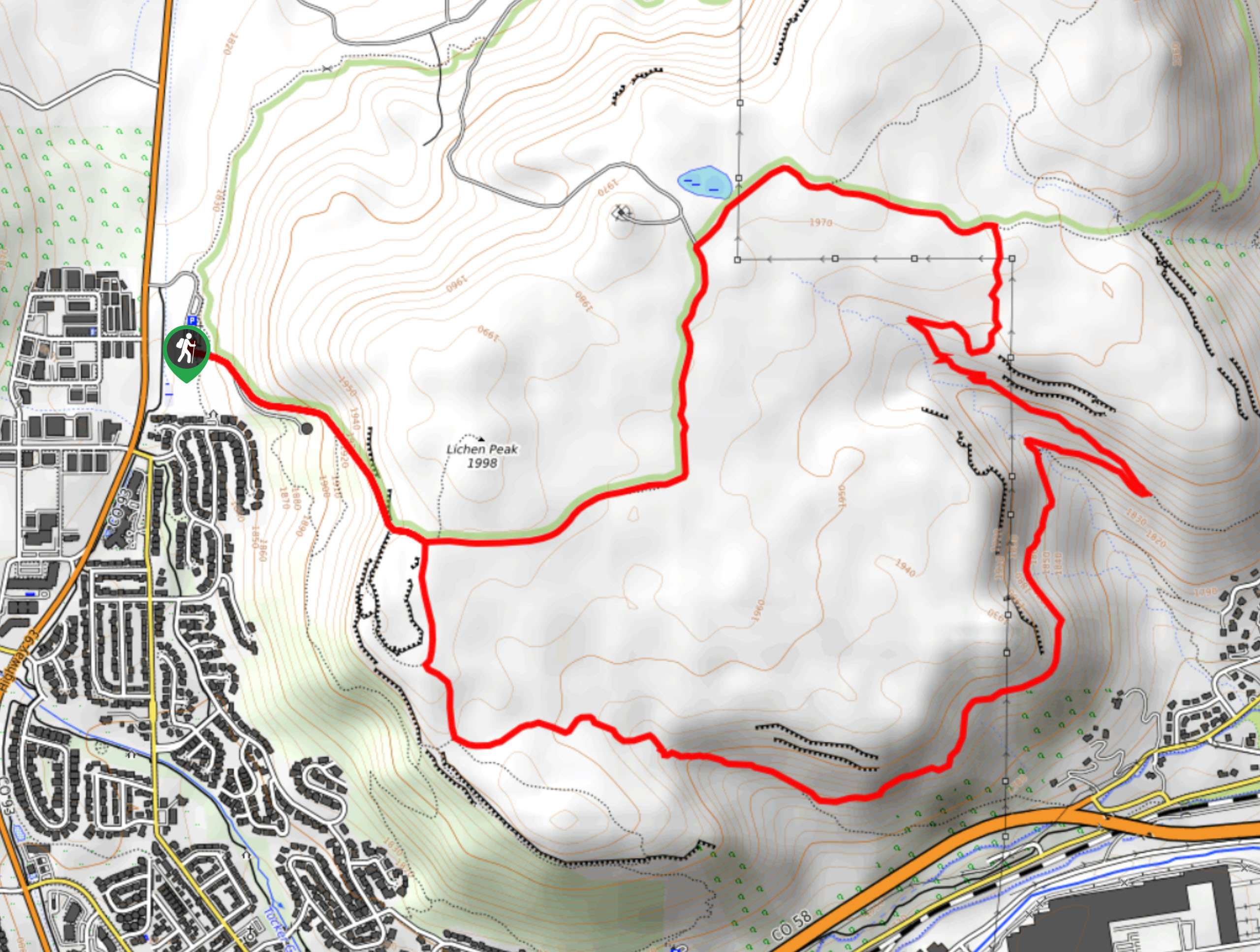
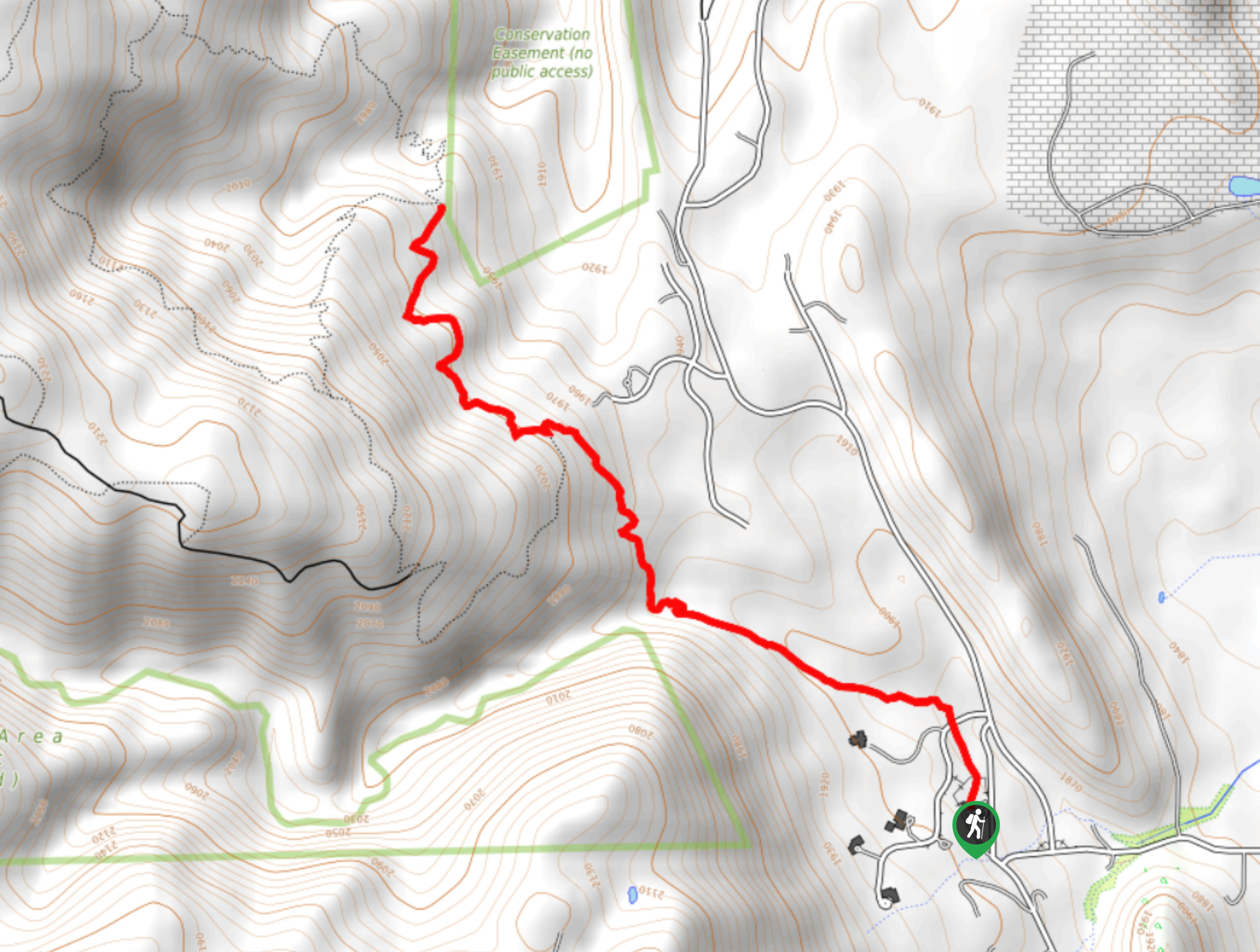
The North Table Mountain and Tilting Mesa Trail departs from the trailhead and parking lot off State Highway 93.

About
| Backcountry Campground | No |
| When to do | Year-round |
| Pets allowed | Yes - On Leash |
| Family friendly | Older Children only |
| Route Signage | Poor |
| Crowd Levels | High |
| Route Type | Lollipop |
North Table Mountain and Tilting Mesa Trail
Elevation Graph
Weather
North Table Mountain and Tilting Mesa Trail Description
The North Table Mountain and Tilting Mesa Trail is an epic day hike just outside the city limits of Denver. Formed millions of years ago by Palaeocene lava flows, the intriguing geological rock that protrudes out of the plains is a favorite tourist destination. Hike up the craggy cliffs and revel in the expansive views, and make sure to look out for elk and grazing deer! Note that there are rattlesnakes, so keep an eye and ear out as you hike. The area is also subject to closure to safeguard nesting raptors, so be sure to check the bulletin at the trailhead.
Begin your adventure around the North Table Mountain and Tilting Mesa Trail from the trailhead. From here, track along the North Table Loop Trail. Ascend the steep terrain, noticing intrepid rock climbers scaling the cliffside. Once you ridge the summit you will confront an intersection, keep right, and continue along the North Table Loop Trail. Hike along the ridge, enjoying sights of the South Table Mountain in the south. Eventually, you will dip into a canyon and cross over a stream. At the intersection with Cottonwood Canyon Trail, divert left and ascend the path.
Hike the Cottonwood Canyon Trail until the next intersection where you will want to veer left onto the Mesa Top Trail. Keep left on this trail, passing a small wetland before reconnecting with the North Table Loop Trail. From here, keep straight, retracing your footing down the ridge and back to the trailhead.
Similar hikes to the North Table Mountain and Tilting Mesa Trail hike

Singletree and Mayhoffer Trail
The Singletree and Mayhoffer Trail is a scenic adventure that will guide adventurers through the lush meadowlands that reveal sights…

Mount Galbraith via Cedar Gulch Trail
The Mount Galbraith via Cedar Gulch Trail is a charming adventure near Golden, Colorado that reveals the beauty and diversity…
Belcher Hill and Whippletree Trail
The Belcher Hill and Whippletree Trail is an exciting adventure—how could it not be with a name like that? The…
Comments